Butte Falls
Oregon • Crater Lake National Park • 20 ft
By Armen Suny · Last verified May 2026
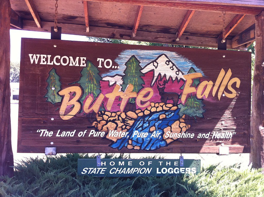
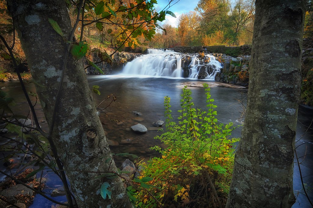
Photo Credits (5)
Difficulty
Moderate
Trail Length
2.4 miles
Trail Type
Out And Back
Elevation Gain
350 ft
About Butte Falls
Butte Falls sits just outside the small town of Butte Falls in Jackson County, Oregon, tumbling roughly 15–20 feet in a single wide cascade along Big Butte Creek. The falls are located on DESG land within the Big Butte Creek (including South Fork Big Butte Creek) unit, a Wild and Scenic Rivers designation managed by the Bureau of Land Management (BLM). The wide plunge is even runnable by experienced whitewater kayakers on the right side, shooting into a large bowl, and the site carries local history — a water-driven sawmill once operated here and helped give rise to the town of Butte Falls. This is an inviting spot for photographers and day-hikers who want a taste of southern Oregon’s forested creek country without a huge commitment. While the falls themselves are easily viewed from the trail terminus, the surrounding BLM lands and creek corridor reward lingering with mossy banks and classic Pacific Northwest shade. The nearest public campground listed in available data is Lodgepole Guard Station, about 19.2 km away, so plan for a day visit or arrange camping farther out.
The Setting
Butte Falls sits at 2,415 feet within Crater Lake National Park, fed by the Big Butte Creek, in the hills of Oregon. The falls drop 20 feet.
Height: 20 feet
Trail & Hike Details
The Approach
The moderate 2.4-mile out and back trail gains 350 feet of elevation on the way to the falls.
Trail Description
Trail data lists the approach to Butte Falls as an out-and-back route of approximately 2.4 miles with about 350 feet of elevation gain and a moderate difficulty rating. The route gains a bit of elevation through forested terrain before reaching the short final approach and viewing area at the creek; available sources describe the falls as a single wide cascade of roughly 15–20 feet. No USFS trail number or detailed surface/grade/class specifications were provided in the source data; the published parameters for this hike are length (2.4 mi), elevation gain (350 ft), difficulty (moderate), and out-and-back type. Hikers should expect a forested trail approach and a defined viewing spot at the terminus.
What to Expect
The falls drop a gentle 20 feet. Dogs are welcome.
Accessibility
The trail is not wheelchair accessible. Uneven terrain and elevation changes require steady footing.
Frequently Asked Questions
🐶 Are Dogs Allowed at Butte Falls?
✅ Dogs are allowed
Are There Any Fees or Permits Required?
🆖 No fees required
🏊 Is There Swimming at Butte Falls?
❌ Swimming is not allowed
When to Visit
Spring and early summer are the best times to visit, as the water flow is typically at its peak due to snowmelt.
Seasonal Access
The best time to visit is Spring, Summer, and Fall. Winter access may be limited. Check with Crater Lake National Park for current conditions.
Safety Information
Exercise caution near the water's edge, as rocks can be slippery. Be aware of changing weather conditions, and avoid visiting during heavy rain or snow.
Current Water Conditions
34 ft³/s
Current discharge — how much water is flowing
Much lower than usual for this time of year
Based on 70 years of record
2.53 ft
Water depth at gauge
61°F
WarmVery comfortable
7-Day Discharge Trend
What does this mean for your visit?
Flow is well below normal for this time of year, so the waterfall may be a trickle. Water temperature is a refreshing 61 degrees F, good for a quick swim.
About This Gauge
This gauge is on a nearby waterway and may not reflect exact conditions at the falls.
7-Day Flow Outlook
Based on the USGS gauge BIG BUTTE CREEK NEAR MCLEOD, OR (16 km away).
Today
Roaring
36 cfs
6/10Tomorrow
Roaring
42 cfs
6/10Sun
Roaring
39 cfs
6/10Mon
Roaring
35 cfs
9/10Tue
Roaring
34 cfs
9/10Wed
Roaring
35 cfs
9/10Thu
Roaring
35 cfs
9/10Best window: Mon — roaring flow, mostly sunny (trip score 9/10).
Best time of year: this gauge typically runs highest from mid February to late April, peaking in March.
How we calculate this
This is a transparent outlook, not a precise forecast. We take the waterfall's current flow strength (how it ranks against its historical normal for today, from the nearest USGS stream gauge), carry that ranking forward along the gauge's seasonal curve, and nudge it for forecast rain. Confidence is highest for the next day or two and falls further out. Always check official conditions and your own judgment before visiting — high flows can be dangerous.
Know when to go.
Get a free email alert when waterfalls near Butte Falls hit peak flow. We only send when conditions are worth the trip — no weekly newsletters, no spam.
Weather Forecast
Location & Access
Getting There
Butte Falls is located near the town of Butte Falls in Jackson County, Oregon. From the town, follow Butte Falls Highway and look for signs directing you to the falls. The waterfall is easily accessible by car.
Get Directions on Google MapsParking
There is a small parking area near the falls, which can accommodate a limited number of vehicles. Parking is free but may fill up during peak seasons.
Hours
Elevation
2,415 feet above sea level
Coordinates
42.545962° N, -122.561978° W
Land Management
Managed by BLM
Visitor Tips & Gear
Visit early in the day to avoid crowds, especially during weekends. Bring a camera to capture the scenic beauty, and wear sturdy shoes if you plan to explore the surrounding area.
As an Amazon Associate, we earn from qualifying purchases.
With 2.4 miles and 350 ft of elevation gain, sturdy boots and trekking poles will help on this moderate trail. Sun exposure on the trail makes good sun protection a must in summer.

Polarized Sunglasses (Knockaround)
Cuts glare off the water so you actually see the falls — and your photos turn out better too.

Columbia Watertight II Rain Jacket
Packs into its own pocket, seam-sealed, and keeps you dry from spray and surprise rain.

Earth Pak Waterproof Dry Bag
Keeps your phone and gear dry when waterfall mist soaks everything else.

Waterproof Phone Pouch (AiRunTech)
Cheap insurance — take photos right next to the falls without killing your phone.

Timberland Euro Sprint Mid Waterproof
Trusted waterproof boot with premium leather and grippy rubber sole — reliable on rocky, wet trails.

TrailBuddy Trekking Poles
Lightweight aluminum, cork grips, and flip-locks that actually hold — a best-seller for good reason.
Where to Stay

Resort at Eagle Point Golf Club Lodging

Edgewater Inn Shady Cove

Best Western Crater Lake Highway White City/Medford

Riverfront Lodging
Browse vacation cabins and private rentals nearby
Unique outdoor stays — tents, yurts, and treehouses
Rent a campervan or RV for your waterfall road trip
Some links are affiliate links. We may earn a commission at no extra cost to you.
Nearby Campground
LODGEPOLE GUARD STATION
11.9 miles away · 1 sites
Overview The guard station at Lodgepole Meadow was built in 1935 by the Civilian Conservation Corps to replace the original station built in 1911. Lodgepole Meadow was used as a remote guard station for the early Forest Service crews working in the area. During WWII, Herb and Zella Wright, a husband and wife lookout team, lived throughout the winter high up on the Blue Rock Lookout several miles away watching for enemy aircraft. Lodgepole Guard Station served as their base camp.Today, Lodgepole G
Book on Recreation.govNearby Hot Springs
Hot springs near Butte Falls, Oregon
Jackson Hot Springs
Jackson Hot Springs registers 95°F with highly alkaline chemistry, posting pH 9.3 in sodium-dominated waters containing 95 mg/L...
Eagle Point Spring
Eagle Point Spring flows at 95°F in Klamath County, emerging 45.6°F above the 49.4°F ambient temperature in a climate receiving...

Annie Spring
Annie Spring flows at 77°F within Crater Lake National Park at 5,983 feet elevation, discharging 1.71 cubic feet per second at ...
Bogus Soda Springs
Bogus Soda Springs flows at 76°F from Siskiyou County's volcanic landscape at 2,801 feet elevation. The name suggests early ske...
Klamath Hot Spring
Klamath Hot Spring discharges at 156°F just 27 feet from the nearest road near Montague in Siskiyou County, making it extraordi...
Howard Holiday
Howard Holiday flows at 77°F in Klamath County near Klamath Falls, emerging at 4,107 feet elevation approximately 157 meters fr...
Looking for a soak after your hike? Explore more hot springs near Butte Falls, Oregon on SoakingSprings.
Explore Oregon springsAdditional Information
Nearby Attractions
Nearby attractions include the town of Butte Falls, hiking trails in the surrounding forest, and Crater Lake National Park, which is about an hour's drive away.
Wildlife
The area around Butte Falls is home to various wildlife, including deer, birds, and small mammals. Visitors may also spot fish in Butte Creek.
Cities near Butte Falls
Writing about Butte Falls? Embed this waterfall on your site for free.