Photo Credits (2)
Difficulty
Moderate
Trail Length
2.4 miles
Trail Type
Out And Back
Elevation Gain
350 ft
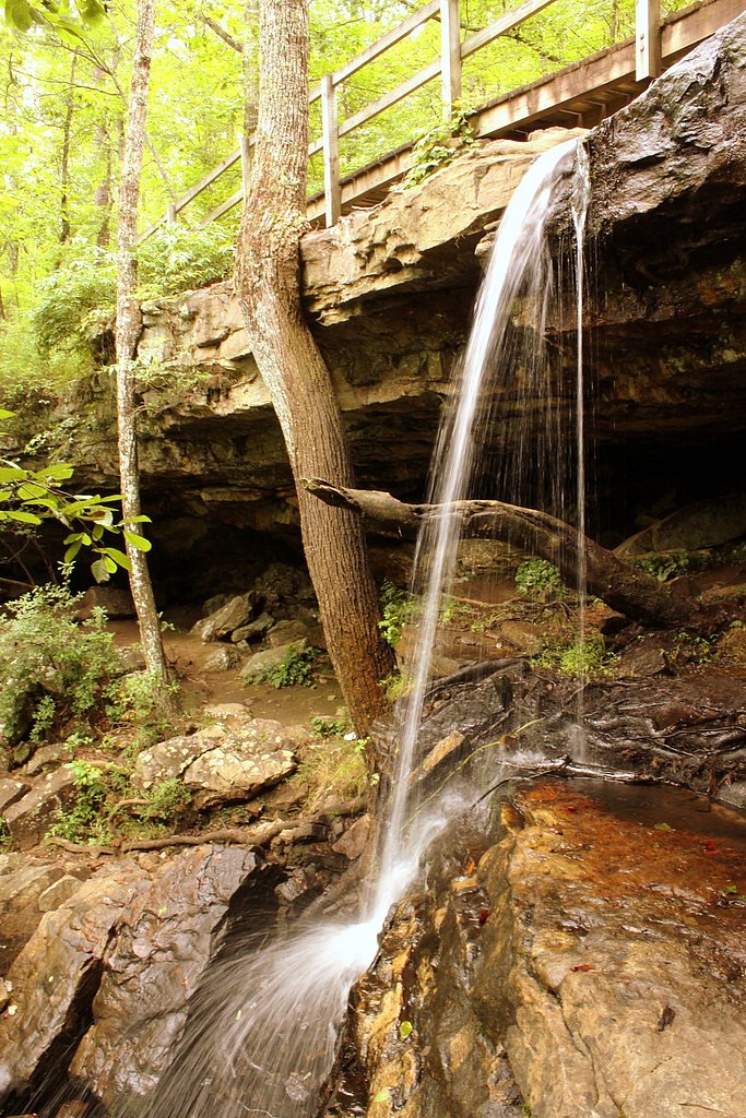
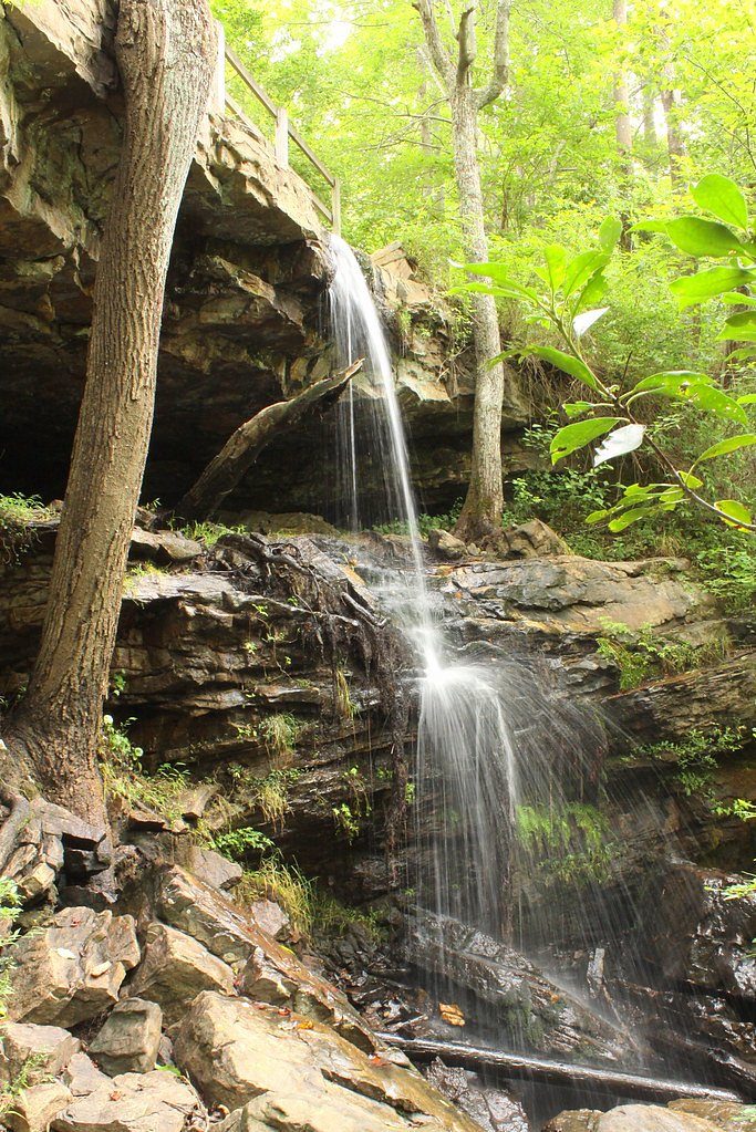
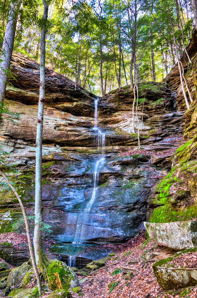
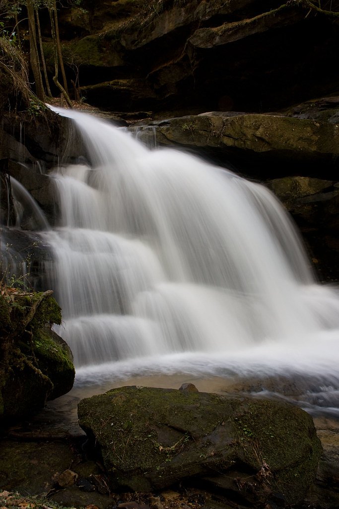
About Butler Falls
Butler Falls is a small, scenic waterfall set in Alabama woodlands, prized for its peaceful cascades and a sense of solitude. Because it doesn’t draw big crowds, the falls are a great destination for photographers or hikers wanting a quiet natural escape — the short drop and surrounding forest create an intimate, restorative setting. The falls are reached by a moderate out-and-back hike of about 2.4 miles with roughly 350 feet of elevation gain, so it’s an easy half‑day outing for most reasonably fit hikers. The nearest developed campground is McDougle Camp, approximately 19.4 km (12 miles) away, so plan to bring water and supplies for your visit.
The Setting
Butler Falls sits at 810 feet along the Sipsey Fork, in the foothills of Alabama.
Trail & Hike Details
The Approach
The moderate 2.4-mile out-and-back trail gains 350 feet of elevation on the way to the falls.
Trail Description
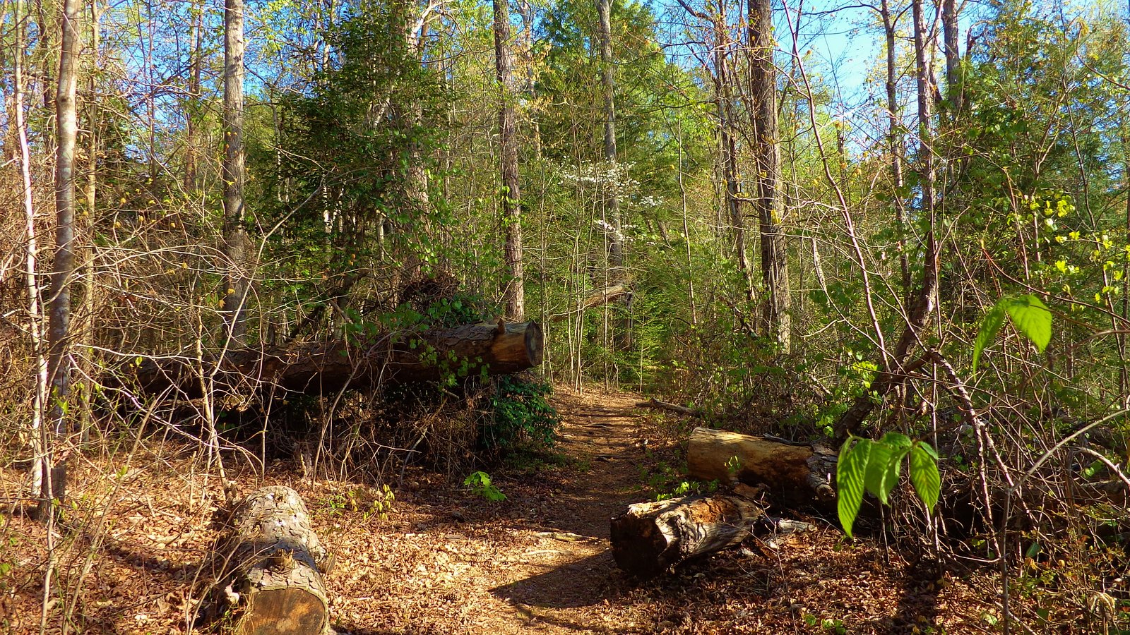
Trail: 2.4-mile out-and-back (total distance) with approximately 350 ft of elevation gain. Difficulty: Moderate. The route features steady climbs rather than steep sustained grades, making for a rewarding short hike to the falls. Detailed surface and formal trail-class data aren’t well documented, so expect natural footpaths and some uneven terrain; sturdy footwear, a map or GPS, and water are recommended. The hike is best treated as a short backcountry outing rather than a fully developed trail system.
What to Expect
Visitors can expect a serene and natural setting with a small waterfall surrounded by forested areas. The site may be less developed, offering a more rustic experience.
Accessibility
The trail is not wheelchair accessible. Uneven terrain and elevation changes require steady footing.
Frequently Asked Questions
🐶 Are Dogs Allowed at Butler Falls?
❌ Dogs are not allowed
Are There Any Fees or Permits Required?
🆖 No fees required
🏊 Is There Swimming at Butler Falls?
❌ Swimming is not allowed
When to Visit
Spring and fall are typically the best times to visit, as the weather is mild and water flow is often at its peak.
Seasonal Access
The best time to visit is Spring, Summer, and Fall. Winter access may be limited.
Safety Information
Visitors should be cautious of slippery rocks, uneven terrain, and potential wildlife encounters. Cell phone service may be limited in the area.
Current Water Conditions
23 ft³/s
Current discharge — how much water is flowing
About average for this time of year
Based on 59 years of record
2.84 ft
Water depth at gauge
79°F
ComfortablePleasant for swimming
7-Day Discharge Trend
What does this mean for your visit?
Flow is about average for this time of year. The water is a comfortable 79 degrees F, pleasant for swimming.
About This Gauge
This gauge is on a nearby waterway and may not reflect exact conditions at the falls.
7-Day Flow Outlook
Based on the USGS gauge SIPSEY FORK NEAR GRAYSON AL (15 km away).
Today
Barely Flowing
23 cfs
5/10Tomorrow
Low
25 cfs
3/10Thu
Low
26 cfs
3/10Fri
Low
23 cfs
3/10Sat
Low
24 cfs
3/10Sun
Low
29 cfs
3/10Mon
Low
31 cfs
3/10Best window: Today — barely flowing flow, sunny (trip score 5/10).
Best time of year: this gauge typically runs highest from mid February to late March, peaking in March.
How we calculate this
This is a transparent outlook, not a precise forecast. We take the waterfall's current flow strength (how it ranks against its historical normal for today, from the nearest USGS stream gauge), carry that ranking forward along the gauge's seasonal curve, and nudge it for forecast rain. Confidence is highest for the next day or two and falls further out. Always check official conditions and your own judgment before visiting — high flows can be dangerous.
Know when to go.
Get a free email alert when waterfalls near Haleyville hit peak flow. We only send when conditions are worth the trip — no weekly newsletters, no spam.
Weather Forecast
Location & Access
Getting There
The exact location of Butler Falls is not widely documented. Visitors are advised to research local maps and consult with nearby park services or locals for directions.
Get Directions on Google MapsParking
Parking availability is unclear. Visitors should prepare for limited or informal parking options near the site.
Elevation
810 feet above sea level
Coordinates
34.305931° N, -87.556691° W
Visitor Tips & Gear
Bring a map or GPS device as the location may not be well-marked. Wear sturdy footwear and be prepared for uneven terrain. Check local weather conditions before visiting.
As an Amazon Associate, we earn from qualifying purchases.
With 2.4 miles and 350 ft of elevation gain, sturdy boots and trekking poles will help on this moderate trail. Sun exposure on the trail makes good sun protection a must in summer.

Polarized Sunglasses (Knockaround)
Cuts glare off the water so you actually see the falls — and your photos turn out better too.

Columbia Watertight II Rain Jacket
Packs into its own pocket, seam-sealed, and keeps you dry from spray and surprise rain.

Earth Pak Waterproof Dry Bag
Keeps your phone and gear dry when waterfall mist soaks everything else.

Waterproof Phone Pouch (AiRunTech)
Cheap insurance — take photos right next to the falls without killing your phone.

Timberland Euro Sprint Mid Waterproof
Trusted waterproof boot with premium leather and grippy rubber sole — reliable on rocky, wet trails.

TrailBuddy Trekking Poles
Lightweight aluminum, cork grips, and flip-locks that actually hold — a best-seller for good reason.
Where to Stay

Best Western Plus Russellville Hotel & Suites

Days Inn by Wyndham Hamilton

Americas Best Value Inn Hamilton

Pet-Friendly Haleyville Cabin Rental with Kayaks!
Browse vacation cabins and private rentals nearby
Unique outdoor stays — tents, yurts, and treehouses
Rent a campervan or RV for your waterfall road trip
Some links are affiliate links. We may earn a commission at no extra cost to you.
Nearby Campground
Additional Information
Nearby Attractions
Nearby attractions may include other natural sites or small towns in Alabama. Research local guides for more information.
Wildlife
The area may feature typical Alabama wildlife, such as birds, deer, and small mammals. Be cautious of snakes and other potentially hazardous animals.
Cities near Butler Falls
Nearby Waterfalls
Other waterfalls named Butler Falls
1 other waterfall shares this name across the U.S.
Writing about Butler Falls? Embed this waterfall on your site for free.