Photo Credits (2)
Difficulty
Moderate
Trail Length
2.4 miles
Trail Type
Out And Back
Elevation Gain
350 ft
About Bonnie Falls
Bonnie Falls (also known locally as Scappoose Falls) is a small, quietly scenic cascade on Scappoose Creek in Columbia County, Oregon. Tucked just off Highway 30 west of the town of Scappoose, the falls are best known for the fish ladder that bypasses the drop, a noteworthy piece of local ecology that helps salmon and other fish navigate upstream. The setting is intimate rather than dramatic—a peaceful spot for a picnic or a short nature break where dappled light and creekside vegetation create a restful atmosphere. The approach feels friendly and approachable: it’s a moderate hike through Pacific Northwest woodland rather than a remote trek, making Bonnie Falls a good half-day outing from Portland or nearby towns. Because the falls sit close to a highway corridor, it’s easy to combine this stop with other Columbia County outdoor sites; just come prepared for variable trail conditions, especially in wet weather.
Trail & Hike Details
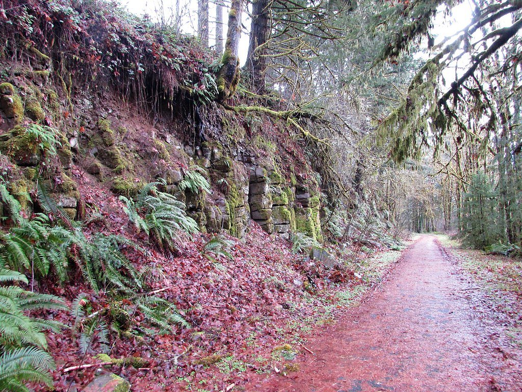
The Approach
The moderate 2.4-mile out-and-back trail gains 350 feet of elevation on the way to the falls.
Trail Description
Trail length: 2.4 miles (out-and-back); elevation gain: 350 ft; difficulty: moderate. The route to Bonnie Falls follows a roughly 2.4-mile out-and-back path that climbs gently through creekside forest—an average grade of about 2.8% over the distance—so expect moderate effort rather than steep, sustained climbs. The tread is natural (forest soil and roots) and can become muddy and slick in rainy seasons, so sturdy, grippy footwear is recommended. This is not a technical trail—there are no major obstacles or scrambling sections—but the footing and occasional wet stretches keep the hike from being purely easy. The proximity to Highway 30 makes access straightforward, and the path delivers directly to viewpoints of the falls and the adjacent fish ladder that helps migrating fish bypass the cascade.
What to Expect
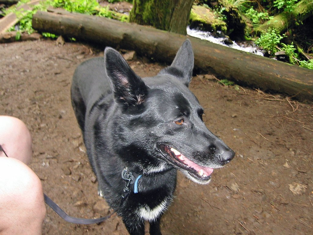
Dogs are welcome.
Accessibility
The trail is not wheelchair accessible. Uneven terrain and elevation changes require steady footing.
Frequently Asked Questions
🐶 Are Dogs Allowed at Bonnie Falls?
✅ Dogs are allowed
Are There Any Fees or Permits Required?
🆖 No fees required
🏊 Is There Swimming at Bonnie Falls?
❌ Swimming is not allowed
When to Visit
Spring and early summer are ideal for visiting Bonnie Falls, as the water flow is typically stronger during these seasons.
Seasonal Access
The best time to visit is Spring, Summer, Fall, and Winter.
Safety Information
Be cautious of slippery rocks near the waterfall. Avoid visiting during heavy rain or flooding conditions. Respect private property in the area.
Current Water Conditions
16 ft³/s
Current discharge — how much water is flowing
About average for this time of year
Based on 4 years of record
5.79 ft
Water depth at gauge
58°F
ColdBracing — limit time in water
7-Day Discharge Trend
What does this mean for your visit?
Flow is about average for this time of year. Water temperature is a bracing 58 degrees F, limit your time in the water.
About This Gauge
This gauge is on a nearby waterway and may not reflect exact conditions at the falls.
7-Day Flow Outlook
Based on the USGS gauge EF DAIRY CR ABV MURTAUGH CR NR MEACHAM CORNER, OR (16 km away).
Today
Moderate
18 cfs
6/10Tomorrow
Moderate
18 cfs
6/10Mon
Moderate
16 cfs
8/10Tue
Moderate
15 cfs
9/10Wed
Moderate
15 cfs
8/10Thu
Moderate
16 cfs
6/10Fri
Moderate
16 cfs
6/10Best window: Tue — moderate flow, partly sunny (trip score 9/10).
Best time of year: this gauge typically runs highest from mid December to late January, peaking in March.
How we calculate this
This is a transparent outlook, not a precise forecast. We take the waterfall's current flow strength (how it ranks against its historical normal for today, from the nearest USGS stream gauge), carry that ranking forward along the gauge's seasonal curve, and nudge it for forecast rain. Confidence is highest for the next day or two and falls further out. Always check official conditions and your own judgment before visiting — high flows can be dangerous.
Know when to go.
Get a free email alert when waterfalls near Warren hit peak flow. We only send when conditions are worth the trip — no weekly newsletters, no spam.
Weather Forecast
Location & Access
Getting There
Bonnie Falls is located near Scappoose, Oregon, and can be accessed via local roads. Visitors typically park near the Scappoose-Vernonia Highway and follow a short path to the falls. Exact directions may vary, so checking a map or GPS is recommended.
Get Directions on Google MapsParking
Parking is limited and may be roadside. Visitors should ensure they are not blocking traffic or private property.
Elevation
344 feet above sea level
Coordinates
45.804085° N, -122.937666° W
Visitor Tips & Gear
Visit during the spring or after rainfall for the best water flow. Bring sturdy shoes if visiting during wet conditions, as the trail may be slippery. Be respectful of private property in the area.
As an Amazon Associate, we earn from qualifying purchases.
With 2.4 miles and 350 ft of elevation gain, sturdy boots and trekking poles will help on this moderate trail. Icy conditions are common in winter — traction cleats are a smart addition.

Columbia Watertight II Rain Jacket
Packs into its own pocket, seam-sealed, and keeps you dry from spray and surprise rain.

Polarized Sunglasses (Knockaround)
Cuts glare off the water so you actually see the falls — and your photos turn out better too.

Earth Pak Waterproof Dry Bag
Keeps your phone and gear dry when waterfall mist soaks everything else.

Waterproof Phone Pouch (AiRunTech)
Cheap insurance — take photos right next to the falls without killing your phone.

Timberland Euro Sprint Mid Waterproof
Trusted waterproof boot with premium leather and grippy rubber sole — reliable on rocky, wet trails.

TrailBuddy Trekking Poles
Lightweight aluminum, cork grips, and flip-locks that actually hold — a best-seller for good reason.
Where to Stay

Best Western Oak Meadows Inn

Lewis River Inn

La Quinta by Wyndham Vancouver

Holiday Inn Express Vancouver North by IHG
Browse vacation cabins and private rentals nearby
Unique outdoor stays — tents, yurts, and treehouses
Rent a campervan or RV for your waterfall road trip
Some links are affiliate links. We may earn a commission at no extra cost to you.
Nearby Hot Springs
Hot springs near Warren, Oregon
Rock Creek Hot Springs
Rock Creek Hot Springs emerges in the Columbia River Gorge in Skamania County, Washington, with water documented as 'hot' witho...
Moffetts (Bonneville) Hot Springs
Moffetts Hot Springs, also called Bonneville Hot Springs, flows at 97 degrees in the Gifford Pinchot National Forest at just 75...

Mt St Helens Fumaroles
Mount St. Helens fumaroles reach 190 degrees at 6,906 feet elevation on the crater rim, emerging 159.1 degrees above ambient in...
Green River Soda Spring
Green River Soda Spring produces 86-degree carbonated water at 1,644 feet elevation, flowing 37.5 degrees above ambient tempera...
Looking for a soak after your hike? Explore more hot springs near Warren, Oregon on SoakingSprings.
Explore Oregon springsAdditional Information
Nearby Attractions
Scappoose-Vernonia Trail, local parks, and the town of Scappoose.
Wildlife
The area around Bonnie Falls may feature birds, small mammals, and aquatic life in the creek.
Cities near Bonnie Falls
Writing about Bonnie Falls? Embed this waterfall on your site for free.