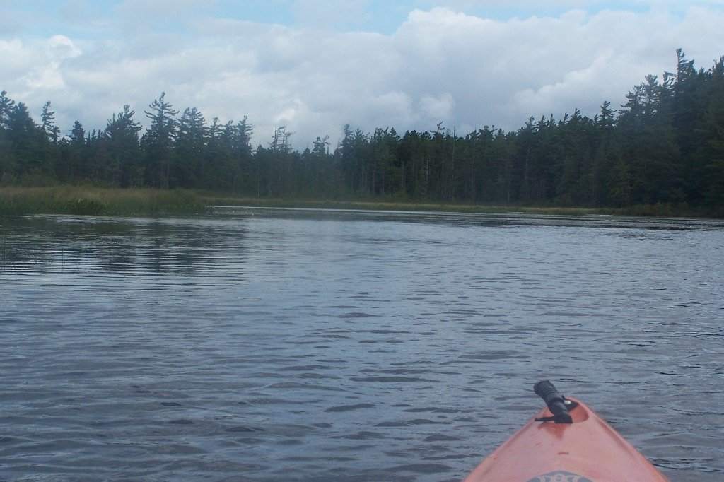
Bog River Falls
By Armen Suny · Last verified Mar 2026
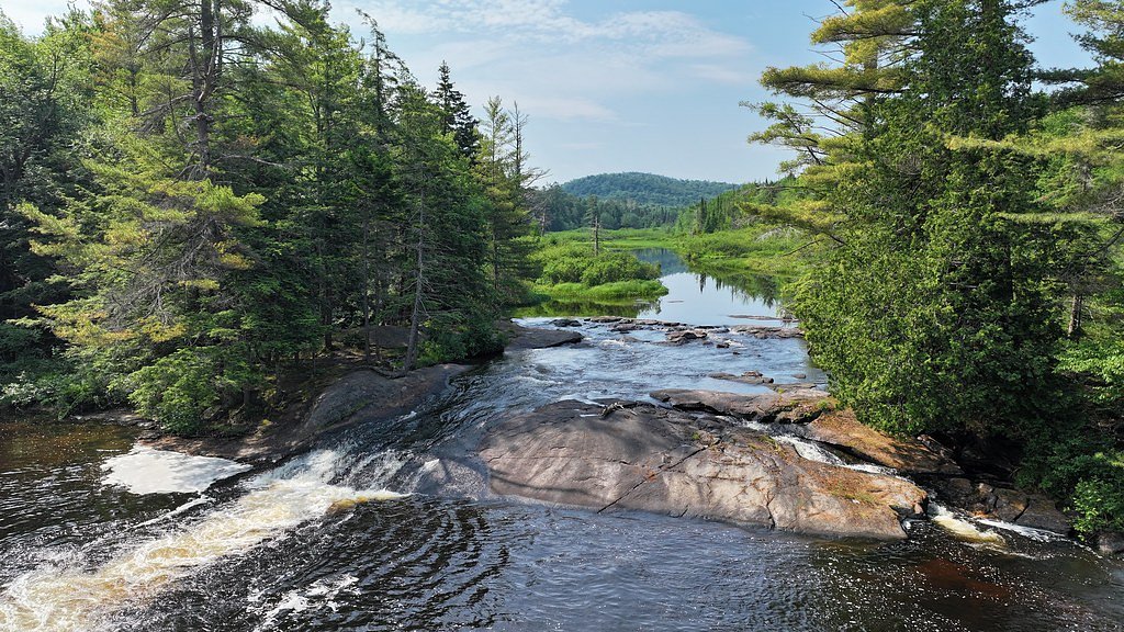
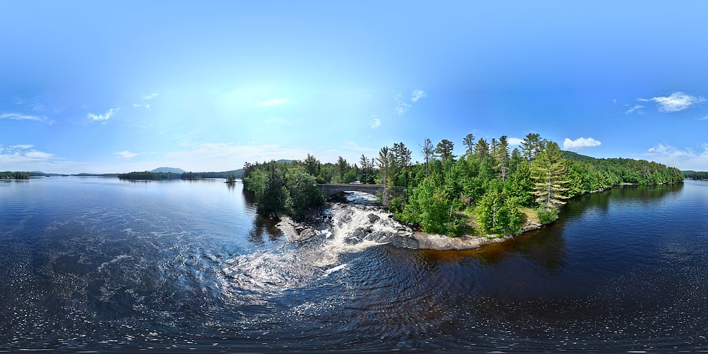
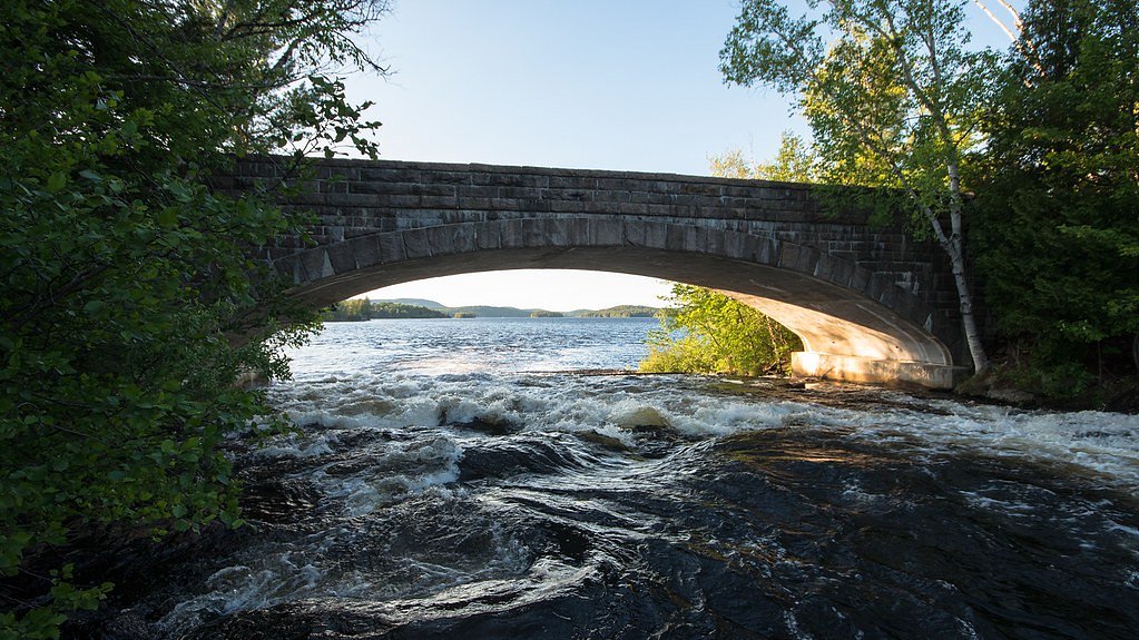
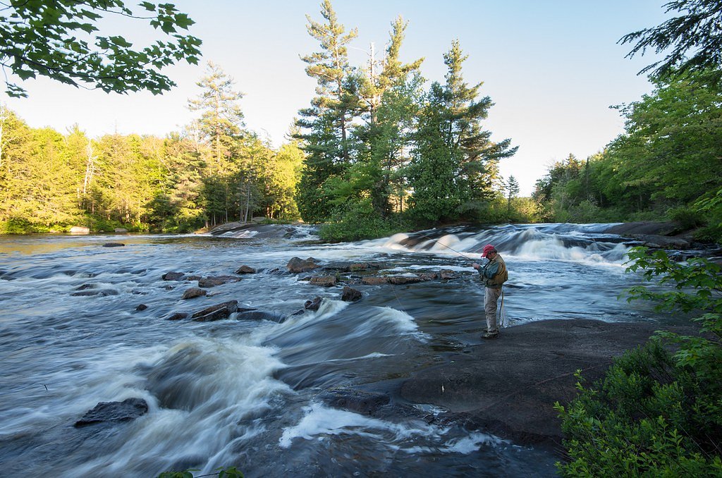

Photo Credits (5)
Difficulty
Moderate
Trail Length
2.4 miles
Trail Type
Out And Back
Elevation Gain
350 ft
About Bog River Falls
Bog River Falls lies within the Horseshoe Lake Wild Forest and is managed by SDC under its SCA designation. Tucked into this protected land unit, the falls offer a tranquil, photogenic cascade that draws hikers and nature lovers looking for a peaceful stop in the woods. The setting feels intentionally preserved and quiet thanks to the area's SCA status and SDC stewardship. Access to the falls is served by a short out-and-back route that gains about 350 feet over the course of the outing. The trail is rated moderate and is well suited to hikers seeking a brief, active excursion rather than a roadside pull-off; its compact length and rewarding water views make it a popular choice for a half-day outing or loop into a longer Adirondack day on nearby trails.
The Setting
Bog River Falls sits at 1,555 feet within Horseshoe Lake Wild Forest, fed by the Raquette River, in the hills of New York.
Trail & Hike Details
The Approach
The moderate 2.4-mile out-and-back trail gains 350 feet of elevation on the way to the falls.
Trail Description
Out-and-back trail, 2.4 miles total with approximately 350 feet of elevation gain. Rated moderate in difficulty. (No USFS trail surface, grade, or class data provided.) Managed by SDC within the Horseshoe Lake Wild Forest (SCA).
What to Expect
Dogs are welcome.
Accessibility
The trail is not wheelchair accessible. Uneven terrain and elevation changes require steady footing.
Frequently Asked Questions
🐶 Are Dogs Allowed at Bog River Falls?
✅ Dogs are allowed
Are There Any Fees or Permits Required?
🆖 No fees required
🏊 Is There Swimming at Bog River Falls?
❌ Swimming is not allowed
When to Visit
Spring and early summer are ideal for viewing the falls at their fullest flow, but the area is beautiful year-round.
Seasonal Access
The best time to visit is Spring, Summer, and Fall. Winter access may be limited.
Safety Information
Exercise caution near the water, as rocks can be slippery. In winter, icy conditions may make the area hazardous.
Current Water Conditions
1,220 ft³/s
Current discharge — how much water is flowing
About average for this time of year
Based on 117 years of record
5.73 ft
Water depth at gauge
7-Day Discharge Trend
What does this mean for your visit?
Flow is about average for this time of year.
About This Gauge
This gauge is on a nearby waterway and may not reflect exact conditions at the falls.
7-Day Flow Outlook
Based on the USGS gauge RAQUETTE RIVER AT PIERCEFIELD NY (12 km away).
Today
Barely Flowing
1220 cfs
5/10Tomorrow
Low
1323 cfs
3/10Wed
Low
1377 cfs
3/10Thu
Low
1358 cfs
3/10Fri
Low
1313 cfs
3/10Sat
Low
1199 cfs
3/10Sun
Low
1216 cfs
4/10Best window: Today — barely flowing flow, sunny (trip score 5/10).
Best time of year: this gauge typically runs highest from late March to early June, peaking in April.
How we calculate this
This is a transparent outlook, not a precise forecast. We take the waterfall's current flow strength (how it ranks against its historical normal for today, from the nearest USGS stream gauge), carry that ranking forward along the gauge's seasonal curve, and nudge it for forecast rain. Confidence is highest for the next day or two and falls further out. Always check official conditions and your own judgment before visiting — high flows can be dangerous.
Know when to go.
Get a free email alert when waterfalls near Cranberry Lake hit peak flow. We only send when conditions are worth the trip — no weekly newsletters, no spam.
Weather Forecast
Location & Access
Getting There
Bog River Falls is located along State Route 421, near Tupper Lake in the Adirondack Park. The falls are easily visible from the road, making them accessible for most visitors.
Get Directions on Google MapsParking
There is a small parking area near the falls along State Route 421. Parking availability may be limited during peak seasons.
Elevation
1,555 feet above sea level
Coordinates
44.128641° N, -74.544951° W
Land Management
Managed by SDC
Visitor Tips & Gear
Visit early in the day to avoid crowds, especially during peak seasons. Bring a camera to capture the scenic beauty. Be cautious near the water, as rocks may be slippery.
As an Amazon Associate, we earn from qualifying purchases.
With 2.4 miles and 350 ft of elevation gain, sturdy boots and trekking poles will help on this moderate trail. Sun exposure on the trail makes good sun protection a must in summer.

Polarized Sunglasses (Knockaround)
Cuts glare off the water so you actually see the falls — and your photos turn out better too.

Columbia Watertight II Rain Jacket
Packs into its own pocket, seam-sealed, and keeps you dry from spray and surprise rain.

Earth Pak Waterproof Dry Bag
Keeps your phone and gear dry when waterfall mist soaks everything else.

Waterproof Phone Pouch (AiRunTech)
Cheap insurance — take photos right next to the falls without killing your phone.

Timberland Euro Sprint Mid Waterproof
Trusted waterproof boot with premium leather and grippy rubber sole — reliable on rocky, wet trails.

TrailBuddy Trekking Poles
Lightweight aluminum, cork grips, and flip-locks that actually hold — a best-seller for good reason.
Where to Stay

Trailhead by Weekender

The Lazy Bear Cabin

Sandy Point Motel

Lake Placid Inn Boutique Hotel
Browse vacation cabins and private rentals nearby
Unique outdoor stays — tents, yurts, and treehouses
Rent a campervan or RV for your waterfall road trip
Some links are affiliate links. We may earn a commission at no extra cost to you.
Additional Information
Nearby Attractions
Tupper Lake, The Wild Center, and other Adirondack hiking trails and lakes.
Wildlife
The area around the falls may feature common Adirondack wildlife such as birds, deer, and small mammals.
Cities near Bog River Falls
Writing about Bog River Falls? Embed this waterfall on your site for free.