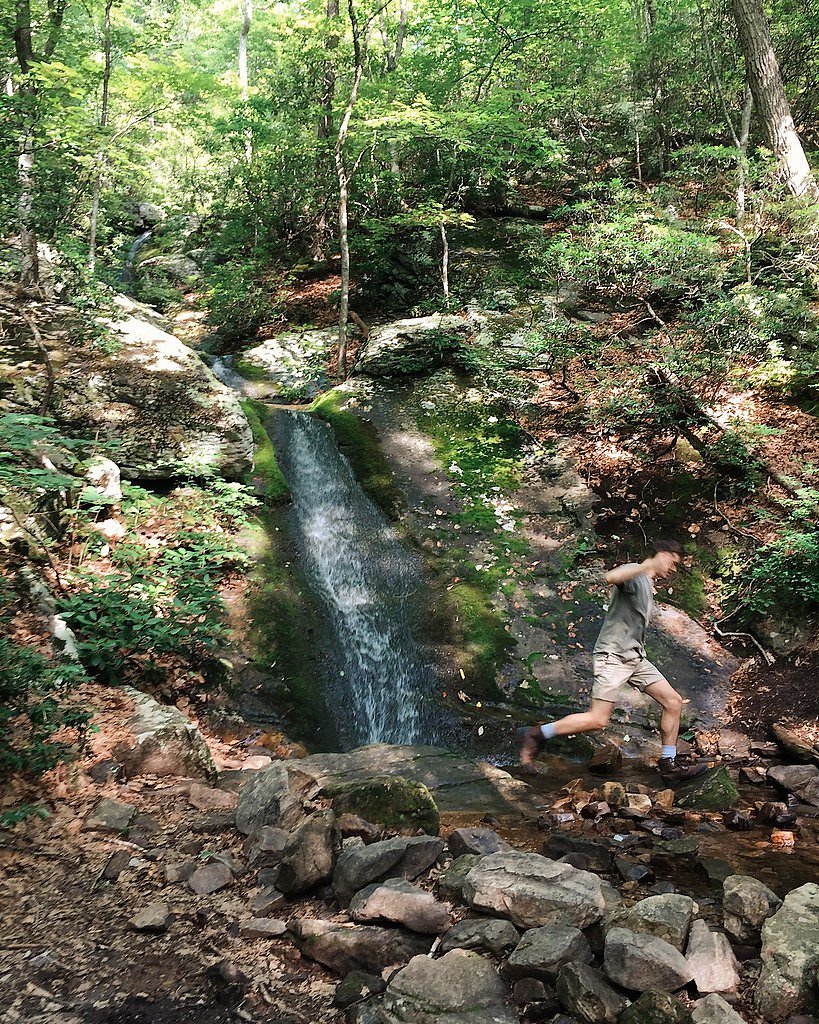
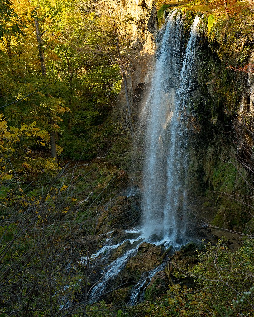
Blue Suck Falls
By Armen Suny · Last verified Jun 2026
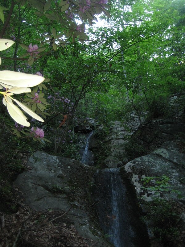
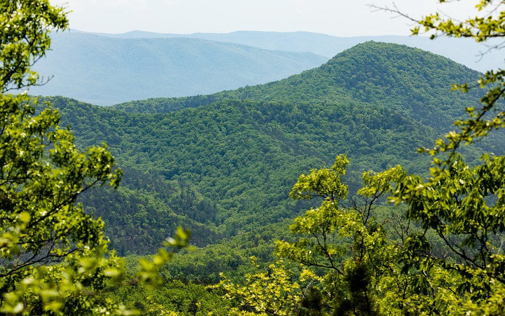
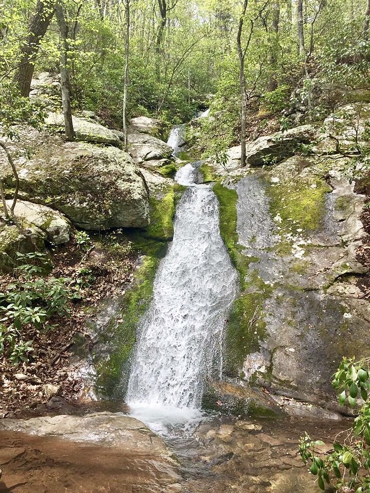
Photo Credits (4)
Difficulty
Moderate
Trail Length
2.4 miles
Trail Type
Out And Back
Elevation Gain
350 ft
About Blue Suck Falls
Blue Suck Falls is a scenic waterfall located in Douthat State Park, Virginia. It is a popular destination for hikers and nature enthusiasts, offering a serene setting surrounded by lush forest. The waterfall is part of a larger trail system within the park.
The Setting
Blue Suck Falls sits at 2,014 feet within Douthat State Park, fed by the Jackson River Bl Gathright Dam, in the hills of Virginia.
Nearby Falls Worth Visiting
Falling Spring Falls (80 ft) lies 7.4 miles to the west.
Trail & Hike Details
The Approach
The moderate 2.4-mile out-and-back trail gains 350 feet of elevation on the way to the falls.
Trail Description
The trail to Blue Suck Falls is a challenging hike with significant elevation gain. It winds through dense forest, offering scenic views of the surrounding mountains and valleys. The trail is well-marked but can be steep and rocky in sections, requiring sturdy footwear and good physical fitness.
What to Expect
Dogs are welcome.
Accessibility
The trail is not wheelchair accessible. Uneven terrain and elevation changes require steady footing.
Frequently Asked Questions
🐶 Are Dogs Allowed at Blue Suck Falls?
✅ Dogs are allowed
Are There Any Fees or Permits Required?
🤑 Fee: $7.00
🏊 Is There Swimming at Blue Suck Falls?
❌ Swimming is not allowed
When to Visit
Spring and fall are the best times to visit, as the weather is mild, and the foliage adds to the scenic beauty. Summer can also be enjoyable, but be prepared for warmer temperatures.
Seasonal Access
The best time to visit is Spring, Summer, and Fall. Winter access may be limited.
Safety Information
The trail can be steep and rocky, so proper footwear is essential. Be cautious of slippery rocks near the waterfall. Cell service may be limited in the area, so plan accordingly.
Current Water Conditions
244 ft³/s
Current discharge — how much water is flowing
Lower than usual for this time of year
Based on 46 years of record
9.01 ft
Water depth at gauge
59°F
ColdBracing — limit time in water
7-Day Discharge Trend
What does this mean for your visit?
Flow is lower than usual for this time of year. Water temperature is a bracing 59 degrees F, limit your time in the water.
About This Gauge
This gauge is on a nearby waterway and may not reflect exact conditions at the falls.
7-Day Flow Outlook
Based on the USGS gauge JACKSON RIVER BL GATHRIGHT DAM NR HOT SPGS, VA (12 km away).
Today
Barely Flowing
264 cfs
3/10Tomorrow
Low
287 cfs
3/10Tue
Barely Flowing
267 cfs
5/10Wed
Barely Flowing
256 cfs
5/10Thu
Barely Flowing
256 cfs
5/10Fri
Barely Flowing
256 cfs
5/10Sat
Low
292 cfs
3/10Best window: Tue — barely flowing flow, mostly sunny (trip score 5/10).
Best time of year: this gauge typically runs highest from late February to mid May, peaking in March.
How we calculate this
This is a transparent outlook, not a precise forecast. We take the waterfall's current flow strength (how it ranks against its historical normal for today, from the nearest USGS stream gauge), carry that ranking forward along the gauge's seasonal curve, and nudge it for forecast rain. Confidence is highest for the next day or two and falls further out. Always check official conditions and your own judgment before visiting — high flows can be dangerous.
Know when to go.
Get a free email alert when waterfalls near Clifton Forge hit peak flow. We only send when conditions are worth the trip — no weekly newsletters, no spam.
Weather Forecast
Location & Access
Getting There
Blue Suck Falls is located within Douthat State Park, which is accessible via Interstate 64. The park entrance is well-marked, and visitors can follow signs to the trailhead leading to the falls.
Get Directions on Google MapsParking
Parking is available at Douthat State Park near the trailhead. A state park parking fee may apply.
Elevation
2,014 feet above sea level
Coordinates
37.904736° N, -79.821287° W
Land Management
Managed by UNK
Visitor Tips & Gear
Start early to allow plenty of time for the hike and to avoid crowds. Bring plenty of water, snacks, and wear sturdy hiking boots. Check weather conditions before visiting, as the trail can become slippery after rain.
As an Amazon Associate, we earn from qualifying purchases.
With 2.4 miles and 350 ft of elevation gain, sturdy boots and trekking poles will help on this moderate trail. Sun exposure on the trail makes good sun protection a must in summer.

Polarized Sunglasses (Knockaround)
Cuts glare off the water so you actually see the falls — and your photos turn out better too.

Columbia Watertight II Rain Jacket
Packs into its own pocket, seam-sealed, and keeps you dry from spray and surprise rain.

Earth Pak Waterproof Dry Bag
Keeps your phone and gear dry when waterfall mist soaks everything else.

Waterproof Phone Pouch (AiRunTech)
Cheap insurance — take photos right next to the falls without killing your phone.

Timberland Euro Sprint Mid Waterproof
Trusted waterproof boot with premium leather and grippy rubber sole — reliable on rocky, wet trails.

TrailBuddy Trekking Poles
Lightweight aluminum, cork grips, and flip-locks that actually hold — a best-seller for good reason.
Where to Stay

Travelodge by Wyndham Low Moor Near Covington

Howard Johnson by Wyndham Lexington

Budget Inn near WestRock

The Gin Hotel, an Ascend Collection Hotel
Browse vacation cabins and private rentals nearby
Unique outdoor stays — tents, yurts, and treehouses
Rent a campervan or RV for your waterfall road trip
Some links are affiliate links. We may earn a commission at no extra cost to you.
Nearby Campground
COLES POINT
8.3 miles away · 2 sites
Overview Coles Point Picnic Shelters are tucked in a small opening surrounded by a hardwood forest. Opportunities abound for hiking, photography, nature study, birding and viewing wildlife. Best of all, Coles Point is perched along Moomaw Lake, providing convenient access to boating, fishing, swimming and relaxing on the beach.Recreation An inviting swimming beach within the recreation area lures crowds, and the picnic area has an open field for games like Frisbee and soccer. The park offers boat
Book on Recreation.govNearby Hot Springs
Hot springs near Clifton Forge, Virginia
Healing Springs
Healing Springs flows at 86 degrees Fahrenheit, producing water 34 degrees above ambient temperature at 2,218 feet elevation in...

Hot Springs
Hot Springs produces 106-degree water that flows 54.4 degrees above ambient temperature at 2,298 feet elevation in Bath County,...
Falling Spring
Falling Spring emerges at 77 degrees Fahrenheit, flowing 25 degrees above the ambient temperature in the City of Covington, Vir...

Warm Springs
Warm Springs flows at 95 degrees Fahrenheit, producing water 43.7 degrees above ambient temperature at 2,335 feet elevation in ...
Layton Spring
Layton Spring produces 72-degree water that flows 17.2 degrees above ambient temperature at 1,334 feet elevation in the City of...
Rockbridge Baths
Rockbridge Baths emerges at 72 degrees Fahrenheit, flowing 18.9 degrees above ambient temperature at 1,807 feet elevation in Ro...
Looking for a soak after your hike? Explore more hot springs near Clifton Forge, Virginia on SoakingSprings.
Explore Virginia springsAdditional Information
Nearby Attractions
Douthat Lake, other hiking trails within Douthat State Park, and scenic overlooks.
Wildlife
The area is home to deer, birds, and other forest wildlife. Be cautious of snakes and other potentially hazardous animals.
Cities near Blue Suck Falls
Nearby Waterfalls
Writing about Blue Suck Falls? Embed this waterfall on your site for free.