
Before you go
Overnight trips in the Sequoia & Kings Canyon backcountry require a wilderness permit.


Photo Credits (5)
Difficulty
Hard
About Blue Canyon Falls
Blue Canyon Falls drops about 370 feet in three tiers where Blue Canyon Creek falls into Tehipite Valley on the Middle Fork Kings River in Kings Canyon National Park. Historically called Sunshine Falls, it is the smaller of the valley's two major waterfalls. Tehipite Valley is remote backcountry with no road or short trail, so reaching the falls is a long, strenuous wilderness trip.
The Setting
Blue Canyon Falls sits at 5,105 feet within Kings Canyon National Park, in the high mountains of California. At 370 feet, it is among the taller waterfalls in California.
Height: 370 feet
Trail & Hike Details
Trail Description
Tehipite Valley is reached only by long, steep backcountry routes; this is not a day hike. Plan the route with park maps and rangers.
What to Expect
The falls plunge a dramatic 370 feet.
Accessibility
The trail involves steep, uneven terrain with significant elevation change and is not accessible to mobility devices.
Frequently Asked Questions
🐶 Are Dogs Allowed at Blue Canyon Falls?
❌ Dogs are not allowed
Pets are prohibited on all trails in Sequoia and Kings Canyon National Parks.
Are There Any Fees or Permits Required?
🆖 No fees required
🏊 Is There Swimming at Blue Canyon Falls?
❌ Swimming is not allowed
When to Visit
Spring and early summer are the best times to visit, as the falls are typically at their fullest due to snowmelt. Fall offers cooler temperatures and vibrant foliage.
Seasonal Access
The best time to visit is Spring, Summer, and Fall. Access roads and trails may close during winter due to snow. Check the National Park Service website for current conditions.
Safety Information
The trail can be hazardous due to steep sections, loose rocks, and potential water crossings. Hikers should be prepared and exercise caution. Always inform someone of your plans before heading out.
Know when to go.
Get a free email alert when waterfalls near Wilsonia hit peak flow. We only send when conditions are worth the trip — no weekly newsletters, no spam.
Is Blue Canyon Falls Frozen?
Updated about 10 hours agoNot frozen highs above freezing lately
Blue Canyon Falls is not frozen right now; highs have been above freezing. Yesterday ran 49°F to 37°F.
- Days below freezing
- 0 of the last 14
- Current cold streak
- 0 days
- Freezing days ahead
- 0 of the next 7
- Flow
- no gauge
Winter safety. Frozen falls are the one waterfall trip with a documented injury pattern: falling ice, and ice-glazed rock and trail. Wear microspikes, keep well back from the base and from overhangs, and never walk out on ice over moving water.
Estimate from Open-Meteo daily temperatures at the falls, the LiDAR-measured facing direction, and the nearest stream gauge. It is a likelihood, not a report from the trail.
Weather Forecast
The Terrain, Seen by LiDAR
Aircraft-mounted lasers measured this ground to within inches. Trees and buildings are digitally stripped away, leaving the bare shape of the land the water has carved.
The ground through the falls loses about 427 feet in steep steps rather than one leap. The listed height of 370 feet matches what the lidar sees. The ground at the falls is roughly 4,997 feet above sea level.
The whole reach is steep: about 281 feet of descent in the 500 feet above the falls and another 289 feet in the 500 feet below. The falls face southeast and sit in full sun for most of the day, best photographed early or late.
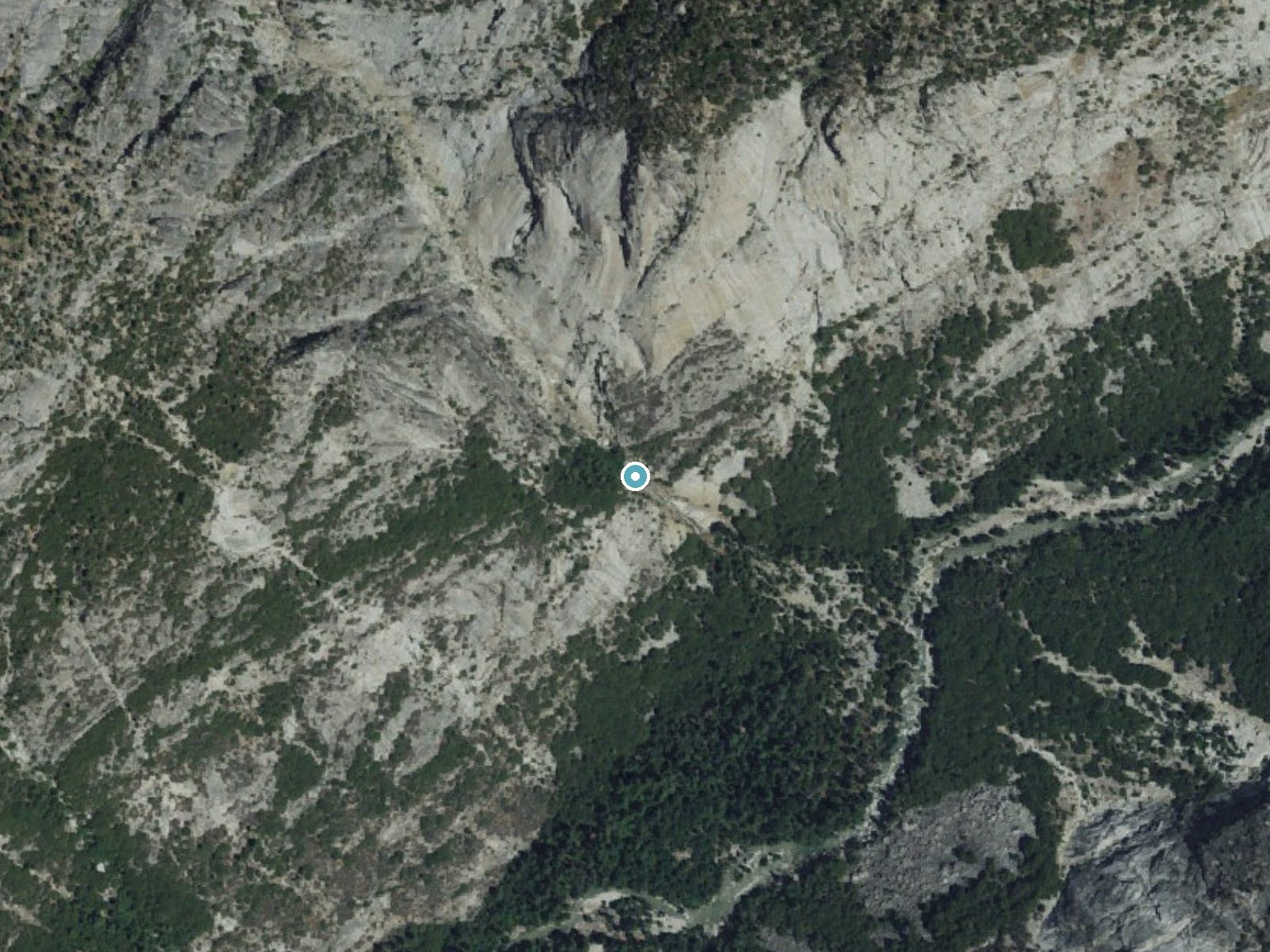
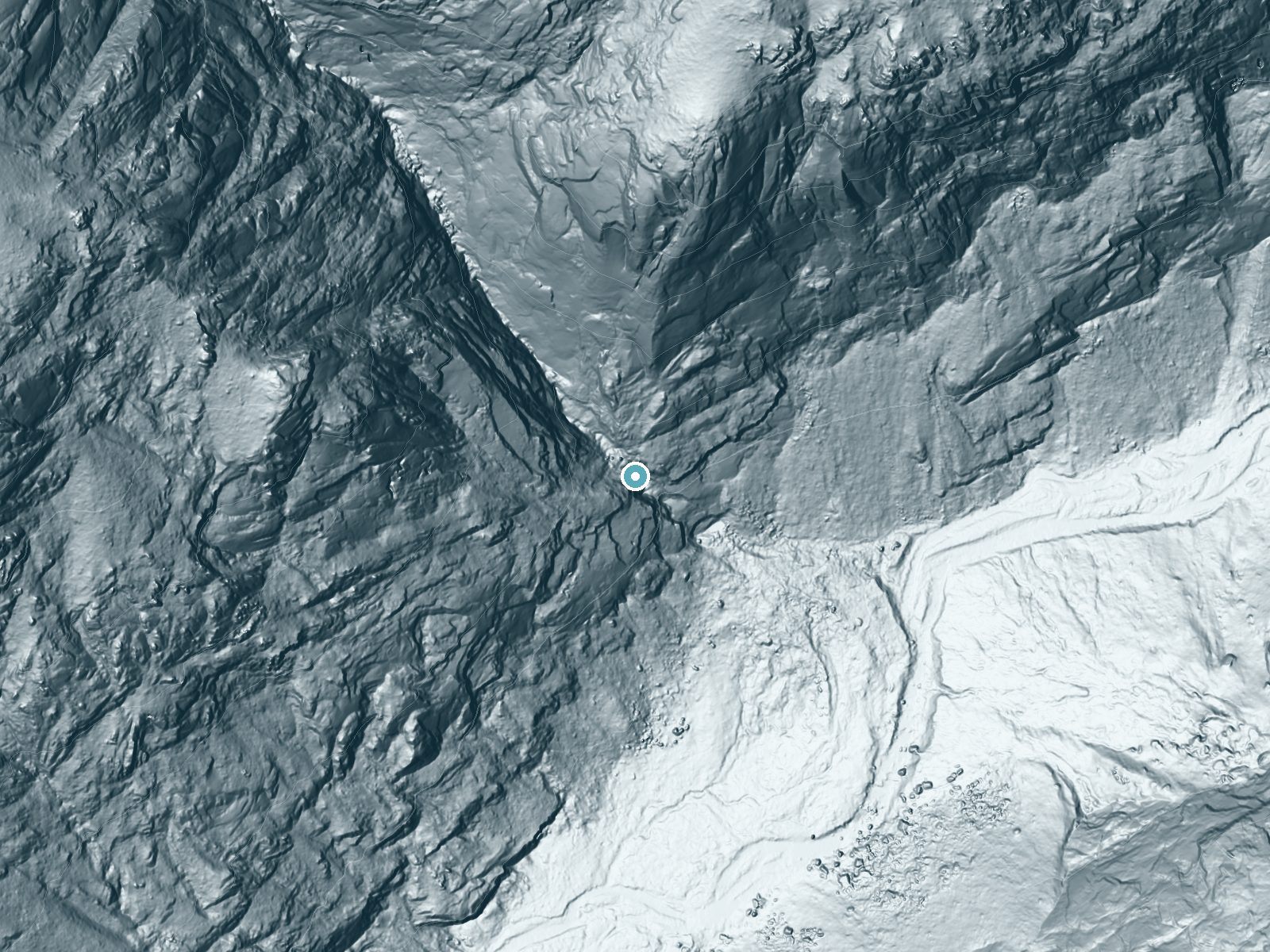
Drag to compare. The dot marks the waterfall. The frame is about a mile across.
- Ground elevation
- 4,997 feet
- Measured by 1-meter lidar
- Drop at the falls
- About 427 feet
- Change in ground height within ~250 feet of the falls
- Faces
- Southeast
- Sunlit most of the day. Go early or late for softer light.
A slice through the lidar ground surface, from above the falls to downstream (heading southeast).
Elevation data: USGS 3D Elevation Program. Aerial imagery: USGS The National Map. Public domain.
Location & Access
Getting There
There is no road to Tehipite Valley. Trips may start inside Sequoia & Kings Canyon or from neighboring Sierra National Forest; get route details and a wilderness permit from the agency where your trip begins.
Get Directions on Google MapsElevation
5,105 feet above sea level
Coordinates
36.931582° N, -118.749770° W
Land Management
Managed by NPS
Visitor Tips & Gear
Wear sturdy hiking boots and bring plenty of water. Check weather conditions before your trip, as the trail can become slippery or hazardous after rain. Cell service may be limited, so carry a map or GPS device.
Where to Stay

Sequoia Resort

Cozy Cottage

Fivespot Cabin

Seven Circles Lodge&Retreat
Browse vacation cabins and private rentals nearby
Unique outdoor stays — tents, yurts, and treehouses
Rent a campervan or RV for your waterfall road trip
Some links are affiliate links. We may earn a commission at no extra cost to you.
Nearby Campground
Convict Flat Campground
9 miles away · 0 sites
Located in Kings Canyon, 19 miles NE of Grant Grove via Hwy 180. Family campground (5 units), vault tiolet and suitable for small - midsize trailers. Elevation 3,000 feet.
Book on Recreation.govNearby Hot Springs
Hot springs near Visalia, California

Blaney Meadows Hot Springs
Blaney Meadows Hot Springs emerges at 109 degrees Fahrenheit from the Sierra National Forest at 7,676 feet elevation, deliverin...

Mono Hot Springs
Mono Hot Springs emerges at 109°F in the High Sierra's alpine terrain, set at 6,561 feet where thermal water feeds a series of ...
Keough Hot Springs
Keough Hot Springs emerges at 124°F in the Owens Valley near Bishop, situated just seven miles south along US Highway 395. The ...
Unnamed Spring Mono County 3
This 86-degree thermal spring sits at 6,800 feet elevation near Mammoth Lakes where water runs 38 degrees above the frigid ambi...
Unnamed Spring Mono County 4
This 73-degree thermal spring emerges at 7,040 feet on Bureau of Land Management lands near Mammoth Lakes, where water runs 26 ...

Springs
These 72-degree springs emerge at 6,790 feet elevation on Bureau of Land Management land within Long Valley Caldera, one of Nor...
Looking for a soak after your hike? Explore more hot springs near Visalia, California on SoakingSprings.
Explore California springsAdditional Information
Nearby Attractions
Tehipite Dome rises above Tehipite Valley.
Wildlife
The area is home to a variety of wildlife, including deer, birds, and occasionally bears. Visitors should practice proper wildlife safety.
Cities near Blue Canyon Falls
Nearby Waterfalls
Writing about Blue Canyon Falls? Embed this waterfall on your site for free.