Blackwater Falls
West Virginia • 57 ft
By Armen Suny · Last verified Sep 2026
LiDAR & 3D terrain
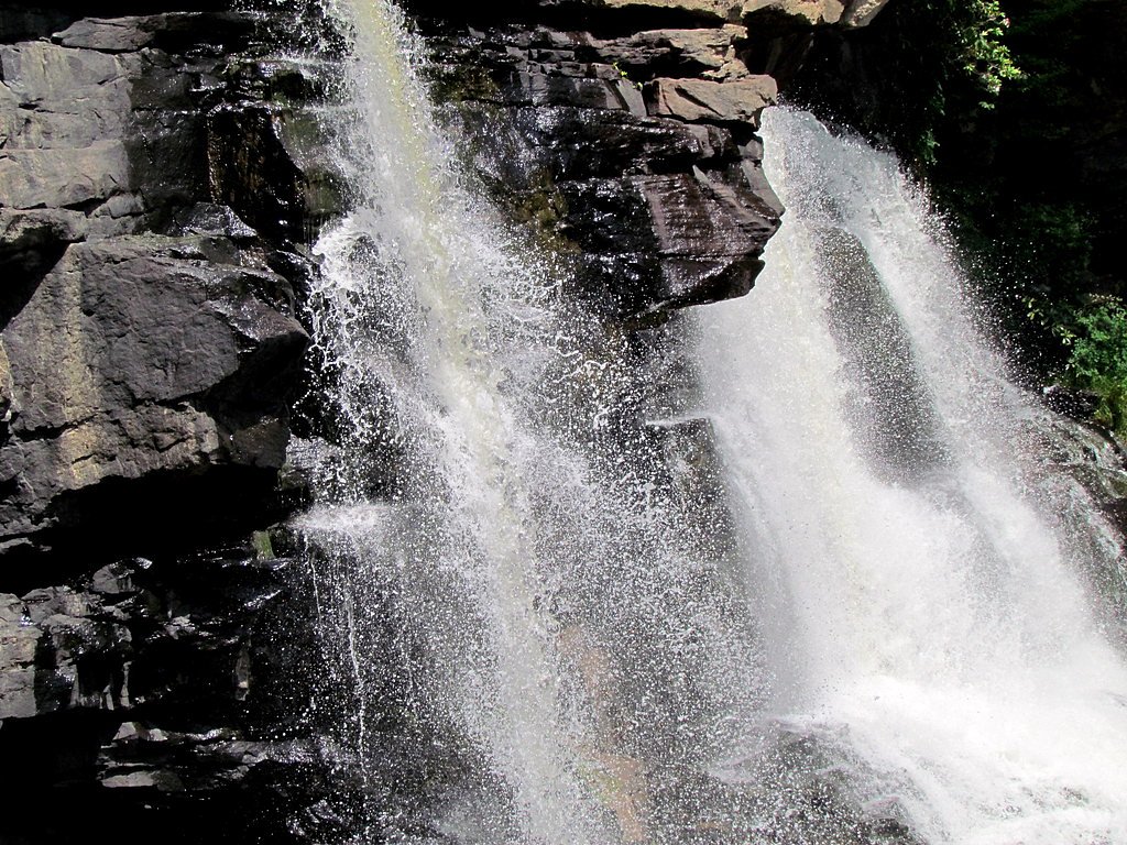
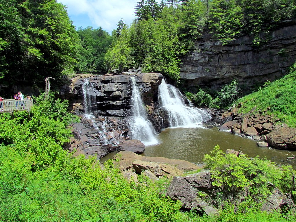

Photo Credits (5)
Difficulty
Easy
Trail Length
0.4 miles
Trail Type
Out And Back
Elevation Gain
100 ft
About Blackwater Falls
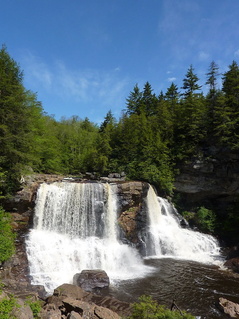
Blackwater Falls is one of the most iconic waterfalls in West Virginia, located in Blackwater Falls State Park. The waterfall is named for the amber-colored water, which gets its hue from tannic acid from fallen hemlock and red spruce needles. The falls drop approximately 57 feet into the Blackwater River gorge, creating a stunning and picturesque scene.
The Setting
Blackwater Falls sits at 3,022 feet within Blackwater Falls State Park, fed by the Blackwater River, in the mountains of West Virginia. The falls drop 57 feet.
Height: 57 feet
Trail & Hike Details
The Approach
The easy 0.4-mile out-and-back trail gains 100 feet of elevation on the way to the falls.
Trail Description
The trail to Blackwater Falls is a short, well-maintained path with wooden boardwalks and stairs leading to multiple viewing platforms. The trail is suitable for most visitors, though the stairs may pose a challenge for those with mobility issues.
What to Expect
The falls drop 57 feet. Dogs are welcome.
Accessibility
The trail is short and relatively flat, but the surface may be uneven. Contact the managing agency for accessibility details.
Frequently Asked Questions
🐶 Are Dogs Allowed at Blackwater Falls?
✅ Dogs are allowed
Are There Any Fees or Permits Required?
🆖 No fees required
🏊 Is There Swimming at Blackwater Falls?
❌ Swimming is not allowed
When to Visit
Blackwater Falls is beautiful year-round, but the best times to visit are in the fall for the foliage and in the spring when the water flow is at its peak.
Seasonal Access
The best time to visit is Spring, Summer, Fall, and Winter.
Safety Information
The boardwalk and stairs can be slippery when wet or icy. Stay on designated paths and do not attempt to climb on rocks near the falls. Be cautious of wildlife and avoid feeding animals.
Current Water Conditions
186 ft³/s
Current discharge — how much water is flowing
Much higher than usual for this time of year
Based on 105 years of record
2.43 ft
Water depth at gauge
59°F
ColdBracing — limit time in water
7-Day Discharge Trend
What does this mean for your visit?
The water is flowing much higher than usual, expect an impressive display. Water temperature is a bracing 59 degrees F, limit your time in the water. PH is normal at 7.3 and mineral content is typical.
Water Quality
pH
NormalWithin healthy range (6.5-8.5)
Conductance
Dissolved minerals in the water
About This Gauge
7-Day Flow Outlook
Based on the USGS gauge BLACKWATER RIVER AT DAVIS, WV (2 km away).
Today
Moderate
186 cfs
8/10Tomorrow
Moderate
186 cfs
8/10Mon
Moderate
201 cfs
5/10Tue
Moderate
193 cfs
6/10Wed
Moderate
186 cfs
8/10Thu
Moderate
186 cfs
8/10Fri
Moderate
201 cfs
5/10Best window: Today — moderate flow, sunny (trip score 8/10).
How we calculate this
This is a transparent outlook, not a precise forecast. We take the waterfall's current flow strength (how it ranks against its historical normal for today, from the nearest USGS stream gauge), carry that ranking forward along the gauge's seasonal curve, and nudge it for forecast rain. Confidence is highest for the next day or two and falls further out. Always check official conditions and your own judgment before visiting — high flows can be dangerous.
Know when to go.
Get a free email alert when waterfalls near Davis hit peak flow. We only send when conditions are worth the trip — no weekly newsletters, no spam.
Weather Forecast
The Terrain, Seen by LiDAR
Aircraft-mounted lasers measured this ground to within inches. Trees and buildings are digitally stripped away, leaving the bare shape of the land the water has carved.
Through the falls the surface drops roughly 120 feet over a short, steep run of tiers. Only part of that is the waterfall, which is listed at 57 feet; the rest is the canyon carrying on downstream. Elevation at the pin is about 3,040 feet.
The whole reach is steep: about 105 feet of descent in the 500 feet above the falls and another 85 feet in the 500 feet below. The falls face southeast and sit in full sun for most of the day, best photographed early or late.
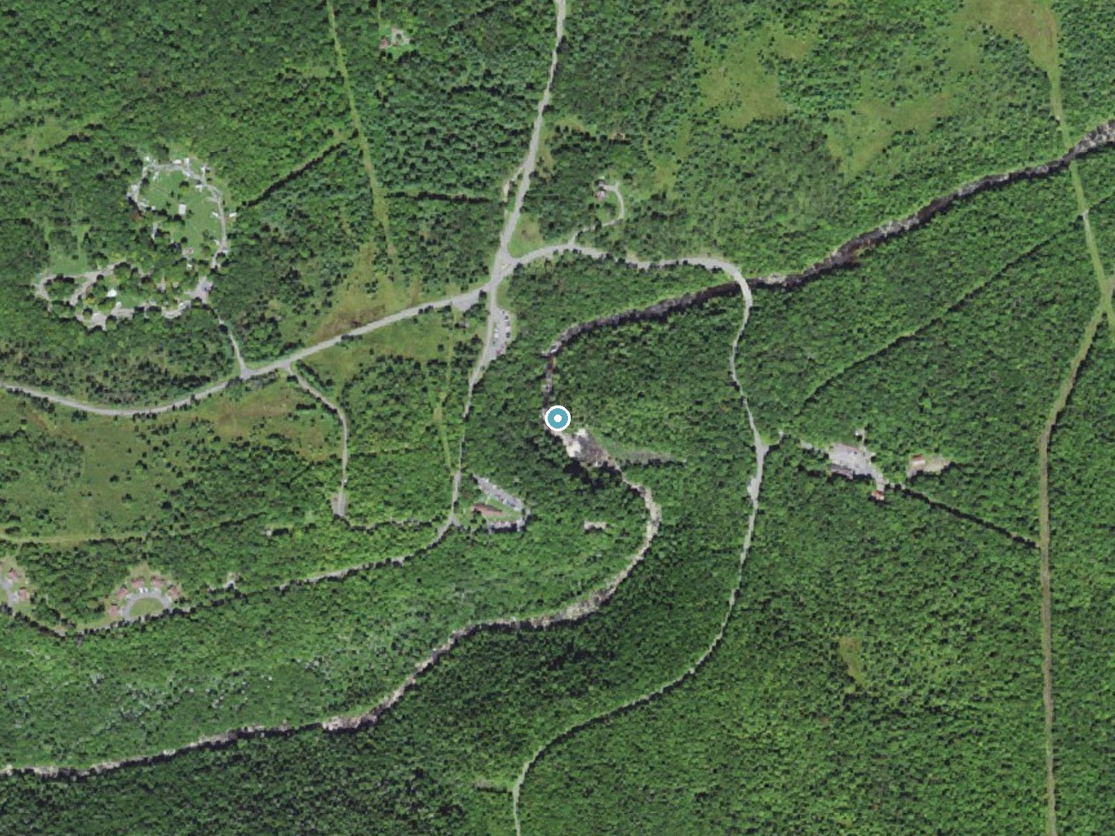
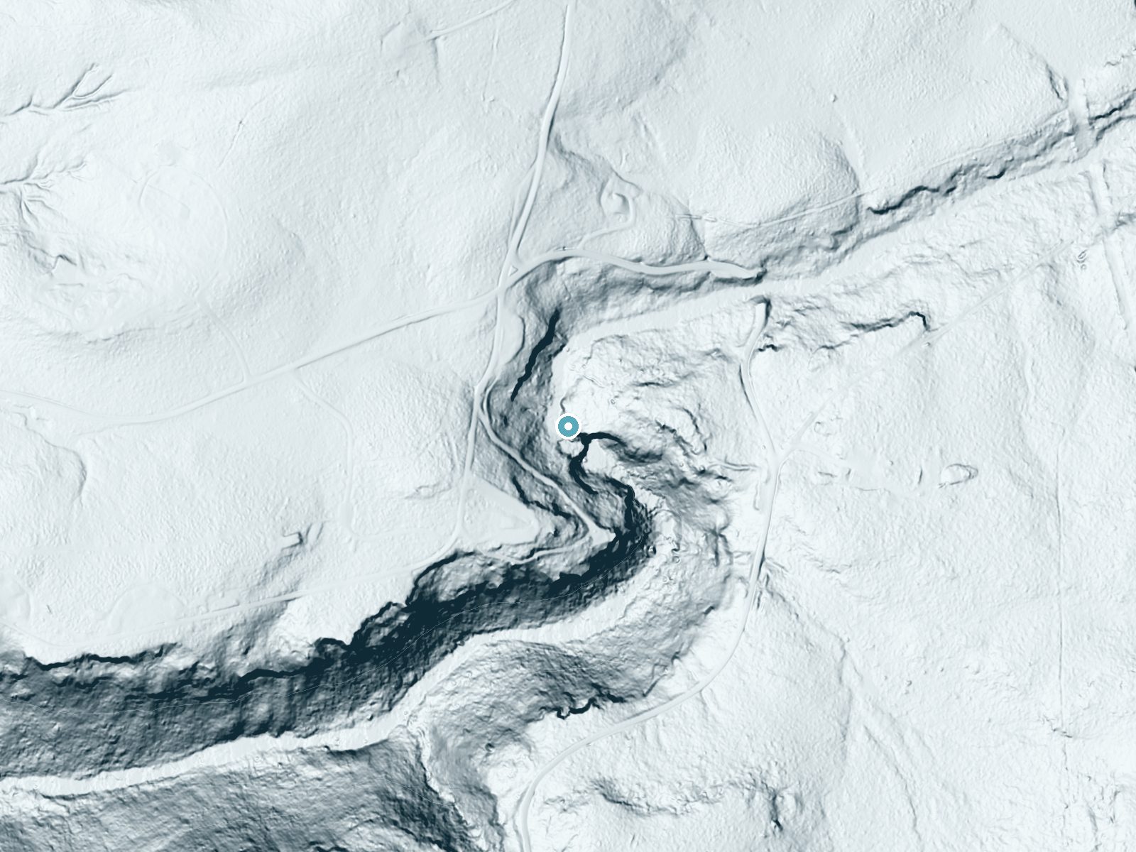
Drag to compare. The dot marks the waterfall. The frame is about a mile across.
- Ground elevation
- 3,040 feet
- Measured by 1-meter lidar
- Drop at the falls
- About 120 feet
- Change in ground height within ~250 feet of the falls
- Faces
- Southeast
- Sunlit most of the day. Go early or late for softer light.
A slice through the lidar ground surface, from above the falls to downstream (heading southeast).
Elevation data: USGS 3D Elevation Program. Aerial imagery: USGS The National Map. Public domain.
Location & Access
Getting There
Blackwater Falls is located within Blackwater Falls State Park near Davis, West Virginia. The falls are easily accessible via well-marked roads leading into the park.
Get Directions on Google MapsParking
There is a designated parking area near the Blackwater Falls Lodge and the main viewing area. Parking is free for visitors to the state park.
Elevation
3,022 feet above sea level
Coordinates
39.113848° N, -79.483221° W
Land Management
Managed by SDNR
Visitor Tips & Gear
Arrive early during peak seasons to avoid crowds, especially in the fall. Wear sturdy shoes as the boardwalk and stairs can be slippery when wet. Bring a camera to capture the stunning views.
As an Amazon Associate, we earn from qualifying purchases.
For this easy 0.4 miles trail, lightweight trail shoes and a water bottle are usually sufficient. Icy conditions are common in winter — traction cleats are a smart addition.

Columbia Watertight II Rain Jacket
Packs into its own pocket, seam-sealed, and keeps you dry from spray and surprise rain.

Polarized Sunglasses (Knockaround)
Cuts glare off the water so you actually see the falls — and your photos turn out better too.

Earth Pak Waterproof Dry Bag
Keeps your phone and gear dry when waterfall mist soaks everything else.

Waterproof Phone Pouch (AiRunTech)
Cheap insurance — take photos right next to the falls without killing your phone.

Kahtoola MICROspikes
Cult-favorite traction cleats that grip ice and wet rock — essential for winter waterfall hikes.

JOBY GorillaPod Starter Kit
Wraps around railings and rocks for long-exposure waterfall shots — no flat surface needed.
Where to Stay

The Davis Loft
The Inn at Canaan
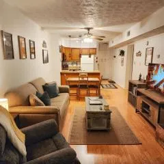
The Davis Ridge
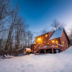
Driftland Cabin sauna, hot tub, pizza oven
Browse vacation cabins and private rentals nearby
Unique outdoor stays — tents, yurts, and treehouses
Rent a campervan or RV for your waterfall road trip
Some links are affiliate links. We may earn a commission at no extra cost to you.
Nearby Campground
HORSESHOE RECREATION AREA
7.8 miles away · 16 sites
Overview Horseshoe Recreation Area is located in north-central West Virginia, 7 miles from the town of St. George. The campground is tucked in a valley along the Horseshoe Run River, providing excellent opportunities for fishing and wildlife viewing. Recreation Day hiking options include the 1.8-mile Losh Trail, the Dorman Ridge Trail at 1.3 miles, and Two Camp, a short 0.3 mile hike. Fishing for trout is a popular pastime and hunting is allowed in an area about a mile beyond the recreation area.
Book on Recreation.govNearby Hot Springs
Hot springs near Oakland, West Virginia
Looking for a soak after your hike? Explore more hot springs near Oakland, West Virginia on SoakingSprings.
Explore West Virginia springsAdditional Information
Nearby Attractions
Nearby attractions include Lindy Point, Pendleton Point Overlook, and the town of Davis, which offers dining and shopping options.
Wildlife
The area is home to a variety of wildlife, including deer, black bears, and numerous bird species. Visitors may also see smaller mammals like squirrels and chipmunks.
Cities near Blackwater Falls
Writing about Blackwater Falls? Embed this waterfall on your site for free.