Bingham Falls
Vermont • 25 ft
By Armen Suny · Last verified Mar 2026
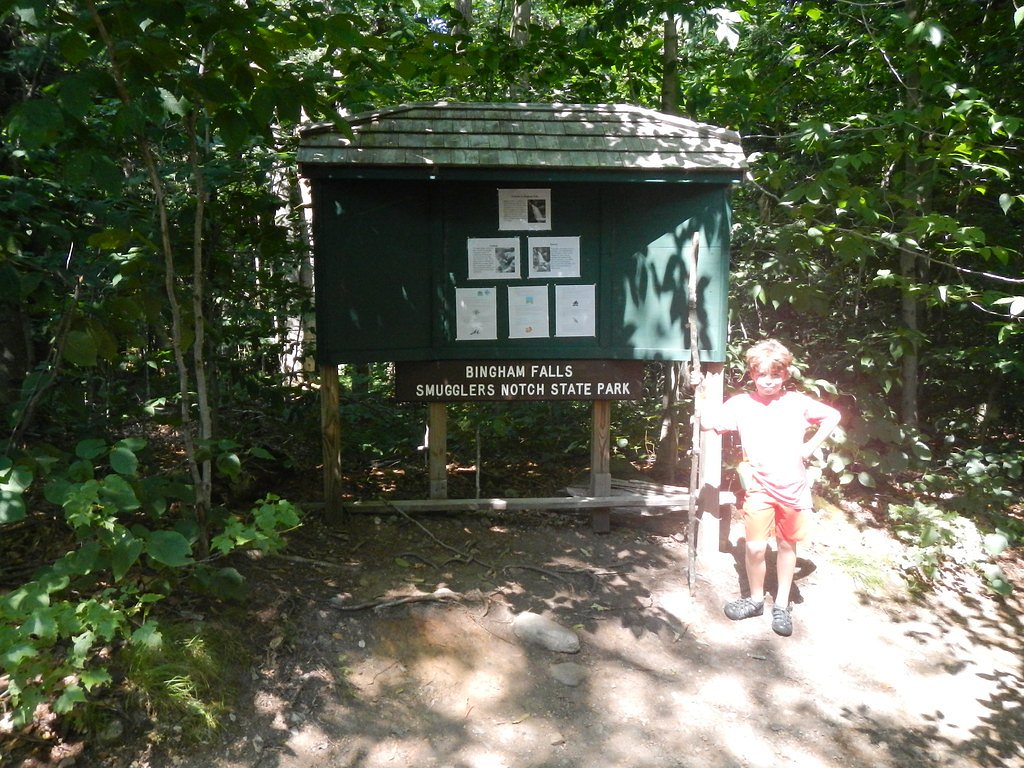
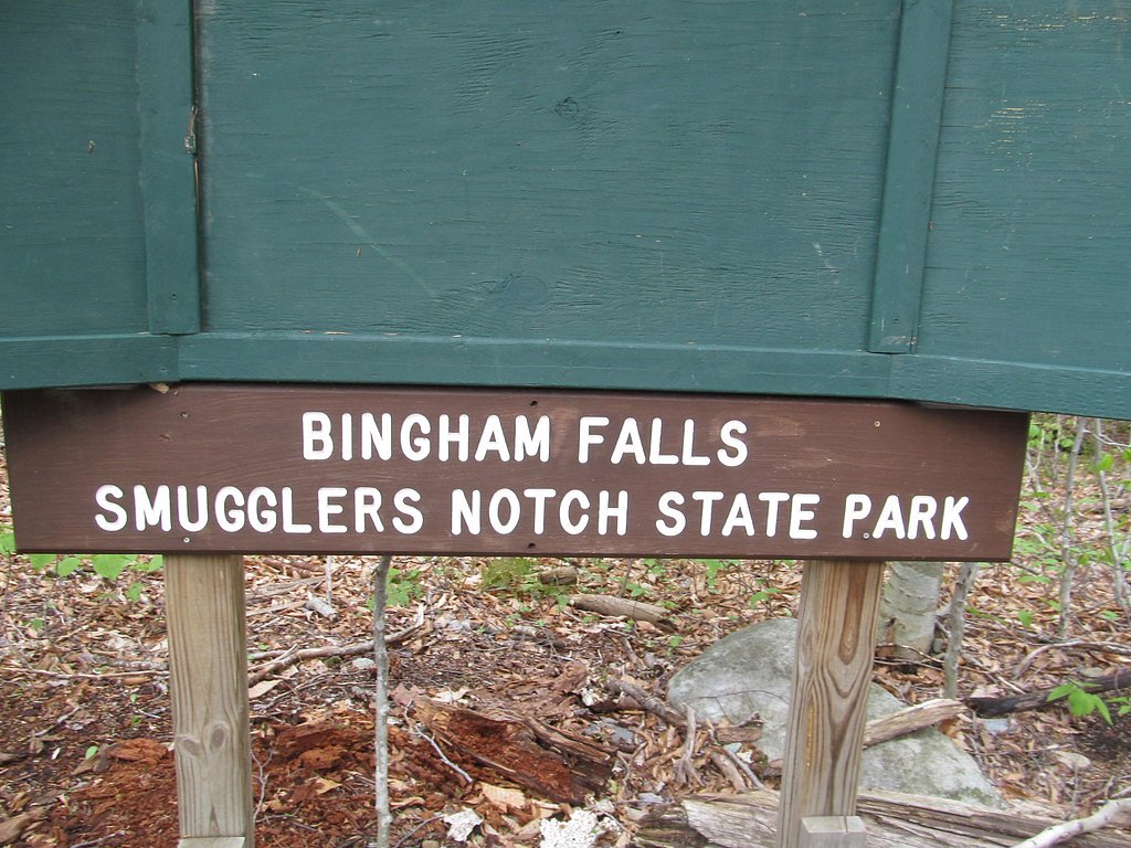
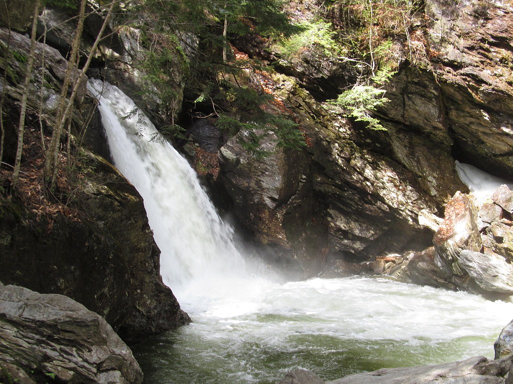
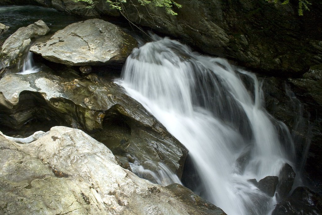
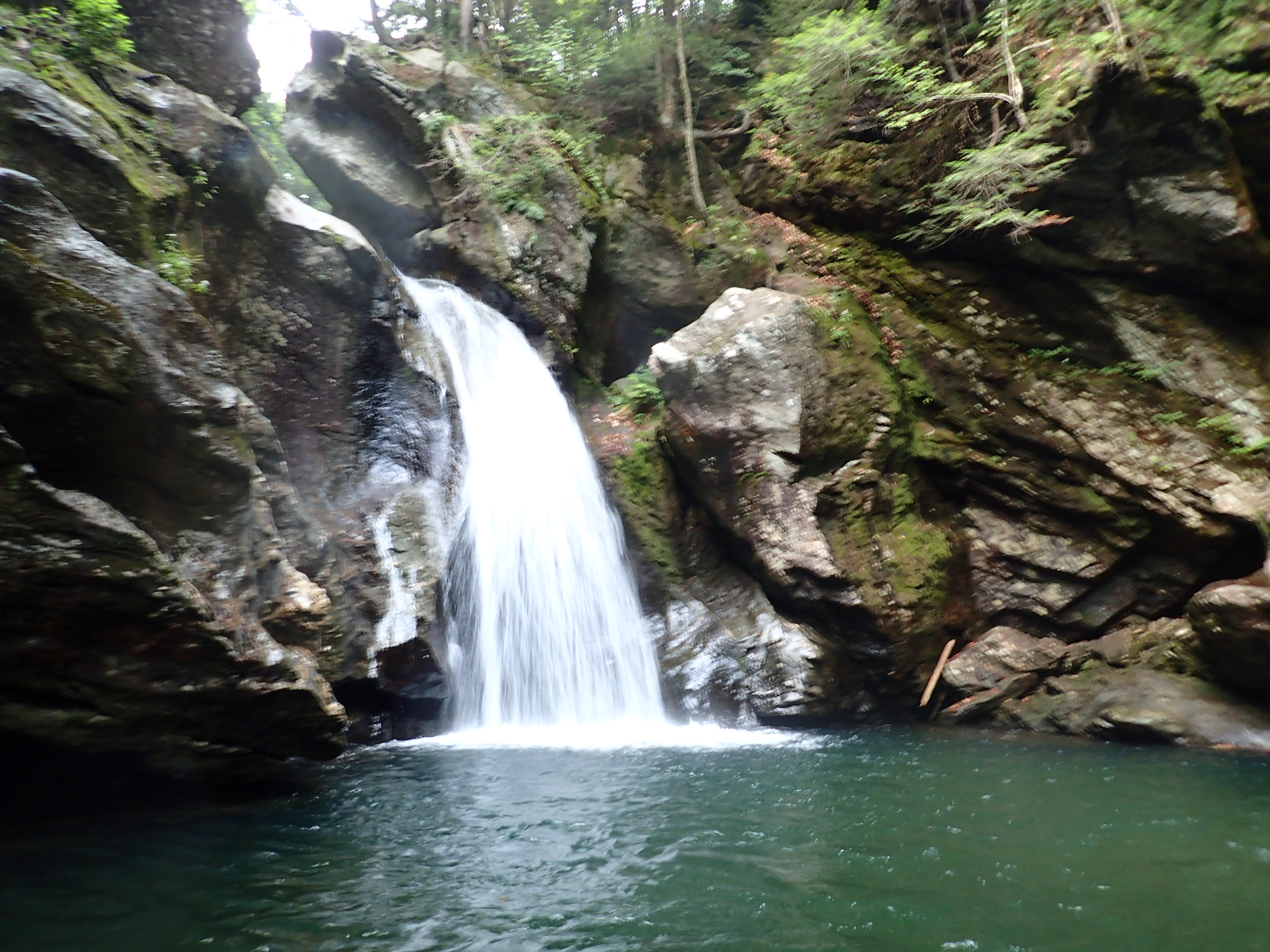
Photo Credits (5)
Difficulty
Easy
Trail Length
0.5 miles
Trail Type
Out And Back
Elevation Gain
100 ft
About Bingham Falls
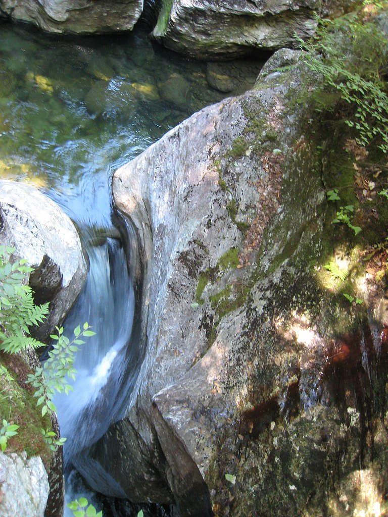
Bingham Falls is a picturesque waterfall located in Stowe, Vermont, known for its stunning cascades and deep swimming holes. It is a popular destination for hikers, nature enthusiasts, and photographers.
The Setting
Bingham Falls sits at 1,286 feet along the W Branch Little R Abv Bingham Falls, in the foothills of Vermont. The falls drop 25 feet.
Height: 25 feet
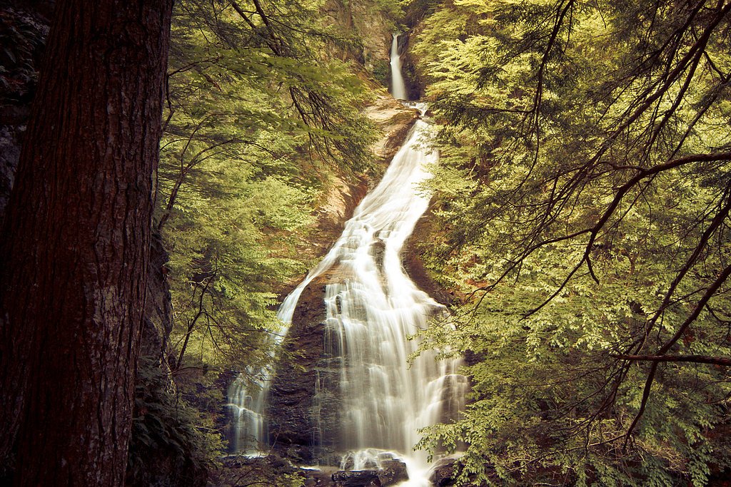
Nearby Falls Worth Visiting
Moss Glen Falls, the tallest waterfall in Vermont at 125 feet, lies 7.5 miles to the east. Also nearby: Bingham Falls (25 ft, 2.6 mi).
Trail & Hike Details
The Approach
The easy 0.5-mile out-and-back trail gains 100 feet of elevation on the way to the falls.
Trail Description
The trail to Bingham Falls is short and well-maintained, with a gentle descent through a forested area. The path leads to a viewing area and access to the falls. Some sections near the falls may be steep and slippery, especially after rain or during winter.
What to Expect
The falls drop a gentle 25 feet. Swimming is permitted. Dogs are welcome.
Accessibility
The trail is short and relatively flat, but the surface may be uneven. Contact the managing agency for accessibility details.
Frequently Asked Questions
🐶 Are Dogs Allowed at Bingham Falls?
✅ Dogs are allowed
Are There Any Fees or Permits Required?
🆖 No fees required
🏊 Is There Swimming at Bingham Falls?
✅ Swimming is allowed
When to Visit
The best time to visit is during the summer for swimming or in the fall to enjoy the vibrant foliage. Spring is also a great time to see the falls at their fullest due to snowmelt.
Seasonal Access
The best time to visit is Spring, Summer, and Fall. Winter access may be limited.
Safety Information
Be cautious near the water, as rocks can be slippery and currents strong. Avoid swimming during high water levels or after heavy rainfall. In winter, icy conditions may make the trail hazardous.
Current Water Conditions
12 ft³/s
Current discharge — how much water is flowing
About average for this time of year
Based on 25 years of record
1.13 ft
Water depth at gauge
7-Day Discharge Trend
What does this mean for your visit?
Flow is about average for this time of year.
About This Gauge
7-Day Flow Outlook
Based on the USGS gauge W BRANCH LITTLE R ABV BINGHAM FALLS NEAR STOWE, VT (1 km away).
Today
Barely Flowing
12 cfs
5/10Tomorrow
Low
10 cfs
3/10Wed
Low
9 cfs
3/10Thu
Low
9 cfs
3/10Fri
Low
8 cfs
3/10Sat
Low
9 cfs
3/10Sun
Low
7 cfs
4/10Best window: Today — barely flowing flow, sunny (trip score 5/10).
Best time of year: this gauge typically runs highest from late March to early June, peaking in May.
How we calculate this
This is a transparent outlook, not a precise forecast. We take the waterfall's current flow strength (how it ranks against its historical normal for today, from the nearest USGS stream gauge), carry that ranking forward along the gauge's seasonal curve, and nudge it for forecast rain. Confidence is highest for the next day or two and falls further out. Always check official conditions and your own judgment before visiting — high flows can be dangerous.
Know when to go.
Get a free email alert when waterfalls near Underhill Center hit peak flow. We only send when conditions are worth the trip — no weekly newsletters, no spam.
Weather Forecast
Location & Access
Getting There
Bingham Falls is located off Route 108 (Mountain Road) in Stowe, Vermont. The trailhead is near the Smugglers' Notch State Park area, with a small parking lot available nearby.
Get Directions on Google MapsParking
There is a small parking area near the trailhead on Route 108. Parking can fill up quickly during peak seasons, so arriving early is recommended.
Elevation
1,286 feet above sea level
Coordinates
44.519686° N, -72.767124° W
Visitor Tips & Gear
Wear sturdy footwear, as the trail and rocks near the falls can be slippery. Arrive early to secure parking, especially during weekends and peak seasons. Be cautious near the water, as currents can be strong.
As an Amazon Associate, we earn from qualifying purchases.
For this easy 0.5 miles trail, lightweight trail shoes and a water bottle are usually sufficient. Sun exposure on the trail makes good sun protection a must in summer.

Polarized Sunglasses (Knockaround)
Cuts glare off the water so you actually see the falls — and your photos turn out better too.

Columbia Watertight II Rain Jacket
Packs into its own pocket, seam-sealed, and keeps you dry from spray and surprise rain.

Earth Pak Waterproof Dry Bag
Keeps your phone and gear dry when waterfall mist soaks everything else.

Waterproof Phone Pouch (AiRunTech)
Cheap insurance — take photos right next to the falls without killing your phone.

JOBY GorillaPod Starter Kit
Wraps around railings and rocks for long-exposure waterfall shots — no flat surface needed.

Osprey Daylite Daypack
Light, organized, and just the right size for a day hike — fits water, snacks, and layers.
Where to Stay

Green Mountain Inn

Northern Lights Lodge

Outbound Stowe

Sun & Ski Inn and Suites
Browse vacation cabins and private rentals nearby
Unique outdoor stays — tents, yurts, and treehouses
Rent a campervan or RV for your waterfall road trip
Some links are affiliate links. We may earn a commission at no extra cost to you.
Additional Information
Nearby Attractions
Smugglers' Notch State Park, Stowe Mountain Resort, and Moss Glen Falls are nearby attractions worth visiting.
Wildlife
The area is home to a variety of wildlife, including birds, squirrels, and occasionally deer.
Cities near Bingham Falls
Nearby Waterfalls

Other waterfalls named Bingham Falls
1 other waterfall shares this name across the U.S.
Writing about Bingham Falls? Embed this waterfall on your site for free.