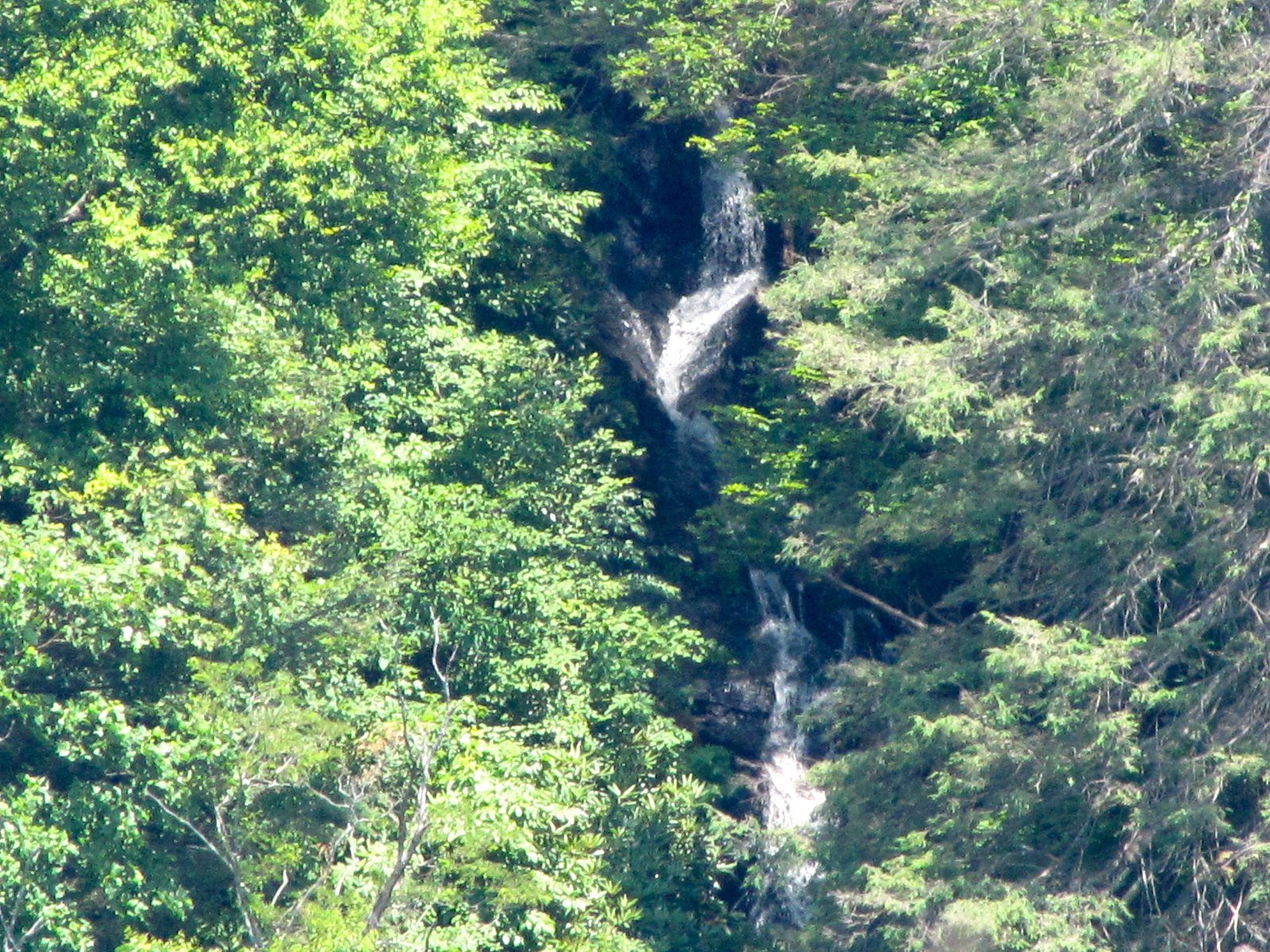
Betseys Rock Falls
By Armen Suny · Last verified May 2026
Photo Credits (1)
Difficulty
Moderate
Trail Length
2.0 miles
Trail Type
Out And Back
Elevation Gain
300 ft
About Betseys Rock Falls
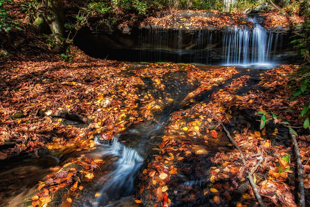
Betseys Rock Falls is a picturesque cascade tucked into privately owned conservation lands in North Carolina. The falls sit on property protected by a Conservation Trust for North Carolina easement and are managed by a conservation NGO, so visitors should be mindful of posted access guidelines and stay on designated routes. The setting is quietly wooded and photogenic, making it a rewarding destination for hikers looking for a peaceful streamside stop. The route to the falls threads through mature forest and a shaded stream corridor, so expect dappled light and mossy rocks underfoot. Not to be confused with Cascade Falls (also called “The Cascades”) at E. B. Jeffress Park on the Blue Ridge Parkway, Betseys Rock Falls offers a more secluded feel thanks to its placement on conserved private land.
The Setting
Betseys Rock Falls sits at 3,146 feet within Conservation Trust for North Carolina Easement, fed by the South Fork New River, in the mountains of North Carolina.
Trail & Hike Details
The Approach
The moderate 2.0-mile out and back trail gains 300 feet of elevation on the way to the falls.
Trail Description
Out-and-back, 2.0 miles round trip with roughly 300 feet of elevation gain; rated moderate. The path is a mix of dirt and rocky tread, largely shaded and passing through dense forest with a few small stream crossings. Grades are steady but generally manageable; no public USFS trail number or surface/grade/class data is provided for this route.
What to Expect
Dogs are welcome.
Accessibility
The trail is not wheelchair accessible. Uneven terrain and elevation changes require steady footing.
Frequently Asked Questions
🐶 Are Dogs Allowed at Betseys Rock Falls?
✅ Dogs are allowed
Are There Any Fees or Permits Required?
🆖 No fees required
🏊 Is There Swimming at Betseys Rock Falls?
❌ Swimming is not allowed
When to Visit
Spring and early summer are ideal for visiting, as the waterfall flow is typically strongest after seasonal rains.
Seasonal Access
The best time to visit is Spring, Summer, and Fall. Winter access may be limited.
Safety Information
The trail can be slippery, especially after rain. Visitors should exercise caution near the waterfall, as the rocks can be wet and unstable. Always stay on marked trails.
Current Water Conditions
153 ft³/s
Current discharge — how much water is flowing
Much lower than usual for this time of year
Based on 99 years of record
1.81 ft
Water depth at gauge
7-Day Discharge Trend
What does this mean for your visit?
Flow is well below normal for this time of year, so the waterfall may be a trickle.
About This Gauge
This gauge is on a nearby waterway and may not reflect exact conditions at the falls.
7-Day Flow Outlook
Based on the USGS gauge SOUTH FORK NEW RIVER NEAR JEFFERSON, NC (12 km away).
Today
Roaring
174 cfs
6/10Tomorrow
Roaring
182 cfs
6/10Wed
Roaring
153 cfs
9/10Thu
Roaring
150 cfs
9/10Fri
Roaring
191 cfs
6/10Sat
Roaring
200 cfs
6/10Sun
Roaring
182 cfs
6/10Best window: Wed — roaring flow, sunny (trip score 9/10).
Best time of year: this gauge typically runs highest from mid February to early May, peaking in April.
How we calculate this
This is a transparent outlook, not a precise forecast. We take the waterfall's current flow strength (how it ranks against its historical normal for today, from the nearest USGS stream gauge), carry that ranking forward along the gauge's seasonal curve, and nudge it for forecast rain. Confidence is highest for the next day or two and falls further out. Always check official conditions and your own judgment before visiting — high flows can be dangerous.
Know when to go.
Get a free email alert when waterfalls near West Jefferson hit peak flow. We only send when conditions are worth the trip — no weekly newsletters, no spam.
Weather Forecast
Location & Access
Getting There
Betseys Rock Falls is located near the town of Mortimer, North Carolina, within the Pisgah National Forest. Access typically involves driving on gravel forest service roads, which may require a high-clearance vehicle depending on conditions.
Get Directions on Google MapsParking
There is limited parking available near the trailhead. Visitors should be prepared for a small, unpaved parking area.
Hours
Elevation
3,146 feet above sea level
Coordinates
36.284989° N, -81.408506° W
Land Management
Managed by NGO
Visitor Tips & Gear
Wear sturdy hiking shoes, as the trail can be uneven and muddy. Bring insect repellent during warmer months, and check weather conditions before visiting. Cell service may be limited in the area.
As an Amazon Associate, we earn from qualifying purchases.
With 2.0 miles and 300 ft of elevation gain, sturdy boots and trekking poles will help on this moderate trail. Sun exposure on the trail makes good sun protection a must in summer.

Polarized Sunglasses (Knockaround)
Cuts glare off the water so you actually see the falls — and your photos turn out better too.

Columbia Watertight II Rain Jacket
Packs into its own pocket, seam-sealed, and keeps you dry from spray and surprise rain.

Earth Pak Waterproof Dry Bag
Keeps your phone and gear dry when waterfall mist soaks everything else.

Waterproof Phone Pouch (AiRunTech)
Cheap insurance — take photos right next to the falls without killing your phone.

Timberland Euro Sprint Mid Waterproof
Trusted waterproof boot with premium leather and grippy rubber sole — reliable on rocky, wet trails.

TrailBuddy Trekking Poles
Lightweight aluminum, cork grips, and flip-locks that actually hold — a best-seller for good reason.
Where to Stay

West Jefferson Vacation Rental Near River

Nations Inn - West Jefferson

Holiday Inn Express West Jefferson by IHG

Walnut Hill Cottage
Browse vacation cabins and private rentals nearby
Unique outdoor stays — tents, yurts, and treehouses
Rent a campervan or RV for your waterfall road trip
Some links are affiliate links. We may earn a commission at no extra cost to you.
Nearby Campground
BANDITS ROOST
14.3 miles away · 103 sites
Overview Bandits Roost Campground is located on the south side of W. Kerr Scott Reservoir in western North Carolina. Constructed in the beautiful Yadkin River Valley, the lake offers extensive opportunities for outdoor recreational activities.Recreation The 1,475-acre reservoir offers excellent boating, canoeing, kayaking and swimming opportunities. Anglers will find channel catfish, large and smallmouth bass, bluegill, threadfin shad, spotted bass, striped bass, and hybrid striped bass. Miles of
Book on Recreation.govAdditional Information
Nearby Attractions
Other nearby attractions include Wilson Creek, Harper Creek Falls, and the Mortimer Campground.
Wildlife
The area is home to a variety of wildlife, including deer, birds, and small mammals. Visitors should be cautious of snakes and other potentially hazardous animals.
Cities near Betseys Rock Falls
Nearby Waterfalls
Writing about Betseys Rock Falls? Embed this waterfall on your site for free.