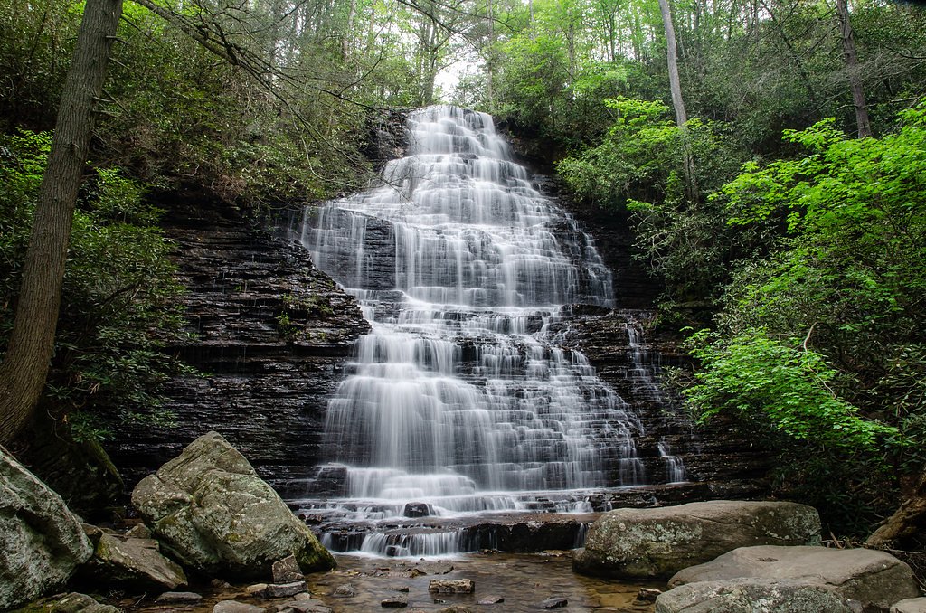
Benton Falls
Tennessee • 65 ft
By Armen Suny · Last verified May 2026
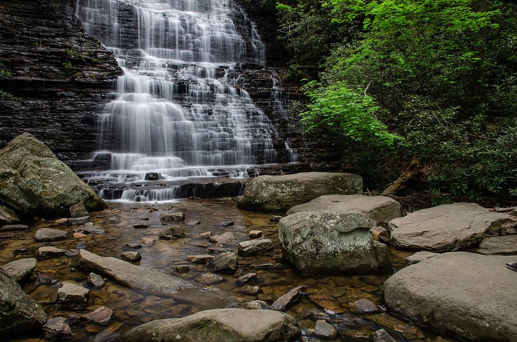
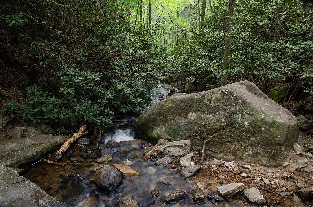
Photo Credits (3)
Difficulty
Easy
Trail Length
3.0 miles
Trail Type
Out And Back
Elevation Gain
200 ft
About Benton Falls
Benton Falls is a picturesque 65-foot waterfall located in the Cherokee National Forest in Tennessee. It is a popular destination for hikers and nature enthusiasts due to its serene setting and relatively accessible trail.
The Setting
Benton Falls sits at 1,637 feet within Cherokee National Forest, fed by the Oostanaula Creek, in the hills of Tennessee. The falls drop 65 feet.
Height: 65 feet
Trail & Hike Details
The Approach
The easy hike follows Benton Falls Hiking Trails (#131), a 3.0-mile out-and-back trail over n/a. Expect 200 feet of elevation gain with grades of N/A.
USFS Trail
BENTON FALLS HIKING TRAILS #131
Trail Class
Class 0
Surface
Avg Grade
USFS Segment
1.51 miTrail Description
The trail to Benton Falls is well-maintained and features a gentle incline, making it suitable for most visitors. It winds through a forested area with scenic views and leads directly to the waterfall. The final approach to the falls includes a short descent over rocky terrain.
What to Expect
The falls drop 65 feet. Dogs are welcome.
Accessibility
The trail is not wheelchair accessible. Uneven terrain and elevation changes require steady footing.
Frequently Asked Questions
🐶 Are Dogs Allowed at Benton Falls?
✅ Dogs are allowed
Are There Any Fees or Permits Required?
🤑 Fee: $3.00
🏊 Is There Swimming at Benton Falls?
❌ Swimming is not allowed
When to Visit
Spring and fall are the best times to visit, as the waterfall flow is typically stronger, and the surrounding foliage is particularly beautiful.
Seasonal Access
The best time to visit is Spring, Summer, and Fall. Winter access may be limited. Check with Cherokee National Forest for seasonal road closures.
Safety Information
The rocks near the waterfall can be slippery, especially after rain. Exercise caution when approaching the falls. Be aware of changing weather conditions and carry sufficient water.
Current Water Conditions
27 ft³/s
Current discharge — how much water is flowing
Much lower than usual for this time of year
2.34 ft
Water depth at gauge
7-Day Discharge Trend
What does this mean for your visit?
Flow is well below normal for this time of year, so the waterfall may be a trickle.
About This Gauge
This gauge is on a nearby waterway and may not reflect exact conditions at the falls.
7-Day Flow Outlook
Based on the USGS gauge OOSTANAULA CREEK NEAR SANFORD, TN (23 km away).
Today
Low
30 cfs
3/10Tomorrow
Barely Flowing
28 cfs
5/10Tue
Barely Flowing
26 cfs
5/10Wed
Low
28 cfs
3/10Thu
Low
30 cfs
3/10Fri
Low
31 cfs
3/10Sat
Low
30 cfs
3/10Best window: Tomorrow — barely flowing flow, sunny (trip score 5/10).
Best time of year: this gauge typically runs highest from late January to mid April, peaking in February.
How we calculate this
This is a transparent outlook, not a precise forecast. We take the waterfall's current flow strength (how it ranks against its historical normal for today, from the nearest USGS stream gauge), carry that ranking forward along the gauge's seasonal curve, and nudge it for forecast rain. Confidence is highest for the next day or two and falls further out. Always check official conditions and your own judgment before visiting — high flows can be dangerous.
Know when to go.
Get a free email alert when waterfalls near Benton hit peak flow. We only send when conditions are worth the trip — no weekly newsletters, no spam.
Weather Forecast
Location & Access
Getting There
Benton Falls is located within the Chilhowee Recreation Area of the Cherokee National Forest. From Benton, Tennessee, take US-64 east to Forest Road 77 and follow signs to the Chilhowee Recreation Area. The trailhead for Benton Falls begins near the main parking area.
Get Directions on Google MapsParking
There is a designated parking area at the Chilhowee Recreation Area, which requires a small day-use fee.
Elevation
1,637 feet above sea level
Coordinates
35.140518° N, -84.596315° W
Land Management
Managed by USFS
Visitor Tips & Gear
Arrive early during weekends or peak seasons to secure parking. Wear sturdy shoes, as the trail can be rocky near the falls. Bring water and snacks, as there are no facilities along the trail.
As an Amazon Associate, we earn from qualifying purchases.
This easy 3.0 miles hike is straightforward — comfortable trail shoes and plenty of water should do. Sun exposure on the trail makes good sun protection a must in summer.

Polarized Sunglasses (Knockaround)
Cuts glare off the water so you actually see the falls — and your photos turn out better too.

Columbia Watertight II Rain Jacket
Packs into its own pocket, seam-sealed, and keeps you dry from spray and surprise rain.

Earth Pak Waterproof Dry Bag
Keeps your phone and gear dry when waterfall mist soaks everything else.

Waterproof Phone Pouch (AiRunTech)
Cheap insurance — take photos right next to the falls without killing your phone.

JOBY GorillaPod Starter Kit
Wraps around railings and rocks for long-exposure waterfall shots — no flat surface needed.

Osprey Daylite Daypack
Light, organized, and just the right size for a day hike — fits water, snacks, and layers.
Where to Stay

Eagles Landing

Incredible Views! - Pet Friendly - Aska Adventure Area - Bearfoot Bungalow

Quality Inn Ocoee - Cleveland East

Still Waters Retreat at the Ocoee
Browse vacation cabins and private rentals nearby
Unique outdoor stays — tents, yurts, and treehouses
Rent a campervan or RV for your waterfall road trip
Some links are affiliate links. We may earn a commission at no extra cost to you.
Nearby Campground
CHILHOWEE CAMPGROUND
1.2 miles away · 61 sites
Overview Located in the Chilhowee Recreation Area, Chilhowee Campground offers a multitude of camping opportunities for both RV and tent sites, many with electric hookups. The day-use area includes McKamy Lake, a swim area with sand beach, picnic sites, a group picnic area, and a bathhouse. Be Aware; Do not use GPS directions: GPS coordinates will direct you up Benton Springs Rd. This route is not recommended. We recommend using Forest Service Road 77 to reach the recreation area. It's important
Book on Recreation.govAdditional Information
Nearby Attractions
The Chilhowee Recreation Area offers additional hiking trails, picnic areas, and McCamy Lake for swimming and fishing.
Wildlife
The area is home to a variety of wildlife, including deer, birds, and small mammals. Visitors should be cautious of snakes and other potentially hazardous animals.
Cities near Benton Falls
Writing about Benton Falls? Embed this waterfall on your site for free.