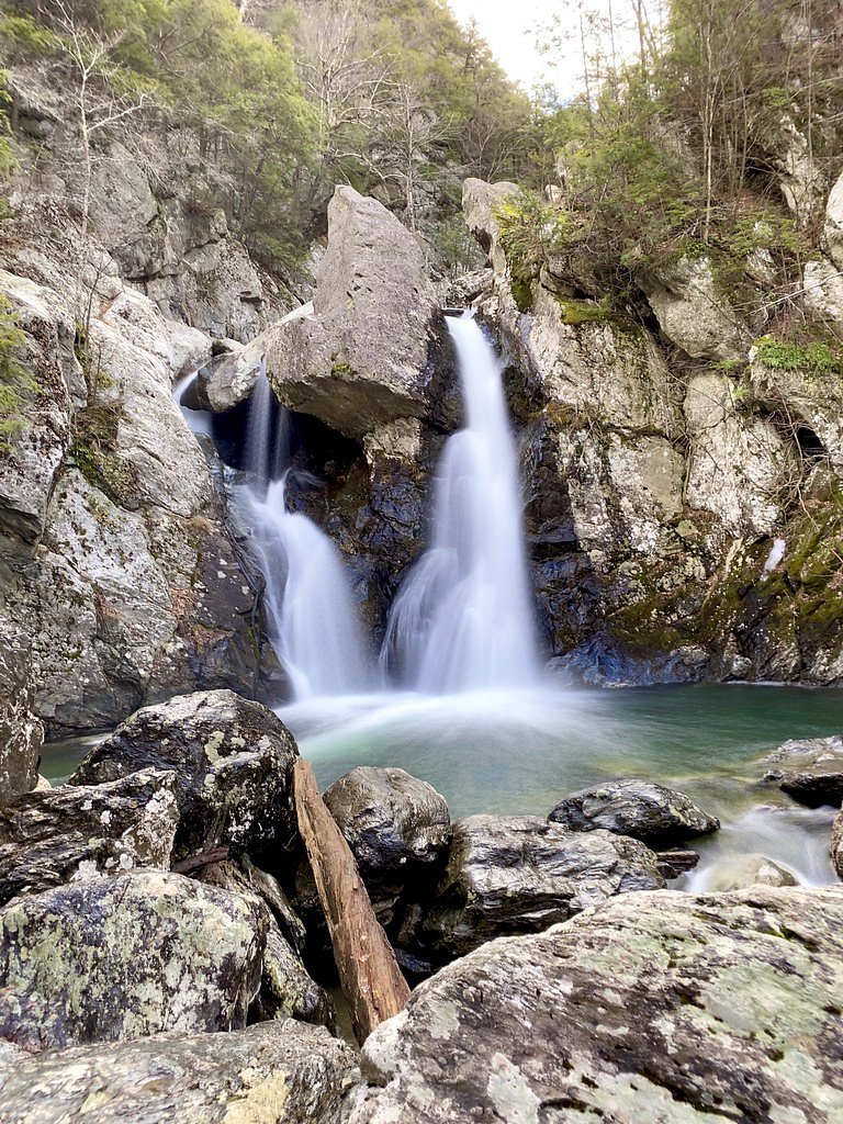
Bash Bish Falls
Massachusetts • 60 ft
By Armen Suny · Last verified Mar 2026
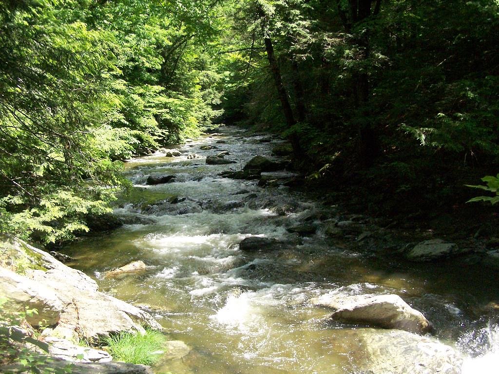
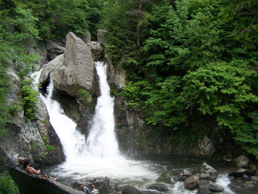

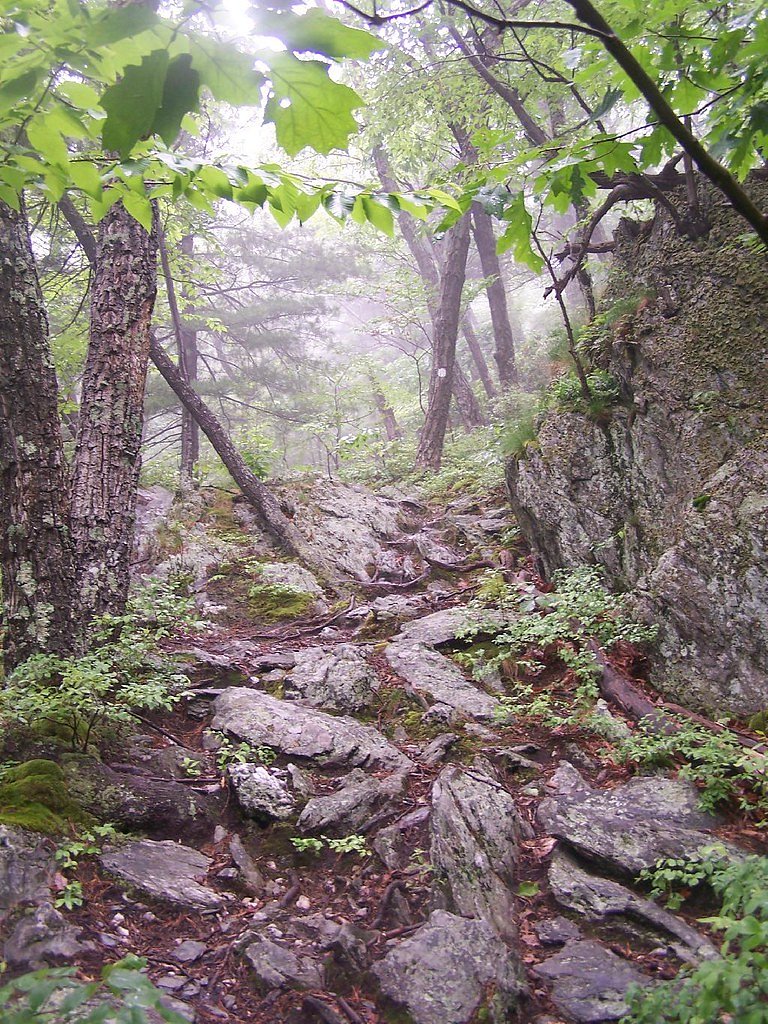

Photo Credits (5)
Difficulty
Moderate
Trail Length
1.5 miles
Trail Type
Out And Back
Elevation Gain
300 ft
About Bash Bish Falls
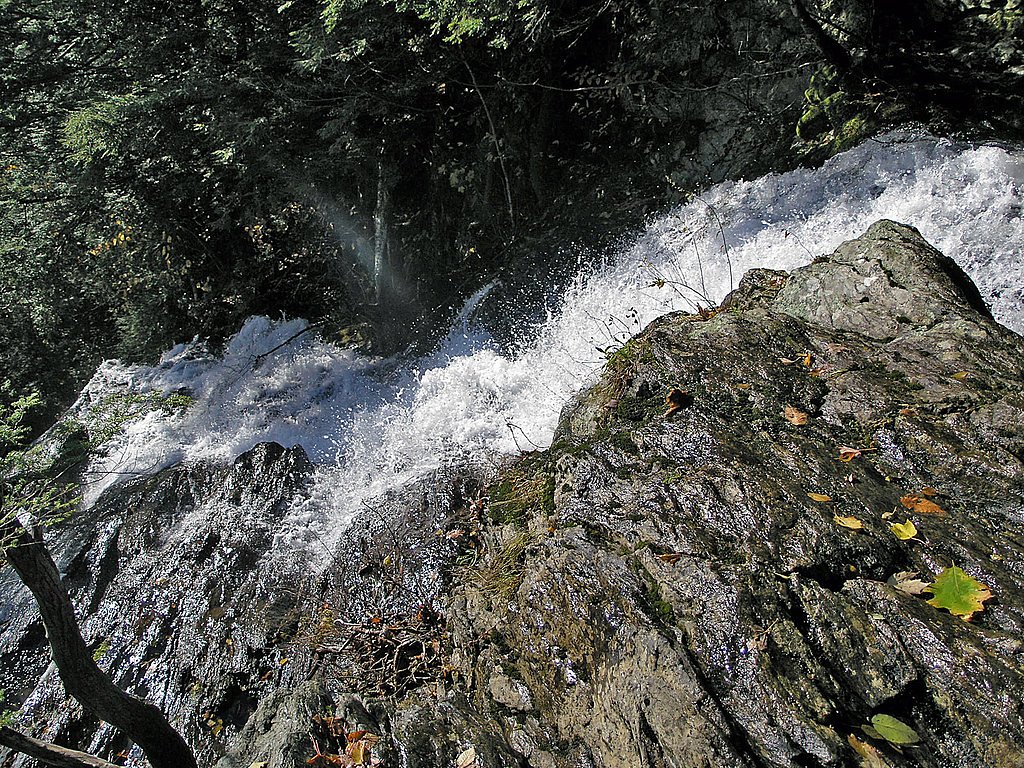
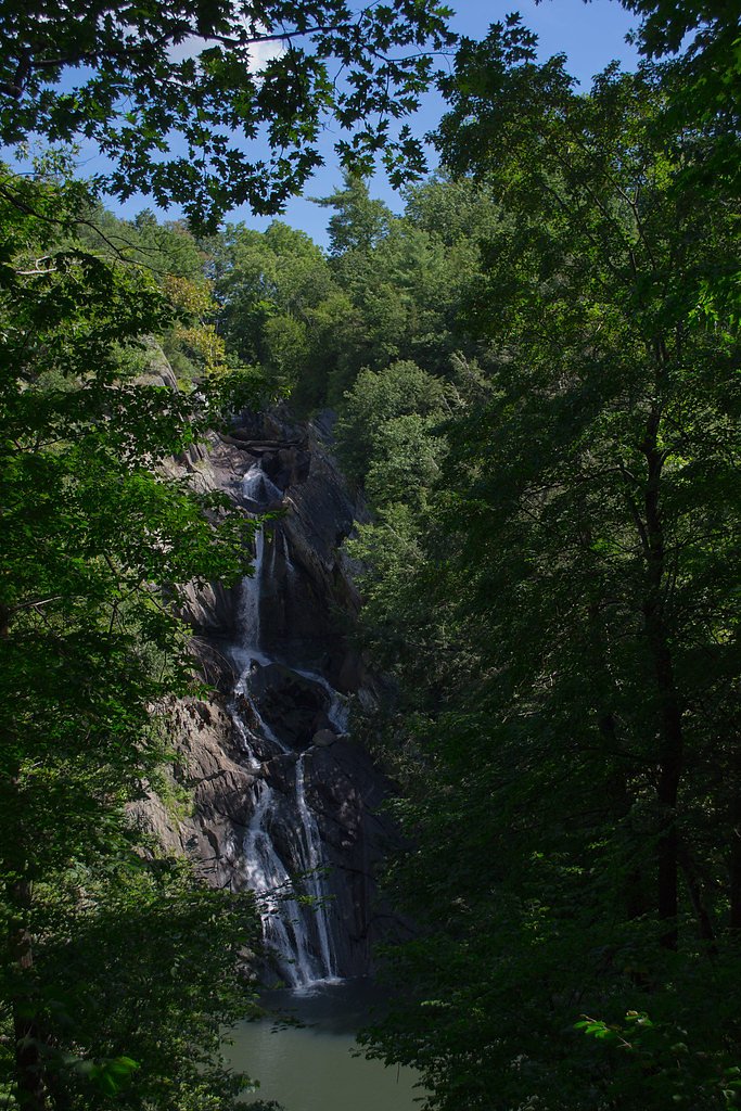
Bash Bish Falls is one of the most iconic and picturesque waterfalls in Massachusetts, located in Bash Bish Falls State Park near the New York border. The waterfall features a dramatic 60-foot drop, splitting into twin cascades that plunge into a serene pool below.
The Setting
Bash Bish Falls sits at 1,089 feet within Bash Bish Falls State Park, fed by the Green River, in the foothills of Massachusetts. The falls drop 60 feet.
Height: 60 feet
Trail & Hike Details
The Approach
The moderate 1.5-mile out-and-back trail gains 300 feet of elevation on the way to the falls.
Trail Description
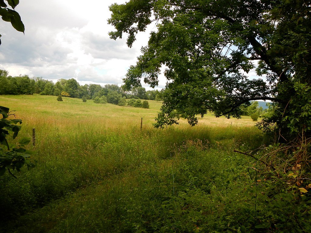
The trail from the Massachusetts side is a moderately challenging hike with some steep sections and rocky terrain, offering scenic views of the forest. The New York side provides a much easier and shorter walk along a flat, gravel path, making it more accessible for families and those with mobility concerns.
What to Expect
The falls drop 60 feet. Dogs are welcome.
Accessibility
The trail is not wheelchair accessible. Uneven terrain and elevation changes require steady footing.
Frequently Asked Questions
🐶 Are Dogs Allowed at Bash Bish Falls?
✅ Dogs are allowed
Are There Any Fees or Permits Required?
🆖 No fees required
🏊 Is There Swimming at Bash Bish Falls?
❌ Swimming is not allowed
When to Visit
Spring and early summer are ideal for visiting, as the waterfall is at its fullest due to snowmelt and rainfall. Fall offers beautiful foliage, while winter provides a unique view of the frozen falls.
Seasonal Access
The best time to visit is Spring, Summer, and Fall. Winter access may be limited.
Safety Information
The rocks around the falls can be slippery, and the currents in the pool are strong. Stay on marked trails and viewing areas. Swimming and climbing on the rocks are prohibited for safety reasons.
Current Water Conditions
15 ft³/s
Current discharge — how much water is flowing
About average for this time of year
Based on 41 years of record
0.72 ft
Water depth at gauge
7-Day Discharge Trend
What does this mean for your visit?
Flow is about average for this time of year.
About This Gauge
This gauge is on a nearby waterway and may not reflect exact conditions at the falls.
7-Day Flow Outlook
Based on the USGS gauge GREEN RIVER NEAR GREAT BARRINGTON, MA (12 km away).
Today
Low
17 cfs
3/10Tomorrow
Moderate
17 cfs
4/10Thu
Low
15 cfs
6/10Fri
Low
13 cfs
3/10Sat
Moderate
14 cfs
4/10Sun
Moderate
13 cfs
4/10Mon
Moderate
13 cfs
4/10Best window: Thu — low flow, sunny (trip score 6/10).
Best time of year: this gauge typically runs highest from early March to mid May, peaking in April.
How we calculate this
This is a transparent outlook, not a precise forecast. We take the waterfall's current flow strength (how it ranks against its historical normal for today, from the nearest USGS stream gauge), carry that ranking forward along the gauge's seasonal curve, and nudge it for forecast rain. Confidence is highest for the next day or two and falls further out. Always check official conditions and your own judgment before visiting — high flows can be dangerous.
Know when to go.
Get a free email alert when waterfalls near Copake Falls hit peak flow. We only send when conditions are worth the trip — no weekly newsletters, no spam.
Weather Forecast
Location & Access
Getting There
Bash Bish Falls can be accessed from two main trailheads: one in Massachusetts and one in New York. The Massachusetts trailhead is located off Falls Road in Mount Washington, MA, while the New York trailhead is off Route 344 in Copake Falls, NY.
Get Directions on Google MapsParking
Parking is available at both trailheads. The New York parking lot is larger and offers a shorter, easier walk to the falls, while the Massachusetts lot requires a steeper hike.
Elevation
1,089 feet above sea level
Coordinates
42.114813° N, -73.492897° W
Land Management
Managed by UNK
Visitor Tips & Gear
Arrive early to secure parking, especially on weekends. Wear sturdy footwear if hiking from the Massachusetts side, and bring water. Note that swimming is prohibited for safety reasons.
As an Amazon Associate, we earn from qualifying purchases.
With 1.5 miles and 300 ft of elevation gain, sturdy boots and trekking poles will help on this moderate trail. Sun exposure on the trail makes good sun protection a must in summer.

Polarized Sunglasses (Knockaround)
Cuts glare off the water so you actually see the falls — and your photos turn out better too.

Columbia Watertight II Rain Jacket
Packs into its own pocket, seam-sealed, and keeps you dry from spray and surprise rain.

Earth Pak Waterproof Dry Bag
Keeps your phone and gear dry when waterfall mist soaks everything else.

Waterproof Phone Pouch (AiRunTech)
Cheap insurance — take photos right next to the falls without killing your phone.

Timberland Euro Sprint Mid Waterproof
Trusted waterproof boot with premium leather and grippy rubber sole — reliable on rocky, wet trails.

TrailBuddy Trekking Poles
Lightweight aluminum, cork grips, and flip-locks that actually hold — a best-seller for good reason.
Where to Stay

Holiday Inn Club Vacations Oak n Spruce Resort in the Berkshires

Holiday Inn Express Great Barrington by IHG

The Perch Hotel

Manor House Inn
Browse vacation cabins and private rentals nearby
Unique outdoor stays — tents, yurts, and treehouses
Rent a campervan or RV for your waterfall road trip
Some links are affiliate links. We may earn a commission at no extra cost to you.
Nearby Hot Springs
Hot springs near Copake Falls, Massachusetts

Lebanon Spring
Lebanon Spring discharges at 72°F at 663 feet elevation in Columbia County, flowing 24 degrees above ambient air temperature ju...
Sand Spring
Sand Spring surfaces at 75°F in Williamstown, Massachusetts — one of the few thermal features in New England. At just 670 feet ...
Looking for a soak after your hike? Explore more hot springs near Copake Falls, Massachusetts on SoakingSprings.
Explore Massachusetts springsAdditional Information
Nearby Attractions
Taconic State Park in New York offers additional hiking trails and camping opportunities. The town of Great Barrington, MA, is nearby and features shops, restaurants, and cultural attractions.
Wildlife
The area is home to a variety of wildlife, including deer, birds, and small mammals. Keep an eye out for birds of prey and other native species.
Cities near Bash Bish Falls
Nearby Waterfalls
Writing about Bash Bish Falls? Embed this waterfall on your site for free.