Difficulty
Moderate
Trail Length
2.4 miles
Trail Type
Out And Back
Elevation Gain
350 ft
About Barrier Falls
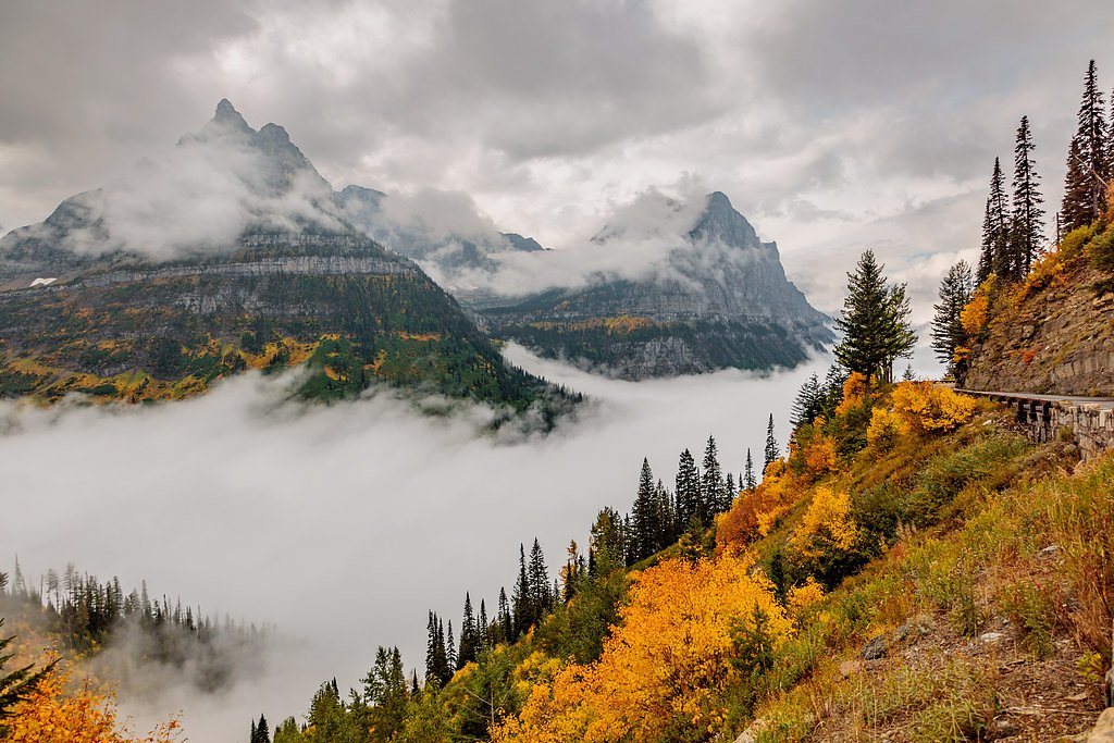
Barrier Falls is a compact, scenic cascade tucked into Montana’s Flathead National Forest and managed by the U.S. Forest Service. The waterfall is most commonly reached via the USFS BROWNIE Trail (Trail #451), a pleasant out-and-back hike that threads through dense forest and open meadow pockets. Hikers praise the peaceful setting and the chance for quiet wildlife sightings along the route, making it a popular half-day outing for local day hikers. The approach is moderate in difficulty: the route gains about 350 feet over the outing and is listed at roughly 2.4 miles round-trip (USFS GIS measurement ~1.83 miles). The trail is Class 2 and follows native-material tread with typical grades of 12–20%, so sturdy footwear and a steady pace make for the most enjoyable visit. The nearest USFS campground/cabin listed is Owl Creek Cabin, about 14.02 km away, so plan accordingly for water and gear.
The Setting
Barrier Falls sits at 4,459 feet within Flathead National Forest, fed by the Mission Creek, in the mountains of Montana.
Trail & Hike Details
The Approach
The moderate hike follows Brownie (#451), a 2.4-mile out-and-back trail over natural surface. Expect 350 feet of elevation gain with grades of 12-20%. The trail is moderately developed (Class 2).
USFS Trail
BROWNIE #451
Trail Class
Moderately Developed
Surface
Avg Grade
USFS Segment
1.83 miTrail Description
BROWNIE (USFS Trail #451) — out-and-back, approximately 2.4 miles total (USFS GIS ~1.83 miles one-way), elevation gain ~350 ft, difficulty: moderate. Trail class: 2. Surface: native material. Typical grade: 12–20%. The trail winds through dense forest and open meadows on mostly natural tread; expect uneven footing and short, steeper pitches consistent with the listed grade. Managed by Flathead National Forest (USFS).
What to Expect
Visitors can expect a rewarding hike with stunning views of the waterfall and the surrounding wilderness. The area is remote, so solitude is common, but weather and trail conditions can change rapidly.
Accessibility
The trail is not wheelchair accessible. Uneven terrain and elevation changes require steady footing.
Frequently Asked Questions
🐶 Are Dogs Allowed at Barrier Falls?
❌ Dogs are not allowed
Are There Any Fees or Permits Required?
🆖 No fees required
🏊 Is There Swimming at Barrier Falls?
❌ Swimming is not allowed
When to Visit
The best time to visit Barrier Falls is late spring through early fall, when the trail is typically clear of snow and the waterfall flow is strong.
Seasonal Access
The best time to visit is Spring, Summer, and Fall. Winter access may be limited. Check with Flathead National Forest for seasonal road closures.
Safety Information
The trail is remote and can be challenging. Visitors should be prepared for changing weather, carry bear spray, and inform someone of their plans. Cell service may be unavailable.
Current Water Conditions
Based on a USGS gauge 28.6 miles away
144 ft³/s
Current discharge — how much water is flowing
About average for this time of year
Based on 42 years of record
2.86 ft
Water depth at gauge
7-Day Discharge Trend
What does this mean for your visit?
Flow is about average for this time of year.
About This Gauge
This gauge is on a regional waterway. Conditions at the falls may differ, especially after local rain.
7-Day Flow Outlook
Based on the USGS gauge Mission Creek ab reservoir nr St. Ignatius MT (46 km away).
Today
Roaring
159 cfs
6/10Tomorrow
Roaring
157 cfs
6/10Mon
Roaring
151 cfs
6/10Tue
Roaring
154 cfs
6/10Wed
Roaring
161 cfs
6/10Thu
Roaring
146 cfs
6/10Fri
Roaring
149 cfs
6/10Best window: Today — roaring flow, chance light rain then chance showers and thunderstorms (trip score 6/10).
Best time of year: this gauge typically runs highest from mid May to early August, peaking in June.
How we calculate this
This is a transparent outlook, not a precise forecast. We take the waterfall's current flow strength (how it ranks against its historical normal for today, from the nearest USGS stream gauge), carry that ranking forward along the gauge's seasonal curve, and nudge it for forecast rain. Confidence is highest for the next day or two and falls further out. Always check official conditions and your own judgment before visiting — high flows can be dangerous.
Know when to go.
Get a free email alert when waterfalls near Condon hit peak flow. We only send when conditions are worth the trip — no weekly newsletters, no spam.
Weather Forecast
Location & Access
Getting There
Barrier Falls is located within the Bob Marshall Wilderness in Montana. Access typically requires a hike starting from a nearby trailhead, such as the Benchmark Trailhead. The area is remote, so visitors should plan accordingly.
Get Directions on Google MapsParking
Parking is available at the trailhead, but spaces may be limited during peak seasons. Visitors should arrive early to secure a spot.
Elevation
4,459 feet above sea level
Coordinates
47.566605° N, -113.495358° W
Land Management
Managed by USFS
Visitor Tips & Gear
Start early to allow plenty of time for the hike. Bring sufficient water, snacks, and layers for changing weather. Be prepared for potential wildlife encounters and carry bear spray. Check trail conditions before heading out.
As an Amazon Associate, we earn from qualifying purchases.
With 2.4 miles and 350 ft of elevation gain, sturdy boots and trekking poles will help on this moderate trail. Sun exposure on the trail makes good sun protection a must in summer.

Polarized Sunglasses (Knockaround)
Cuts glare off the water so you actually see the falls — and your photos turn out better too.

Columbia Watertight II Rain Jacket
Packs into its own pocket, seam-sealed, and keeps you dry from spray and surprise rain.

Earth Pak Waterproof Dry Bag
Keeps your phone and gear dry when waterfall mist soaks everything else.

Waterproof Phone Pouch (AiRunTech)
Cheap insurance — take photos right next to the falls without killing your phone.

Timberland Euro Sprint Mid Waterproof
Trusted waterproof boot with premium leather and grippy rubber sole — reliable on rocky, wet trails.

TrailBuddy Trekking Poles
Lightweight aluminum, cork grips, and flip-locks that actually hold — a best-seller for good reason.
Where to Stay

Secluded Bigfork Cabin with Canoes and Views!

Secluded Cabin w/ Mtn Views ~ 33 Mi to Bigfork!

Secluded Mtn-View Cabin 16 Mi to Swan Lake!
Browse vacation cabins and private rentals nearby
Unique outdoor stays — tents, yurts, and treehouses
Rent a campervan or RV for your waterfall road trip
Some links are affiliate links. We may earn a commission at no extra cost to you.
Nearby Campground
OWL CREEK CABIN
8.7 miles away · 1 sites
Overview Owl Creek Cabin is a rustic, single-room dwelling that can accommodate up to four guests. Horse campers enjoy the Owl Creek experience because a corral is available for use just 200 feet from the cabin. The corral may be reserved independently from the cabin by Clicking HERE Same day reservations may be made by contacting the Swan Lake Ranger Station during business hours at 406-837-7500. The cabin can be accessed by vehicle. Guests are responsible for their own travel arrangements and s
Book on Recreation.govNearby Hot Springs
Hot springs near Condon, Montana
Looking for a soak after your hike? Explore more hot springs near Condon, Montana on SoakingSprings.
Explore Montana springsAdditional Information
Nearby Attractions
The Bob Marshall Wilderness offers numerous hiking trails, scenic vistas, and opportunities for camping and fishing.
Wildlife
The area is home to a variety of wildlife, including deer, elk, bears, and birds. Visitors should practice proper wildlife safety.
Cities near Barrier Falls
Nearby Waterfalls
Writing about Barrier Falls? Embed this waterfall on your site for free.