Photo Credits (2)
Difficulty
Moderate
Trail Length
2.4 miles
Trail Type
Out And Back
Elevation Gain
350 ft
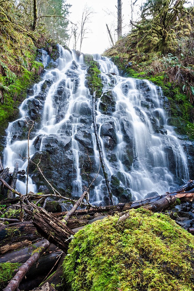
About Baker Creek Falls
Baker Creek Falls is a tucked‑away, picture‑perfect cascade in Oregon’s Coast Range near McMinnville. Framed by dense, ferny forest and moss‑coated boulders, the falls are modest in height but endlessly photogenic—a peaceful reward after a short backcountry approach. The route to the viewpoint is a roughly 2.4‑mile out‑and‑back that gains about 350 feet, making it a moderate, satisfying half‑day jaunt for hikers who prefer quieter, less‑developed destinations. The approach follows unmarked, primitive paths rather than a signed or maintained trail, so expect uneven footing and limited signage as you move through the mossy amphitheater surrounding the stream. Bring sturdy footwear, allow extra time for route‑finding, and take care on slippery rocks and roots—the forest setting is remote in feel even if the distance is short, which is part of what makes Baker Creek Falls a favorite for photographers and hikers seeking solitude.
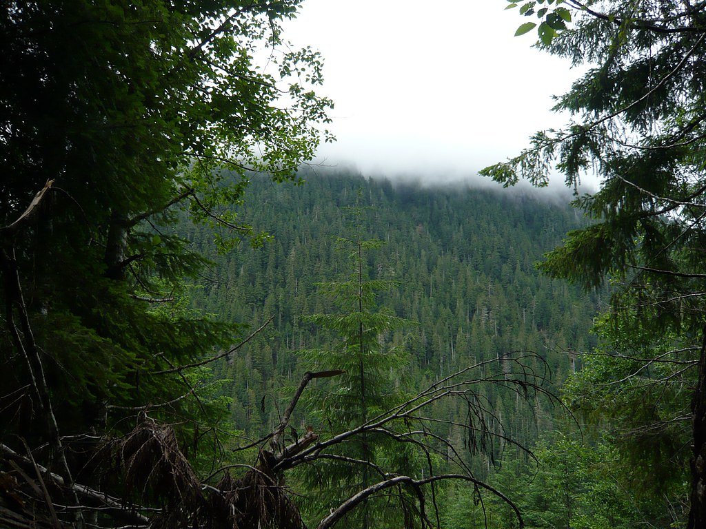
The Setting
Baker Creek Falls sits at 899 feet along the Nestucca River, in the foothills of Oregon.
Trail & Hike Details
The Approach
The moderate 2.4-mile out-and-back trail gains 350 feet of elevation on the way to the falls.
Trail Description
Route: ~2.4 miles round trip (out‑and‑back); Elevation gain: ~350 feet; Difficulty: moderate; Trail type: out‑and‑back. There is no established, maintained USFS trail leading directly to the base of Baker Creek Falls; the approach follows unmarked or primitive paths rather than a signed/maintained route. Surface: natural forest footing—leaf litter, roots, rocks and mossy ground. Grade/Class: variable moderate grades with short ups and downs on primitive tread (trail is essentially unclassified/off‑trail). Use caution, wear sturdy hiking shoes, and allow extra time for slower travel and route‑finding through forested terrain.
What to Expect
Expect a peaceful and natural setting with a small, cascading waterfall surrounded by dense forest. The area is not heavily trafficked, offering a quiet retreat for those seeking solitude. However, the lack of signage and maintained trails may make access challenging.
Accessibility
The trail is not wheelchair accessible. Uneven terrain and elevation changes require steady footing.
Frequently Asked Questions
🐶 Are Dogs Allowed at Baker Creek Falls?
❌ Dogs are not allowed
Are There Any Fees or Permits Required?
🆖 No fees required
🏊 Is There Swimming at Baker Creek Falls?
❌ Swimming is not allowed
When to Visit
Spring and early summer are the best times to visit, as the waterfall is most active due to seasonal rainfall.
Seasonal Access
The best time to visit is Spring, Summer, and Fall. Winter access may be limited.
Safety Information
The terrain around the falls can be slippery and uneven. Exercise caution when exploring the area, especially near the water. Cell service may be limited, so plan accordingly.
Current Water Conditions
6.67 ft
Water depth at gauge
About This Gauge
7-Day Flow Outlook
Based on the USGS gauge NESTUCCA RIVER NEAR FAIRDALE, OR (8 km away).
Today
Barely Flowing
4 cfs
3/10Tomorrow
Low
4 cfs
4/10Sat
Low
4 cfs
3/10Sun
Low
4 cfs
4/10Mon
Barely Flowing
3 cfs
5/10Tue
Barely Flowing
3 cfs
5/10Wed
Barely Flowing
3 cfs
5/10Best window: Mon — barely flowing flow, partly sunny (trip score 5/10).
Best time of year: this gauge typically runs highest from mid November to late January, peaking in January.
How we calculate this
This is a transparent outlook, not a precise forecast. We take the waterfall's current flow strength (how it ranks against its historical normal for today, from the nearest USGS stream gauge), carry that ranking forward along the gauge's seasonal curve, and nudge it for forecast rain. Confidence is highest for the next day or two and falls further out. Always check official conditions and your own judgment before visiting — high flows can be dangerous.
Know when to go.
Get a free email alert when waterfalls near McMinnville hit peak flow. We only send when conditions are worth the trip — no weekly newsletters, no spam.
Weather Forecast
Location & Access
Getting There
Baker Creek Falls is accessible via Baker Creek Road, which is located near McMinnville, Oregon. The falls are situated in a forested area, and visitors typically park along the road or in nearby pullouts. The exact location may require some exploration as it is not a heavily marked or developed site.
Get Directions on Google MapsParking
Limited roadside parking is available along Baker Creek Road. Visitors should ensure they park safely and avoid blocking traffic.
Elevation
899 feet above sea level
Coordinates
45.259558° N, -123.345664° W
Visitor Tips & Gear
Wear sturdy footwear and be prepared for uneven terrain. Bring a map or GPS device as the area is not well-marked. Visit during the spring or early summer for the best water flow.
As an Amazon Associate, we earn from qualifying purchases.
With 2.4 miles and 350 ft of elevation gain, sturdy boots and trekking poles will help on this moderate trail. Sun exposure on the trail makes good sun protection a must in summer.

Polarized Sunglasses (Knockaround)
Cuts glare off the water so you actually see the falls — and your photos turn out better too.

Columbia Watertight II Rain Jacket
Packs into its own pocket, seam-sealed, and keeps you dry from spray and surprise rain.

Earth Pak Waterproof Dry Bag
Keeps your phone and gear dry when waterfall mist soaks everything else.

Waterproof Phone Pouch (AiRunTech)
Cheap insurance — take photos right next to the falls without killing your phone.

Timberland Euro Sprint Mid Waterproof
Trusted waterproof boot with premium leather and grippy rubber sole — reliable on rocky, wet trails.

TrailBuddy Trekking Poles
Lightweight aluminum, cork grips, and flip-locks that actually hold — a best-seller for good reason.
Where to Stay

McMinnville Inn

Best Western McMinnville Inn

The Big Larz Casa, hot tub, pool, steps to Main Street

McMenamins Hotel Oregon
Browse vacation cabins and private rentals nearby
Unique outdoor stays — tents, yurts, and treehouses
Rent a campervan or RV for your waterfall road trip
Some links are affiliate links. We may earn a commission at no extra cost to you.
Nearby Campground
Fan Creek Recreation Site
7.5 miles away · 11 sites
Overview Want to camp? Camping season is generally May-September, with Alder Glen and Elk Bend remaining open through the weekend following General Western Oregon Coast 2nd Season for elk. During months with reduced sunlight, potable water may be turned off. Be prepared to bring your own wash and drinking water. Reserve a site at one of our four campgrounds on recreation.gov or pay when you arrive for non-reserved campsites using the Recreation.gov Mobile App. You must download before you reach t
Book on Recreation.govAdditional Information
Nearby Attractions
McMinnville, Oregon, is nearby and offers restaurants, wineries, and the Evergreen Aviation & Space Museum.
Wildlife
The area is home to various wildlife, including birds, deer, and small mammals. Be cautious of ticks and other insects.
Cities near Baker Creek Falls
Writing about Baker Creek Falls? Embed this waterfall on your site for free.