


Photo Credits (5)
Difficulty
Moderate
Trail Length
2.4 miles
Trail Type
Out And Back
Elevation Gain
350 ft
About Bagaduce Falls
Bagaduce Falls is a compact, captivating tidal rapid on the Bagaduce River in Brooksville, Maine, where the narrowing channel produces a dramatic reversing‑falls effect as the tide flows in and out. Rather than a vertical drop, the site is an ever‑changing ballet of currents, eddies and swirling water that can look very different depending on tide stage — plan your visit with a tide chart to see the strongest flows. Many visitors enjoy the falls from roadside pull‑offs and short viewing spots that place you close to the action without a long hike. For hikers who want a little more time in the woods, an informal out‑and‑back route of about 2.4 miles round trip (roughly 350 feet of elevation gain) provides a pleasant walk through coastal forest before reaching viewpoints of the river. The route is rated moderate and follows natural terrain rather than a maintained, numbered U.S. Forest Service trail, so expect a more rustic experience and bring basic navigation awareness and sturdy footwear.
The Setting
Bagaduce Falls sits at 23 feet along the Ducktrap River, in the coastal lowlands of Maine.
Trail & Hike Details
The Approach
The moderate 2.4-mile out-and-back trail gains 350 feet of elevation on the way to the falls.
Trail Description
Route type: out‑and‑back. Distance: ~2.4 miles round trip. Elevation gain: ~350 feet. Difficulty: Moderate. There is no formal maintained trail or USFS trail number for direct access to the falls; the approach follows an informal, unmarked footpath across natural surfaces. Surface: natural soil with roots, rocks and leaf litter. Grade: generally moderate with a few steeper pitches. Trail class: non‑technical hiking; expect uneven footing and basic route‑finding. Recommendations: wear sturdy footwear, be prepared for variable underfoot conditions, and time your visit with the tide for the most dramatic water movement.
What to Expect
Dogs are welcome.
Accessibility
The trail is not wheelchair accessible. Uneven terrain and elevation changes require steady footing.
Frequently Asked Questions
🐶 Are Dogs Allowed at Bagaduce Falls?
✅ Dogs are allowed
Are There Any Fees or Permits Required?
🆖 No fees required
🏊 Is There Swimming at Bagaduce Falls?
❌ Swimming is not allowed
When to Visit
The best time to visit is during high or low tide when the reversing falls effect is most visible. Spring and summer are particularly pleasant due to milder weather.
Seasonal Access
The best time to visit is Spring, Summer, Fall, and Winter.
Safety Information
Exercise caution when parking along the roadside and avoid getting too close to the water due to strong tidal currents. Be aware of changing tides, as water levels can rise quickly.
Current Water Conditions
Based on a USGS gauge 18.1 miles away
10 ft³/s
Current discharge — how much water is flowing
About average for this time of year
Based on 28 years of record
1.98 ft
Water depth at gauge
7-Day Discharge Trend
What does this mean for your visit?
Flow is about average for this time of year.
About This Gauge
This gauge is on a regional waterway. Conditions at the falls may differ, especially after local rain.
7-Day Flow Outlook
Based on the USGS gauge Ducktrap River near Lincolnville, Maine (29 km away).
Today
Moderate
10 cfs
8/10Tomorrow
Moderate
12 cfs
6/10Mon
Moderate
11 cfs
8/10Tue
Moderate
12 cfs
6/10Wed
Moderate
11 cfs
6/10Thu
Moderate
15 cfs
6/10Fri
Moderate
11 cfs
6/10Best window: Today — moderate flow, areas of fog then partly sunny (trip score 8/10).
Best time of year: this gauge typically runs highest from early March to late April, peaking in April.
How we calculate this
This is a transparent outlook, not a precise forecast. We take the waterfall's current flow strength (how it ranks against its historical normal for today, from the nearest USGS stream gauge), carry that ranking forward along the gauge's seasonal curve, and nudge it for forecast rain. Confidence is highest for the next day or two and falls further out. Always check official conditions and your own judgment before visiting — high flows can be dangerous.
Know when to go.
Get a free email alert when waterfalls near Belfast hit peak flow. We only send when conditions are worth the trip — no weekly newsletters, no spam.
Weather Forecast
Location & Access
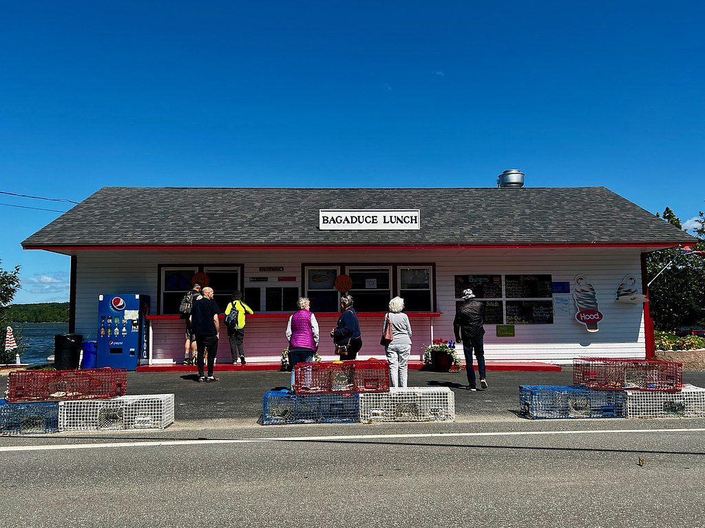
Getting There
Bagaduce Falls is located near the town of Brooksville, Maine. Visitors can access the area via Route 175 or Route 176. The falls are visible from the road, and there are small pull-off areas nearby for viewing.
Get Directions on Google MapsParking
Limited roadside parking is available near the falls. Visitors should exercise caution when parking and ensure they are not blocking traffic.
Elevation
23 feet above sea level
Coordinates
44.395355° N, -68.705583° W
Visitor Tips & Gear
Check the local tide schedule before visiting to experience the reversing falls at their most active. Bring binoculars for a closer view of the water and any wildlife in the area.
As an Amazon Associate, we earn from qualifying purchases.
With 2.4 miles and 350 ft of elevation gain, sturdy boots and trekking poles will help on this moderate trail. Icy conditions are common in winter — traction cleats are a smart addition.

Columbia Watertight II Rain Jacket
Packs into its own pocket, seam-sealed, and keeps you dry from spray and surprise rain.

Polarized Sunglasses (Knockaround)
Cuts glare off the water so you actually see the falls — and your photos turn out better too.

Earth Pak Waterproof Dry Bag
Keeps your phone and gear dry when waterfall mist soaks everything else.

Waterproof Phone Pouch (AiRunTech)
Cheap insurance — take photos right next to the falls without killing your phone.

Timberland Euro Sprint Mid Waterproof
Trusted waterproof boot with premium leather and grippy rubber sole — reliable on rocky, wet trails.

TrailBuddy Trekking Poles
Lightweight aluminum, cork grips, and flip-locks that actually hold — a best-seller for good reason.
Where to Stay

Oceanfront Hancock Cottage

Colonial Gables Oceanfront Village

Belfast Harbor Inn

Seascape Motel & Cottages
Browse vacation cabins and private rentals nearby
Unique outdoor stays — tents, yurts, and treehouses
Rent a campervan or RV for your waterfall road trip
Some links are affiliate links. We may earn a commission at no extra cost to you.
Nearby Campground
SEAWALL CAMPGROUND
22.7 miles away · 210 sites
Overview For Seawall campsites, 90 percent of campsites are released six months in advance on the first of each month at 10 am EST. The remaining 10 percent are released at 10 am 14 days ahead of a desired arrival date on a rolling basis. For example, if you plan to arrive on May 24, you can make an online reservation starting at 10 am EST Dec 1 from the first release or starting at 10 am EST on May 10 from the second release. All campsite reservations must be made through recreation.gov. 90% of
Book on Recreation.govAdditional Information
Nearby Attractions
Nearby attractions include Holbrook Island Sanctuary State Park and the town of Castine, which offers historical sites and coastal views.
Wildlife
The area around Bagaduce Falls is home to various bird species, including eagles and ospreys, as well as marine life such as seals during certain times of the year.
Cities near Bagaduce Falls
Nearby Waterfalls
 CC
CC
Writing about Bagaduce Falls? Embed this waterfall on your site for free.