Difficulty
Moderate
Trail Length
2.4 miles
Trail Type
Out And Back
Elevation Gain
350 ft
About Attean Falls
Attean Falls is a scenic waterfall located in the Moose River area of Maine, known for its natural beauty and serene surroundings. The falls are part of a remote and rugged landscape, making them a popular destination for outdoor enthusiasts and paddlers.
The Setting
Attean Falls sits at 1,165 feet along the Spencer Stream, in the foothills of Maine.
Trail & Hike Details
The Approach
The moderate 2.4-mile out-and-back trail gains 350 feet of elevation on the way to the falls.
Trail Description
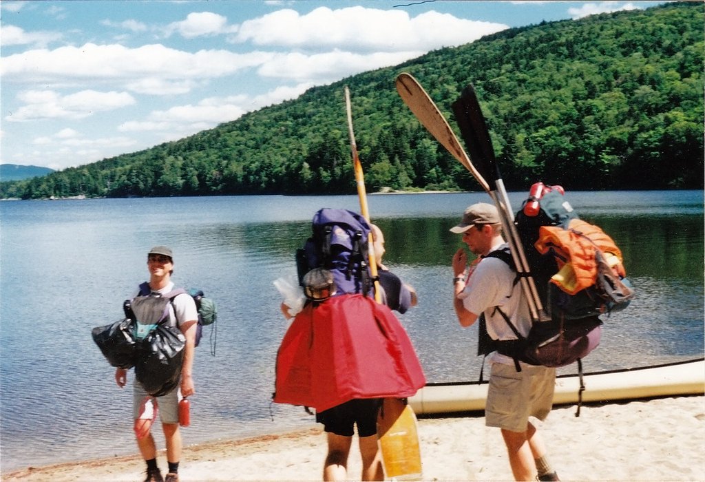
Attean Falls is typically visited as part of the Moose River Bow Trip, a multi-day paddling and portaging adventure. The route includes sections of flatwater paddling, portages, and scenic views of the surrounding wilderness. The falls themselves are a highlight of the trip, offering a picturesque spot to rest and enjoy the natural beauty.
What to Expect
Visitors can expect a remote and peaceful experience surrounded by Maine's wilderness. The falls are a cascading series of rapids and drops, creating a beautiful and dynamic water feature. Wildlife sightings, such as moose and birds, are common in the area.
Accessibility
The trail is not wheelchair accessible. Uneven terrain and elevation changes require steady footing.
Frequently Asked Questions
🐶 Are Dogs Allowed at Attean Falls?
❌ Dogs are not allowed
Are There Any Fees or Permits Required?
🆖 No fees required
🏊 Is There Swimming at Attean Falls?
❌ Swimming is not allowed
When to Visit
The best time to visit is late spring through early fall when water levels are suitable for paddling and the weather is more favorable.
Seasonal Access
The best time to visit is Spring, Summer, and Fall. Winter access may be limited.
Safety Information
Visitors should be prepared for remote wilderness conditions. Bring appropriate safety gear, including a first aid kit, and inform someone of your travel plans. Be cautious of strong currents near the falls and changing weather conditions.
Current Water Conditions
Based on a USGS gauge 16 miles away
377 ft³/s
Current discharge — how much water is flowing
Higher than usual for this time of year
Based on 26 years of record
3.52 ft
Water depth at gauge
7-Day Discharge Trend
What does this mean for your visit?
The water is flowing higher than usual for this time of year.
About This Gauge
This gauge is on a regional waterway. Conditions at the falls may differ, especially after local rain.
7-Day Flow Outlook
Based on the USGS gauge Spencer Stream near Grand Falls, Maine (26 km away).
Today
Moderate
407 cfs
5/10Tomorrow
Moderate
390 cfs
4/10Sun
Moderate
468 cfs
4/10Mon
Moderate
615 cfs
8/10Tue
Moderate
503 cfs
5/10Wed
Moderate
571 cfs
5/10Thu
Moderate
502 cfs
5/10Best window: Mon — moderate flow, mostly sunny (trip score 8/10).
Best time of year: this gauge typically runs highest from late March to mid June, peaking in April.
How we calculate this
This is a transparent outlook, not a precise forecast. We take the waterfall's current flow strength (how it ranks against its historical normal for today, from the nearest USGS stream gauge), carry that ranking forward along the gauge's seasonal curve, and nudge it for forecast rain. Confidence is highest for the next day or two and falls further out. Always check official conditions and your own judgment before visiting — high flows can be dangerous.
Know when to go.
Get a free email alert when waterfalls near Kingfield hit peak flow. We only send when conditions are worth the trip — no weekly newsletters, no spam.
Weather Forecast
Location & Access
Getting There
Attean Falls is located along the Moose River near Jackman, Maine. Access is typically via canoe or kayak as part of the Moose River Bow Trip, a popular paddling route. There is no direct road access to the falls.
Get Directions on Google MapsParking
Parking is available at the starting points of the Moose River Bow Trip, such as the Attean Landing or Holeb Landing. Visitors should plan their trip accordingly as the falls are not accessible by car.
Elevation
1,165 feet above sea level
Coordinates
45.545326° N, -70.246178° W
Visitor Tips & Gear
Plan your trip carefully, as Attean Falls is remote and requires paddling and portaging to access. Bring a detailed map of the Moose River Bow Trip, and be prepared for changing weather conditions. Ensure you have all necessary camping and safety gear if planning an overnight trip.
As an Amazon Associate, we earn from qualifying purchases.
With 2.4 miles and 350 ft of elevation gain, sturdy boots and trekking poles will help on this moderate trail. Sun exposure on the trail makes good sun protection a must in summer.

Columbia Watertight II Rain Jacket
Packs into its own pocket, seam-sealed, and keeps you dry from spray and surprise rain.

Earth Pak Waterproof Dry Bag
Keeps your phone and gear dry when waterfall mist soaks everything else.

Waterproof Phone Pouch (AiRunTech)
Cheap insurance — take photos right next to the falls without killing your phone.

Timberland Euro Sprint Mid Waterproof
Trusted waterproof boot with premium leather and grippy rubber sole — reliable on rocky, wet trails.

TrailBuddy Trekking Poles
Lightweight aluminum, cork grips, and flip-locks that actually hold — a best-seller for good reason.

Polarized Sunglasses (Knockaround)
Cuts glare off the water so you actually see the falls — and your photos turn out better too.
Where to Stay

All-Season Sanctuary: Steps to Moosehead Lake

Fun on Moosehead Lake

The Sterling Inn

Mountainview Resort by Coolvacay
Browse vacation cabins and private rentals nearby
Unique outdoor stays — tents, yurts, and treehouses
Rent a campervan or RV for your waterfall road trip
Some links are affiliate links. We may earn a commission at no extra cost to you.
Additional Information
Nearby Attractions
Jackman, Maine offers additional outdoor activities such as hiking, fishing, and wildlife viewing. The Moose River Bow Trip itself is a major attraction in the area.
Wildlife
The area is home to a variety of wildlife, including moose, deer, beavers, and numerous bird species.
Cities near Attean Falls
Nearby Waterfalls
Writing about Attean Falls? Embed this waterfall on your site for free.