Photo Credits (5)
Difficulty
Moderate
Trail Length
2.4 miles
Trail Type
Out And Back
Elevation Gain
350 ft
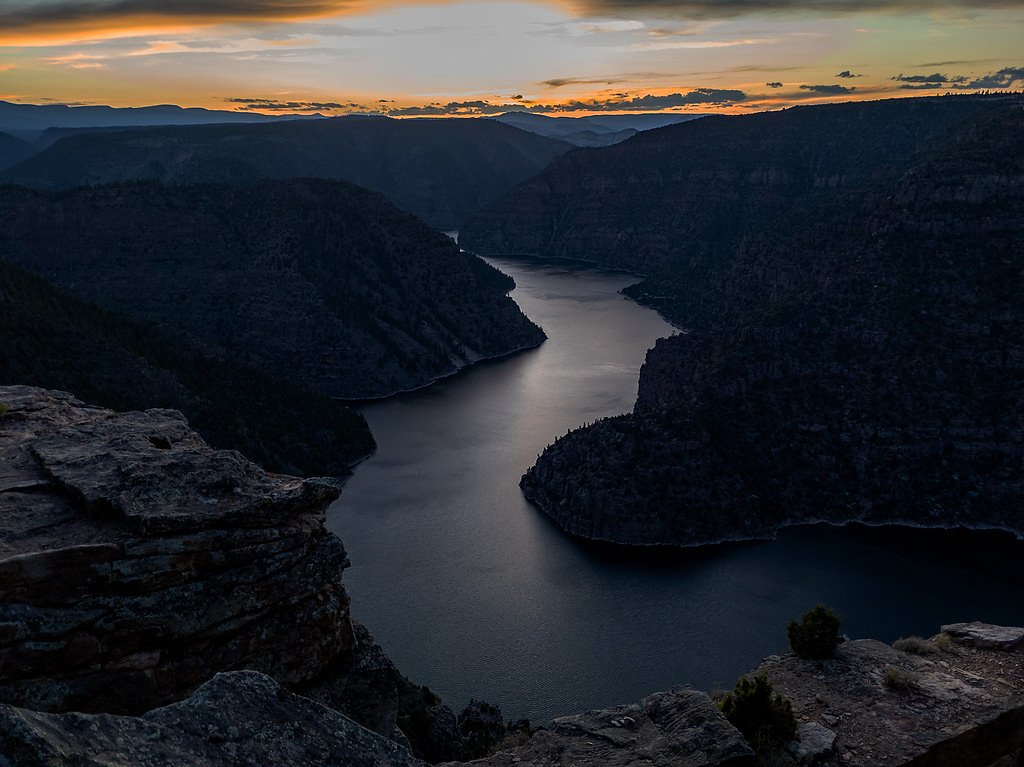
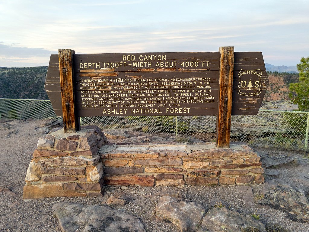
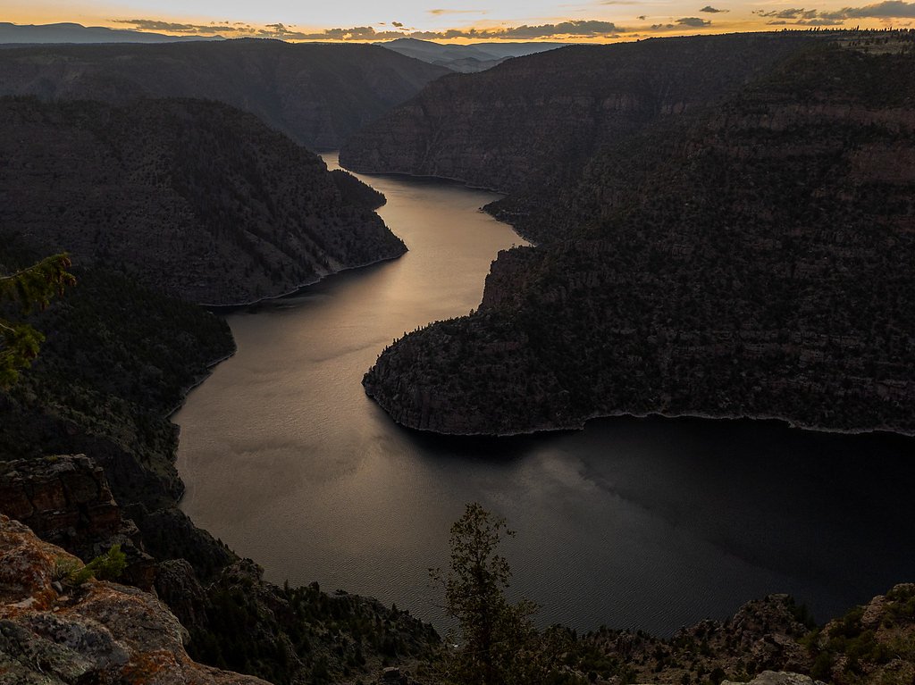
About Ashley Falls
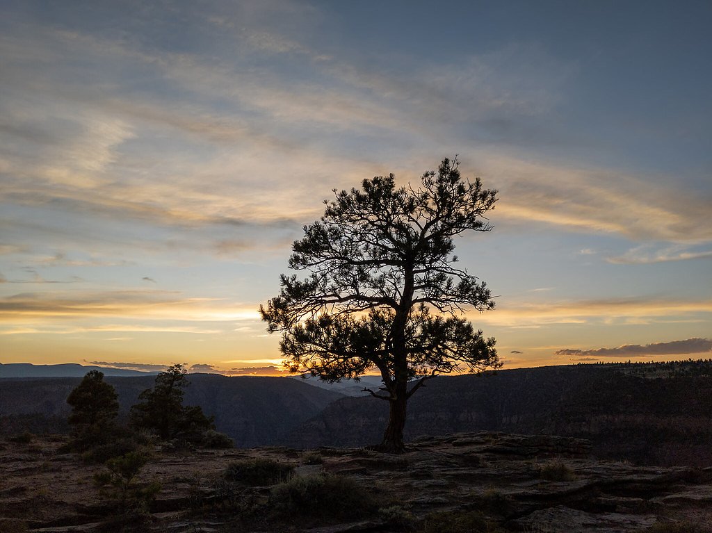
Ashley Falls is a quiet, lesser-known cascade tucked inside Ashley National Forest in northeastern Utah and managed by the U.S. Forest Service. The setting is classic high-country forest—pine-shaded approaches, the steady sound of flowing water, and a peaceful atmosphere that makes it a favorite for hikers looking for a serene retreat rather than a crowded viewpoint. Specific measurements for the fall’s height aren’t well-documented, which adds to its off-the-beaten-path charm. The falls are conveniently close to camping: Jarvies Family Boat In campground sits about 2.38 km (roughly 1.5 miles) away, making multi-day trips or evening campfires easy to combine with a day hike. Since the site sits on National Forest land, visitors should follow Forest Service guidelines, practice Leave No Trace, and check local trail conditions before heading out to ensure the best experience.
The Setting
Ashley Falls sits at 6,047 feet within Ashley National Forest, fed by the Green River, in the high mountains of Utah.
Trail & Hike Details
The Approach
The moderate 2.4-mile out-and-back trail gains 350 feet of elevation on the way to the falls.
Trail Description
The trail to Ashley Falls is an out-and-back route of approximately 2.4 miles round trip with about 350 feet of elevation gain, rated as moderate. This USFS-managed route is suitable for hikers looking for a relatively short hike with rewarding scenery; expect a forested approach and some uneven tread typical of National Forest trails. USFS surface, grade, and trail class details are not specified in the available Forest Service data, so hikers should prepare for natural-surface conditions and variable footing. Seasonal conditions can affect trail quality—check current Forest Service notices before you go and note that camping at Jarvies Family Boat In is less than 10 km away if you plan an overnight stay.
What to Expect
Visitors can expect a peaceful and scenic environment with natural beauty surrounding the waterfall. However, specific features of the waterfall and its surroundings are not well-documented.
Accessibility
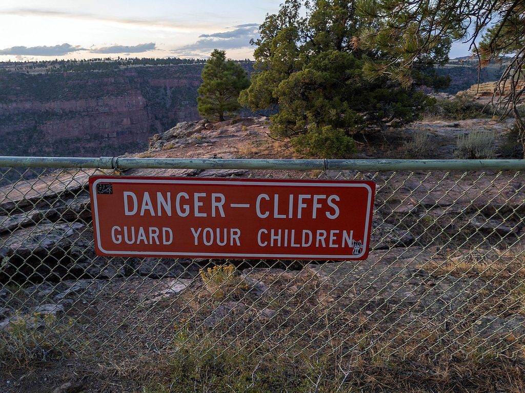
The trail is not wheelchair accessible. Uneven terrain and elevation changes require steady footing.
Frequently Asked Questions
🐶 Are Dogs Allowed at Ashley Falls?
❌ Dogs are not allowed
Are There Any Fees or Permits Required?
🆖 No fees required
🏊 Is There Swimming at Ashley Falls?
❌ Swimming is not allowed
When to Visit
Spring and summer are typically the best times to visit, as water flow is likely to be higher during these seasons.
Seasonal Access
The best time to visit is Spring, Summer, and Fall. Access roads and trails may close during winter due to snow. Watch for flash flood warnings during monsoon season (July through September). Check with Ashley National Forest for seasonal road closures.
Safety Information
Visitors should be prepared for uneven terrain and changing weather conditions. Carry sufficient water and be aware of potential wildlife encounters.
Current Water Conditions
2,190 ft³/s
Current discharge — how much water is flowing
About average for this time of year
Based on 62 years of record
9.66 ft
Water depth at gauge
57°F
ColdBracing — limit time in water
7-Day Discharge Trend
What does this mean for your visit?
Flow is about average for this time of year. Water temperature is a bracing 57 degrees F, limit your time in the water. Mineral content is moderate.
Water Quality
Conductance
Dissolved minerals in the water
About This Gauge
7-Day Flow Outlook
Based on the USGS gauge GREEN RIVER NEAR GREENDALE, UT (7 km away).
Today
Strong
2190 cfs
10/10Tomorrow
Roaring
2589 cfs
6/10Mon
Roaring
2580 cfs
6/10Tue
Roaring
2543 cfs
6/10Wed
Strong
2375 cfs
10/10Thu
Strong
2311 cfs
10/10Fri
Strong
2230 cfs
10/10Best window: Today — strong flow, mostly sunny (trip score 10/10).
Best time of year: this gauge typically runs highest from mid May to early June, peaking in May.
How we calculate this
This is a transparent outlook, not a precise forecast. We take the waterfall's current flow strength (how it ranks against its historical normal for today, from the nearest USGS stream gauge), carry that ranking forward along the gauge's seasonal curve, and nudge it for forecast rain. Confidence is highest for the next day or two and falls further out. Always check official conditions and your own judgment before visiting — high flows can be dangerous.
Know when to go.
Get a free email alert when waterfalls near Flaming Gorge hit peak flow. We only send when conditions are worth the trip — no weekly newsletters, no spam.
Weather Forecast
Location & Access
Getting There
The exact location and directions to Ashley Falls are not widely documented. Visitors are encouraged to consult local resources or trail guides for accurate directions.
Get Directions on Google MapsParking
Parking availability near Ashley Falls is unclear. Visitors should plan ahead and check for nearby parking options or trailhead facilities.
Elevation
6,047 feet above sea level
Coordinates
40.916626° N, -109.500417° W
Land Management
Managed by USFS
Visitor Tips & Gear
Check local resources or visitor centers for updated trail conditions and access information. Bring appropriate footwear and supplies for hiking, as trail conditions may vary.
This trail sits at 6,047 ft above sea level
Elevated TrailUV radiation is roughly 24% stronger at this elevation than at sea level, and the dry air accelerates dehydration. Extra sun protection and fluids go a long way.
As an Amazon Associate, we earn from qualifying purchases.

Coppertone Sport SPF 50 Sunscreen
UV intensity jumps ~4% per 1,000 ft — at this elevation you can burn in half the time.

Sun Bum SPF 30 Lip Balm (3-Pack)
Lips have almost no natural UV protection and burn fast in thin, dry mountain air.

Liquid I.V. Electrolyte Packets
You lose moisture ~2x faster at elevation — electrolytes help you absorb water efficiently.

ROCKNIGHT Polarized UV400 Sunglasses
High-altitude glare off rock and water is intense — UV400 lenses block 99%+ of UVA/UVB.
As an Amazon Associate, we earn from qualifying purchases.
With 2.4 miles and 350 ft of elevation gain, sturdy boots and trekking poles will help on this moderate trail. Sun exposure on the trail makes good sun protection a must in summer.

Polarized Sunglasses (Knockaround)
Cuts glare off the water so you actually see the falls — and your photos turn out better too.

Columbia Watertight II Rain Jacket
Packs into its own pocket, seam-sealed, and keeps you dry from spray and surprise rain.

Earth Pak Waterproof Dry Bag
Keeps your phone and gear dry when waterfall mist soaks everything else.

Waterproof Phone Pouch (AiRunTech)
Cheap insurance — take photos right next to the falls without killing your phone.

Timberland Euro Sprint Mid Waterproof
Trusted waterproof boot with premium leather and grippy rubber sole — reliable on rocky, wet trails.

TrailBuddy Trekking Poles
Lightweight aluminum, cork grips, and flip-locks that actually hold — a best-seller for good reason.
Where to Stay

Dutch John Adventure Outpost, 2800 Sq Ft log home

Villa Inn

Manila Adventure Home
Browse vacation cabins and private rentals nearby
Unique outdoor stays — tents, yurts, and treehouses
Rent a campervan or RV for your waterfall road trip
Some links are affiliate links. We may earn a commission at no extra cost to you.
Nearby Campground
JARVIES FAMILY BOAT IN
1.5 miles away · 8 sites
Overview Jarvies Family Boat-In Campground is located on beautiful Flaming Gorge Reservoir in Jarvies Canyon at an elevation of 6,040 feet. Campers must boat-in to the facility, and the nearest boat ramps are located at Cedar Springs and Mustang Ridge Marinas, both 20 minutes across the water.Recreation Boating, water skiing, fishing and swimming are popular activities, all located steps from the campsites. A hiking trail passes through the site as well.Facilities Jarvies offers eight single-fami
Book on Recreation.govNearby Hot Springs
Hot springs near Flaming Gorge, Utah
Split Mountain Warm Springs
Split Mountain Warm Springs flows at 86°F within Dinosaur National Monument, emerging near the Green River at 4,920 feet in Uin...
Warm Springs (Moffat County, Colorado)
Warm Springs in Rio Blanco County flows at 70 degrees Fahrenheit within the protected boundaries of Dinosaur National Monument ...
Looking for a soak after your hike? Explore more hot springs near Flaming Gorge, Utah on SoakingSprings.
Explore Utah springsAdditional Information
Nearby Attractions
Nearby attractions may include other natural landmarks and hiking trails in the surrounding area, but specific recommendations are not documented.
Wildlife
The area may feature typical Utah wildlife such as deer, birds, and small mammals. Visitors should be cautious and respect wildlife habitats.
Cities near Ashley Falls
Writing about Ashley Falls? Embed this waterfall on your site for free.