Anglin Falls
By Armen Suny · Last verified Sep 2026
LiDAR & 3D terrain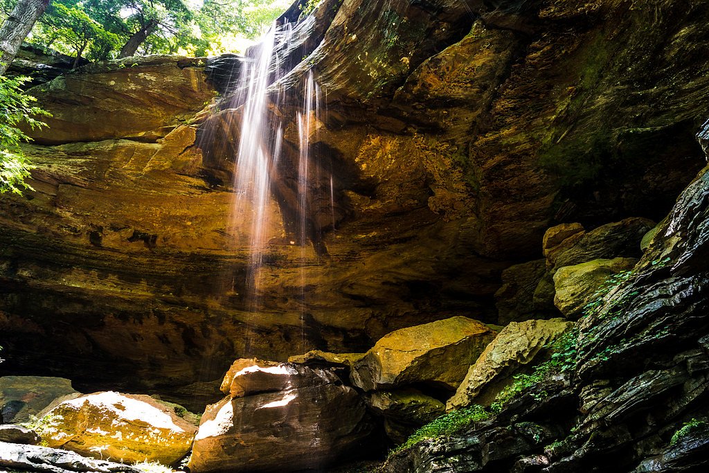
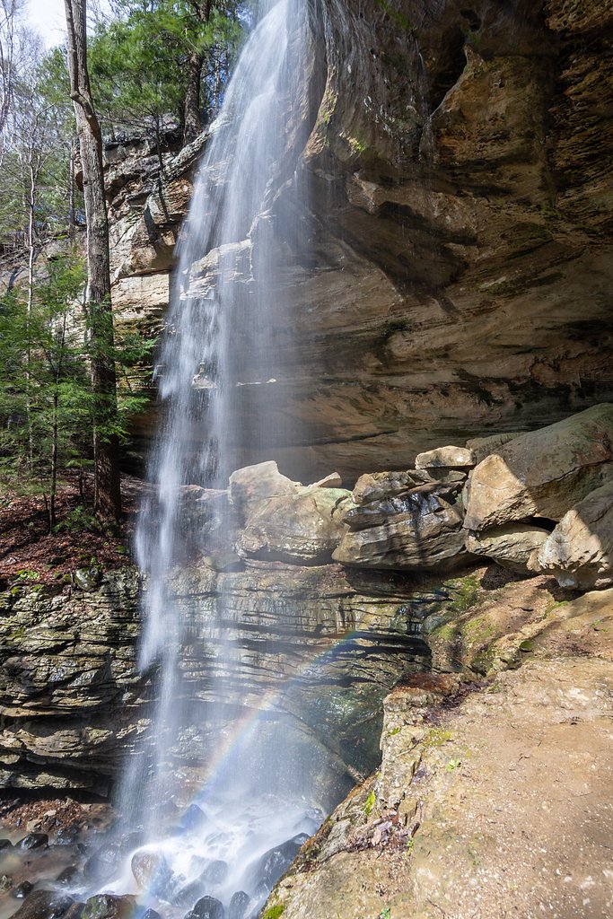
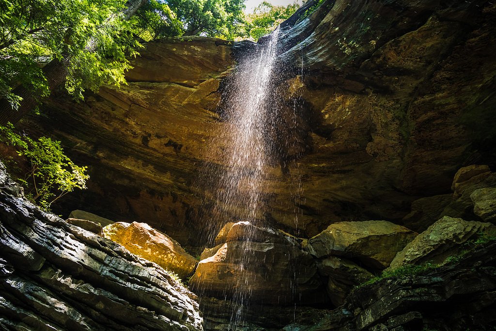
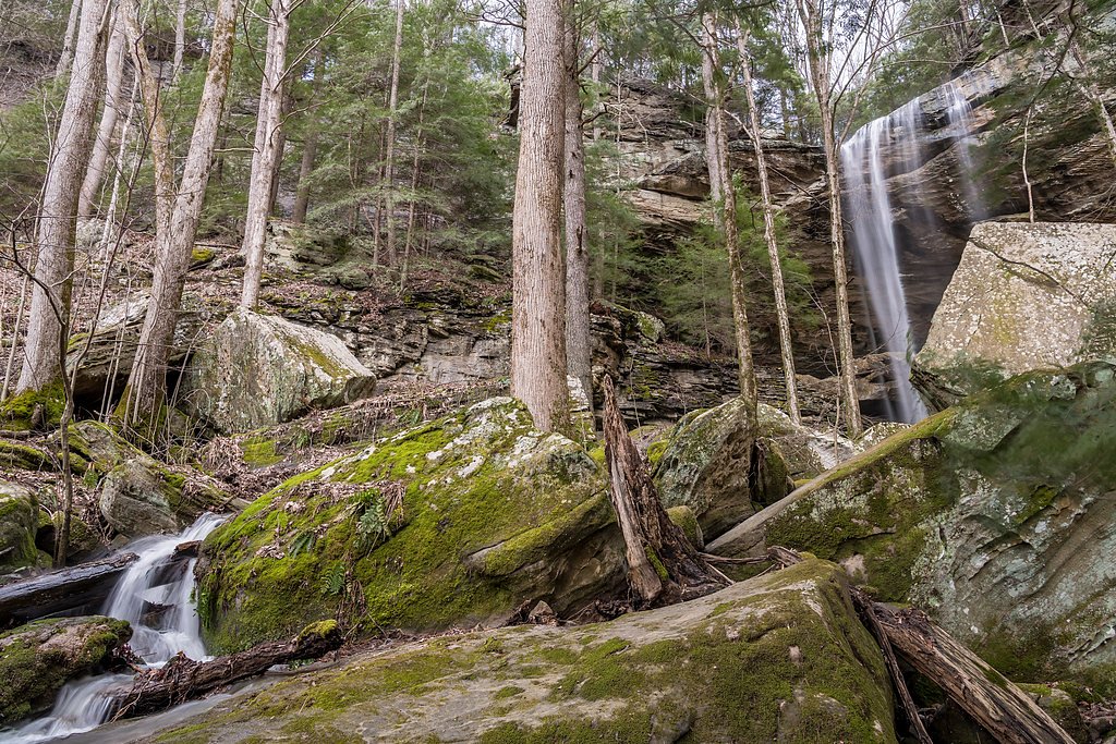
Photo Credits (5)
Difficulty
Easy
Trail Length
1.7 miles
Trail Type
Out And Back
Elevation Gain
200 ft
About Anglin Falls
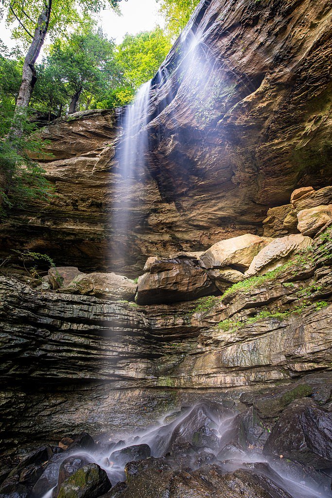
Anglin Falls tumbles through a quiet, forested ravine in the John B. Stephenson Memorial Forest State Nature Preserve, just outside Berea, Kentucky. The seasonal cascade is most dramatic in spring when surrounding hardwoods leaf out and wildflowers brighten the understory, creating an intimate, photogenic scene that’s perfect for photographers and families seeking a low-key outdoor stop. The setting feels largely undisturbed, offering a peaceful pause during a short nature outing or as part of a longer walk through the preserve. If you’re exploring the surrounding countryside, you’ll pass near Disputanta in Rockcastle County, which lies along Kentucky Route 1787; local history notes the community’s unusual name reportedly arose from a dispute over a post office and many residents still refer to the area as Clear Creek. The preserve’s easy, shaded trails make it an inviting way to experience southeastern Kentucky’s mixed hardwood forest and seasonal streams while soaking up a bit of local character and calm.
The Setting
Anglin Falls sits at 1,529 feet along the Kentucky River, in the hills of Kentucky.
Trail & Hike Details
The Approach
The easy 1.7-mile out-and-back trail gains 200 feet of elevation on the way to the falls.
Trail Description
Length: 1.7 miles round trip (out-and-back); Elevation gain: ~200 ft; Difficulty: easy. The trail to Anglin Falls is a short, well-maintained footpath through mixed hardwood forest with gentle grades and mostly even footing, suitable for most visitors and families. The path winds through shaded woods and ends at the base of the waterfall, providing close-up views and a peaceful place to rest; because the falls are seasonal, streamflow varies with recent rainfall and can be minimal during dry periods.
What to Expect
Dogs are welcome.
Accessibility
The trail is not wheelchair accessible. Uneven terrain and elevation changes require steady footing.
Frequently Asked Questions
🐶 Are Dogs Allowed at Anglin Falls?
✅ Dogs are allowed
Are There Any Fees or Permits Required?
🆖 No fees required
🏊 Is There Swimming at Anglin Falls?
❌ Swimming is not allowed
When to Visit
Spring is the best time to visit Anglin Falls, as the waterfall is typically flowing, and wildflowers are in bloom. However, it can also be enjoyed in summer and fall for its natural beauty.
Seasonal Access
The best time to visit is Spring, Summer, Fall, and Winter.
Safety Information
The trail may be slippery after rain, and the waterfall area can have wet rocks. Exercise caution and avoid climbing on rocks near the falls. Cell service may be limited in the area.
Current Water Conditions
Based on a USGS gauge 20.6 miles away
332 ft³/s
Current discharge — how much water is flowing
About average for this time of year
Based on 22 years of record
10.85 ft
Water depth at gauge
7-Day Discharge Trend
What does this mean for your visit?
Flow is about average for this time of year.
About This Gauge
This gauge is on a regional waterway. Conditions at the falls may differ, especially after local rain.
7-Day Flow Outlook
Based on the USGS gauge KENTUCKY RIVER AT LOCK 11 NEAR COLLEGE HILL, KY (33 km away).
Today
Strong
380 cfs
10/10Tomorrow
Strong
346 cfs
10/10Sun
Strong
319 cfs
10/10Mon
Strong
315 cfs
10/10Tue
Strong
373 cfs
10/10Wed
Strong
403 cfs
10/10Thu
Roaring
408 cfs
6/10Best window: Today — strong flow, sunny (trip score 10/10).
Best time of year: this gauge typically runs highest from mid February to late March, peaking in March.
How we calculate this
This is a transparent outlook, not a precise forecast. We take the waterfall's current flow strength (how it ranks against its historical normal for today, from the nearest USGS stream gauge), carry that ranking forward along the gauge's seasonal curve, and nudge it for forecast rain. Confidence is highest for the next day or two and falls further out. Always check official conditions and your own judgment before visiting — high flows can be dangerous.
Know when to go.
Get a free email alert when waterfalls near Berea hit peak flow. We only send when conditions are worth the trip — no weekly newsletters, no spam.
Weather Forecast
The Terrain, Seen by LiDAR
Aircraft-mounted lasers measured this ground to within inches. Trees and buildings are digitally stripped away, leaving the bare shape of the land the water has carved.
1-meter lidar shows the creek losing roughly 123 feet through Anglin Falls over a long run of ledges. Elevation at the pin is about 1,527 feet.
The ground changes about 58 feet in the 500 feet above the falls and 220 feet in the 500 feet below. The falls face south and sit in full sun for most of the day, best photographed early or late.
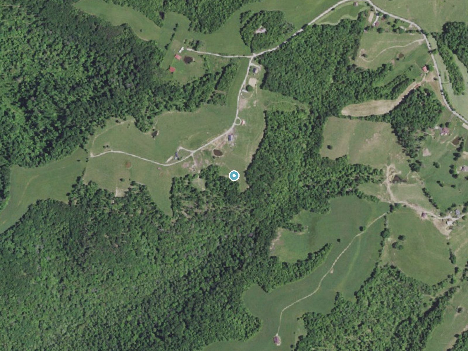
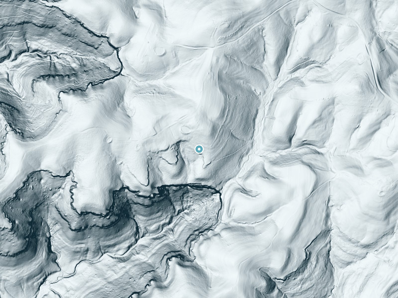
Drag to compare. The dot marks the waterfall. The frame is about a mile across.
- Ground elevation
- 1,527 feet
- Measured by 1-meter lidar
- Drop at the falls
- About 123 feet
- Change in ground height within ~250 feet of the falls
- Faces
- South
- Sunlit most of the day. Go early or late for softer light.
A slice through the lidar ground surface, from above the falls to downstream (heading south).
Elevation data: USGS 3D Elevation Program. Aerial imagery: USGS The National Map. Public domain.
Location & Access
Getting There
Anglin Falls is located in the John B. Stephenson Memorial Forest State Nature Preserve, approximately 10 miles from Berea, Kentucky. Visitors can access the preserve via Anglin Falls Road. The trailhead is clearly marked, and the area is relatively easy to find with GPS.
Get Directions on Google MapsParking
There is a small parking area near the trailhead, but it may fill up quickly during peak seasons.
Elevation
1,529 feet above sea level
Coordinates
37.499807° N, -84.217155° W
Visitor Tips & Gear
Visit after recent rainfall for the best waterfall flow. Wear sturdy shoes, as the trail may be muddy or slippery in places. Arrive early to secure parking, especially during weekends or peak seasons.
As an Amazon Associate, we earn from qualifying purchases.
This easy 1.7 miles hike is straightforward — comfortable trail shoes and plenty of water should do. Icy conditions are common in winter — traction cleats are a smart addition.

Columbia Watertight II Rain Jacket
Packs into its own pocket, seam-sealed, and keeps you dry from spray and surprise rain.

Polarized Sunglasses (Knockaround)
Cuts glare off the water so you actually see the falls — and your photos turn out better too.

Earth Pak Waterproof Dry Bag
Keeps your phone and gear dry when waterfall mist soaks everything else.

Waterproof Phone Pouch (AiRunTech)
Cheap insurance — take photos right next to the falls without killing your phone.

Kahtoola MICROspikes
Cult-favorite traction cleats that grip ice and wet rock — essential for winter waterfall hikes.

JOBY GorillaPod Starter Kit
Wraps around railings and rocks for long-exposure waterfall shots — no flat surface needed.
Where to Stay

Quiet and Secluded Berea Cabin on 70-Acre Farm!

Historic Boone Tavern
Charming Farmhouse on working Red Haven Farm

Comfort Inn & Suites Berea
Browse vacation cabins and private rentals nearby
Unique outdoor stays — tents, yurts, and treehouses
Rent a campervan or RV for your waterfall road trip
Some links are affiliate links. We may earn a commission at no extra cost to you.
Additional Information
Nearby Attractions
Berea College Forest, Pinnacles Hiking Trails, and the town of Berea, known for its arts and crafts community.
Wildlife
The area is home to various bird species, small mammals, and seasonal wildflowers. Visitors may also encounter insects and reptiles typical of the region.
Cities near Anglin Falls
Writing about Anglin Falls? Embed this waterfall on your site for free.