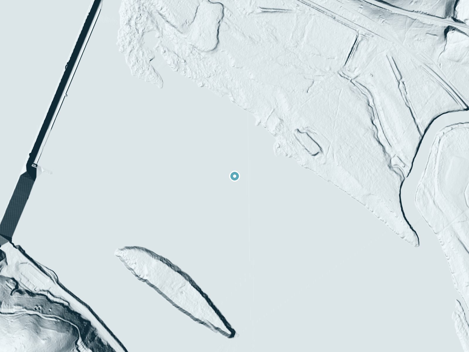
 LiDAR terrain view · USGS 3DEP
Amos Falls
By Armen Suny · Last verified Sep 2026
LiDAR & 3D terrainAbout Amos Falls
Amos Falls is a small, picturesque waterfall located in Maryland. It is known for its serene surroundings and is a hidden gem for nature enthusiasts. The waterfall may not be very tall but offers a peaceful retreat for visitors.
Trail & Hike Details
Trail Description
The trail to Amos Falls is not well-documented, and details about its length, terrain, and difficulty are unclear. Visitors should prepare for potentially uneven or unmarked paths.
What to Expect
Visitors can expect a tranquil natural setting with a small waterfall surrounded by forested areas. The site may be less crowded due to its lesser-known status.
Accessibility
Accessibility information is not available. The trail may not be suitable for individuals with mobility challenges.
Frequently Asked Questions
🐶 Are Dogs Allowed at Amos Falls?
❌ Dogs are not allowed
Are There Any Fees or Permits Required?
🆖 No fees required
🏊 Is There Swimming at Amos Falls?
❌ Swimming is not allowed
When to Visit
Spring and fall are typically the best times to visit due to pleasant weather and potentially higher water flow in the falls.
Seasonal Access
The best time to visit is Spring, Summer, and Fall. Winter access may be limited.
Safety Information
Trail conditions may be uneven or unmarked. Visitors should exercise caution, especially after rain when trails may be slippery. Always inform someone of your plans before visiting remote areas.
Current Water Conditions
These readings come from the USGS gauge on Susquehanna River, 0.4 miles away, not on Amos Falls's own stream. Use them as a sign of whether the area is running wet or dry.
19,400 ft³/s
Current discharge — how much water is flowing
About average for this time of year
Based on 58 years of record
11.71 ft
Water depth at gauge
7-Day Discharge Trend
What does this mean for your visit?
Flow is about average for this time of year.
About This Gauge
7-Day Flow Outlook
Based on the USGS gauge SUSQUEHANNA RIVER AT CONOWINGO, MD (1 km away).
Today
Moderate
20952 cfs
6/10Tomorrow
Moderate
24529 cfs
8/10Tue
Moderate
21858 cfs
9/10Wed
Moderate
20197 cfs
9/10Thu
Moderate
23607 cfs
6/10Fri
Strong
23365 cfs
8/10Sat
Strong
24704 cfs
8/10Best window: Tue — moderate flow, sunny (trip score 9/10).
Best time of year: this gauge typically runs highest from late February to early May, peaking in April.
How we calculate this
This is a transparent outlook, not a precise forecast. We take the waterfall's current flow strength (how it ranks against its historical normal for today, from the nearest USGS stream gauge), carry that ranking forward along the gauge's seasonal curve, and nudge it for forecast rain. Confidence is highest for the next day or two and falls further out. Always check official conditions and your own judgment before visiting — high flows can be dangerous.
Know when to go.
Get a free email alert when waterfalls near Darlington hit peak flow. We only send when conditions are worth the trip — no weekly newsletters, no spam.
Is Amos Falls Frozen?
Updated about 9 hours agoNot frozen highs above freezing lately big river, rarely freezes solid
Amos Falls is not frozen right now; highs have been above freezing. Yesterday ran 65°F to 38°F.
- Days below freezing
- 0 of the last 14
- Current cold streak
- 0 days
- Freezing days ahead
- 0 of the next 7
- Flow
- 19600 ft³/s
Winter safety. Frozen falls are the one waterfall trip with a documented injury pattern: falling ice, and ice-glazed rock and trail. Wear microspikes, keep well back from the base and from overhangs, and never walk out on ice over moving water.
Estimate from Open-Meteo daily temperatures at the falls, the LiDAR-measured facing direction, and the nearest stream gauge. It is a likelihood, not a report from the trail.
Weather Forecast
The Terrain, Seen by LiDAR
Aircraft-mounted lasers measured this ground to within inches. Trees and buildings are digitally stripped away, leaving the bare shape of the land the water has carved.
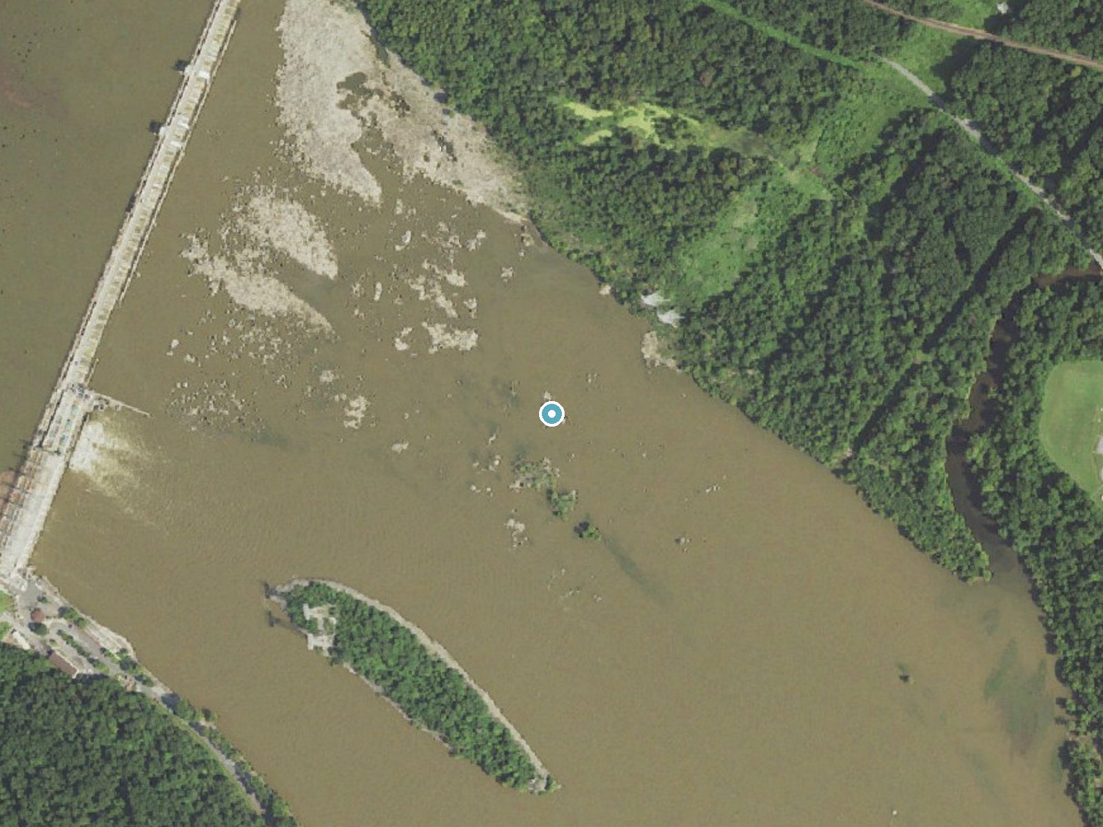
Drag to compare. The dot marks the waterfall. The frame is about a mile across.
Elevation data: USGS 3D Elevation Program. Aerial imagery: USGS The National Map. Public domain.
Location & Access
Getting There
Amos Falls is located in a relatively remote area of Maryland. Access may require navigating local roads and possibly a short hike. Specific directions are not widely documented, so visitors should research the area thoroughly before visiting.
Get Directions on Google MapsParking
Parking availability is unclear. Visitors may need to park along nearby roads or in designated areas if available.
Hours
Elevation
20 feet above sea level
Coordinates
39.658441° N, -76.166342° W
Visitor Tips & Gear
Bring a map or GPS device as the area may not have clear signage. Wear sturdy footwear and be prepared for varying trail conditions.
Where to Stay

La Quinta by Wyndham Aberdeen-APG

Hampton Inn & Suites By Hilton Baltimore/Aberdeen, Md

Red Roof Inn Perryville

Country Inn & Suites by Radisson, Bel Air-Aberdeen, MD
Browse vacation cabins and private rentals nearby
Unique outdoor stays — tents, yurts, and treehouses
Rent a campervan or RV for your waterfall road trip
Some links are affiliate links. We may earn a commission at no extra cost to you.
Additional Information
Nearby Attractions
Nearby attractions are not well-documented but may include other natural areas or hiking trails in Maryland.
Wildlife
The area may feature typical Maryland wildlife such as birds, deer, and small mammals. Be cautious of ticks and other insects.
Cities near Amos Falls
Other waterfalls named Amos Falls
1 other waterfall shares this name across the U.S.
Writing about Amos Falls? Embed this waterfall on your site for free.