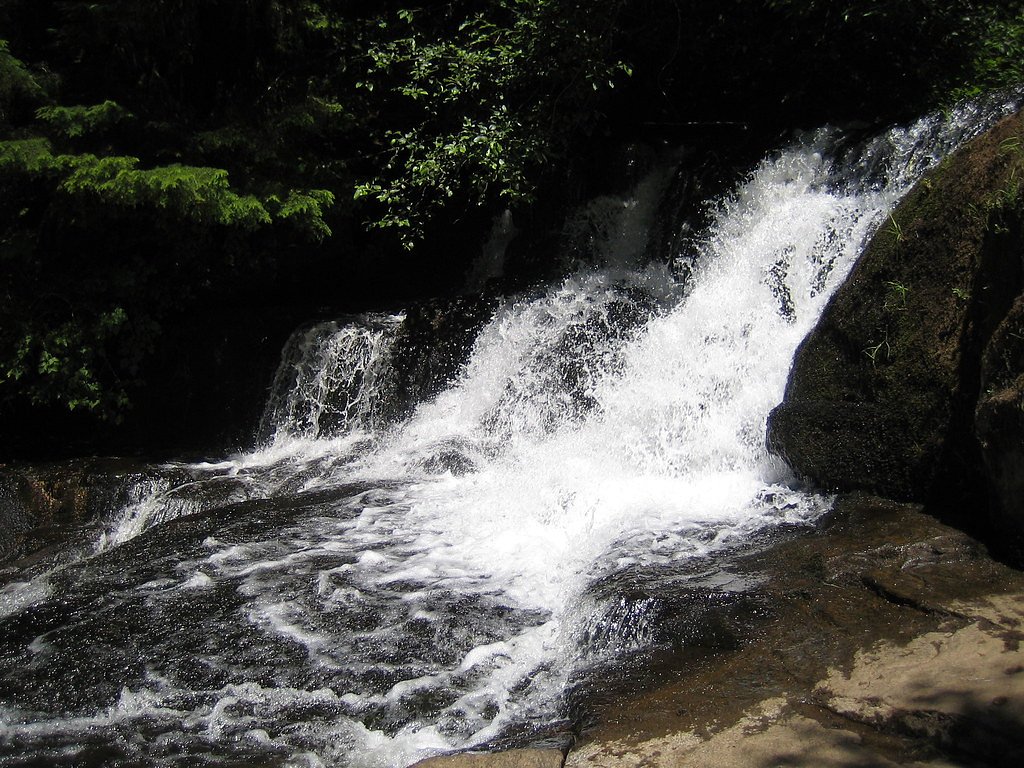
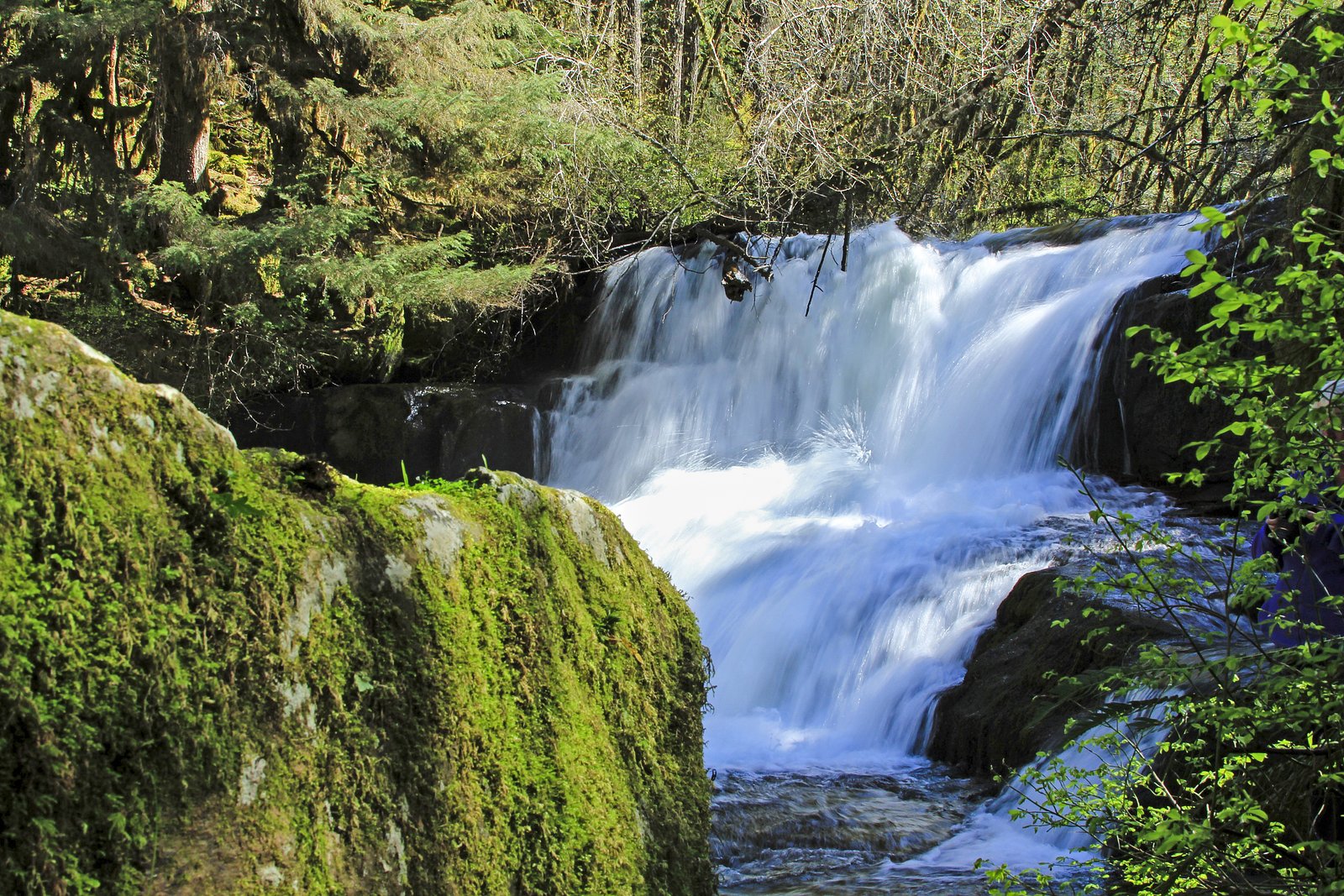
Alsea Falls
Oregon • 30 ft
By Armen Suny · Last verified Mar 2026
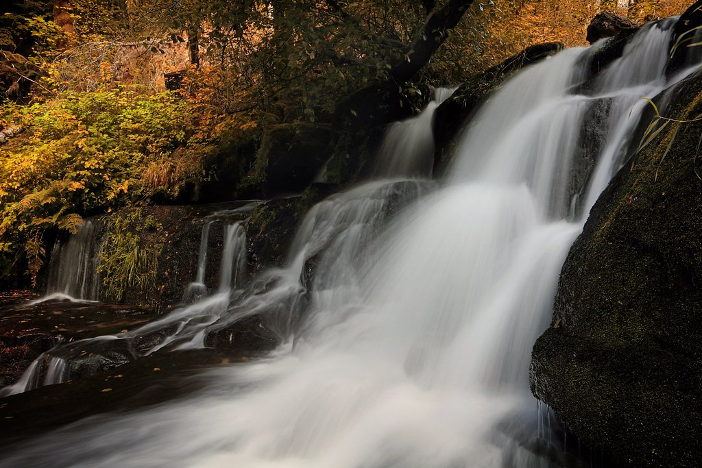
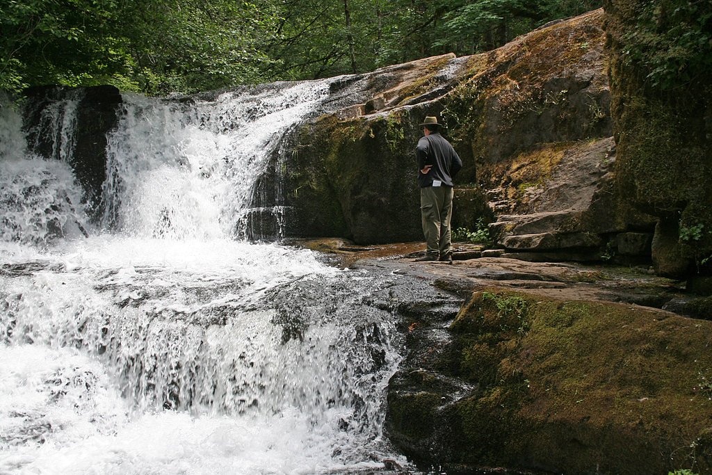
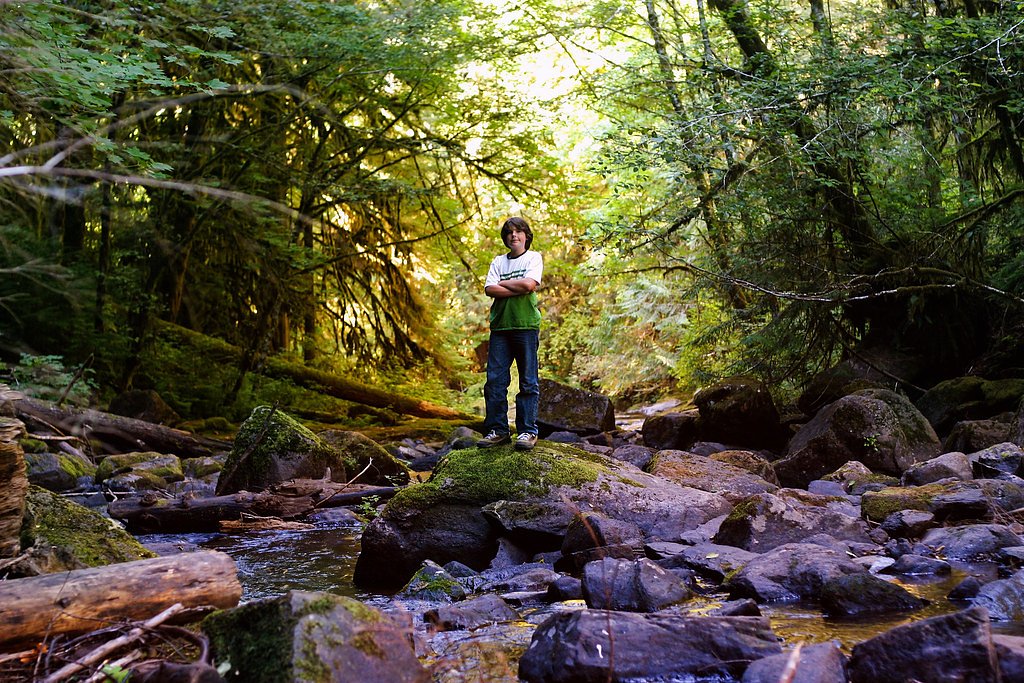
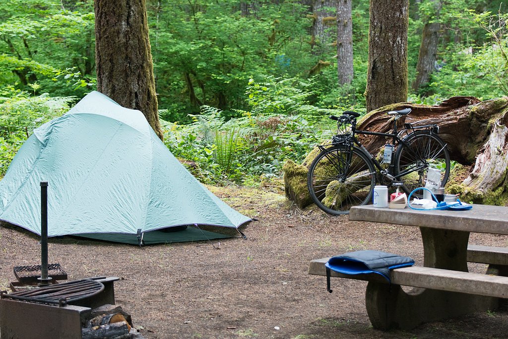

Photo Credits (5)
Difficulty
Easy
Trail Length
2.4 miles
Trail Type
Loop
Elevation Gain
200 ft
About Alsea Falls
Alsea Falls is a 30-foot waterfall tucked into the Central Oregon Coast Range, about 13 miles west of Monroe in Benton County, Oregon. The cascade sits at the Alsea Falls Recreation Site and is managed by the Bureau of Land Management’s NW Oregon Marys Peak Field Office, making it a convenient nature stop for day hikers and families visiting the Coast Range. A compact 2.4-mile loop trail with roughly 200 feet of elevation gain provides access to the falls from the trailhead at the recreation site. The area is popular for short hikes, picnics, and easy outdoor outings, and the Alsea Falls campground is less than a kilometer away (0.73 km) for anyone who wants to extend their visit and camp overnight.
The Setting
Alsea Falls sits at 781 feet within Nw Oregon Marys Peak Field Office, fed by the East Fork Lobster Creek, in the foothills of Oregon. The falls drop 30 feet.
Height: 30 feet
Trail & Hike Details
The Approach
The easy 2.4-mile loop trail gains 200 feet of elevation on the way to the falls.
Trail Description
The Alsea Falls trail is a 2.4-mile loop with approximately 200 feet of elevation gain and an easy difficulty rating. This short loop leads from the Alsea Falls Recreation Site trailhead to the waterfall and back, featuring generally gentle grades that make it accessible to most visitors. The trail and recreation site are managed by the Bureau of Land Management’s NW Oregon Marys Peak Field Office, and the nearby Alsea Falls campground sits about 0.73 km from the falls for convenient overnight camping.
What to Expect
The falls drop 30 feet. Swimming is permitted. Dogs are welcome.
Accessibility
The trail is not wheelchair accessible. Uneven terrain and elevation changes require steady footing.
Frequently Asked Questions
🐶 Are Dogs Allowed at Alsea Falls?
✅ Dogs are allowed
Are There Any Fees or Permits Required?
🤑 Fee: $5.00
🏊 Is There Swimming at Alsea Falls?
✅ Swimming is allowed
When to Visit
Spring and early summer are ideal times to visit when the water flow is at its peak, but the falls can be enjoyed year-round.
Seasonal Access
The best time to visit is Spring, Summer, and Fall. Winter access may be limited.
Safety Information
The rocks near the falls can be slippery, so use caution when exploring. Be aware of changing water levels, especially after heavy rain.
Current Water Conditions
2 ft³/s
Current discharge — how much water is flowing
Lower than usual for this time of year
Based on 42 years of record
2.08 ft
Water depth at gauge
7-Day Discharge Trend
What does this mean for your visit?
Flow is lower than usual for this time of year.
About This Gauge
This gauge is on a nearby waterway and may not reflect exact conditions at the falls.
7-Day Flow Outlook
Based on the USGS gauge EAST FORK LOBSTER CREEK NEAR ALSEA, OR. (14 km away).
Today
Roaring
2 cfs
6/10Tomorrow
Roaring
2 cfs
8/10Tue
Strong
2 cfs
10/10Wed
Strong
2 cfs
10/10Thu
Roaring
2 cfs
6/10Fri
Roaring
2 cfs
9/10Sat
Strong
2 cfs
10/10Best window: Tue — strong flow, mostly sunny (trip score 10/10).
Best time of year: this gauge typically runs highest from early December to late January, peaking in January.
How we calculate this
This is a transparent outlook, not a precise forecast. We take the waterfall's current flow strength (how it ranks against its historical normal for today, from the nearest USGS stream gauge), carry that ranking forward along the gauge's seasonal curve, and nudge it for forecast rain. Confidence is highest for the next day or two and falls further out. Always check official conditions and your own judgment before visiting — high flows can be dangerous.
Know when to go.
Get a free email alert when waterfalls near Alpine hit peak flow. We only send when conditions are worth the trip — no weekly newsletters, no spam.
Weather Forecast
Location & Access
Getting There
Alsea Falls is located approximately 27 miles southwest of Corvallis, Oregon. From Corvallis, take Highway 34 west, then turn left onto South Fork Road and follow signs to the Alsea Falls Recreation Area.
Get Directions on Google MapsParking
There is a designated parking area near the trailhead, with a day-use fee required.
Elevation
781 feet above sea level
Coordinates
44.326425° N, -123.491849° W
Land Management
Managed by BLM
Visitor Tips & Gear
Arrive early during weekends or holidays to secure parking. Bring sturdy shoes as the trail can be muddy, especially after rain. Consider visiting Green Peak Falls, which is accessible via a connecting trail.
As an Amazon Associate, we earn from qualifying purchases.
This easy 2.4 miles hike is straightforward — comfortable trail shoes and plenty of water should do. Sun exposure on the trail makes good sun protection a must in summer.

Polarized Sunglasses (Knockaround)
Cuts glare off the water so you actually see the falls — and your photos turn out better too.

Columbia Watertight II Rain Jacket
Packs into its own pocket, seam-sealed, and keeps you dry from spray and surprise rain.

Earth Pak Waterproof Dry Bag
Keeps your phone and gear dry when waterfall mist soaks everything else.

Waterproof Phone Pouch (AiRunTech)
Cheap insurance — take photos right next to the falls without killing your phone.

JOBY GorillaPod Starter Kit
Wraps around railings and rocks for long-exposure waterfall shots — no flat surface needed.

Osprey Daylite Daypack
Light, organized, and just the right size for a day hike — fits water, snacks, and layers.
Where to Stay

Hallmark Resort - Newport

Allred Hotel

Elizabeth Oceanfront Suites, an Ascend Collection Hotel

Inn at Nye Beach
Browse vacation cabins and private rentals nearby
Unique outdoor stays — tents, yurts, and treehouses
Rent a campervan or RV for your waterfall road trip
Some links are affiliate links. We may earn a commission at no extra cost to you.
Nearby Campground
Alsea Falls Recreation Site (Campground)
0.5 miles away · 38 sites
Overview Reserve a site at Alsea Falls on recreation.gov or pay when you arrive for non-reserved campsites using the Recreation.gov Mobile App. You must download before you reach the site since there is no cell reception in the drainage. Alsea Falls Recreation Site is located along a Bureau of Land Management National Back Country Byway, located in the Oregon Coast Range, 13 miles west of Monroe, Oregon, in Benton County. Alsea Falls is open for camping the first weekend in May through the end o
Book on Recreation.govAdditional Information
Nearby Attractions
Green Peak Falls, Marys Peak Scenic Area, and the town of Corvallis.
Wildlife
The area is home to various wildlife, including deer, birds, and small mammals. Keep an eye out for native flora and fauna.
Cities near Alsea Falls
Nearby Waterfalls
Writing about Alsea Falls? Embed this waterfall on your site for free.