
Photo Credits (5)
Difficulty
Moderate
Trail Length
2.4 miles
Trail Type
Out And Back
Elevation Gain
350 ft
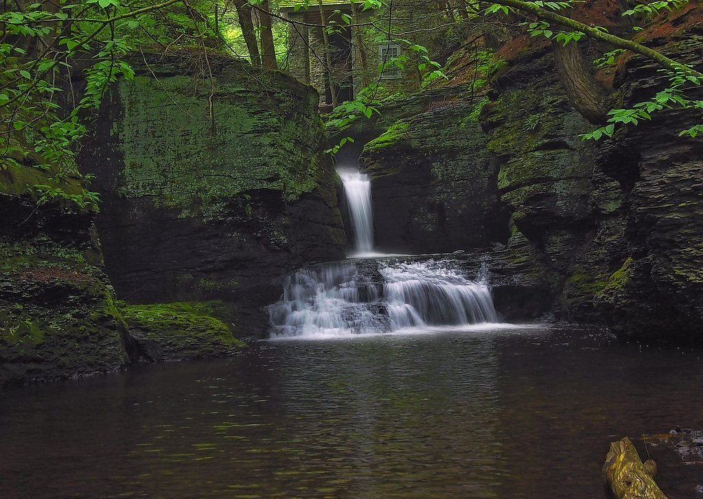
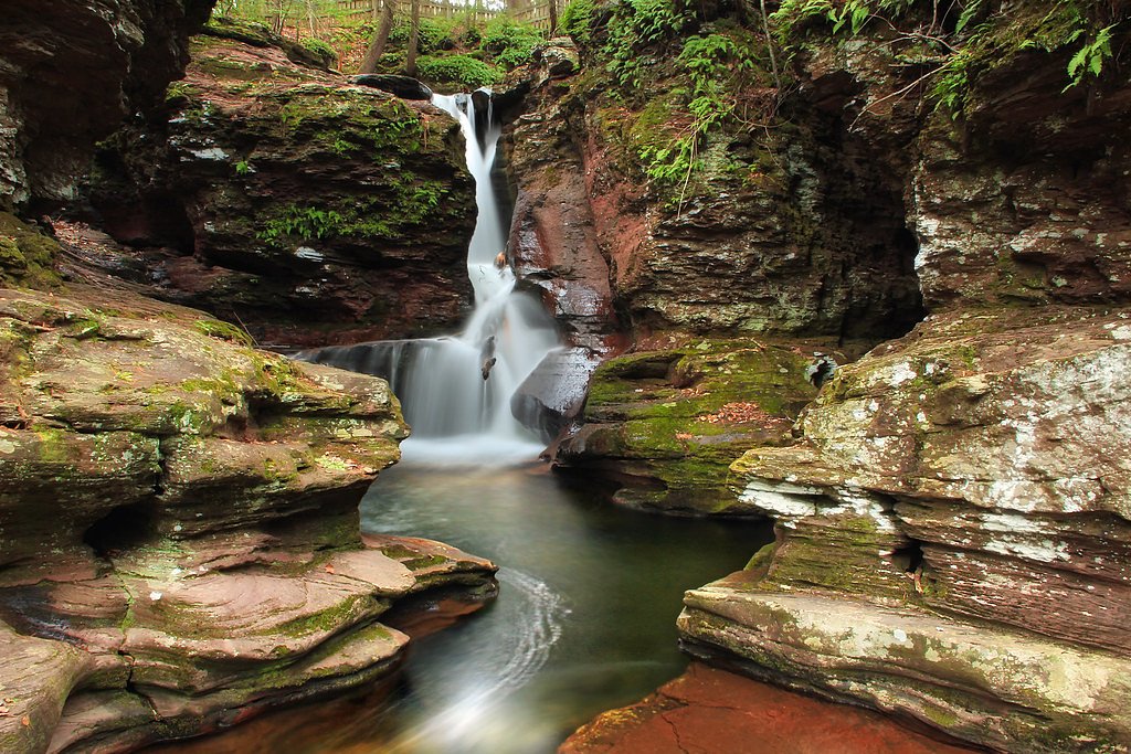
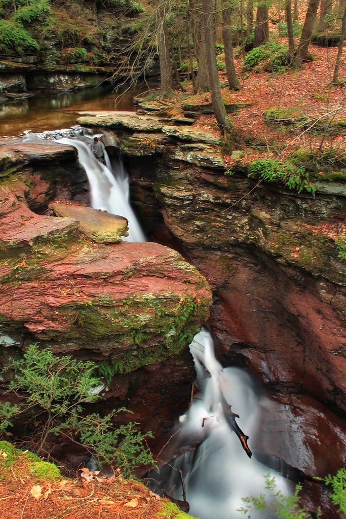
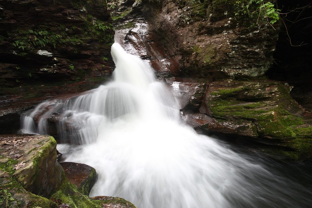
About Adams Falls
Adams Falls is a scenic cascade tucked into the hardwood forests of Linn Run State Park in western Pennsylvania. This is one of two waterfalls named Adams Falls in the state (per Wikipedia), and the Linn Run location delivers a compact, photogenic drop set into a quiet parkland pocket. The falls sit within Linn Run State Park (Designation: SP), on land listed as OTHS and managed by SPR, making it an accessible day-into-evening destination for local hikers and photographers. The setting feels intimate rather than remote: tree-shaded trails lead down to a clear viewing area where the stream tumbles over ledges. The site’s moderate hiking approach rewards visitors with close-up views and seasonal color, especially in spring runoff and fall foliage. Because it’s inside a state park unit, plan for a short outing rather than a full backcountry trip.
The Setting
Adams Falls sits at 1,647 feet within Linn Run State Park, fed by the Linn Run, in the hills of Pennsylvania.
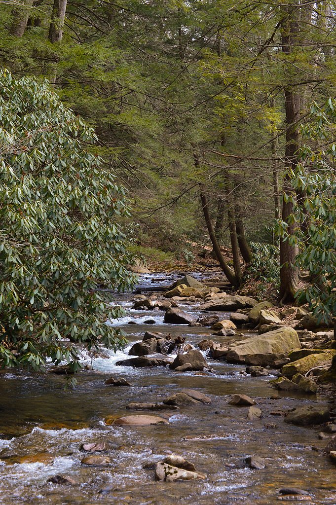
Trail & Hike Details
The Approach
The moderate 2.4-mile out-and-back trail gains 350 feet of elevation on the way to the falls.
Trail Description
Trail: out-and-back, 2.4 miles total; Elevation gain: ~350 ft; Difficulty: moderate. The route is a relatively short state-park trail that leads directly to the falls and a nearby viewing area. Specific surface type, grade, and trail class are not specified in the supplied park data; hikers should expect a typical park footpath with some uphill sections and bring appropriate footwear for uneven terrain.
What to Expect
Dogs are welcome.
Accessibility
The trail is not wheelchair accessible. Uneven terrain and elevation changes require steady footing.
Frequently Asked Questions
🐶 Are Dogs Allowed at Adams Falls?
✅ Dogs are allowed
Are There Any Fees or Permits Required?
🆖 No fees required
🏊 Is There Swimming at Adams Falls?
❌ Swimming is not allowed
When to Visit
Spring and early summer are the best times to visit, as the waterfall is typically at its fullest due to seasonal rainfall.
Seasonal Access
The best time to visit is Spring, Summer, and Fall. Winter access may be limited.
Safety Information
Exercise caution near the waterfall as rocks can be slippery. Be mindful of changing weather conditions and avoid visiting during heavy rain or storms.
Current Water Conditions
2 ft³/s
Current discharge — how much water is flowing
About average for this time of year
Based on 19 years of record
1.63 ft
Water depth at gauge
7-Day Discharge Trend
What does this mean for your visit?
Flow is about average for this time of year.
About This Gauge
7-Day Flow Outlook
Based on the USGS gauge Linn Run at Linn Run State Park near Rector, PA (0 km away).
Today
Barely Flowing
2 cfs
4/10Tomorrow
Low
2 cfs
3/10Tue
Low
2 cfs
3/10Wed
Low
3 cfs
3/10Thu
Low
4 cfs
3/10Fri
Low
3 cfs
4/10Sat
Low
2 cfs
3/10Best window: Today — barely flowing flow, patchy fog then sunny (trip score 4/10).
Best time of year: this gauge typically runs highest from early May to mid May, peaking in April.
How we calculate this
This is a transparent outlook, not a precise forecast. We take the waterfall's current flow strength (how it ranks against its historical normal for today, from the nearest USGS stream gauge), carry that ranking forward along the gauge's seasonal curve, and nudge it for forecast rain. Confidence is highest for the next day or two and falls further out. Always check official conditions and your own judgment before visiting — high flows can be dangerous.
Know when to go.
Get a free email alert when waterfalls near Laurel Mountain hit peak flow. We only send when conditions are worth the trip — no weekly newsletters, no spam.
Weather Forecast
Location & Access
Getting There
Adams Falls is located near Laurel Mountain, approximately 4.1 miles away, and can be accessed via local roads. The coordinates for the waterfall are 40.1673, -79.2309.
Get Directions on Google MapsParking
There is a small parking area near the trailhead, but availability may be limited during peak seasons.
Elevation
1,647 feet above sea level
Coordinates
40.167296° N, -79.230865° W
Land Management
Managed by SPR
Visitor Tips & Gear
Visit early in the morning or on weekdays to avoid crowds. Wear sturdy shoes as the area near the waterfall may be slippery. Bring a camera to capture the scenic views.
As an Amazon Associate, we earn from qualifying purchases.
With 2.4 miles and 350 ft of elevation gain, sturdy boots and trekking poles will help on this moderate trail. Sun exposure on the trail makes good sun protection a must in summer.

Polarized Sunglasses (Knockaround)
Cuts glare off the water so you actually see the falls — and your photos turn out better too.

Columbia Watertight II Rain Jacket
Packs into its own pocket, seam-sealed, and keeps you dry from spray and surprise rain.

Earth Pak Waterproof Dry Bag
Keeps your phone and gear dry when waterfall mist soaks everything else.

Waterproof Phone Pouch (AiRunTech)
Cheap insurance — take photos right next to the falls without killing your phone.

Timberland Euro Sprint Mid Waterproof
Trusted waterproof boot with premium leather and grippy rubber sole — reliable on rocky, wet trails.

TrailBuddy Trekking Poles
Lightweight aluminum, cork grips, and flip-locks that actually hold — a best-seller for good reason.
Where to Stay

Sunset Cottage Motel

Holiday Inn Express & Suites Donegal by IHG

Inn at Mountainview

Fairfield Inn & Suites By Marriott Somerset, PA
Browse vacation cabins and private rentals nearby
Unique outdoor stays — tents, yurts, and treehouses
Rent a campervan or RV for your waterfall road trip
Some links are affiliate links. We may earn a commission at no extra cost to you.
Nearby Campground
BUSH RECREATION AREA
21.6 miles away · 45 sites
Overview The Bush Recreation Area is located next to the scenic Loyalhanna Lake. This location provides picturesque views of the lake as well as opportunities for bird watching, boating, fishing, hunting and paddle sports.Recreation The Bush Recreation Area offers boating with unlimited horse power. Visitors to the area can kayak or canoe the lake as well, and take advantage of kayak rentals located in the Bush Recreation Area. The Loyalhanna Lake offers great fishing opportunities, with multiple
Book on Recreation.govAdditional Information
Nearby Attractions
Laurel Mountain, Jennerstown, and other natural attractions in the area.
Wildlife
The area is home to various bird species, small mammals, and occasional deer sightings.
Cities near Adams Falls
Other waterfalls named Adams Falls
2 other waterfalls share this name across the U.S.
Writing about Adams Falls? Embed this waterfall on your site for free.