

Photo Credits (5)
Difficulty
Moderate
Trail Length
1.5 miles
Trail Type
Out And Back
Elevation Gain
300 ft
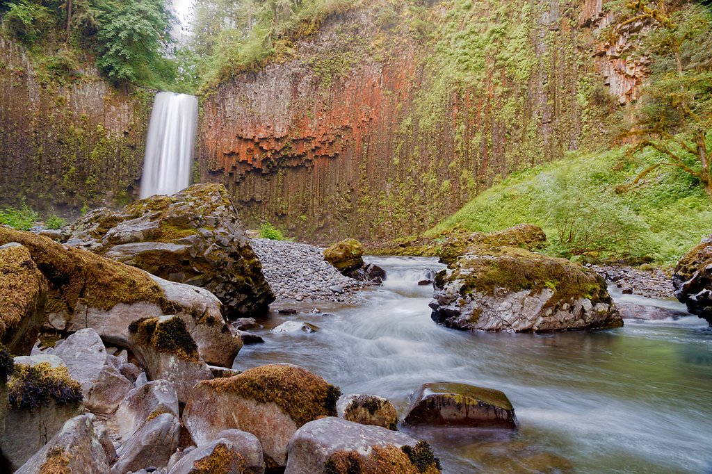
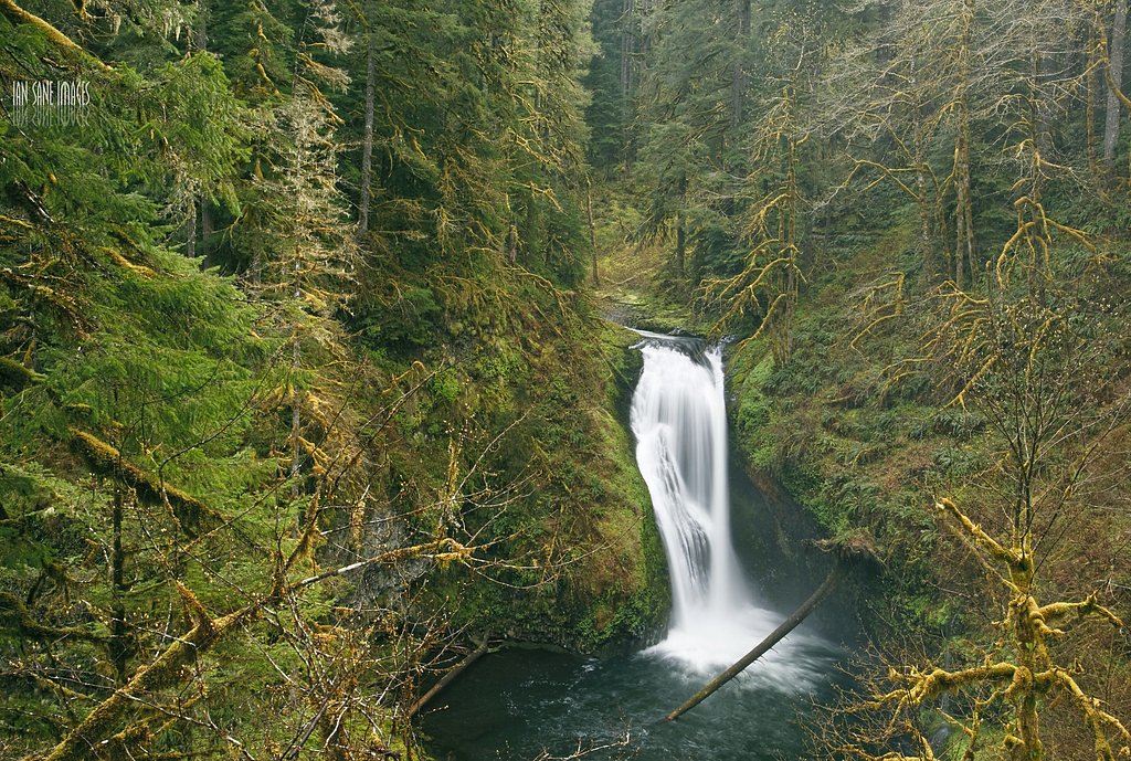
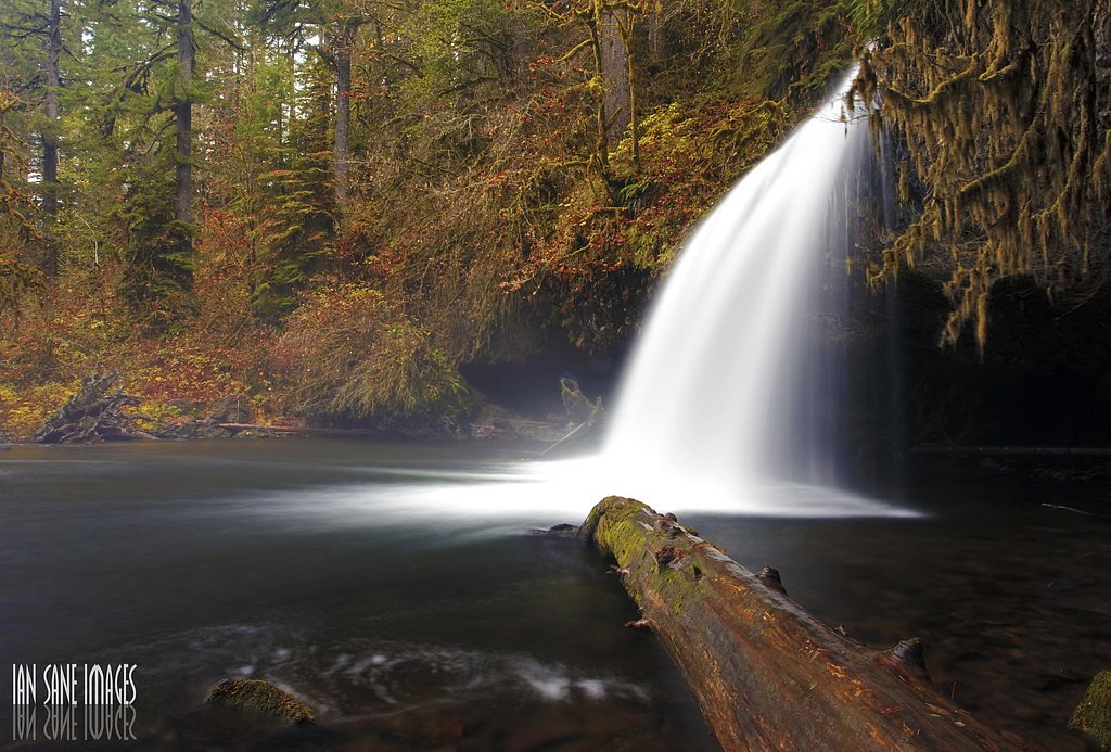
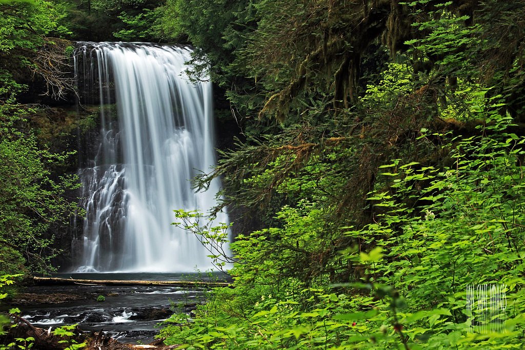
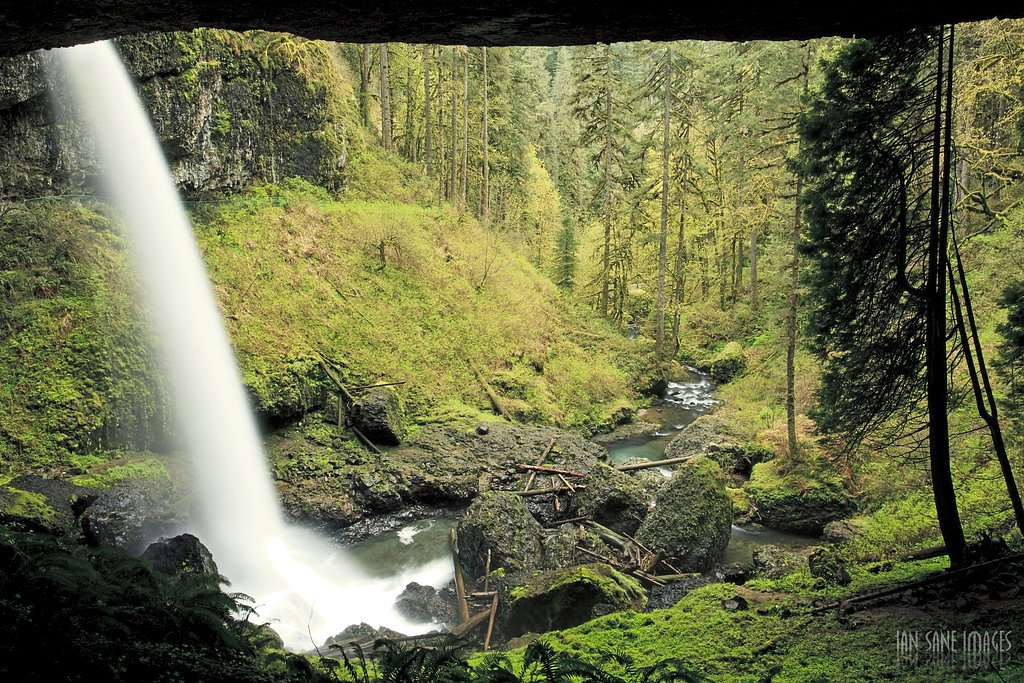
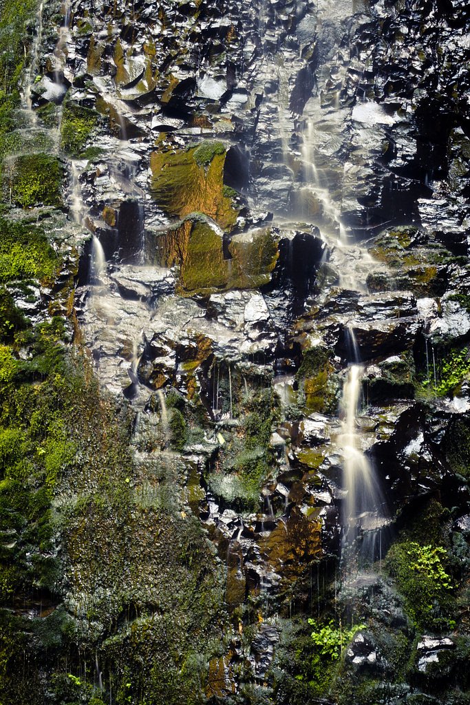
About Abiqua Falls
Abiqua Falls is a dramatic 92-foot cascade tucked near Scotts Mills, Oregon, plunging into a deep, clear pool framed by a basalt amphitheater — a favorite subject for photographers and anyone who appreciates a show-stopping waterfall. The short approach and close-up views make it feel intimate and wild at once, with the roar of the falls filling the canyon as you descend. The falls sit on land managed by SDNR under the Forest Development Fund (Board Of Forestry), designated as an SRMA and managed by SLB. A roughly 1.5-mile out-and-back route (moderate, about 300 feet of elevation gain) brings you in; if you’re planning to camp nearby, the Aquila Vista Recreation Site is the closest option at about 8.69 km away.
The Setting
Abiqua Falls sits at 1,263 feet within Forest Development Fund (Board Of Forestry), in the foothills of Oregon. The falls drop 92 feet.
Height: 92 feet
Nearby Falls Worth Visiting
Double Falls (178 ft) lies 4.5 miles to the southwest. Also nearby: North Falls (136 ft, 3.9 mi) and Upper North Falls (65 ft, 3.8 mi).
Trail & Hike Details
The Approach
The moderate 1.5-mile out-and-back trail gains 300 feet of elevation on the way to the falls.
Trail Description
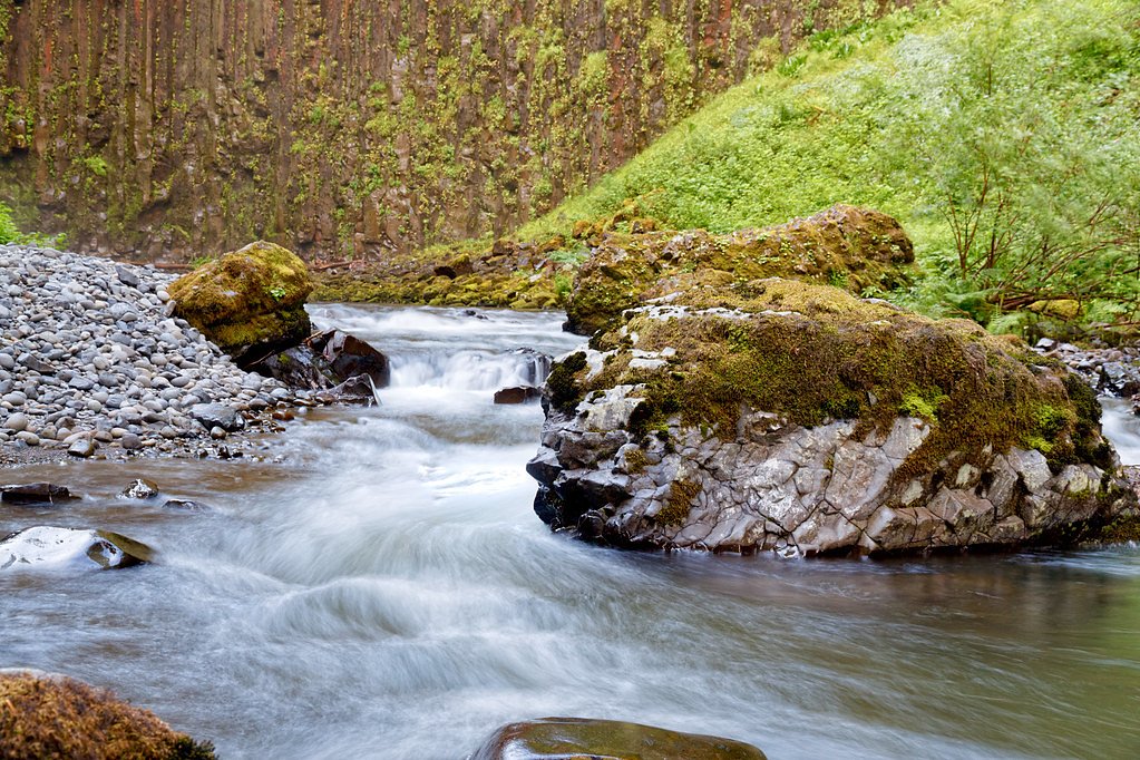
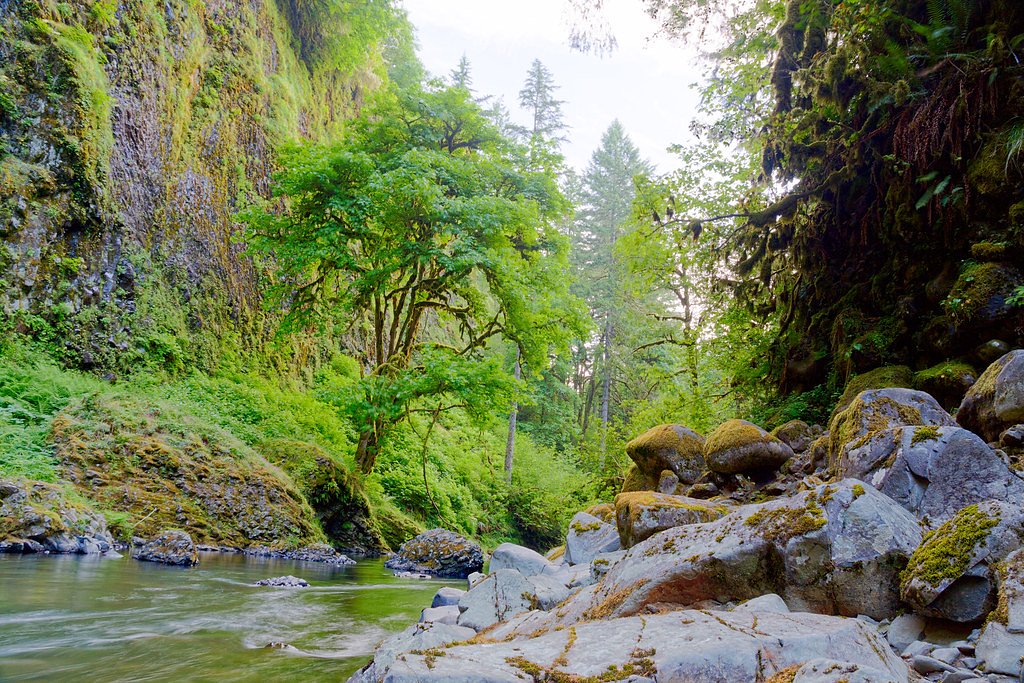
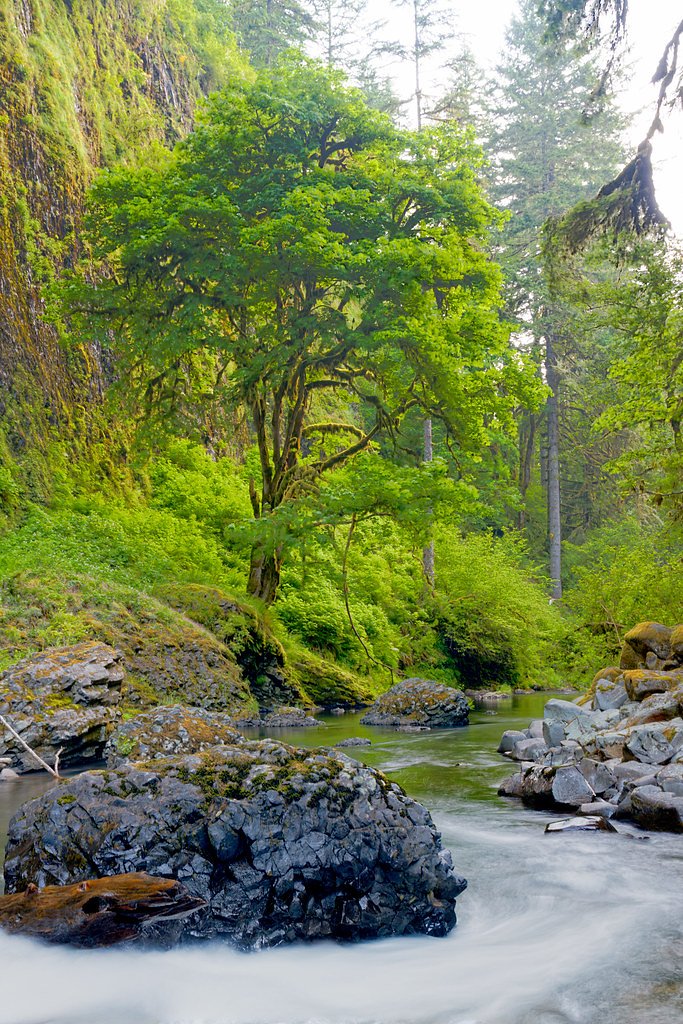
This is a roughly 1.5-mile out-and-back route with about 300 feet of elevation gain, rated moderate. Expect a steep, uneven descent through forest to reach the base of the falls; sections can be muddy and slippery after rain, and footing is often rooty and rocky. The trail provides direct access to the basalt-walled pool below the 92-foot drop. No official USFS trail number, trail surface, grade, or class is listed by the managing land unit.
What to Expect
The falls cascade 92 feet. Swimming is permitted. Dogs are welcome.
Accessibility
The trail is not wheelchair accessible. Uneven terrain and elevation changes require steady footing.
Frequently Asked Questions
🐶 Are Dogs Allowed at Abiqua Falls?
✅ Dogs are allowed
Are There Any Fees or Permits Required?
🆖 No fees required
🏊 Is There Swimming at Abiqua Falls?
✅ Swimming is allowed
When to Visit
Spring and early summer are ideal for visiting, as the waterfall flow is strongest during these seasons. Fall offers beautiful foliage, while summer provides easier trail conditions.
Seasonal Access
The best time to visit is Spring, Summer, and Fall. Winter access may be limited.
Safety Information
The trail can be slippery and muddy, especially after rain. Use caution when descending to the falls. Cell service may be limited, so plan accordingly.
Current Water Conditions
1.86 ft
Water depth at gauge
60°F
WarmVery comfortable
What does this mean for your visit?
Water temperature is a bracing 60 degrees F, limit your time in the water.
About This Gauge
This gauge is on a nearby waterway and may not reflect exact conditions at the falls.
7-Day Flow Outlook
Based on the USGS gauge MOLALLA R AB PC NR WILHOIT, OR (12 km away).
Today
Low
103 cfs
3/10Tomorrow
Low
102 cfs
4/10Mon
Low
98 cfs
4/10Tue
Low
94 cfs
4/10Wed
Barely Flowing
82 cfs
5/10Thu
Barely Flowing
83 cfs
3/10Fri
Low
86 cfs
4/10Best window: Wed — barely flowing flow, partly sunny (trip score 5/10).
Best time of year: this gauge typically runs highest from late November to mid December, peaking in January.
How we calculate this
This is a transparent outlook, not a precise forecast. We take the waterfall's current flow strength (how it ranks against its historical normal for today, from the nearest USGS stream gauge), carry that ranking forward along the gauge's seasonal curve, and nudge it for forecast rain. Confidence is highest for the next day or two and falls further out. Always check official conditions and your own judgment before visiting — high flows can be dangerous.
Know when to go.
Get a free email alert when waterfalls near Lyons hit peak flow. We only send when conditions are worth the trip — no weekly newsletters, no spam.
Weather Forecast
Location & Access
Getting There
Abiqua Falls is located on private land, but access is generally allowed. The trailhead can be reached via Crooked Finger Road, though the last stretch of the road is rough and may require a high-clearance vehicle. Visitors should park at the designated area before the trailhead and walk the rest of the way.
Get Directions on Google MapsParking
Limited parking is available near the trailhead. Visitors should avoid blocking the road or private property.
Elevation
1,263 feet above sea level
Coordinates
44.926321° N, -122.567289° W
Land Management
Managed by SLB
Visitor Tips & Gear
Wear sturdy hiking shoes with good traction, as the trail can be slippery. Bring a map or GPS, as the trail is not well-marked. Arrive early to secure parking and avoid crowds. Be respectful of the private land and pack out all trash.
As an Amazon Associate, we earn from qualifying purchases.
With 1.5 miles and 300 ft of elevation gain, sturdy boots and trekking poles will help on this moderate trail. Sun exposure on the trail makes good sun protection a must in summer.

Polarized Sunglasses (Knockaround)
Cuts glare off the water so you actually see the falls — and your photos turn out better too.

Columbia Watertight II Rain Jacket
Packs into its own pocket, seam-sealed, and keeps you dry from spray and surprise rain.

Earth Pak Waterproof Dry Bag
Keeps your phone and gear dry when waterfall mist soaks everything else.

Waterproof Phone Pouch (AiRunTech)
Cheap insurance — take photos right next to the falls without killing your phone.

Timberland Euro Sprint Mid Waterproof
Trusted waterproof boot with premium leather and grippy rubber sole — reliable on rocky, wet trails.

TrailBuddy Trekking Poles
Lightweight aluminum, cork grips, and flip-locks that actually hold — a best-seller for good reason.
Where to Stay

Oregon Garden Resort

The 1908 Bungalow

La Quinta by Wyndham Salem OR

Best Western Premier Keizer Salem Hotel
Browse vacation cabins and private rentals nearby
Unique outdoor stays — tents, yurts, and treehouses
Rent a campervan or RV for your waterfall road trip
Some links are affiliate links. We may earn a commission at no extra cost to you.
Nearby Campground
Aquila Vista Recreation Site
5.4 miles away · 1 sites
Overview Aquila Vista is closed until further notice to remove wildfire burned danger trees. Aquila Vista is available for overnight group camping for groups up to 30 people and 20 vehicles. The season, when it reopens, will be mid-May through mid-October. The site is located in the heart of the forest next to a large beaver pond. There is plenty of hiking and natural beauty to see at Aquila Vista including a small waterfall. Amenities include vault toilet, two group picnic shelters with multiple
Book on Recreation.govNearby Hot Springs
Hot springs near Lyons, Oregon

Bagby Hot Springs
Bagby Hot Springs flows at 136°F deep in Mount Hood National Forest at 2,272 feet elevation, requiring a 3,720-foot hike from F...

Austin Hot Springs
Austin Hot Springs discharges at 186°F along the Clackamas River at 1,680 feet elevation, emerging just 310 feet from Clackamas...

Breitenbush Hot Springs
Breitenbush Hot Springs emerges at 198°F along the Breitenbush River, ranking as one of Oregon's hottest thermal features with ...

Swim Warm Springs
Swim Warm Springs emerges at 79°F within Mount Hood National Forest at 4,063 feet elevation, flowing just 6.9 meters from White...

Bigelow Hot Springs
Bigelow Hot Springs, also called Deer Creek Hot Springs, emerges at 142°F just 400 feet from Deer Creek Road in the Willamette ...

Mount Hood Fumaroles
Mount Hood Fumaroles vent at 194°F from the flanks of Oregon's highest peak, among the state's most extreme geothermal features...
Looking for a soak after your hike? Explore more hot springs near Lyons, Oregon on SoakingSprings.
Explore Oregon springsAdditional Information
Nearby Attractions
Silver Falls State Park, Butte Creek Falls, and the town of Silverton.
Wildlife
The area is home to various birds, deer, and small mammals. Visitors may also encounter amphibians near the water.
Cities near Abiqua Falls
Nearby Waterfalls
Writing about Abiqua Falls? Embed this waterfall on your site for free.