Photo Credits (5)
Difficulty
Easy
Trail Length
1.0 km
Trail Type
Out And Back
Elevation Gain
30 m
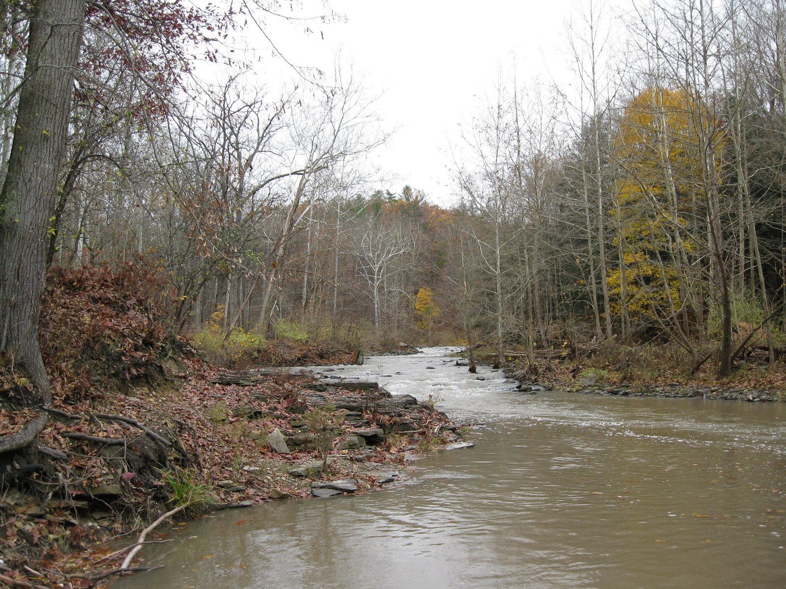
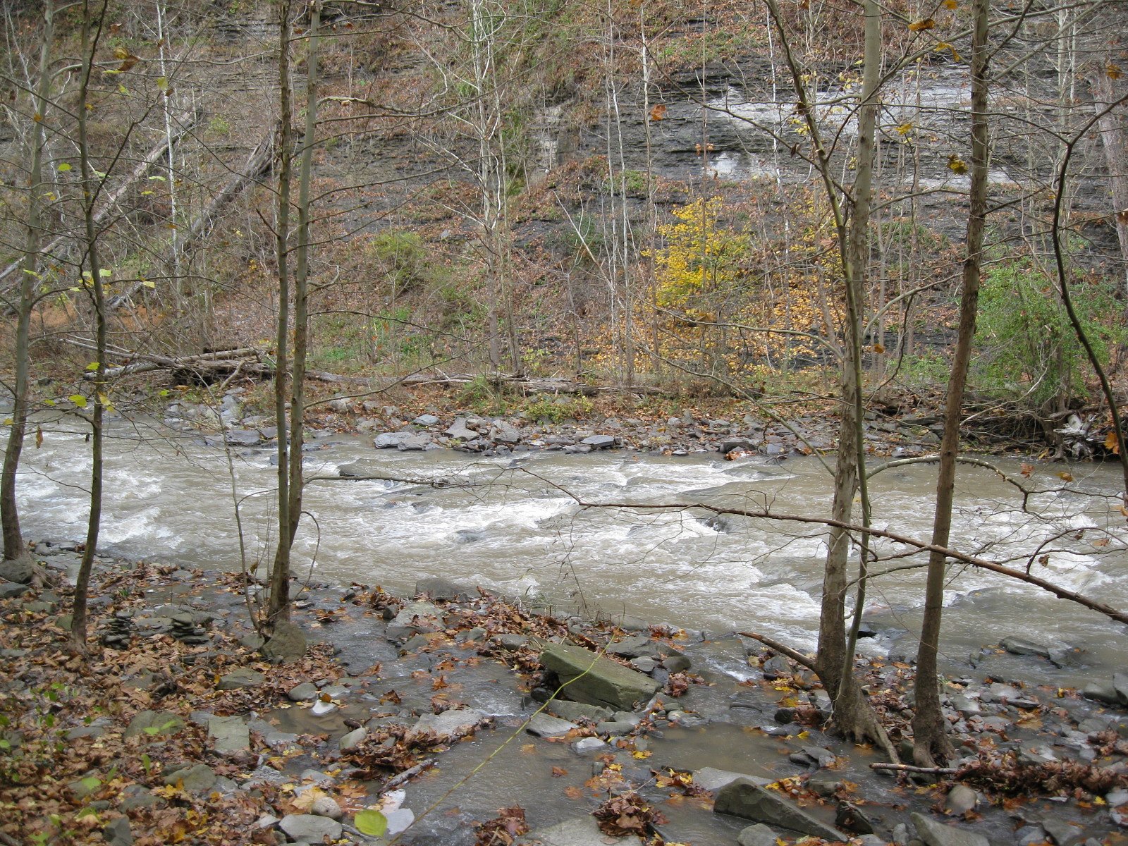
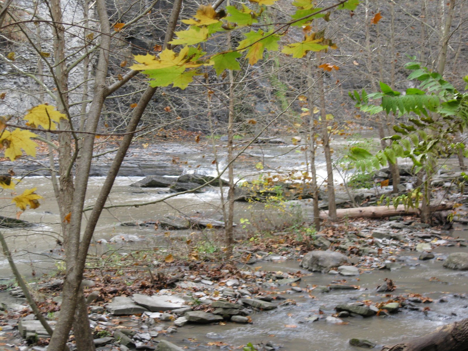
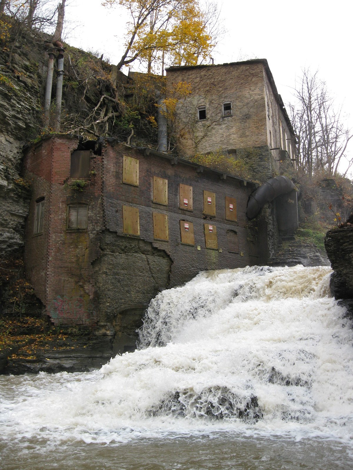
About Wells Falls
Wells Falls is a small to medium-sized cascade located on Cape Breton Island, Nova Scotia (coordinates 45.4144, -61.5164). The site appears to be a forested, rocky gorge setting rather than a large, developed tourism site. Water flow is likely highest in spring/after rain and lower in late summer. Specifics about official trailhead infrastructure, viewing platforms, or an established trail are not confirmed and may be minimal or informal.
Trail & Hike Details
The Approach
The easy 1.0-km out-and-back trail gains 30 metres of elevation on the way to the falls.
Trail Description
There is no verified, maintained trail description available from official sources for this exact feature. Access may require a short walk from a roadside parking spot over uneven, potentially muddy or rocky forest terrain. The route to the falls may not be signed and could cross wet/slippery sections; expect a natural footpath or scramble rather than a developed trail.
What to Expect
Expect a wooded setting with rocky banks and a cascade or small plunge area. Flow varies seasonally, higher in spring and after heavy rains, lower in late summer. Terrain near the water is likely slippery and uneven. Facilities (toilets, garbage bins, railings) are probably not present. Insects (black flies, mosquitoes) are common in spring and early summer. Cell coverage may be limited in some spots.
Accessibility
The trail is short and relatively flat, but the surface may be uneven. Contact the managing agency for accessibility details.
Frequently Asked Questions
🐶 Are Dogs Allowed at Wells Falls?
❌ Dogs are not allowed
Are There Any Fees or Permits Required?
🆖 No fees required
🏊 Is There Swimming at Wells Falls?
❌ Swimming is not allowed
When to Visit
Late spring for strongest flows and fewer biting insects than early spring; early fall for lower crowds and good foliage color. Summer can be pleasant but flows may be reduced by late summer droughts. Winter access may be difficult or hazardous due to ice and snow.
Seasonal Access
The best time to visit is Spring, Summer, and Fall. Winter access may be limited. Check with the managing park or local authority for current conditions.
Safety Information
Hazards may include slippery wet rocks, unstable cliff edges, fast currents after rain/snowmelt, cold water temperatures, ticks, black flies, limited cell coverage, and no emergency services on site. Do not approach the water edge carelessly or climb unstable rock faces. Travel with a partner when possible and tell someone your route and expected return time.
Current Water Conditions
Based on a Water Survey of Canada gauge 34.2 km away
0.5 m³/s
Current discharge — how much water is flowing
Lower than usual for this time of year
Based on 75 years of record
0.99 m
Water depth at gauge
7-Day Discharge Trend
What does this mean for your visit?
Flow is lower than usual for this time of year.
About This Gauge
This gauge is on a regional waterway. Conditions at the falls may differ, especially after local rain.
7-Day Flow Outlook
Based on the WSC gauge SOUTH RIVER AT ST. ANDREWS (34 km away).
Today
Moderate
0.6 m³/s
4/10Tomorrow
Moderate
0.6 m³/s
8/10Tue
Moderate
0.5 m³/s
6/10Wed
Moderate
0.6 m³/s
4/10Thu
Moderate
0.6 m³/s
4/10Fri
Moderate
0.5 m³/s
5/10Sat
Moderate
0.5 m³/s
5/10Best window: Tomorrow — moderate flow, mainly sunny (trip score 8/10).
Best time of year: this gauge typically runs highest from late March to early May, peaking in April.
How we calculate this
This is a transparent outlook, not a precise forecast. We take the waterfall's current flow strength (how it ranks against its historical normal for today, from the nearest WSC stream gauge), carry that ranking forward along the gauge's seasonal curve, and nudge it for forecast rain. Confidence is highest for the next day or two and falls further out. Always check official conditions and your own judgment before visiting — high flows can be dangerous.
Know when to go.
Get a free email alert when waterfalls near Antigonish hit peak flow. We only send when conditions are worth the trip — no weekly newsletters, no spam.
Weather Forecast
Location & Access
Getting There
Approximate location: 45.4144 N, -61.5164 W. Nearest towns listed are Antigonish (~28.9 miles) and Baddeck (~65.9 miles). Expect to reach the area via local secondary roads off Route/Highway corridors on Cape Breton Island; last-mile access may be on unpaved roads. Use a reliable mapping app or GPS with the coordinates to plan the final approach.
Get Directions on Google MapsParking
No confirmed formal parking lot. There may be limited roadside parking or an informal pullout near the access point; park with caution and avoid blocking the road or private driveways. If parking is informal, use sticky-out-of-the-way locations and follow local signage.
Elevation
51 metres above sea level
Coordinates
45.414445° N, -61.516435° W
Visitor Tips & Gear
• Use sturdy, closed-toe footwear with good traction. • Stay back from cliff edges, rocks can be unstable and slippery. • Avoid swimming unless you can confirm safe access and conditions; currents and underwater hazards are possible. • Pack out all trash and follow Leave No Trace. • Check local road conditions before travel; unpaved roads can be rough, especially after rain. • If visiting in spring, expect higher water and faster currents; exercise extra caution.
As an Amazon Associate, we earn from qualifying purchases.
For this easy 1.0 km trail, lightweight trail shoes and a water bottle are usually sufficient. Sun exposure on the trail makes good sun protection a must in summer.

Polarized Sunglasses (Knockaround)
Cuts glare off the water so you actually see the falls — and your photos turn out better too.

Columbia Watertight II Rain Jacket
Packs into its own pocket, seam-sealed, and keeps you dry from spray and surprise rain.

Earth Pak Waterproof Dry Bag
Keeps your phone and gear dry when waterfall mist soaks everything else.

Waterproof Phone Pouch (AiRunTech)
Cheap insurance — take photos right next to the falls without killing your phone.

JOBY GorillaPod Starter Kit
Wraps around railings and rocks for long-exposure waterfall shots — no flat surface needed.

Osprey Daylite Daypack
Light, organized, and just the right size for a day hike — fits water, snacks, and layers.
Where to Stay
Browse vacation cabins and private rentals nearby
Unique outdoor stays — tents, yurts, and treehouses
Rent a campervan or RV for your waterfall road trip
Some links are affiliate links. We may earn a commission at no extra cost to you.
Additional Information
Nearby Attractions
Antigonish (approx. 28.9 miles) offers services and amenities. Cape Breton highlights such as Baddeck (approx. 65.9 miles), the Cabot Trail, and Bras d'Or Lake are regional attractions but are a drive away from this site.
Wildlife
Typical Nova Scotia forest and riparian species: white-tailed deer, small mammals, songbirds, raptors (possible bald eagles or hawks), and common insects. Black bears exist on Cape Breton Island; while encounters are uncommon at roadside falls, be bear-aware (store food securely, make noise when hiking).
Cities near Wells Falls
Writing about Wells Falls? Embed this waterfall on your site for free.