
Photo Credits (5)
Difficulty
Easy
Trail Length
2.1 km
Trail Type
Out And Back
Elevation Gain
57 m
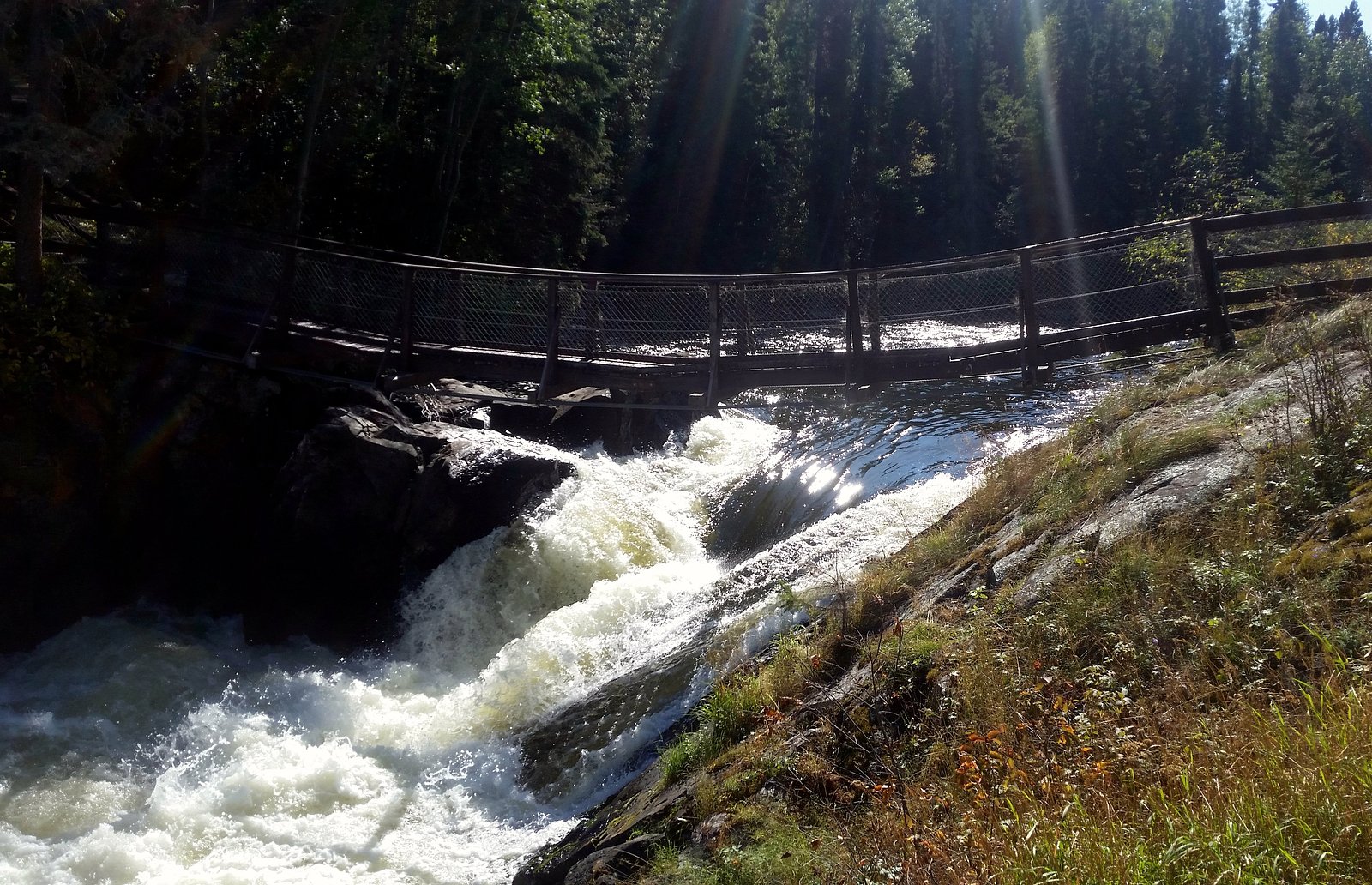
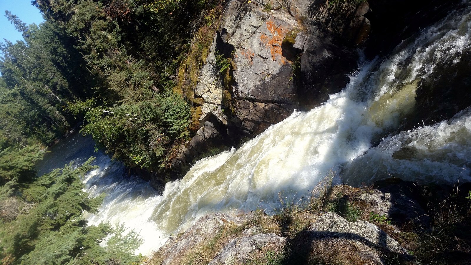
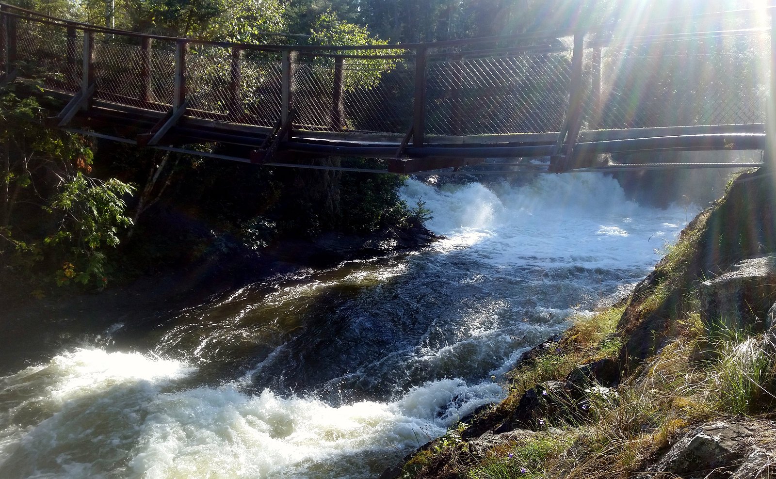
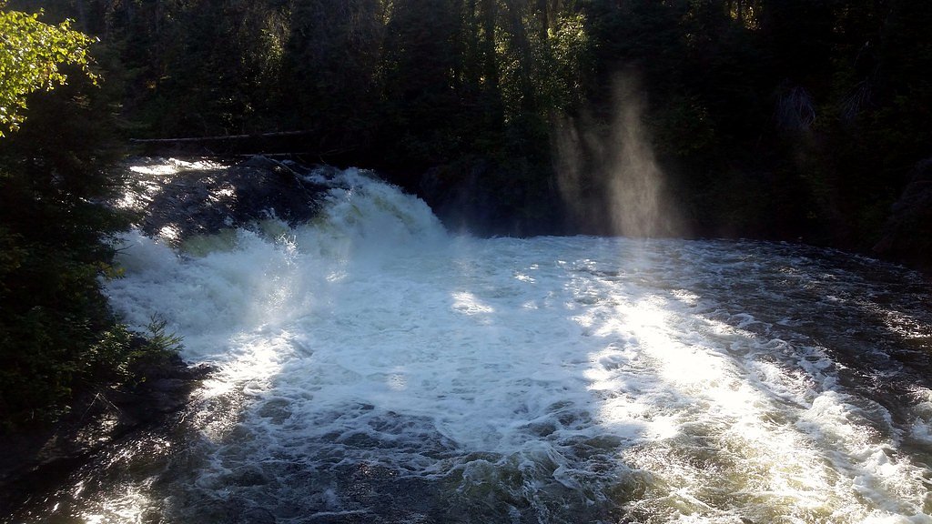
About Wekusko Falls
Wekusko Falls is a scenic set of cascades on the Wekusko River in north-central Manitoba, located within/adjacent to Wekusko Falls Provincial Park (coordinates ~54.7898, -99.9729). The river flows over rocky outcrops creating multiple drops and rapids rather than a single tall plunge. The site is a popular roadside/day-use destination with viewpoints and picnic areas; flow and appearance vary seasonally (high flows in spring).
Why This Waterfall Exists
Wekusko Falls flows over hard volcanic rock laid down over 1.6-2.5 billion years ago. These resistant rocks form a durable ledge that water cannot easily wear away, creating the falls where softer material downstream has already eroded.
Trail & Hike Details
The Approach
The easy 2.1-km out-and-back trail gains 57 metres of elevation on the way to the falls.
Trail Description
A short, generally easy walk from the parking area leads to viewpoints and river-edge lookouts. Trails are typically short and may include boardwalks, wooden viewing platforms or short sections of uneven rock and steps. The main access route is suitable for most visitors but may be slippery when wet or icy.
What to Expect
Expect a series of cascades and rapids over exposed bedrock with scenic river and forest surroundings. Spring runoff produces higher, more dramatic flows; summer offers calmer conditions and accessible picnic areas. Facilities are basic; expect limited services, seasonal restrooms, and potentially significant insect activity (mosquitoes and blackflies) in summer. The site is relatively remote, plan accordingly.
Accessibility
The trail is not wheelchair accessible. Uneven terrain and elevation changes require steady footing.
Frequently Asked Questions
🐶 Are Dogs Allowed at Wekusko Falls?
❌ Dogs are not allowed
Are There Any Fees or Permits Required?
🆖 No fees required
🏊 Is There Swimming at Wekusko Falls?
❌ Swimming is not allowed
When to Visit
Late spring (after ice-out) for high water and dramatic flows; early to mid-summer for easiest access and milder weather; early fall for fall color and fewer insects. Winter can present a dramatic frozen scene but may be icy and more hazardous, only attempt in winter if properly equipped and aware of conditions.
Seasonal Access
The best time to visit is Spring, Summer, Fall, and Winter. Check with the managing park or local authority for current conditions.
Safety Information
The river around Wekusko Falls includes fast, powerful currents and slippery rocks. There are no lifeguards; swimming near the falls is hazardous. Fall, spring thaw, wet weather, and ice can make surfaces unstable. The area is remote with limited cell service, let someone know your plans, carry emergency supplies, and check road and weather conditions before traveling. Be prepared for insects in summer and sudden temperature changes. Follow posted signage and stay on designated trails.
Weather Forecast
Location & Access
Getting There
The falls are reached by driving to the Wekusko Falls Provincial Park/day‑use area near the provided coordinates. There is a short maintained path from a nearby parking area to viewpoints. Roads in the region are provincial highways and secondary roads, check maps and local travel advisories before travel. Cell service may be limited; use offline maps or print directions.
Get Directions on Google MapsParking
There is a small park/ day‑use parking area close to the trailhead/viewing points. The lot is likely gravel and may fill on busy summer weekends. Expect limited facilities and seasonal maintenance.
Elevation
284 metres above sea level
Coordinates
54.789795° N, -99.972928° W
Visitor Tips & Gear
1) Wear sturdy, non-slip footwear, rocks and boardwalks can be slippery. 2) Bring insect repellent in summer and warm layers in cooler months. 3) Keep a safe distance from fast-moving water and unstable rock edges. 4) Supervise children closely near the river and rapids. 5) Check official Manitoba provincial parks resources or local signage for current conditions, road status, and facility availability before travel. 6) Pack out waste, limited services on site.
As an Amazon Associate, we earn from qualifying purchases.
This easy 2.1 km hike is straightforward — comfortable trail shoes and plenty of water should do. Icy conditions are common in winter — traction cleats are a smart addition.

Columbia Watertight II Rain Jacket
Packs into its own pocket, seam-sealed, and keeps you dry from spray and surprise rain.

Polarized Sunglasses (Knockaround)
Cuts glare off the water so you actually see the falls — and your photos turn out better too.

Earth Pak Waterproof Dry Bag
Keeps your phone and gear dry when waterfall mist soaks everything else.

Waterproof Phone Pouch (AiRunTech)
Cheap insurance — take photos right next to the falls without killing your phone.

Kahtoola MICROspikes
Cult-favorite traction cleats that grip ice and wet rock — essential for winter waterfall hikes.

JOBY GorillaPod Starter Kit
Wraps around railings and rocks for long-exposure waterfall shots — no flat surface needed.
Where to Stay
Browse vacation cabins and private rentals nearby
Unique outdoor stays — tents, yurts, and treehouses
Rent a campervan or RV for your waterfall road trip
Some links are affiliate links. We may earn a commission at no extra cost to you.
Additional Information
Nearby Attractions
Wekusko Falls Provincial Park amenities (day-use areas, potential campground), nearby lakes and rivers for fishing and boating, and general wilderness recreation in north-central Manitoba. For specific nearby towns, services, and attractions, consult a regional map or provincial tourism resources.
Wildlife
Typical boreal wildlife may be present, including moose, black bears, beavers, waterfowl and a variety of songbirds. Maintain distance from wildlife, store food securely, and follow provincial guidelines for wildlife encounters.
Writing about Wekusko Falls? Embed this waterfall on your site for free.