Virginia Falls
Northwest Territories • 96 m
By Armen Suny · Last verified Jun 2026
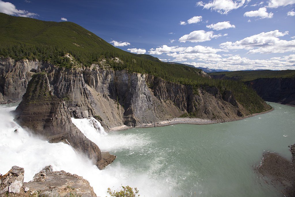
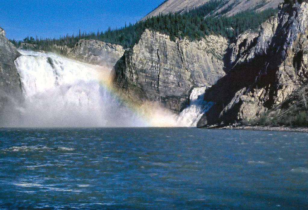

Photo Credits (5)
Difficulty
Easy
Trail Length
2.6 km
Trail Type
Out And Back
Elevation Gain
92 m
About Virginia Falls
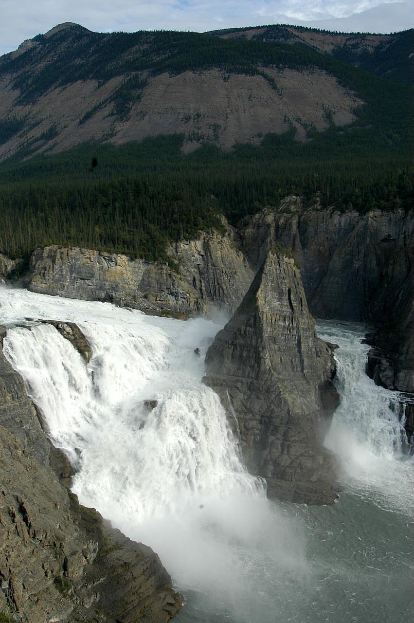
Virginia Falls is a waterfall in Nahanni National Park Reserve, Northwest Territories, Canada. It is on the South Nahanni River, at an elevation of 500 m (1,600 ft). It is located 120 km (75 mi) from the Yukon border.
The Setting
Virginia Falls sits at 560 metres within Nahanni National Park Reserve Of Canada, in the hills of Northwest Territories. At 96 metres, it is among the taller waterfalls in Northwest Territories.
Why This Waterfall Exists
Virginia Falls flows over layered carbonate rock, primarily limestone and dolostone, laid down about 359-539 million years ago. These soft rocks erode readily, allowing the stream to carve a 315-foot drop into the landscape.
Trail & Hike Details
The Approach
The easy 2.6-km out-and-back trail gains 92 metres of elevation on the way to the falls.
Trail Description
From the typical floatplane landing or nearby campsite there is a short maintained trail and boardwalk leading to a viewing platform above the canyon rim. The surface is typically packed dirt/boardwalk; the walk is short (under 1 mile round-trip) with only modest elevation change. Some stairs and uneven sections may be present near viewpoints.
What to Expect
The falls plunge a dramatic 96 metres over layered carbonate rock.
Accessibility
The trail is not wheelchair accessible. Uneven terrain and elevation changes require steady footing.
Frequently Asked Questions
🐶 Are Dogs Allowed at Virginia Falls?
❌ Dogs are not allowed
Are There Any Fees or Permits Required?
🆖 No fees required
🏊 Is There Swimming at Virginia Falls?
❌ Swimming is not allowed
When to Visit
Late June through August offers the most reliable access and milder weather. Spring (late snowmelt) can mean higher flows and dramatic water levels but may be logistically harder. Early fall can be quieter with good colors. Winter access is extremely limited and typically not practical for casual visitors.
Seasonal Access
The best time to visit is Spring, Summer, and Fall. Winter access may be limited. Check with the managing park or local authority for current conditions.
Safety Information
Major hazards include extreme remoteness, rapidly changing weather, cold water and strong river currents, slippery edges near the canyon, steep drops, and wildlife (bears). There is little or no cell service. Visitors should carry proper safety equipment (including bear spray and an emergency locator), travel with experienced guides if unfamiliar with remote river travel, and follow Parks Canada guidance. Do not approach cliff edges or attempt to descend into the canyon. Conditions can change quickly, be prepared to delay or alter plans.
Current Water Conditions
514.0 m³/s
Current discharge — how much water is flowing
About average for this time of year
Based on 57 years of record
3.19 m
Water depth at gauge
7-Day Discharge Trend
What does this mean for your visit?
Flow is about average for this time of year.
About This Gauge
7-Day Flow Outlook
Based on the WSC gauge SOUTH NAHANNI RIVER ABOVE VIRGINIA FALLS (5 km away).
Today
Moderate
555 m³/s
6/10Tomorrow
Moderate
571 m³/s
6/10Tue
Moderate
557 m³/s
6/10Wed
Moderate
567 m³/s
6/10Thu
Moderate
563 m³/s
6/10Fri
Moderate
595 m³/s
6/10Sat
Moderate
575 m³/s
6/10Best window: Today — moderate flow, drizzle (trip score 6/10).
Best time of year: this gauge typically runs highest from late May to mid August, peaking in June.
How we calculate this
This is a transparent outlook, not a precise forecast. We take the waterfall's current flow strength (how it ranks against its historical normal for today, from the nearest WSC stream gauge), carry that ranking forward along the gauge's seasonal curve, and nudge it for forecast rain. Confidence is highest for the next day or two and falls further out. Always check official conditions and your own judgment before visiting — high flows can be dangerous.
Weather Forecast
Location & Access
Getting There
There is no direct road access. Typical approaches are by floatplane charter from Fort Simpson, by guided or private river trip (multi-day canoe/raft) on the South Nahanni River, or by helicopter charter. Most visitors arrive by air and make a short walk from the landing to the viewing area. Allow for weather delays and book air/river travel well in advance.
Get Directions on Google MapsParking
No standard roadside parking at the falls. Nearest road-access services and vehicle parking are in Fort Simpson (base for charters).
Elevation
560 metres above sea level
Coordinates
61.607821° N, -125.735176° W
Land Management
Managed by Parks Canada Agency
Visitor Tips & Gear
Book floatplane or river travel well in advance and confirm schedules. Check Parks Canada/Nahanni National Park Reserve for current conditions, permits, and advisories. Dress in layers and bring waterproof outerwear; expect wind and spray near the falls. Bring insect repellent, sturdy footwear, sun protection, and bear-aware gear. Leave no trace. Carry emergency communication (satellite/PLB) because cell coverage is unreliable to non-existent.
As an Amazon Associate, we earn from qualifying purchases.
This easy 2.6 km hike is straightforward — comfortable trail shoes and plenty of water should do. Sun exposure on the trail makes good sun protection a must in summer.

Polarized Sunglasses (Knockaround)
Cuts glare off the water so you actually see the falls — and your photos turn out better too.

Columbia Watertight II Rain Jacket
Packs into its own pocket, seam-sealed, and keeps you dry from spray and surprise rain.

Earth Pak Waterproof Dry Bag
Keeps your phone and gear dry when waterfall mist soaks everything else.

Waterproof Phone Pouch (AiRunTech)
Cheap insurance — take photos right next to the falls without killing your phone.

JOBY GorillaPod Starter Kit
Wraps around railings and rocks for long-exposure waterfall shots — no flat surface needed.

Osprey Daylite Daypack
Light, organized, and just the right size for a day hike — fits water, snacks, and layers.
Where to Stay
Browse vacation cabins and private rentals nearby
Unique outdoor stays — tents, yurts, and treehouses
Rent a campervan or RV for your waterfall road trip
Some links are affiliate links. We may earn a commission at no extra cost to you.
Additional Information
Nearby Attractions
Other highlights in Nahanni National Park Reserve include long stretches of the South Nahanni River (classic multi-day paddling/raft trips), the surrounding canyons, and nearby features such as the Rabbitkettle Hot Springs area (within the park). Fort Simpson serves as the primary gateway community for services and charters.
Wildlife
Moose, woodland caribou, black and possibly grizzly bears, wolves, Dall's sheep in some areas, and many bird species. As with all boreal/wilderness areas, encounters are possible, practice bear-aware and wildlife-safe behavior.
Other waterfalls named Virginia Falls
1 other waterfall shares this name across Canada.
Writing about Virginia Falls? Embed this waterfall on your site for free.