Virgin falls
British Columbia • 53 m
By Armen Suny · Last verified Oct 2026
Difficulty
Easy
Trail Length
0.4 km
Trail Type
Out And Back
About Virgin falls
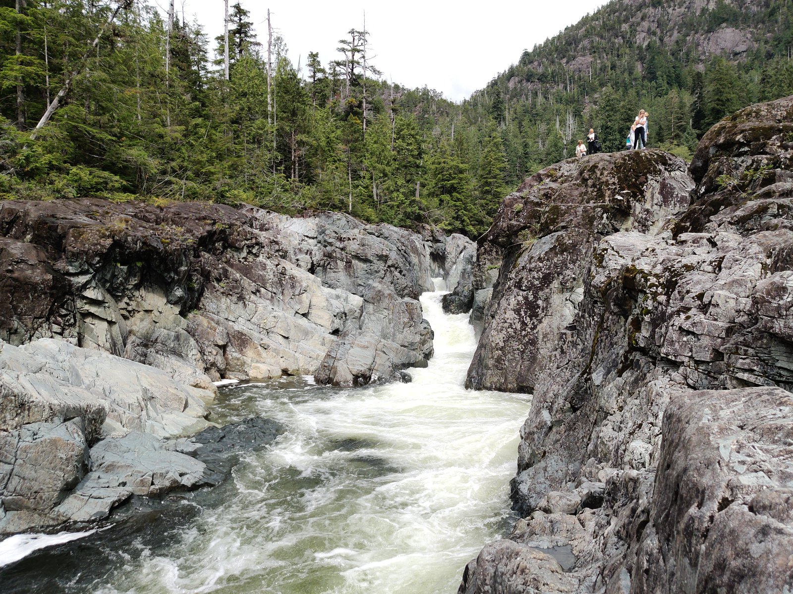
Virgin Falls is a fan-shaped waterfall about 53 m (174 ft) high on Tofino Creek, in the Clayoquot Sound area of western Vancouver Island beyond Clayoquot Arm and Clayoquot Plateau provincial parks. It is reached by a long drive on active logging roads, followed by a walk of about 200 m from where you park.
The Setting
Virgin falls sits at 175 metres in the foothills of British Columbia. At 53 metres, it is among the taller waterfalls in British Columbia.
Why This Waterfall Exists
Virgin falls flows over volcanic rock laid down about 201-252 million years ago. These resistant rocks form a durable ledge that water cannot easily wear away, creating a 174-foot drop where softer material downstream has already eroded.
Nearby Falls Worth Visiting
Kennedy River Falls (9 m) lies 15.9 kilometres to the east.
Trail & Hike Details
Trail Description
From the parking spot the walk to the falls is about 200 m. If the trailhead is not obvious, follow the sound of the falls or head toward the red bridge at the washout and follow the washout to the trail.
What to Expect
The falls plunge 53 metres over volcanic rock.
Accessibility
The trail is short and relatively flat, but the surface may be uneven. Contact the managing agency for accessibility details.
Frequently Asked Questions
🐶 Are Dogs Allowed at Virgin falls?
❌ Dogs are not allowed
Are There Any Fees or Permits Required?
🆖 No fees required
🏊 Is There Swimming at Virgin falls?
❌ Swimming is not allowed
When to Visit
Late spring offers higher flows and dramatic falls from snowmelt and wetter weather. Summer typically provides the driest and easiest conditions for road and trail access. Fall can offer good flows and fewer bugs, but expect wetter footing. Winter access may be more difficult due to heavy rain, saturated ground, and potential road closures.
Seasonal Access
The best time to visit is Spring, Summer, and Fall. Winter access may be limited. Check with the managing park or local authority for current conditions.
Safety Information
Logging trucks use the access roads, which are rough gravel with single-lane sections.
Current Water Conditions
These readings come from the Water Survey of Canada gauge on Tofino Creek, 1.5 km away, not on Virgin falls's own stream. Use them as a sign of whether the area is running wet or dry.
0.7 m³/s
Current discharge — how much water is flowing
Lower than usual for this time of year
Based on 29 years of record
1.25 m
Water depth at gauge
7-Day Discharge Trend
What does this mean for your visit?
Flow is lower than usual for this time of year.
About This Gauge
7-Day Flow Outlook
Based on the WSC gauge TOFINO CREEK NEAR THE MOUTH (2 km away).
Today
Low
0.7 m³/s
5/10Tomorrow
Low
0.6 m³/s
5/10Sat
Low
0.5 m³/s
4/10Sun
Low
0.8 m³/s
4/10Mon
Low
0.6 m³/s
5/10Tue
Low
0.6 m³/s
5/10Wed
Low
0.9 m³/s
5/10Best window: Today — low flow, cloudy (trip score 5/10).
Best time of year: this gauge typically runs highest from early November to mid November, peaking in October.
How we calculate this
This is a transparent outlook, not a precise forecast. We take the waterfall's current flow strength (how it ranks against its historical normal for today, from the nearest WSC stream gauge), carry that ranking forward along the gauge's seasonal curve, and nudge it for forecast rain. Confidence is highest for the next day or two and falls further out. Always check official conditions and your own judgment before visiting — high flows can be dangerous.
Know when to go.
Get a free email alert when waterfalls near Tofino hit peak flow. We only send when conditions are worth the trip — no weekly newsletters, no spam.
Weather Forecast
Location & Access
Getting There
From the Tofino-Ucluelet junction on Highway 4, the route uses West Road past Kennedy Lake Provincial Park, crosses the Staghorn Creek bridge, and continues about 24 km on Deer Bay Road. One visitor puts it at about an hour and a half each way from Tofino (a 110 km round trip). The gravel roads have large potholes and single-lane sections, logging trucks use them, and a four-wheel-drive vehicle is recommended.
Get Directions on Google MapsElevation
175 metres above sea level
Coordinates
49.263283° N, -125.574147° W
Visitor Tips & Gear
Where to Stay
Browse vacation cabins and private rentals nearby
Unique outdoor stays — tents, yurts, and treehouses
Rent a campervan or RV for your waterfall road trip
Some links are affiliate links. We may earn a commission at no extra cost to you.
Nearby Campground
Trailhead Campground
18.7 km away
Additional Information
Nearby Attractions
Kennedy Lake Provincial Park, Clayoquot Arm Provincial Park and Tofino.
Wildlife
Black bears, cougars (rare but present), deer, eagles, various shore and forest birds, and typical coastal-mountain understory species. Practice wildlife safety: store food securely and give animals space.
Cities near Virgin falls
Nearby Waterfalls
Writing about Virgin falls? Embed this waterfall on your site for free.