
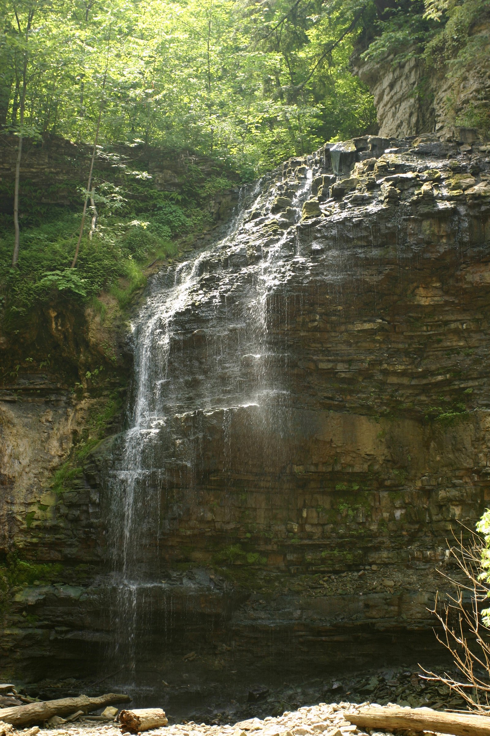
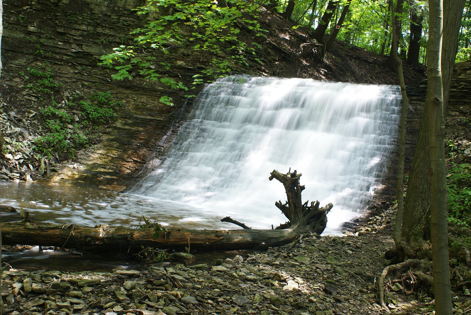
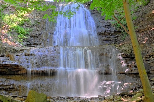
Upper Shaver Falls
By Armen Suny · Last verified Jun 2026
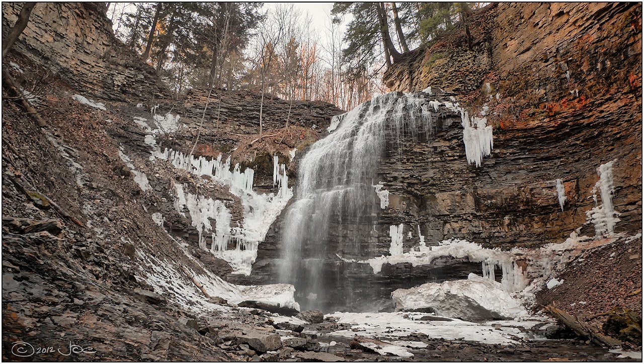
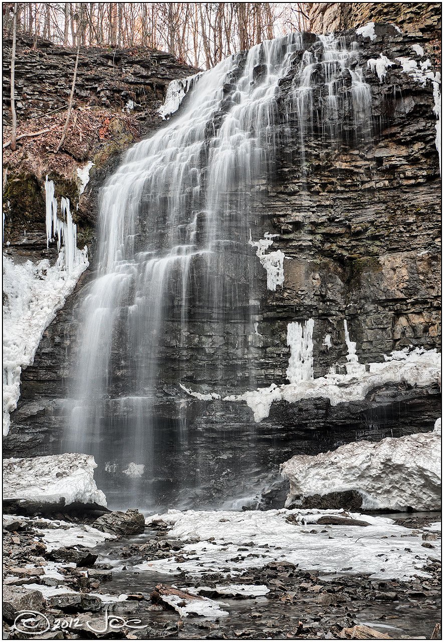
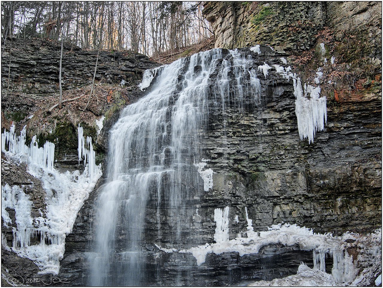

Photo Credits (5)
Trail Type
Out And Back
About Upper Shaver Falls
Upper Shaver Falls is a small, forested waterfall site in southern Ontario near the Niagara Escarpment corridor. The falls sit in a wooded setting and are best known for seasonal flow variability, higher in spring and after heavy rains, lower during late summer dry spells. Precise published measurements and official facility information for this specific fall are limited; visitors should expect a natural, minimally developed site and variable trail infrastructure.
Nearby Falls Worth Visiting
Tiffany Falls (21 m) lies 0.6 kilometres to the west. Also nearby: Ancaster Heights Falls (13 m, 1.0 km) and Stephanie Falls (9 m, 0.6 km).
Trail & Hike Details
Trail Description
Detailed, authoritative trail descriptions for Upper Shaver Falls are limited. The approach is typically through mixed hardwood forest and may follow an unpaved footpath. Trails may be narrow, uneven and include roots, rocks and short steep sections. Expect minimal signage and limited developed infrastructure (boardwalks or guardrails may not be present). Use topographic maps, GPS coordinates and local resources to confirm the route before hiking.
What to Expect
A natural, relatively small waterfall in a wooded setting. Flow will be highest in spring and after rain. The immediate area may have slippery rock and muddy sections, and there may be informal viewpoints rather than developed overlooks. Cellular reception may be spotty in some places. Facilities (restrooms, trash bins, picnic tables) are likely absent.
Accessibility
Accessibility information is not available. Given likely unpaved, narrow and uneven trails, the site may not be wheelchair-accessible or suitable for visitors with limited mobility without assistance.
Frequently Asked Questions
🐶 Are Dogs Allowed at Upper Shaver Falls?
❌ Dogs are not allowed
Are There Any Fees or Permits Required?
🆖 No fees required
🏊 Is There Swimming at Upper Shaver Falls?
❌ Swimming is not allowed
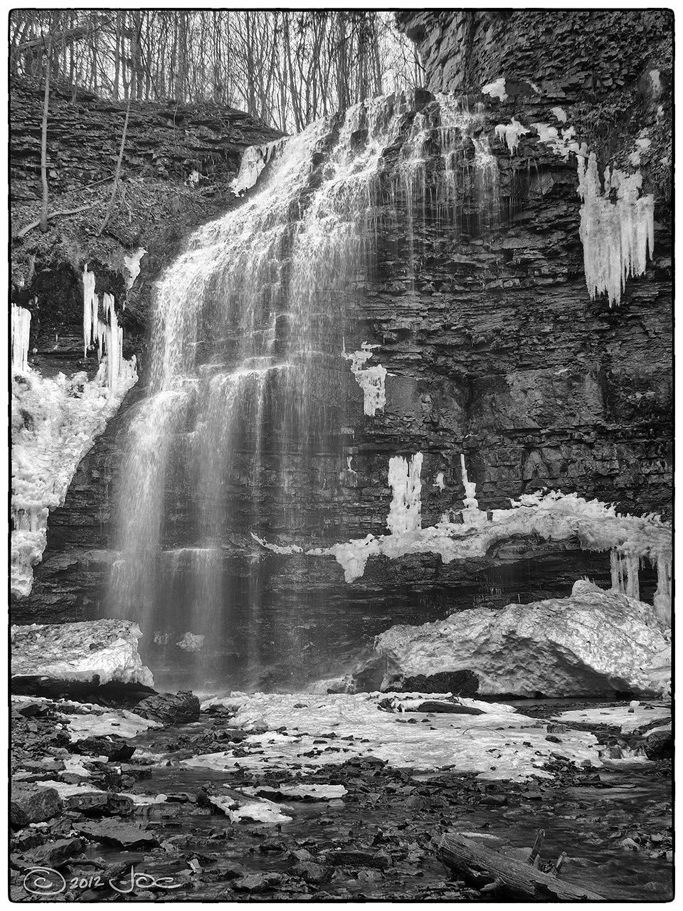
When to Visit
Spring for highest flows and fuller cascades; fall for foliage color. Summer can be pleasant but flows may be lower; winter offers icy scenery but can be hazardous due to ice and freeze-thaw conditions.
Seasonal Access
The best time to visit is Spring, Summer, Fall, and Winter. Check with the managing park or local authority for current conditions.
Safety Information
Hazards include slippery rocks, steep or unstable banks, fast or cold water, falling ice in winter, and limited or patchy cell service. Do not climb on wet or moss-covered rocks near the falls; supervise children closely. Check weather and recent condition reports before visiting.
Current Water Conditions
0.0 m³/s
Current discharge — how much water is flowing
Lower than usual for this time of year
Based on 33 years of record
0.11 m
Water depth at gauge
7-Day Discharge Trend
What does this mean for your visit?
Flow is lower than usual for this time of year.
About This Gauge
7-Day Flow Outlook
Based on the WSC gauge ANCASTER CREEK AT ANCASTER (2 km away).
Today
Low
0.0 m³/s
6/10Tomorrow
Low
0.0 m³/s
5/10Tue
Moderate
0.0 m³/s
4/10Wed
Moderate
0.0 m³/s
6/10Thu
Low
0.0 m³/s
5/10Fri
Moderate
0.0 m³/s
5/10Sat
Moderate
0.0 m³/s
6/10Best window: Today — low flow, mainly sunny (trip score 6/10).
Best time of year: this gauge typically runs highest from early March to late May, peaking in April.
How we calculate this
This is a transparent outlook, not a precise forecast. We take the waterfall's current flow strength (how it ranks against its historical normal for today, from the nearest WSC stream gauge), carry that ranking forward along the gauge's seasonal curve, and nudge it for forecast rain. Confidence is highest for the next day or two and falls further out. Always check official conditions and your own judgment before visiting — high flows can be dangerous.
Know when to go.
Get a free email alert when waterfalls near Hamilton hit peak flow. We only send when conditions are worth the trip — no weekly newsletters, no spam.
Weather Forecast
Location & Access
Getting There
Coordinates: 43.2391, -79.9502. The site is located roughly 4.8 miles from Hamilton, 32.3 miles from Kitchener and 38.8 miles from Youngstown (distances provided as context). Access typically requires driving local roads to a nearby parking or roadside pullout and then a short hike; confirm route and road conditions before you go.
Get Directions on Google MapsParking
Parking information is not well documented. Expect limited parking or roadside pullouts; do not block private driveways or gates. If you require accessible parking, verify with local land managers beforehand.
Elevation
213 metres above sea level
Coordinates
43.239140° N, -79.950238° W
Visitor Tips & Gear
• Check recent trip reports or local hiking resources for current conditions before visiting. • Wear sturdy, grippy footwear, rocks around falls are slippery. • Bring insect repellent in warm months and be aware of ticks. • Pack out all trash and follow Leave No Trace principles. • Be cautious near edges; banks and rocks can be unstable. • If parking along a road, ensure your vehicle is entirely out of the travel lane and do not block access.
Where to Stay
Browse vacation cabins and private rentals nearby
Unique outdoor stays — tents, yurts, and treehouses
Rent a campervan or RV for your waterfall road trip
Some links are affiliate links. We may earn a commission at no extra cost to you.
Nearby Campground
Lost Forest Park & Camping Resort
15.9 km away
Additional Information
Nearby Attractions
The broader Hamilton/Niagara Escarpment region contains numerous waterfalls, scenic lookouts and conservation areas. If visiting this area, consider researching other nearby escarpment falls and conservation parks for formal trails and visitor facilities.
Wildlife
Expect typical southern Ontario wildlife: songbirds, small mammals (squirrels, raccoons), white-tailed deer and seasonal insects. Take standard precautions against ticks and do not approach or feed wildlife.
Cities near Upper Shaver Falls
Nearby Waterfalls
Writing about Upper Shaver Falls? Embed this waterfall on your site for free.