Photo Credits (5)
Difficulty
Easy
Trail Length
1.0 km
Trail Type
Out And Back
Elevation Gain
22 m
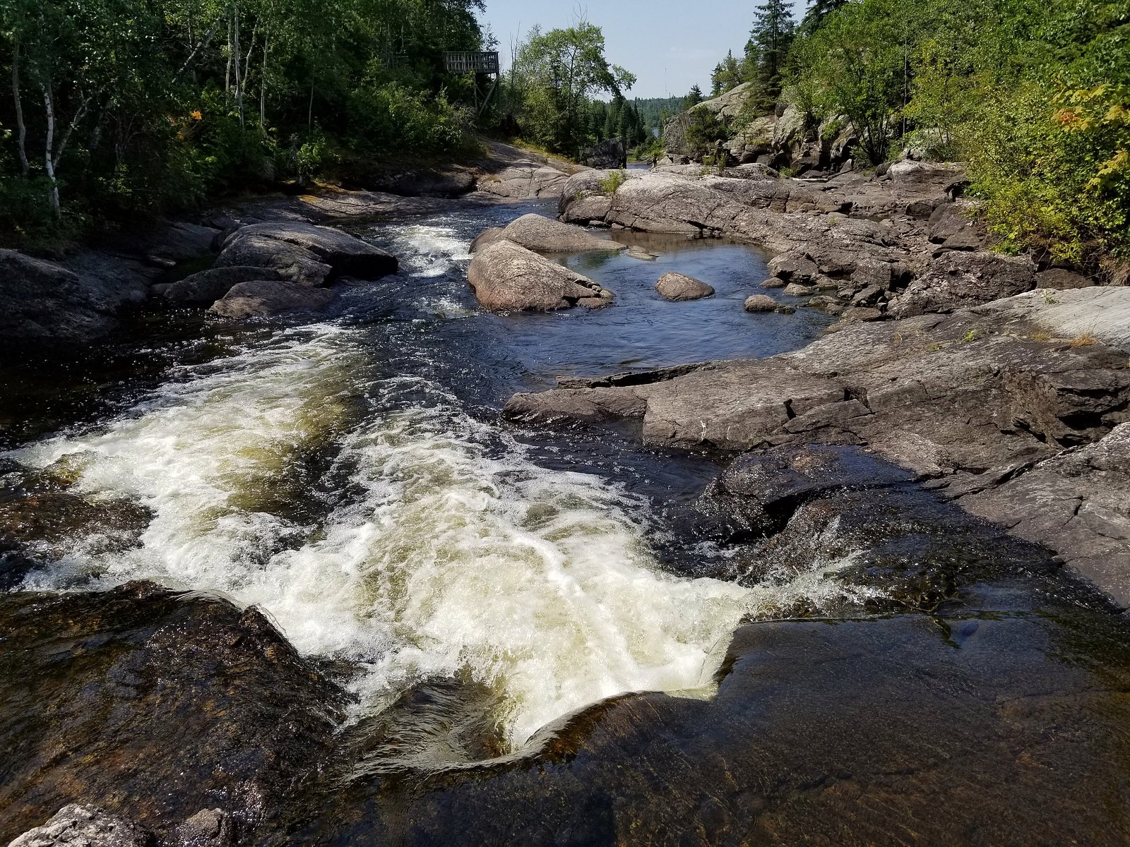
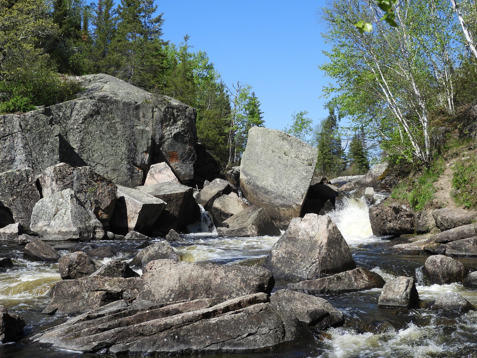
About Tulabi falls
Tulabi Falls is a relatively remote waterfall site in northwestern Manitoba (coordinates: 50.4822, -95.2642), located roughly 68.7 miles from Kenora. The falls appear to be on a small river/stream in a forested, largely undeveloped landscape. Visitor information is limited; the site is likely to be best experienced by those prepared for backcountry or rough-road access. Seasonal flow is likely highest in spring during snowmelt and lower in late summer.
The Setting
Tulabi falls sits at 299 metres within Nopiming Provincial Park, in the foothills of Manitoba.
Why This Waterfall Exists
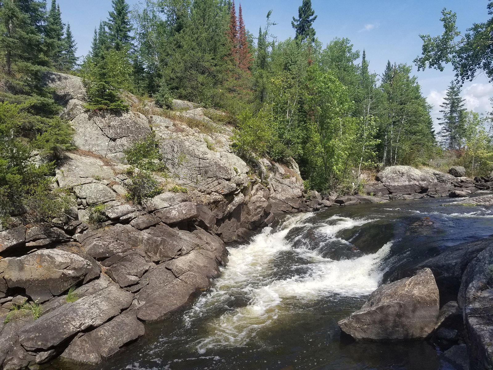
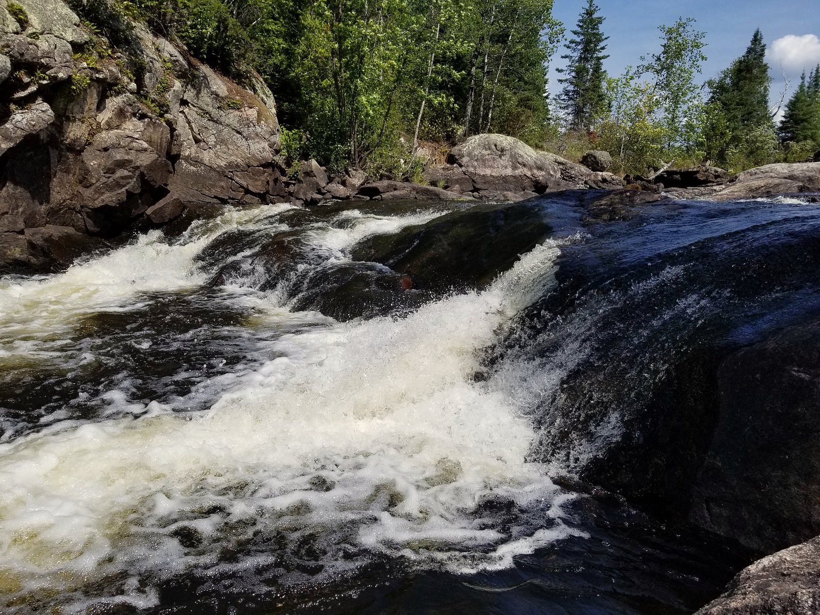
Tulabi falls flows over hard intrusive rock, primarily tonalite, laid down over 2.5-4.0 billion years ago. These resistant rocks form a durable ledge that water cannot easily wear away, creating the falls where softer material downstream has already eroded.
Trail & Hike Details
The Approach
The easy 1.0-km out-and-back trail gains 22 metres of elevation on the way to the falls.
Trail Description
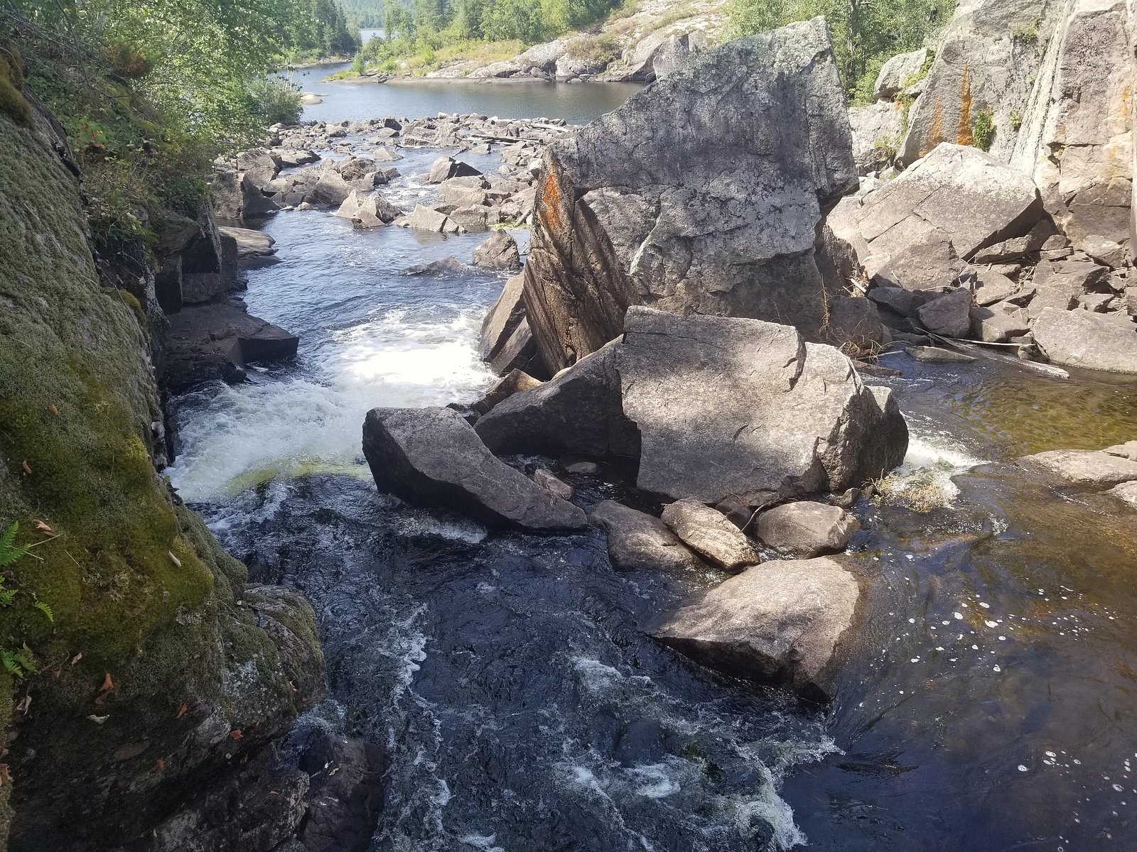
There is no well-documented, maintained trail widely published for Tulabi Falls. Approaches may be cross-country through forest, along riverbanks, or via unimproved roads. Trails, if present, may be rough, unmarked, and subject to wet/muddy sections. Visitors should be prepared for variable terrain, route-finding, and possible bushwhacking.
What to Expect
Remote, natural setting with no visitor facilities. Expect uneven, rocky banks and wet, potentially slippery approaches near the water. Seasonal variability in flow, higher in spring. Limited or no cell service in parts. In summer, expect mosquitoes and black flies. No formal viewing platforms or safety railings are likely.
Accessibility
The trail is short and relatively flat, but the surface may be uneven. Contact the managing agency for accessibility details.
Frequently Asked Questions
🐶 Are Dogs Allowed at Tulabi falls?
❌ Dogs are not allowed
Are There Any Fees or Permits Required?
🆖 No fees required
🏊 Is There Swimming at Tulabi falls?
❌ Swimming is not allowed
When to Visit
Late spring to early summer for the most impressive water flow (spring runoff). Summer provides easier access and warmer conditions for hiking, while fall offers cooler temperatures and possible fall colors. Winter access is possible but will be more difficult (snow/ice) and carries additional hazards such as thin ice and extreme cold.
Seasonal Access
The best time to visit is Spring, Summer, and Fall. Winter access may be limited. Check with the managing park or local authority for current conditions.
Safety Information
Primary hazards include remote location (limited rescue options), slippery and unstable rock near the falls, cold/fast water and undertows, changing weather, insect-borne irritation, and wildlife encounters (including bears and moose). There may be unstable or seasonal roads and no signage. Bring a first-aid kit, navigation tools, and adequate supplies. Let someone know your plans and estimated return time. If venturing in winter, be aware of avalanche risk is low in this terrain but thin ice and hypothermia are serious concerns. When in doubt, choose safety and avoid risky approaches.
Current Water Conditions
7.1 m³/s
Current discharge — how much water is flowing
About average for this time of year
Based on 38 years of record
1.24 m
Water depth at gauge
7-Day Discharge Trend
What does this mean for your visit?
Flow is about average for this time of year.
About This Gauge
This gauge is on a nearby waterway and may not reflect exact conditions at the falls.
7-Day Flow Outlook
Based on the WSC gauge BIRD RIVER AT OUTLET OF BIRD LAKE (11 km away).
Today
Moderate
7.3 m³/s
8/10Tomorrow
Moderate
7.7 m³/s
6/10Tue
Moderate
7.1 m³/s
8/10Wed
Moderate
7.2 m³/s
6/10Thu
Moderate
7.3 m³/s
6/10Fri
Moderate
6.6 m³/s
8/10Sat
Moderate
6.8 m³/s
6/10Best window: Today — moderate flow, cloudy (trip score 8/10).
Best time of year: this gauge typically runs highest from late April to late July, peaking in June.
How we calculate this
This is a transparent outlook, not a precise forecast. We take the waterfall's current flow strength (how it ranks against its historical normal for today, from the nearest WSC stream gauge), carry that ranking forward along the gauge's seasonal curve, and nudge it for forecast rain. Confidence is highest for the next day or two and falls further out. Always check official conditions and your own judgment before visiting — high flows can be dangerous.
Know when to go.
Get a free email alert when waterfalls near Kenora hit peak flow. We only send when conditions are worth the trip — no weekly newsletters, no spam.
Weather Forecast
Location & Access
Getting There
The falls are in a remote area of northwestern Manitoba. Exact access may require travel on unpaved logging or seasonal roads, canoe/boat, or cross-country travel from the nearest maintained road. Use the provided coordinates in a reliable GPS or maps app. Expect limited signage and no formal maintained trailhead unless recent visitor reports indicate otherwise.
Get Directions on Google MapsParking
No confirmed formal parking area. If there is roadside access, parking may be informal and limited. Park well off any travel lanes and avoid blocking gates or private access. If arriving by boat, use a safe landing site and respect shoreline owners.
Elevation
299 metres above sea level
Coordinates
50.482237° N, -95.264164° W
Land Management
Managed by Manitoba Environment and Climate Change
Visitor Tips & Gear
• Use the supplied coordinates and a reliable GPS or offline map. • Tell someone your route and expected return time, this is a remote area. • Wear sturdy waterproof boots and bring trekking poles for stability on wet rocks. • Bring insect repellent and layered clothing (weather changes quickly). • Practice Leave No Trace, pack out all trash. • Be cautious on riverbanks and rocks; wet rock is slippery and falls can be severe. • Check local forestry or provincial websites and recent trip reports for access updates and road conditions before you go.
As an Amazon Associate, we earn from qualifying purchases.
For this easy 1.0 km trail, lightweight trail shoes and a water bottle are usually sufficient. Sun exposure on the trail makes good sun protection a must in summer.

Polarized Sunglasses (Knockaround)
Cuts glare off the water so you actually see the falls — and your photos turn out better too.

Columbia Watertight II Rain Jacket
Packs into its own pocket, seam-sealed, and keeps you dry from spray and surprise rain.

Earth Pak Waterproof Dry Bag
Keeps your phone and gear dry when waterfall mist soaks everything else.

Waterproof Phone Pouch (AiRunTech)
Cheap insurance — take photos right next to the falls without killing your phone.

JOBY GorillaPod Starter Kit
Wraps around railings and rocks for long-exposure waterfall shots — no flat surface needed.

Osprey Daylite Daypack
Light, organized, and just the right size for a day hike — fits water, snacks, and layers.
Where to Stay
Browse vacation cabins and private rentals nearby
Unique outdoor stays — tents, yurts, and treehouses
Rent a campervan or RV for your waterfall road trip
Some links are affiliate links. We may earn a commission at no extra cost to you.
Nearby Campground
Tulabi Falls Group site
0.2 km away
Additional Information
Nearby Attractions
Nearest significant town: Kenora (approximately 68.7 miles / ~110 km by straight line). The broader region includes numerous lakes, rivers, and provincial/territorial parks and recreation areas, check local maps for nearby named parks or canoe routes.
Wildlife
Typical boreal/wildlife may include black bears, moose, white-tailed deer, beavers, wolves, and many bird species. Insect activity (mosquitoes, black flies) can be high in summer.
Cities near Tulabi falls
Writing about Tulabi falls? Embed this waterfall on your site for free.