Tsusiat Falls
British Columbia • 10 m
By Armen Suny · Last verified Jun 2026
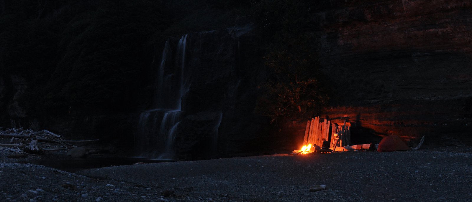

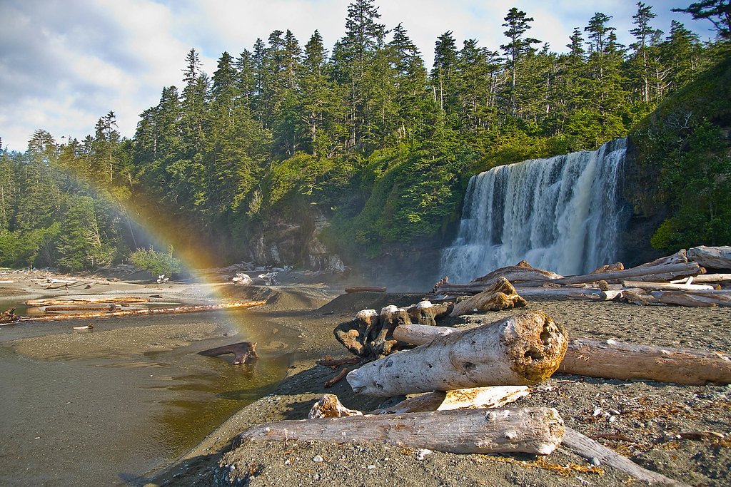
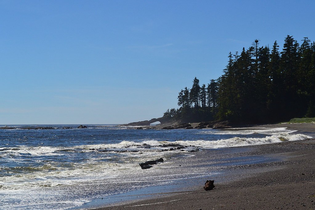
Photo Credits (5)
Difficulty
Hard
Trail Type
Out And Back
About Tsusiat Falls
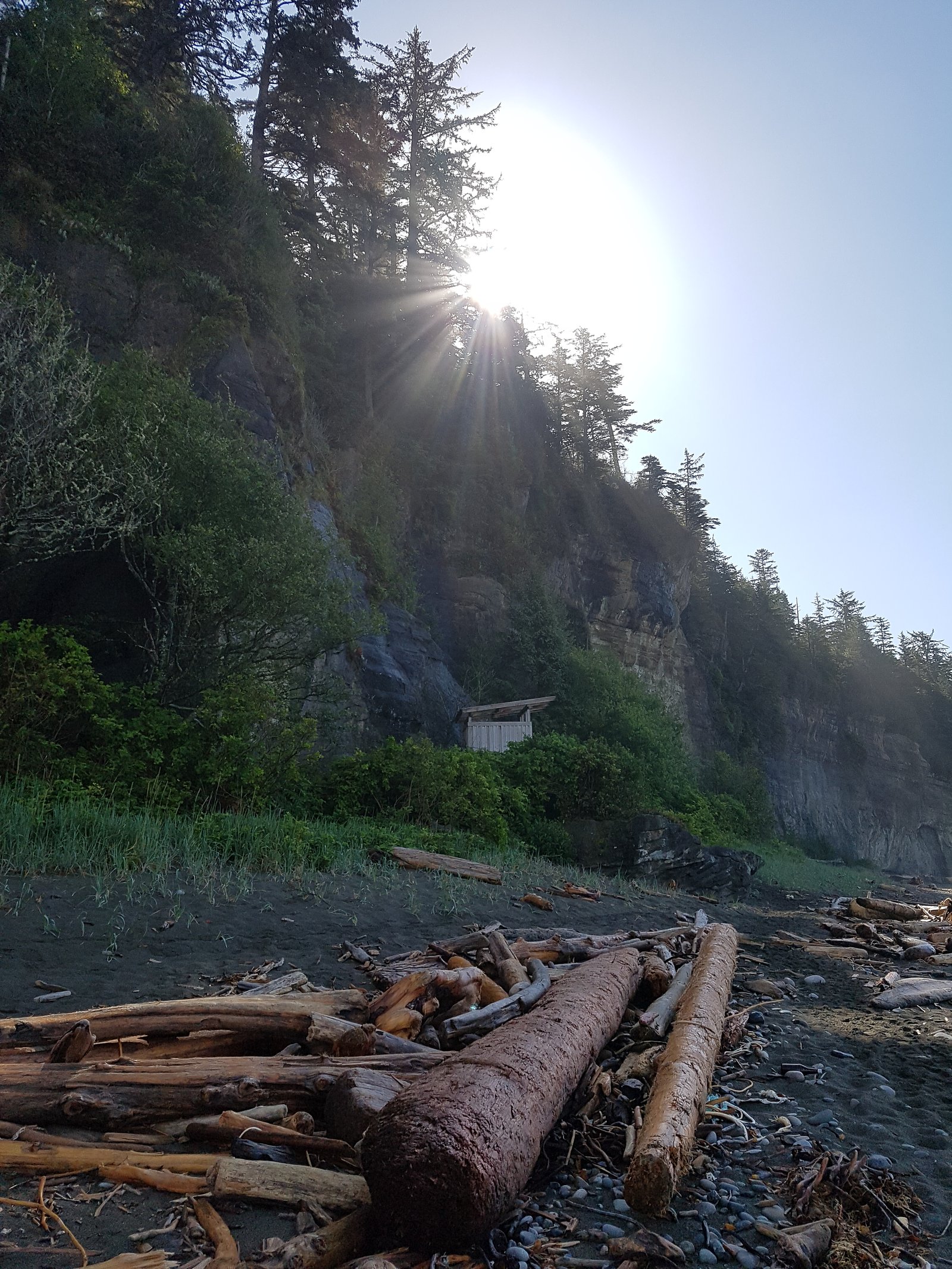
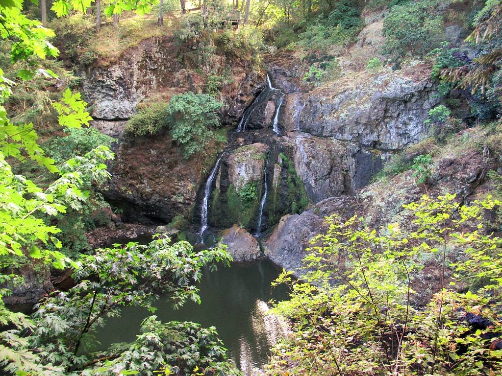
Tsusiat Falls is a coastal Pacific Northwest waterfall located on the Olympic Peninsula near Neah Bay, British Columbia coordinates (48.6908, -124.9266). The feature is in a rugged coastal rainforest / tribal lands setting and is best known locally rather than as a developed tourist site. Public information about formal facilities, maintained trails, or exact vertical drop is limited; visitors should assume access is rustic and may cross unmarked or unmaintained routes. Verify access with local authorities (Makah Tribe / local land managers) before visiting.
The Setting
Tsusiat Falls sits at 15 metres within Pacific Rim National Park Reserve Of Canada, in the coastal lowlands of British Columbia. The falls drop 10 metres.
Why This Waterfall Exists
Tsusiat Falls flows over Carmanah Group, a layered sedimentary rock layer deposited about 23-38 million years ago. Over time, the stream has worn through these layers at different rates, creating a 33-foot drop that forms the waterfall.
Trail & Hike Details
Trail Description
Public trail descriptions for Tsusiat Falls are scarce. Expect a rough, unmaintained footpath or informal spur off forest/river roads with sections of steep, muddy, rooty terrain through coastal rainforest. Route-finding skills may be required; parts of the approach may involve short bushwhacks or travel on logging/primitive roads. There may be only limited viewpoints above the falls rather than developed overlooks.
What to Expect
The falls drop 10 metres over layered sedimentary rock.
Accessibility
The trail involves steep, uneven terrain with significant elevation change and is not accessible to mobility devices.
Frequently Asked Questions
🐶 Are Dogs Allowed at Tsusiat Falls?
❌ Dogs are not allowed
Are There Any Fees or Permits Required?
🆖 No fees required
🏊 Is There Swimming at Tsusiat Falls?
❌ Swimming is not allowed
When to Visit
Late fall through spring typically provides the highest flows and most dramatic viewing, but trails will be wet and muddy. Summer offers easier hiking conditions but lower water flow. Always check current local access rules and weather before planning a visit.
Seasonal Access
The best time to visit is Spring, Summer, Fall, and Winter. Check with the managing park or local authority for current conditions.
Safety Information
Hazards may include slippery rocks and roots, unstable banks near the falls, strong currents if attempting to enter the water, poor footing on wet rock, rapidly changing coastal weather, limited cell service, and potential private or tribal land closures. Always check local access permissions, stay back from edges, avoid going alone, tell someone your plan, and carry basic emergency equipment.
Current Water Conditions
0.7 m³/s
Current discharge — how much water is flowing
Much lower than usual for this time of year
Based on 73 years of record
1.42 m
Water depth at gauge
7-Day Discharge Trend
What does this mean for your visit?
Flow is well below normal for this time of year, so the waterfall may be a trickle.
About This Gauge
This gauge is on a nearby waterway and may not reflect exact conditions at the falls.
7-Day Flow Outlook
Based on the WSC gauge SARITA RIVER NEAR BAMFIELD (23 km away).
Today
Low
0.7 m³/s
5/10Tomorrow
Low
0.7 m³/s
5/10Wed
Low
0.6 m³/s
5/10Thu
Low
0.6 m³/s
5/10Fri
Low
0.6 m³/s
5/10Sat
Low
0.6 m³/s
4/10Sun
Low
0.6 m³/s
4/10Best window: Today — low flow, cloudy (trip score 5/10).
Best time of year: this gauge typically runs highest from early November to late December, peaking in November.
How we calculate this
This is a transparent outlook, not a precise forecast. We take the waterfall's current flow strength (how it ranks against its historical normal for today, from the nearest WSC stream gauge), carry that ranking forward along the gauge's seasonal curve, and nudge it for forecast rain. Confidence is highest for the next day or two and falls further out. Always check official conditions and your own judgment before visiting — high flows can be dangerous.
Know when to go.
Get a free email alert when waterfalls near Tofino hit peak flow. We only send when conditions are worth the trip — no weekly newsletters, no spam.
Weather Forecast
Location & Access
Getting There
Tsusiat Falls is near Neah Bay on the extreme northwest Olympic Peninsula. From Neah Bay the general approach is by local forest or reservation roads toward nearby creeks and coastal inlets; exact public trailheads and legal public access points are not well documented online. Because the falls are near or on tribal lands in the Neah Bay area, check with the Makah Tribal offices or local land managers for current access rules and directions before attempting to visit.
Get Directions on Google MapsParking
Parking is likely informal/limited (roadside or small pullouts). There are no widely advertised developed parking lots for Tsusiat Falls; expect limited parking and potentially private or restricted areas. Confirm permitted parking locations locally.
Elevation
15 metres above sea level
Coordinates
48.690760° N, -124.926582° W
Land Management
Managed by Parks Canada Agency
Visitor Tips & Gear
1) Contact Makah Tribal offices or local land managers to confirm access rules before visiting. 2) Wear waterproof hiking boots with good traction; trail is likely muddy and slippery. 3) Bring a map, GPS, or waypoint, route-finding may be required. 4) Leave no trace and avoid crossing posted private/tribal boundaries. 5) Avoid approaching the top or base of falls on wet slippery rocks; unstable banks and currents are hazards. 6) Plan for limited or no cell service and short daylight in winter.
Where to Stay
Browse vacation cabins and private rentals nearby
Unique outdoor stays — tents, yurts, and treehouses
Rent a campervan or RV for your waterfall road trip
Some links are affiliate links. We may earn a commission at no extra cost to you.
Nearby Campground
Tsusiat Falls Camp
0.1 km away
Nearby Hot Springs
Hot springs near Tofino, British Columbia

Looking for a soak after your hike? Explore more hot springs near Tofino, British Columbia on SoakingSprings.
Explore British Columbia springsAdditional Information
Nearby Attractions
Neah Bay and the Makah Cultural sites, Cape Flattery (westernmost point of the contiguous U.S.), Shi-Shi Beach and Ozette area beaches, Hoko River area. Olympic National Park attractions are farther to the southeast.
Wildlife
Coastal Olympic Peninsula wildlife: bald eagles and seabirds, black-tailed deer, black bears (occasionally), river otters, and a variety of marine and intertidal species along nearby coastlines. Take standard wildlife precautions (store food, keep distance).
Cities near Tsusiat Falls
Nearby Waterfalls
Writing about Tsusiat Falls? Embed this waterfall on your site for free.