
Photo Credits (5)
Difficulty
Moderate
About The Rapids
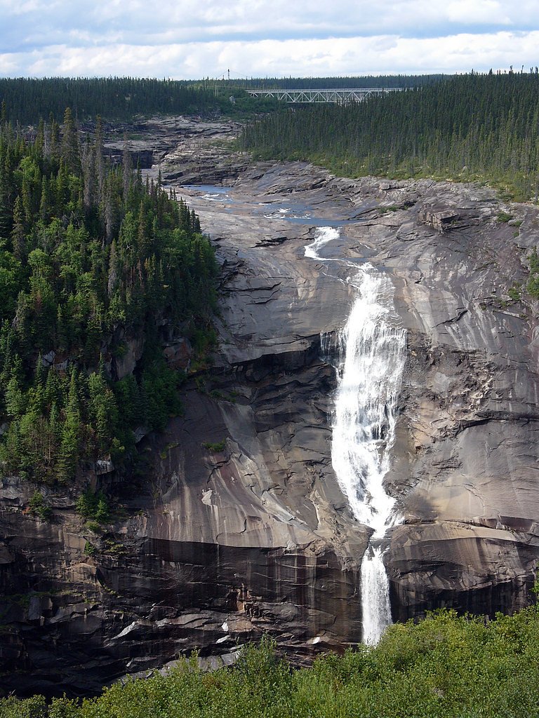
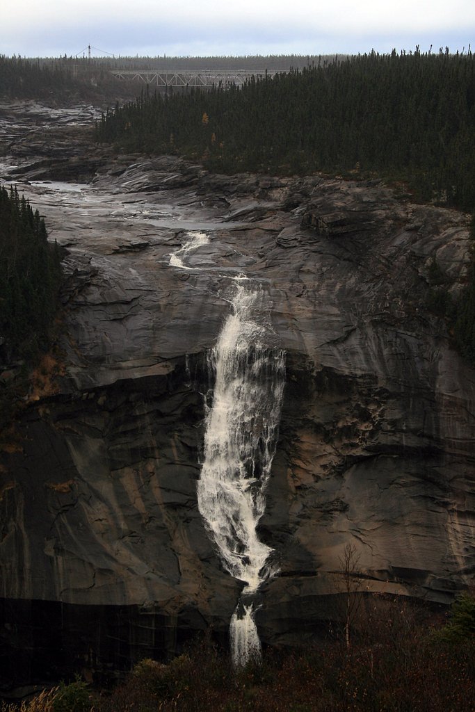
The Rapids is a set of fast-moving rapids and small falls on a riverine section near Happy Valley-Goose Bay in Labrador. At the provided coordinates it appears as a rugged, relatively remote river feature rather than a developed waterfall attraction. Flow and character vary seasonally (higher flows in spring melt; lower, clearer flows in late summer). There are no widely published formal facilities or maintained viewpoints associated with this site; access is typically informal from nearby roads or riverbanks. Information about a maintained trail, official viewpoint, or exact drop is limited, so details below are conservative and may require verification with local authorities before visiting.
Trail & Hike Details
Trail Description
There is no widely documented maintained trail to this feature. Visiting typically involves walking from a roadside pullout or rough parking area down a riverbank over uneven, often rocky terrain. Expect short scrambles, wet/muddy sections, and possibly dense vegetation. Trail length and elevation gain are not well documented and will depend on chosen access point. Use caution around river edges and unstable banks.
What to Expect
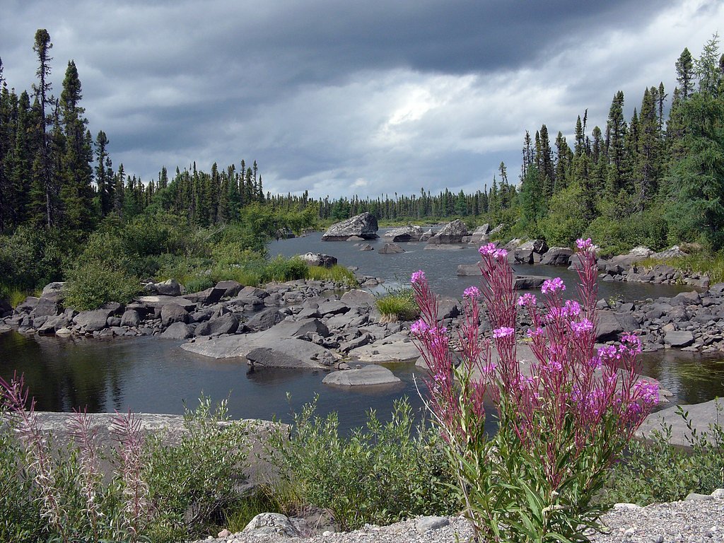
Expect a natural, undeveloped riverside setting with strong currents and turbulent water in the rapids. No facilities (no toilets, signage, or formal viewpoints). Seasonal variability: high, powerful flows in spring; lower, clearer water in late summer. Mosquitoes and black flies can be abundant in summer. Limited or no cell coverage in parts. Weather can change rapidly; dress for wind and wet conditions.
Accessibility
The trail is not wheelchair accessible. Uneven terrain and elevation changes require steady footing.
Frequently Asked Questions
🐶 Are Dogs Allowed at The Rapids?
❌ Dogs are not allowed
Are There Any Fees or Permits Required?
🆖 No fees required
🏊 Is There Swimming at The Rapids?
❌ Swimming is not allowed
When to Visit
Late spring (for highest flows) through early fall (for easier access and warmer weather). Summer offers the warmest conditions but also the most insects. Winter access can be hazardous due to ice and snow and is not generally recommended unless you have appropriate winter travel experience and equipment.
Seasonal Access
The best time to visit is Spring, Summer, and Fall. Winter access may be limited. Check with the managing park or local authority for current conditions.
Safety Information
Strong currents, slippery and unstable rocks, and cold water present serious hazards. There are likely no lifeguards or emergency services immediately on site; response times from Happy Valley-Goose Bay can be lengthy in remote areas. Expect limited cell coverage. Dress for cold water immersion even in summer. Use caution near edges and avoid crossing fast-moving water. Check local weather and river conditions before travel.
Current Water Conditions
Based on a Water Survey of Canada gauge 47.3 km away
1,260.0 m³/s
Current discharge — how much water is flowing
1.98 m
Water depth at gauge
7-Day Discharge Trend
About This Gauge
This gauge is on a regional waterway. Conditions at the falls may differ, especially after local rain.
7-Day Flow Outlook
Based on the WSC gauge CHURCHILL RIVER 6.15 KMS BELOW LOWER MUSKRAT FALLS (47 km away).
Today
Moderate
1361 m³/s
6/10Tomorrow
Moderate
1411 m³/s
6/10Tue
Moderate
1310 m³/s
8/10Wed
Moderate
1361 m³/s
6/10Thu
Moderate
1411 m³/s
6/10Fri
Moderate
1310 m³/s
8/10Sat
Moderate
1361 m³/s
6/10Best window: Tue — moderate flow, cloudy (trip score 8/10).
How we calculate this
This is a transparent outlook, not a precise forecast. We take the waterfall's current flow strength (how it ranks against its historical normal for today, from the nearest WSC stream gauge), carry that ranking forward along the gauge's seasonal curve, and nudge it for forecast rain. Confidence is highest for the next day or two and falls further out. Always check official conditions and your own judgment before visiting — high flows can be dangerous.
Know when to go.
Get a free email alert when waterfalls near Happy Valley hit peak flow. We only send when conditions are worth the trip — no weekly newsletters, no spam.
Weather Forecast
Location & Access
Getting There
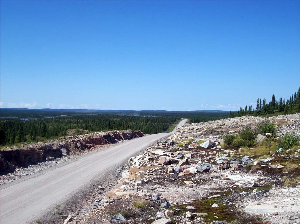
Approx. 16.7 miles from Happy Valley-Goose Bay. The site at coordinates 53.5521, -60.1954 is in a sparsely developed area of Labrador; access is likely via local gravel or logging roads and may require a high-clearance or 4x4 vehicle. Expect unmarked pullouts and informal approach routes. Confirm conditions with local contacts (Happy Valley-Goose Bay municipal office or local outfitter) before attempting access.
Get Directions on Google MapsParking
No formal parking lot is known. Parking is likely informal roadside or a small pullout. Park well off the road, avoid blocking gated access, and be prepared for uneven or soft ground.
Elevation
0 metres above sea level
Coordinates
53.552060° N, -60.195396° W
Visitor Tips & Gear
• Tell someone your route and expected return time; mobile coverage may be limited. • Wear sturdy, waterproof footwear with good traction; rocks will be slippery. • Bring insect repellent for summer visits. • Avoid getting close to the edge of fast-flowing water; currents are strong and rocks are slippery. • Use a high-clearance vehicle if accessing on gravel or logging roads and check road conditions before travel. • Pack out what you pack in; no trash services present. • Check local authorities or visitor information in Happy Valley-Goose Bay for up-to-date access info.
Where to Stay
Browse vacation cabins and private rentals nearby
Unique outdoor stays — tents, yurts, and treehouses
Rent a campervan or RV for your waterfall road trip
Some links are affiliate links. We may earn a commission at no extra cost to you.
Nearby Campground
Gosling Park
20.6 km away
Additional Information
Nearby Attractions
Happy Valley-Goose Bay (town services), the Churchill River system, and Lake Melville region. Local outfitters and guiding services operate in the general region and can provide more detailed access information.
Wildlife
Typical Labrador wildlife may be present: moose, black bear, various waterfowl and shorebirds, and numerous insects in summer. Be bear aware and store food securely.
Cities near The Rapids
Writing about The Rapids? Embed this waterfall on your site for free.