Photo Credits (4)
About Smoky Falls
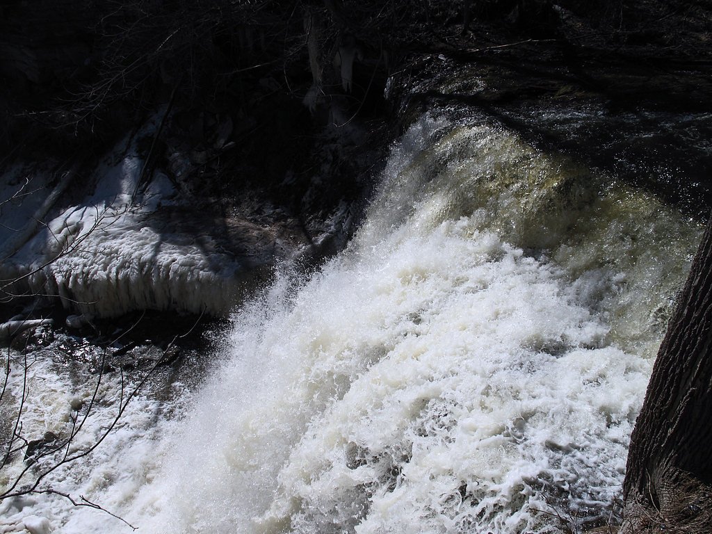
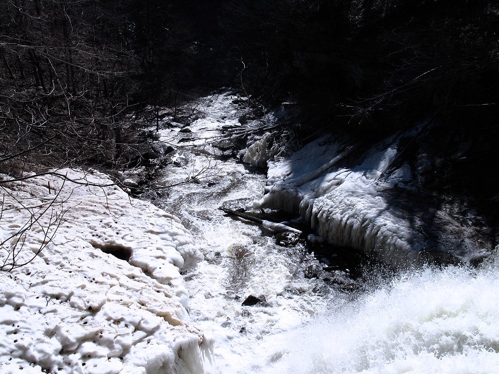
Smoky Falls is a remote waterfall site in northern Ontario, located roughly 43 miles (about 70 km) north of Kapuskasing (coordinates: 50.064, -82.1587). The falls sit in boreal-forest country and are best described as a natural, relatively undeveloped cascade/rapids area rather than a developed tourist site. Exact details about the local river name and the vertical drop vary in reports and are not confidently confirmed here; visitors should expect a natural, rugged setting with few or no facilities.
Why This Waterfall Exists
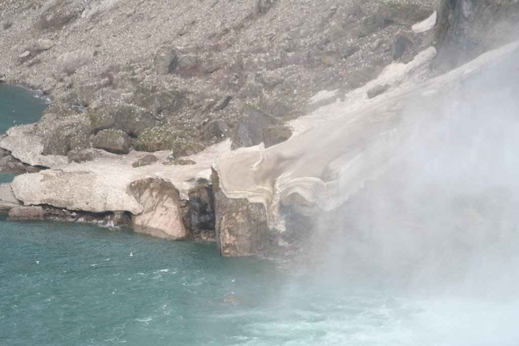
Smoky Falls flows over hard banded metamorphic rock, primarily gneiss, laid down over 2.5-2.8 billion years ago. These resistant rocks form a durable ledge that water cannot easily wear away, creating the falls where softer material downstream has already eroded.
Trail & Hike Details
Trail Description
There is no widely documented, maintained trail to Smoky Falls in authoritative trail databases available here. Access often involves following unimproved access roads and short, unmarked footpaths or bushwhacking from a roadside pullout. Expect uneven terrain, natural footings (roots/rocks), and limited signage. If you require a maintained trail or facilities, plan for a different, developed waterfall site or check current local trail reports before attempting the approach.
What to Expect
A rugged, natural waterfall/rapids environment surrounded by boreal forest. Minimal or no visitor facilities (no toilets, no marked viewpoints), potentially wet and slippery rock surfaces, abundant insects in spring and summer (black flies/mosquitoes), and variable water flow depending on season. Weather can change quickly and cell coverage may be spotty or non-existent.
Accessibility
Not wheelchair accessible. Terrain is natural and likely uneven and steep in places; access may require hiking over unmaintained ground and negotiating slippery rocks and roots.
Frequently Asked Questions
🐶 Are Dogs Allowed at Smoky Falls?
❌ Dogs are not allowed
Are There Any Fees or Permits Required?
🆖 No fees required
🏊 Is There Swimming at Smoky Falls?
❌ Swimming is not allowed
When to Visit
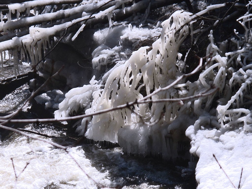
Spring (snowmelt) typically produces the highest flows and most dramatic appearance. Summer and early fall provide easier access and more stable hiking conditions. Winter visits can be scenic (ice formations) but carry increased hazards, icy terrain, deep snow, and limited access, and should only be attempted by experienced winter hikers with the right gear.
Seasonal Access
The best time to visit is Spring, Summer, Fall, and Winter. Check with the managing park or local authority for current conditions.
Safety Information
Remote location with limited or no cell service, plan accordingly. Expect slippery rocks, steep drop-offs near the falls, strong currents, cold water temperatures, and seasonal hazards (ice in winter, high water during spring melt). Wildlife encounters (including bears and moose) are possible, store food securely and know how to respond. Road conditions on logging/secondary roads can change quickly; check for closures due to logging or hydro operations. Always use caution near water edges and do not climb on unstable or wet rock faces.
Know when to go.
Get a free email alert when waterfalls near Kapuskasing hit peak flow. We only send when conditions are worth the trip — no weekly newsletters, no spam.
Weather Forecast
Location & Access
Getting There
Smoky Falls is in a remote area north of Kapuskasing. Typical access requires driving north from Kapuskasing on regional roads (Highway 11 for part of the route) and then turning onto secondary or logging roads. The final approach may be on unpaved roads or trails and can require a high-clearance vehicle. Exact access routes and conditions change seasonally; consult local sources (town of Kapuskasing, local forestry offices or recent trip reports) and maps/GPS before you go.
Get Directions on Google MapsParking
There is likely no formal parking lot. Expect roadside pullouts or informal parking near a trailhead or logging-road access point. Park safely off the highway and avoid blocking gates or forestry operations. Availability and safety of parking may vary seasonally.
Elevation
142 metres above sea level
Coordinates
50.064016° N, -82.158690° W
Visitor Tips & Gear
• Check recent trip reports or contact Kapuskasing town/local forestry offices for current road access and conditions. • Use a high-clearance vehicle for secondary/unpaved roads and expect possible seasonal closures. • Wear sturdy footwear with good traction; rocks near the water are slippery. • Bring insect repellent for spring/summer and layered clothing for rapidly changing conditions. • Tell someone your route and expected return time; cell service may be unreliable. • Avoid approaching the edge of falls and fast-flowing water; currents can be deceptively strong.
Where to Stay
Browse vacation cabins and private rentals nearby
Unique outdoor stays — tents, yurts, and treehouses
Rent a campervan or RV for your waterfall road trip
Some links are affiliate links. We may earn a commission at no extra cost to you.
Additional Information
Nearby Attractions
Town of Kapuskasing (services and accommodations), boreal forest landscapes and numerous lakes and rivers typical of northern Ontario. Specific developed parks or maintained waterfall trails in the immediate vicinity are not confirmed here; check local tourism resources for nearby managed attractions.
Wildlife
Typical boreal wildlife, moose, white-tailed deer, black bear, beaver, fox, wolves, and a variety of birds (raptors, waterfowl, songbirds). Insect activity (black flies, mosquitoes) can be heavy in spring and early summer.
Cities near Smoky Falls
Writing about Smoky Falls? Embed this waterfall on your site for free.