Sinclair Canyon
British Columbia • Kootenay National Park
By Armen Suny · Last verified Jun 2026
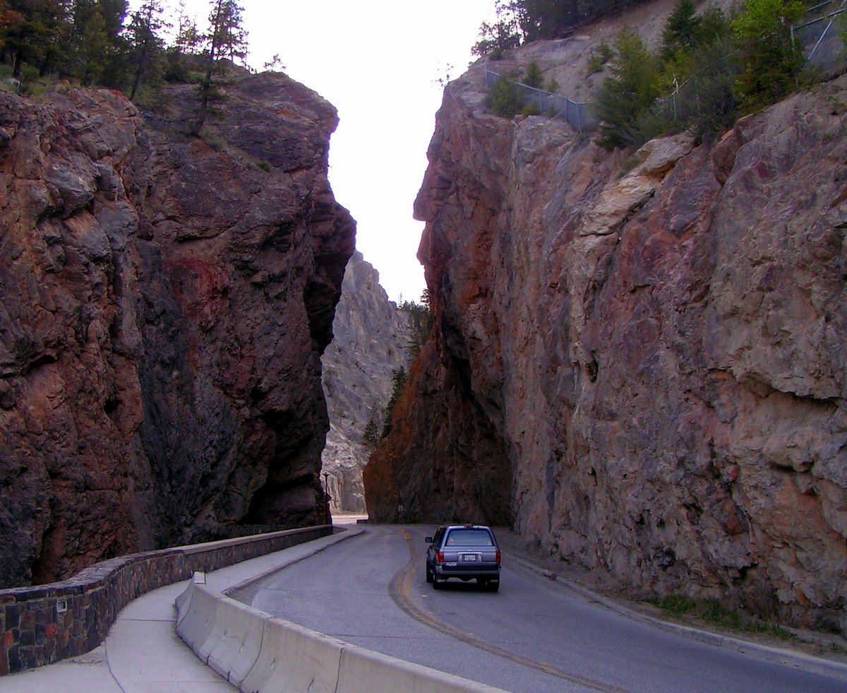
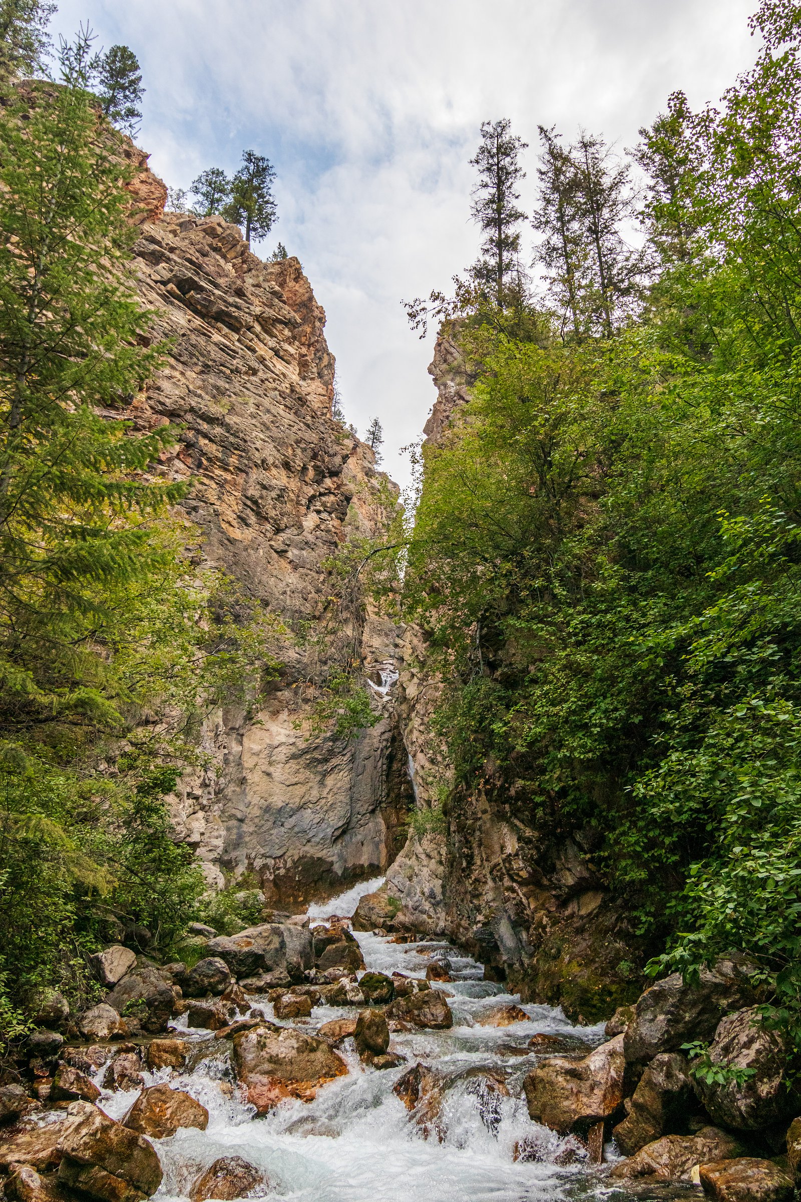
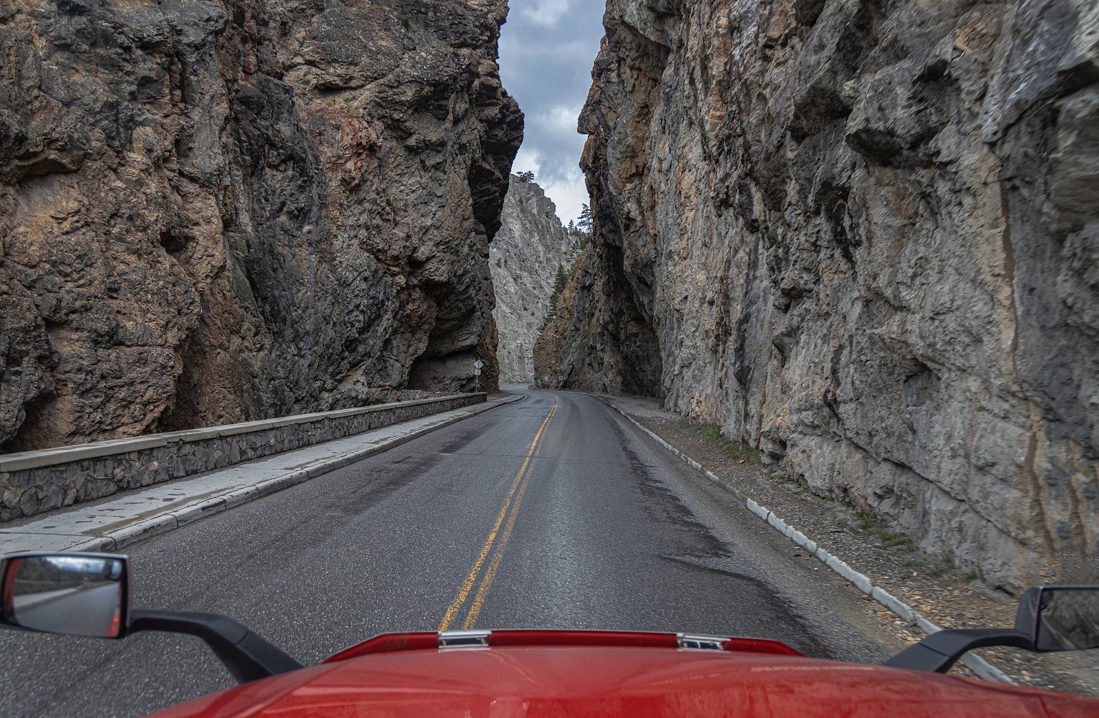
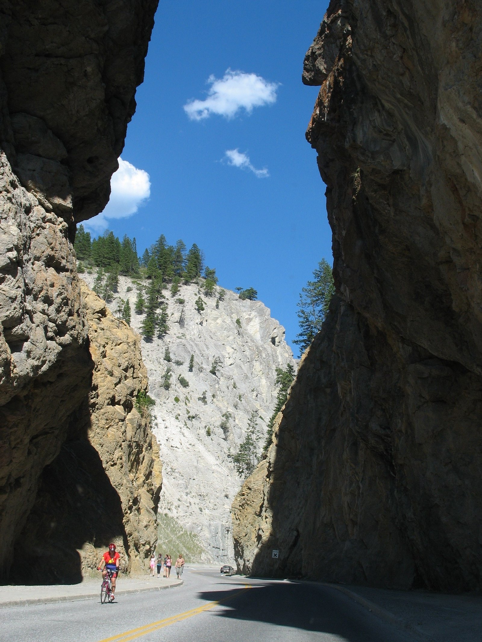
Photo Credits (5)
Difficulty
Easy
Trail Length
0.8 km
Trail Type
Out And Back
Elevation Gain
18 m
About Sinclair Canyon
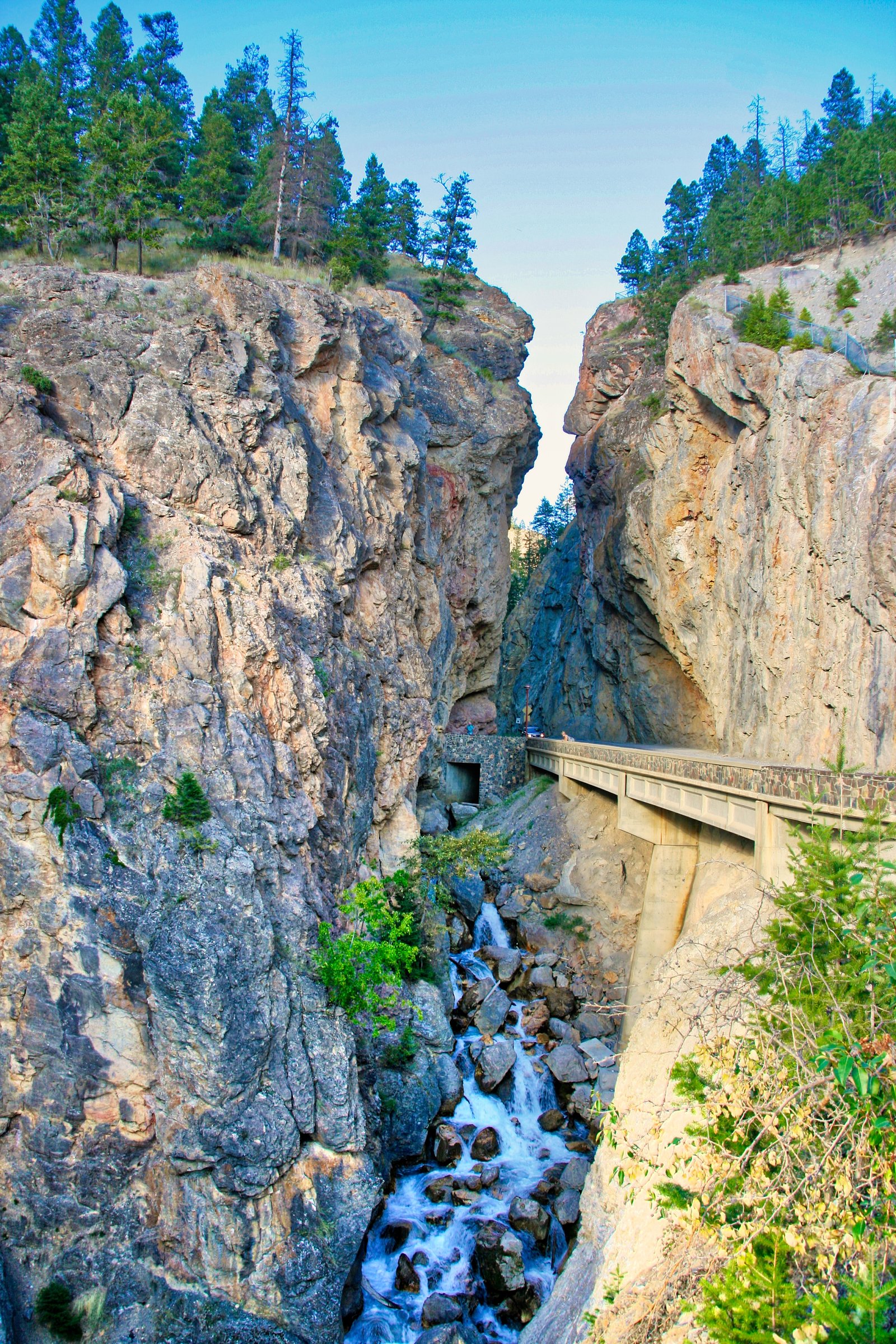
Sinclair Canyon is a narrow, steep-walled canyon feature in southeastern British Columbia (coordinates 50.6327, -116.0571). The site is relatively remote and is best described as a scenic canyon and creek corridor rather than a large, developed waterfall attraction. Visitors should expect a rugged landscape with exposed rock walls and a creek that can run strongly in spring and early summer. Specific infrastructure (viewpoints, railings, formal trails) may be minimal or absent; access and conditions can vary seasonally.
The Setting
Sinclair Canyon sits at 963 metres within Kootenay National Park, in the mountains of British Columbia.
Why This Waterfall Exists
Sinclair Canyon flows over McKay Group, a layered sedimentary rock layer deposited about 444-539 million years ago. These soft rocks erode readily, allowing the stream to carve a vertical drop into the landscape.
Trail & Hike Details
The Approach
The easy 0.8-km out-and-back trail gains 18 metres of elevation on the way to the falls.
Trail Description
Detailed, reliably-sourced trail routing for Sinclair Canyon is not available here. Access appears to be informal: short walks, scrambles or roadside stops to reach viewpoints of the canyon and creek. Expect uneven terrain, loose rock, and sections that may require basic route-finding. If you plan to explore beyond obvious viewpoints, be prepared for unmarked terrain and use map/GPS and local guidance.
What to Expect
A rugged, natural canyon environment with exposed rock faces and a creek that swells in spring. Little to no developed visitor infrastructure should be expected. Cell coverage may be limited. Weather can change rapidly in mountain areas. In winter the canyon and creek may be iced over and snow-covered; spring runoff can make creek crossings and streamside areas hazardous.
Accessibility
The trail is short and relatively flat, but the surface may be uneven. Contact the managing agency for accessibility details.
Frequently Asked Questions
🐶 Are Dogs Allowed at Sinclair Canyon?
❌ Dogs are not allowed
Are There Any Fees or Permits Required?
🆖 No fees required
🏊 Is There Swimming at Sinclair Canyon?
❌ Swimming is not allowed
When to Visit
Late spring through early fall is typically the most accessible time, with spring offering higher creek flows. Late-summer and fall provide more stable trail conditions and lower water levels. Winter access is possible but can be hazardous due to snow, ice, and avalanche risk; only attempt winter visits if experienced and properly equipped.
Seasonal Access
The best time to visit is Spring, Summer, Fall, and Winter. Check with Kootenay National Park for current conditions.
Safety Information
Exercise caution around cliff edges, loose rock, and fast-moving water. Spring runoff can raise water levels and create strong currents. Winter conditions add hazards: ice, deep snow, and avalanche danger in steep terrain. Cell service may be intermittent; tell someone your route and expected return time. Carry bear spray in bear country and know how to use it. Avoid attempting technical climbs without proper experience and equipment.
Current Water Conditions
Based on a Water Survey of Canada gauge 28.3 km away
9.7 m³/s
Current discharge — how much water is flowing
About average for this time of year
Based on 83 years of record
0.89 m
Water depth at gauge
7-Day Discharge Trend
What does this mean for your visit?
Flow is about average for this time of year.
About This Gauge
This gauge is on a regional waterway. Conditions at the falls may differ, especially after local rain.
7-Day Flow Outlook
Based on the WSC gauge KOOTENAY RIVER AT KOOTENAY CROSSING (28 km away).
Today
Moderate
9.7 m³/s
9/10Tomorrow
Moderate
9.5 m³/s
8/10Tue
Moderate
9.0 m³/s
8/10Wed
Moderate
8.9 m³/s
8/10Thu
Moderate
8.6 m³/s
8/10Fri
Moderate
9.1 m³/s
6/10Sat
Moderate
9.0 m³/s
6/10Best window: Today — moderate flow, mainly sunny (trip score 9/10).
Best time of year: this gauge typically runs highest from early May to early August, peaking in June.
How we calculate this
This is a transparent outlook, not a precise forecast. We take the waterfall's current flow strength (how it ranks against its historical normal for today, from the nearest WSC stream gauge), carry that ranking forward along the gauge's seasonal curve, and nudge it for forecast rain. Confidence is highest for the next day or two and falls further out. Always check official conditions and your own judgment before visiting — high flows can be dangerous.
Know when to go.
Get a free email alert when waterfalls near Banff hit peak flow. We only send when conditions are worth the trip — no weekly newsletters, no spam.
Weather Forecast
Location & Access
Getting There
Sinclair Canyon lies in southeastern British Columbia near the Alberta border (the user noted it is about 46.8 miles from Banff). Access is likely by vehicle on regional highways/forest roads with a short walk from a roadside pullout or informal parking area. Exact approach routes and parking locations are not confidently confirmed here, check recent trip reports, local maps, or Parks/forest service resources before traveling.
Get Directions on Google MapsParking
Parking may be limited to a roadside pullout or informal area. There may be no developed parking lot or facilities. Park legally and avoid blocking traffic. If visiting a nearby national or provincial park, use official lots where provided.
Elevation
963 metres above sea level
Coordinates
50.632698° N, -116.057109° W
Land Management
Managed by Parks Canada Agency
Visitor Tips & Gear
• Check recent visitor reports and local park/forest service advisories before you go. • Wear sturdy boots and bring layers, mountain weather can be cool and wet even in summer. • There may be no signage, toilets, or garbage service, pack out what you bring in. • If visiting within a national or provincial park, carry the necessary park pass and follow posted rules. • Be bear-aware: carry bear spray where appropriate and know how to use it. • Avoid cliff edges and unstable rock; do not attempt to climb canyon walls without proper gear and experience.
As an Amazon Associate, we earn from qualifying purchases.
For this easy 0.8 km trail, lightweight trail shoes and a water bottle are usually sufficient. Icy conditions are common in winter — traction cleats are a smart addition.

Columbia Watertight II Rain Jacket
Packs into its own pocket, seam-sealed, and keeps you dry from spray and surprise rain.

Polarized Sunglasses (Knockaround)
Cuts glare off the water so you actually see the falls — and your photos turn out better too.

Earth Pak Waterproof Dry Bag
Keeps your phone and gear dry when waterfall mist soaks everything else.

Waterproof Phone Pouch (AiRunTech)
Cheap insurance — take photos right next to the falls without killing your phone.

Kahtoola MICROspikes
Cult-favorite traction cleats that grip ice and wet rock — essential for winter waterfall hikes.

JOBY GorillaPod Starter Kit
Wraps around railings and rocks for long-exposure waterfall shots — no flat surface needed.
Where to Stay
Browse vacation cabins and private rentals nearby
Unique outdoor stays — tents, yurts, and treehouses
Rent a campervan or RV for your waterfall road trip
Some links are affiliate links. We may earn a commission at no extra cost to you.
Nearby Campground
Redstreak Campground
0.6 km away
Additional Information
Nearby Attractions
The region around these coordinates sits in the broader mountain corridor near the Alberta–British Columbia border. Nearby points of interest may include mountain hiking, scenic drives, and hot springs or communities in the Columbia Valley region. Banff is approximately the distance noted by the user (about 46–47 miles) but is across the provincial border in Alberta.
Wildlife
Expect typical mountain wildlife for southeastern British Columbia: black bear and possibly grizzly bear, deer and elk, small mammals, and raptors. Maintain a safe distance from all wildlife and follow local guidance for encounters.
Cities near Sinclair Canyon
Writing about Sinclair Canyon? Embed this waterfall on your site for free.