Similkameen Falls
British Columbia • 7 m
By Armen Suny · Last verified Jun 2026
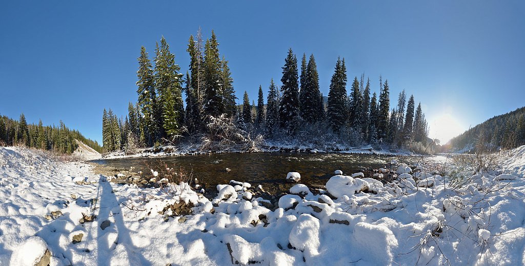
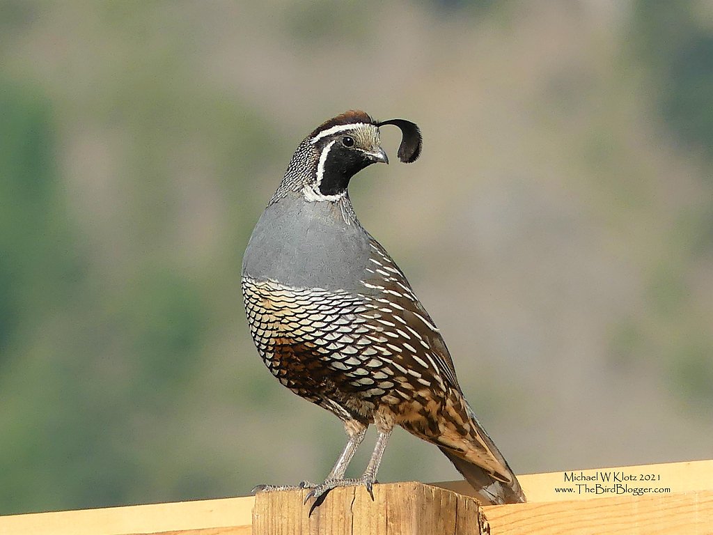

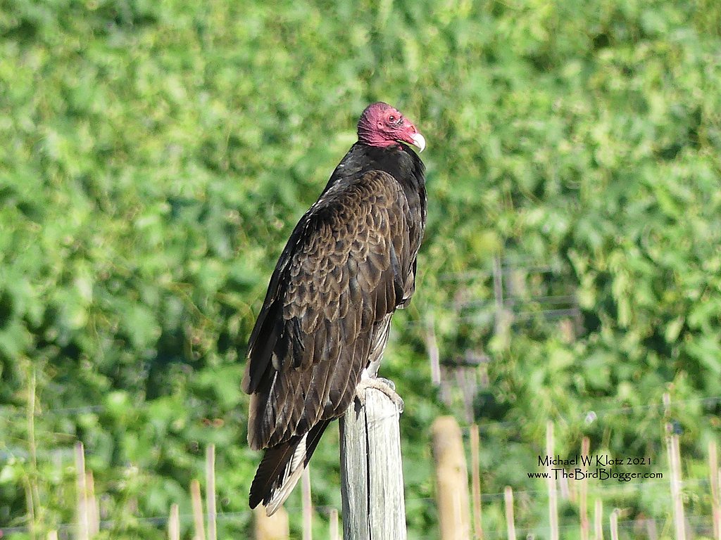

Photo Credits (5)
Difficulty
Drive Up
About Similkameen Falls
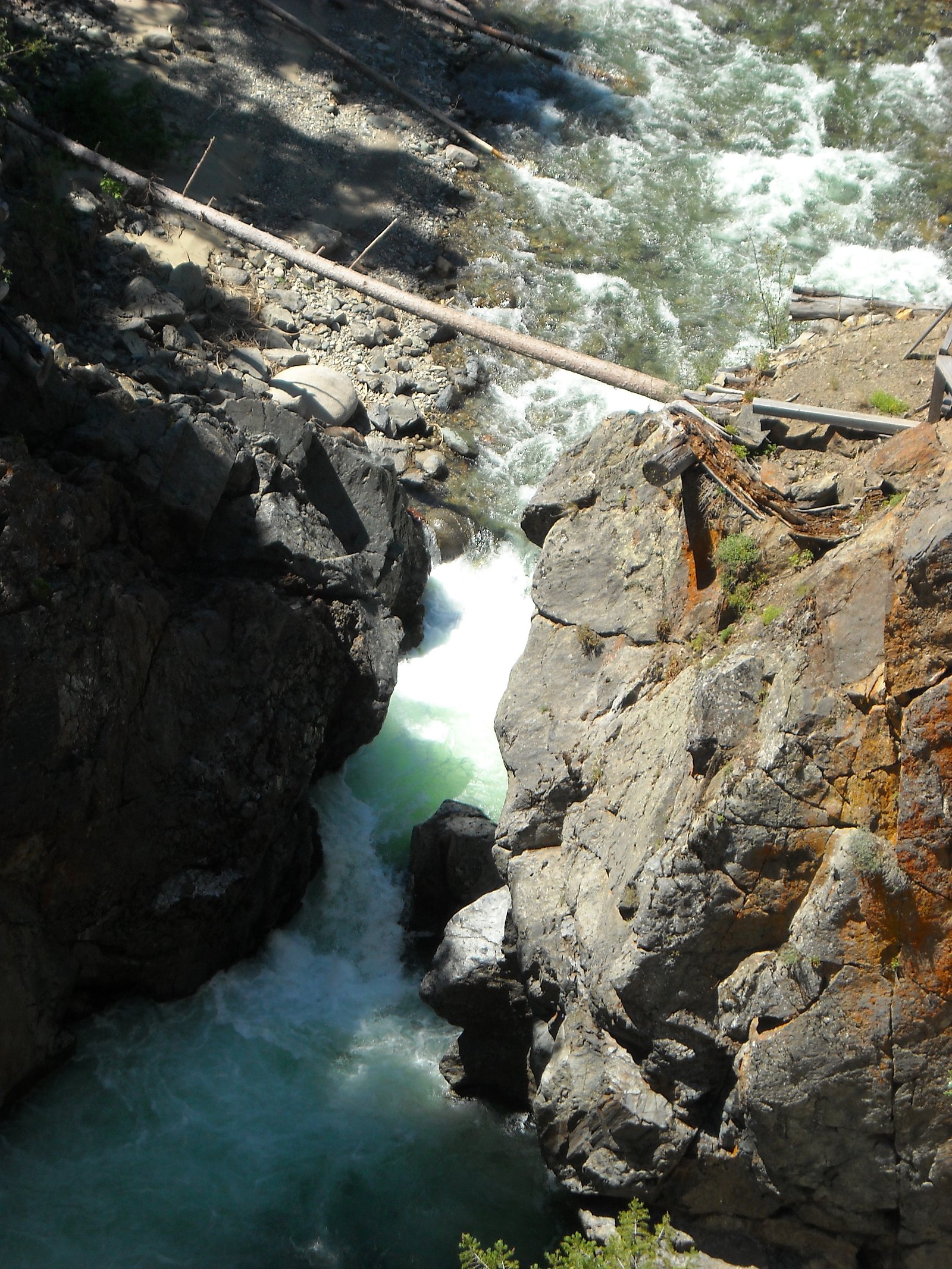
Similkameen Falls is a waterfall in British Columbia, Canada, on the Similkameen River located just below the mouth of the Pasayten River and just above the mouth of Copper Creek about 25 km upstream (south) from Princeton.
The Setting
Similkameen Falls sits at 1,009 metres in the mountains of British Columbia. The falls drop 7 metres.
Why This Waterfall Exists
Similkameen Falls flows over Nicola Group, a hard volcanic rock layer deposited about 201-237 million years ago. These resistant rocks form a durable ledge that water cannot easily wear away, creating a 24-foot drop where softer material downstream has already eroded.
Trail & Hike Details
The Approach
No hiking required. Similkameen Falls is accessible by vehicle with a roadside viewing area.
Trail Description
There does not appear to be a maintained trail to a developed viewpoint. Access often involves an unmarked/rough approach from a roadside pullout or short scramble down to the riverbank. Expect uneven, possibly steep and slippery terrain near water; routes may cross brush, loose rock, or small gullies. Follow the safest, least-impact route and avoid approaching the edge of the river on unstable banks.
What to Expect
The falls drop a gentle 7 metres over hard volcanic rock.
Accessibility
This waterfall is viewable from a vehicle-accessible area. No hiking is required.
Frequently Asked Questions
🐶 Are Dogs Allowed at Similkameen Falls?
❌ Dogs are not allowed
Are There Any Fees or Permits Required?
🆖 No fees required
🏊 Is There Swimming at Similkameen Falls?
❌ Swimming is not allowed
When to Visit
Late spring (snowmelt) for highest flows and most dramatic water; early summer for good weather with substantial flow; fall for lower flows and fall colors. Winter access may be difficult or unsafe due to snow, ice, and closed roads.
Seasonal Access
The best time to visit is Spring, Summer, and Fall. Winter access may be limited. Check with the managing park or local authority for current conditions.
Safety Information
Hazards include slippery rocks and riverbanks, strong currents, cold water, unstable or eroding edges, variable road conditions (mud, washboards, loose rock), limited cell coverage, and potential private land or active forestry operations. Always check local road and land access conditions before traveling, avoid approaching the water in high-flow conditions, and keep a safe distance from edges. Wear appropriate footwear and travel with a companion when possible.
Current Water Conditions
Based on a Water Survey of Canada gauge 32.9 km away
2.9 m³/s
Current discharge — how much water is flowing
Much lower than usual for this time of year
Based on 74 years of record
0.25 m
Water depth at gauge
7-Day Discharge Trend
What does this mean for your visit?
Flow is well below normal for this time of year, so the waterfall may be a trickle.
About This Gauge
This gauge is on a regional waterway. Conditions at the falls may differ, especially after local rain.
7-Day Flow Outlook
Based on the WSC gauge TULAMEEN RIVER AT PRINCETON (33 km away).
Today
Barely Flowing
2.9 m³/s
4/10Tomorrow
Barely Flowing
2.6 m³/s
4/10Thu
Barely Flowing
2.4 m³/s
4/10Fri
Barely Flowing
2.4 m³/s
3/10Sat
Barely Flowing
2.3 m³/s
4/10Sun
Barely Flowing
2.1 m³/s
4/10Mon
Barely Flowing
2.1 m³/s
4/10Best window: Today — barely flowing flow, cloudy (trip score 4/10).
Best time of year: this gauge typically runs highest from early April to early July, peaking in May.
How we calculate this
This is a transparent outlook, not a precise forecast. We take the waterfall's current flow strength (how it ranks against its historical normal for today, from the nearest WSC stream gauge), carry that ranking forward along the gauge's seasonal curve, and nudge it for forecast rain. Confidence is highest for the next day or two and falls further out. Always check official conditions and your own judgment before visiting — high flows can be dangerous.
Know when to go.
Get a free email alert when waterfalls near Penticton hit peak flow. We only send when conditions are worth the trip — no weekly newsletters, no spam.
Weather Forecast
Location & Access
Getting There
The falls are located at coordinates 49.1643, -120.5746 on the Similkameen River. Approaches typically require driving on regional highways followed by secondary or forestry/logging roads; a high-clearance or 4WD vehicle may be helpful. Expect limited or no signage. From nearby population centers (Winthrop ~50.6 miles, Loomis ~56.2 miles, Penticton ~58.3 miles), drive toward the Similkameen Valley and follow local access roads toward the river; consult up-to-date local maps and landowner/park information before travel.
Get Directions on Google MapsParking
There is likely only limited roadside or informal pullout parking. No formal parking lot, restrooms, or developed facilities are known. Park clear of fences and gates and avoid blocking the road.
Elevation
1,009 metres above sea level
Coordinates
49.164280° N, -120.574619° W
Visitor Tips & Gear
1) Confirm access and land status before visiting, portions of river access in the Similkameen Valley may cross private land or active forestry areas. 2) Use a high-clearance vehicle if taking unpaved roads and check local road reports. 3) Wear sturdy footwear for uneven, wet, and slippery terrain. 4) Bring water, sun protection, and navigation (offline map or GPS coordinate). 5) Leave no trace, pack out all trash. 6) Tell someone your plan and expected return time. 7) Be cautious near the water; river currents and cold water present hazards.
Where to Stay
Browse vacation cabins and private rentals nearby
Unique outdoor stays — tents, yurts, and treehouses
Rent a campervan or RV for your waterfall road trip
Some links are affiliate links. We may earn a commission at no extra cost to you.
Nearby Campground
Similkameen Falls Campground
0.2 km away
Nearby Hot Springs
Hot springs near Penticton, British Columbia
Hot Lake
Hot Lake reaches 122 degrees at 1,902 feet elevation on Bureau of Land Management property in Okanogan County, producing water ...
Baker Hot Spring
Baker Hot Spring emerges at 108 degrees Fahrenheit on US Forest Service land in Mt. Baker National Forest, flowing 59.5 degrees...
Looking for a soak after your hike? Explore more hot springs near Penticton, British Columbia on SoakingSprings.
Explore British Columbia springsAdditional Information
Nearby Attractions
Similkameen Valley scenery, regional hiking and fishing opportunities, Penticton area lakes (Penticton/Vaseux region), Keremeos and nearby fruit stands/wineries, Manning Provincial Park (regionally). Check local guides for exact distances and recommended side trips.
Wildlife
Typical interior BC valley species may be present: deer, black bear, coyotes, various small mammals, and migratory and resident birds. Use standard wildlife precautions.
Cities near Similkameen Falls
Writing about Similkameen Falls? Embed this waterfall on your site for free.