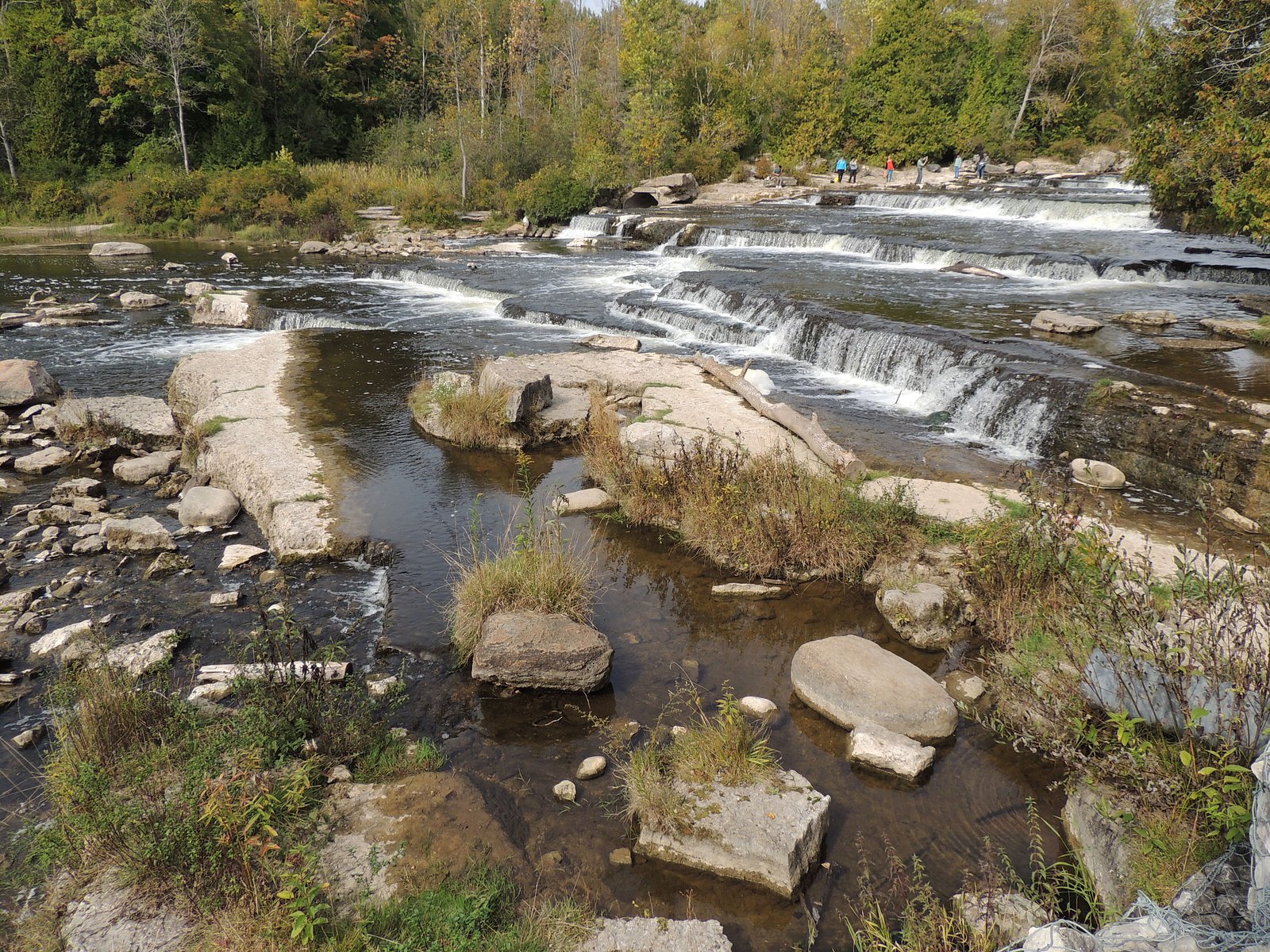
Sauble Falls
Ontario • 6 m
By Armen Suny · Last verified Jun 2026
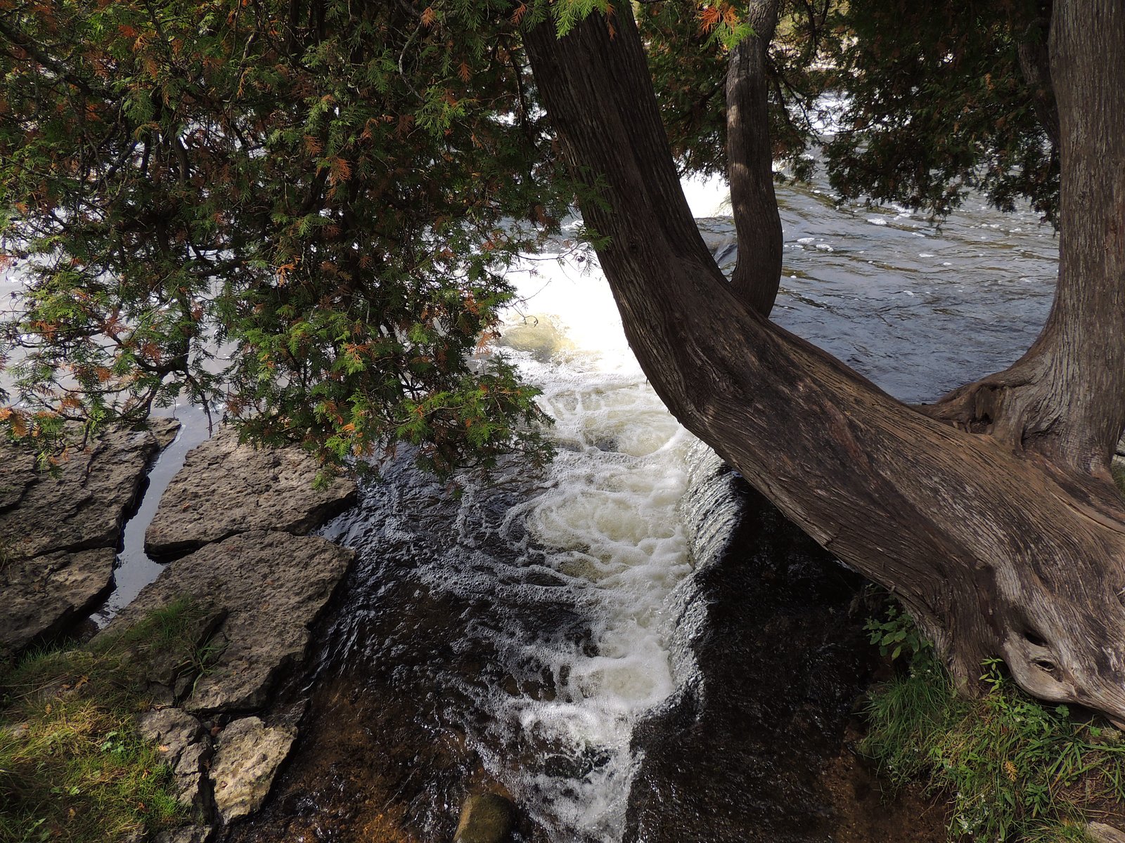
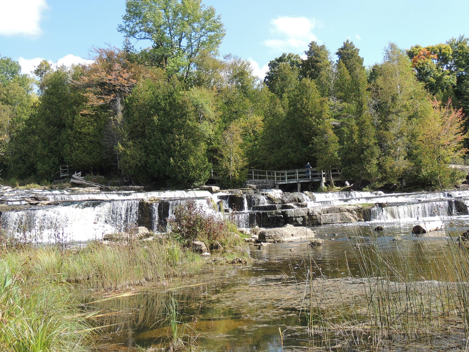
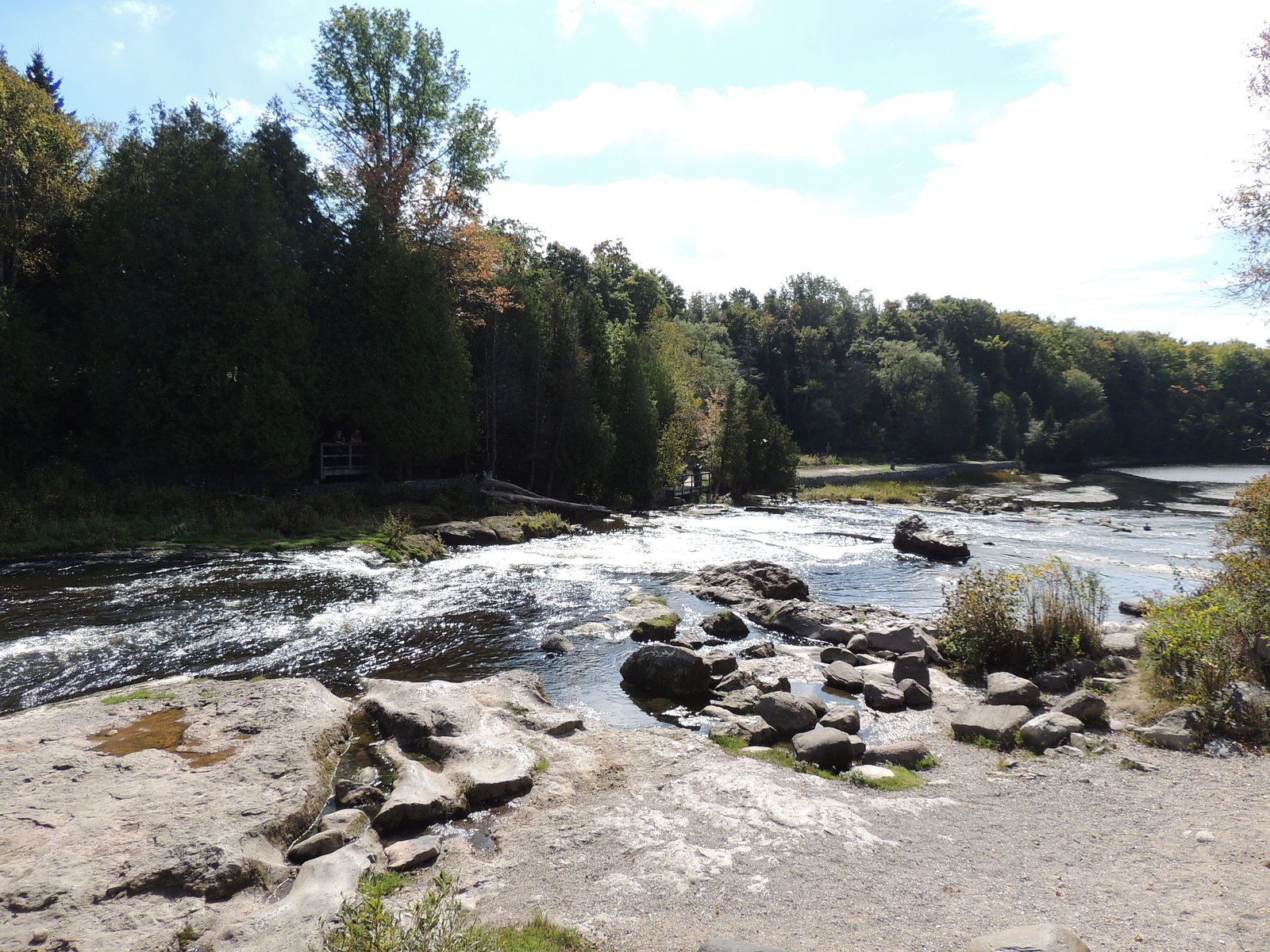

Photo Credits (5)
Difficulty
Easy
Trail Length
0.3 km
Trail Type
Out And Back
Elevation Gain
6 m
About Sauble Falls
Sauble Falls is a small series of drops and rapids on the Sauble River located in Sauble Falls Provincial Park, on the eastern shore of Lake Huron near Wiarton and Owen Sound. The site features short, well-marked trails and a scenic viewpoint/picnic area. Water flow is highest in spring and after heavy rain; in summer the river can be lower but the area remains scenic and popular for short visits and photography.
The Setting
Sauble Falls sits at 197 metres within Sauble Falls Provincial Park (Recreational Class), in the foothills of Ontario. The falls drop 6 metres.
Height: 20 feet
Trail & Hike Details
The Approach
The easy 0.3-km out-and-back trail gains 6 metres of elevation on the way to the falls.
Trail Description
From the park parking area a short, well-signed path leads to the falls viewpoint and picnic areas. The route is short (a few minutes' walk), with some stairs and natural, sometimes rocky footing near the river edge. There may be short boardwalks or gravel paths in parts of the park. Trails are suitable for most visitors but watch for uneven surfaces and wet/icy sections in cooler months.
What to Expect
The falls drop a gentle 6 metres.
Accessibility
The trail is short and relatively flat, but the surface may be uneven. Contact the managing agency for accessibility details.
Frequently Asked Questions
🐶 Are Dogs Allowed at Sauble Falls?
❌ Dogs are not allowed
Are There Any Fees or Permits Required?
🆖 No fees required
🏊 Is There Swimming at Sauble Falls?
❌ Swimming is not allowed
When to Visit
Spring for highest flows and fall for fall color and cooler weather. Early morning or weekdays reduce crowds in summer.
Seasonal Access
The best time to visit is Spring, Summer, and Fall. Winter access may be limited. Check with the managing park or local authority for current conditions.
Safety Information
Hazards include slippery rocks, fast or cold water, and steep/unstable banks near the river. Water levels and currents can change rapidly, especially during spring melt or after heavy rain. There are no lifeguards; supervise children closely and do not climb on wet rocks. In winter, ice near falls can be unstable, exercise extreme caution. Check weather and park advisories before visiting.
Current Water Conditions
3.4 m³/s
Current discharge — how much water is flowing
About average for this time of year
Based on 68 years of record
0.82 m
Water depth at gauge
7-Day Discharge Trend
What does this mean for your visit?
Flow is about average for this time of year.
About This Gauge
7-Day Flow Outlook
Based on the WSC gauge SAUBLE RIVER AT SAUBLE FALLS (0 km away).
Today
Moderate
3.4 m³/s
8/10Tomorrow
Moderate
3.2 m³/s
8/10Tue
Moderate
3.6 m³/s
6/10Wed
Strong
3.5 m³/s
8/10Thu
Moderate
3.2 m³/s
9/10Fri
Moderate
3.2 m³/s
6/10Sat
Moderate
3.0 m³/s
8/10Best window: Thu — moderate flow, mainly sunny (trip score 9/10).
Best time of year: this gauge typically runs highest from early March to early May, peaking in April.
How we calculate this
This is a transparent outlook, not a precise forecast. We take the waterfall's current flow strength (how it ranks against its historical normal for today, from the nearest WSC stream gauge), carry that ranking forward along the gauge's seasonal curve, and nudge it for forecast rain. Confidence is highest for the next day or two and falls further out. Always check official conditions and your own judgment before visiting — high flows can be dangerous.
Know when to go.
Get a free email alert when waterfalls near Wiarton hit peak flow. We only send when conditions are worth the trip — no weekly newsletters, no spam.
Weather Forecast
Location & Access
Getting There
Sauble Falls is reached from local roads off Highway 21 / regional routes serving the Sauble Beach/Wiarton area. The falls are located inside Sauble Falls Provincial Park; use park signage and local maps. Coordinates: 44.6767, -81.256.
Get Directions on Google MapsParking
There is a small park parking area near the falls and picnic grounds. Parking is typically at a designated lot adjacent to park facilities; parking area can be busy on summer weekends.
Elevation
197 metres above sea level
Coordinates
44.676672° N, -81.255952° W
Land Management
Managed by Ontario Parks
Visitor Tips & Gear
• Wear sturdy footwear; rocks and paths near the river can be slippery. • Stay on designated trails and viewing areas; do not climb on wet rocks near the falls. • Check current park information (Ontario Parks) for facility status, closures, and any advisories. • Bring insect repellent in warm months. • If visiting during peak season, arrive early to secure parking. • Respect posted rules about pets, fires and camping, provincial park regulations apply.
As an Amazon Associate, we earn from qualifying purchases.
For this easy 0.3 km trail, lightweight trail shoes and a water bottle are usually sufficient. Sun exposure on the trail makes good sun protection a must in summer.

Polarized Sunglasses (Knockaround)
Cuts glare off the water so you actually see the falls — and your photos turn out better too.

Columbia Watertight II Rain Jacket
Packs into its own pocket, seam-sealed, and keeps you dry from spray and surprise rain.

Earth Pak Waterproof Dry Bag
Keeps your phone and gear dry when waterfall mist soaks everything else.

Waterproof Phone Pouch (AiRunTech)
Cheap insurance — take photos right next to the falls without killing your phone.

JOBY GorillaPod Starter Kit
Wraps around railings and rocks for long-exposure waterfall shots — no flat surface needed.

Osprey Daylite Daypack
Light, organized, and just the right size for a day hike — fits water, snacks, and layers.
Where to Stay
Browse vacation cabins and private rentals nearby
Unique outdoor stays — tents, yurts, and treehouses
Rent a campervan or RV for your waterfall road trip
Some links are affiliate links. We may earn a commission at no extra cost to you.
Nearby Campground
Sauble Falls Park - East Campground
0.2 km away
Additional Information
Nearby Attractions
Sauble Beach (popular Lake Huron beach), Wiarton (town with shops and services), Owen Sound (larger center with cultural attractions), Bruce Peninsula and Bruce Trail access points, Inglis Falls (near Owen Sound) and other regional waterfalls.
Wildlife
Typical Great Lakes/St. Lawrence Plain wildlife: songbirds, waterfowl, white-tailed deer, beavers, and occasional small mammals. Maintain distance from wildlife and store food responsibly in campground areas.
Cities near Sauble Falls
Writing about Sauble Falls? Embed this waterfall on your site for free.