Photo Credits (5)
Difficulty
Easy
Trail Length
6.0 km
Trail Type
Out And Back
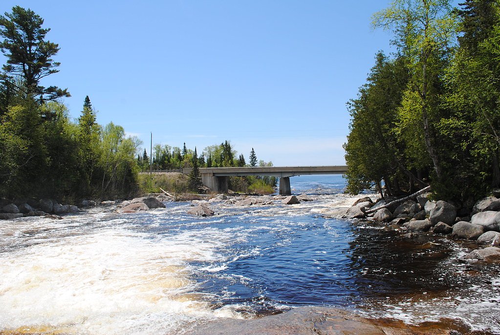
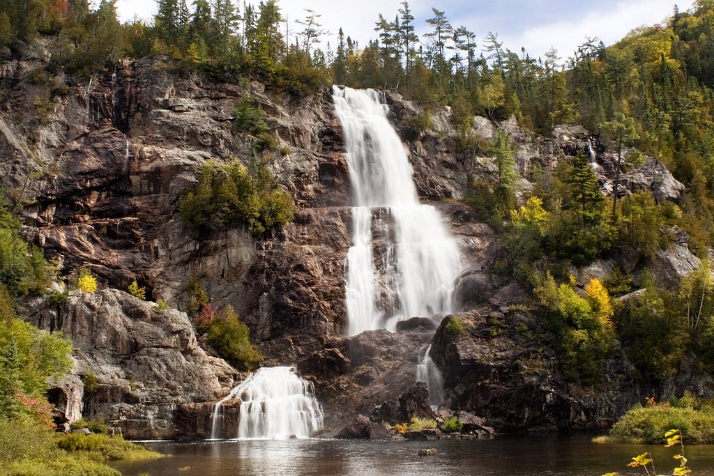
About Sand River Falls
Sand River Falls is a small, scenic waterfall on the Sand River located in the Wawa area of northern Ontario (approx. 29 miles from Wawa; coordinates 47.4358, -84.7289). The falls typically feature variable flow that is highest during spring snowmelt and after heavy rains. Access appears to be from a roadside turnout or short footpath off Highway 17/Trans-Canada corridor in the region; on-site facilities are likely minimal. Information about formal trail infrastructure and exact measured height is not well-documented, so some details below are described conservatively.
The Setting
Sand River Falls sits at 229 metres within Lake Superior Provincial Park, in the foothills of Ontario.
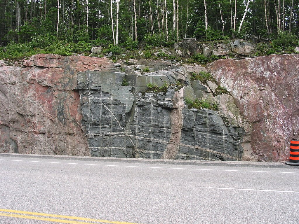
Why This Waterfall Exists
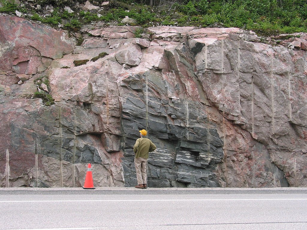
Sand River Falls flows over hard intrusive rock, primarily granodiorite and tonalite, laid down over 2.5-3.2 billion years ago. These resistant rocks form a durable ledge that water cannot easily wear away, creating the falls where softer material downstream has already eroded.
Trail & Hike Details
Trail Description
Reports indicate access is likely a short walk from a roadside turnout, over uneven and possibly rocky terrain. The approach may include natural footing (roots, rocks) and short slopes to the riverbank. Trails in this part of Ontario can be unmaintained and may not have boardwalks or railings. Expect a short, informal approach rather than a developed, signed trail.
What to Expect
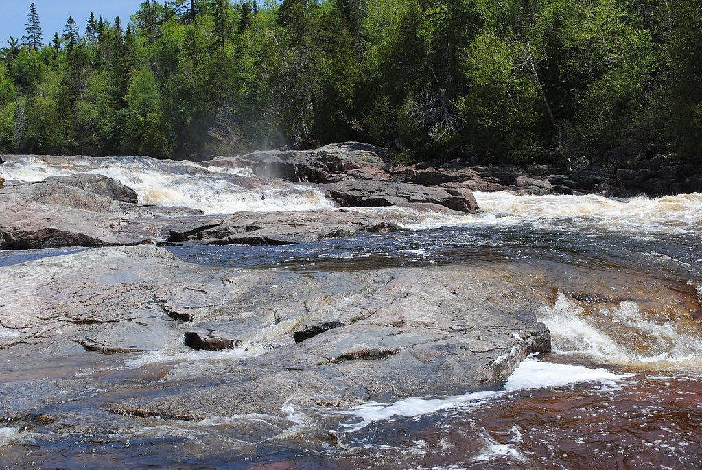
Expect a modest waterfall with rocky ledges and a small plunge or cascade into a shallow pool. Flow is seasonal, highest in spring and after heavy rain, lower in late summer and early fall. Vegetation is typical boreal/mixed-wood forest (spruce, fir, poplar) with moss-covered rocks. There are likely no facilities (toilets, picnic tables, formal viewpoints) and limited signage.
Accessibility
The trail is not wheelchair accessible. Uneven terrain and elevation changes require steady footing.
Frequently Asked Questions
🐶 Are Dogs Allowed at Sand River Falls?
❌ Dogs are not allowed
Are There Any Fees or Permits Required?
🆖 No fees required
🏊 Is There Swimming at Sand River Falls?
❌ Swimming is not allowed
When to Visit
Late spring (snowmelt) for peak flow and after heavy rains. Early fall offers cooler temperatures and fall foliage. Summer provides the most reliable access for casual visitors. Winter access may be possible but can be hazardous (ice, snow, limited access).
Seasonal Access
The best time to visit is Spring, Summer, and Fall. Winter access may be limited. Check with Lake Superior Provincial Park for current conditions.
Safety Information
Hazards may include slippery rocks, steep or unstable banks, cold water and hidden currents, variable flow during spring melt, limited cell service, and seasonal wildlife encounters. Wear appropriate footwear, supervise children, avoid approaching edges, and do not attempt to climb wet rocks near the falls. If visiting in winter, be aware of ice hazards and limited winter maintenance.
Know when to go.
Get a free email alert when waterfalls near Wawa hit peak flow. We only send when conditions are worth the trip — no weekly newsletters, no spam.
Weather Forecast
Location & Access
Getting There
Sand River Falls is reached from the Wawa area by driving approximately 29 miles along regional highways (general area near Highway 17 / Trans-Canada). Expect a roadside pullout or short unmarked access path rather than a developed trailhead. Use the provided coordinates (47.4358, -84.7289) for precise location; cell service may be limited in parts of this region.
Get Directions on Google MapsParking
Parking is likely limited to a small roadside turnout or informal gravel pullout. There may not be an established parking lot, signage, or facilities. Park well off the highway and use caution entering/exiting.
Elevation
229 metres above sea level
Coordinates
47.435826° N, -84.728858° W
Land Management
Managed by Ontario Parks
Visitor Tips & Gear
• Use the GPS coordinates to locate the turnout; wayfinding signage may be minimal. • Wear sturdy footwear with good traction, rocks and banks are often slippery. • Stay back from the edge; riverbanks can be unstable. Children should be supervised closely. • Expect bugs (black flies, mosquitoes) in spring and summer; bring repellent. • Check weather conditions and road status before traveling; remote roads can be affected by seasonal conditions.
Where to Stay
Browse vacation cabins and private rentals nearby
Unique outdoor stays — tents, yurts, and treehouses
Rent a campervan or RV for your waterfall road trip
Some links are affiliate links. We may earn a commission at no extra cost to you.
Nearby Campground
Baldhead North
9.8 km away
Additional Information
Nearby Attractions
Town of Wawa (services), Lake Superior shoreline and provincial parks in the region, and various other roadside falls and scenic spots along Highway 17. Use local tourism resources for confirmed nearby parks and attractions.
Wildlife
Typical northern Ontario wildlife: moose, white-tailed deer, black bears, beavers, and a variety of songbirds and waterfowl. Take standard precautions for bears (store food securely, make noise while hiking) and be aware of ticks in warm months.
Cities near Sand River Falls
Nearby Waterfalls
Writing about Sand River Falls? Embed this waterfall on your site for free.