Photo Credits (5)
Difficulty
Moderate
Trail Length
3.7 km
Trail Type
Out And Back
Elevation Gain
132 m
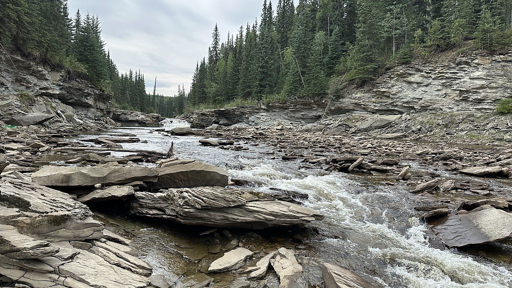
About Red Willow Falls
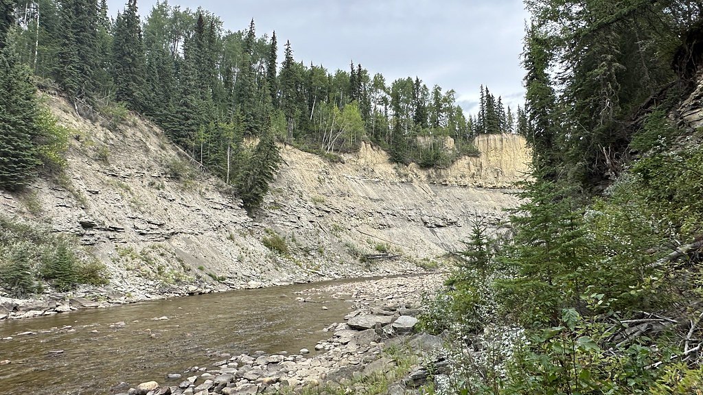
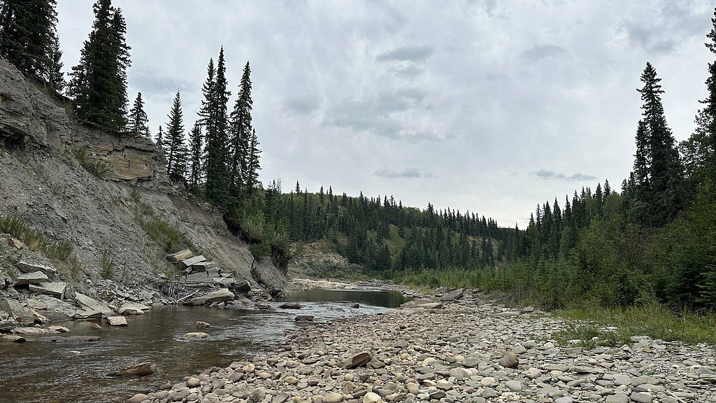
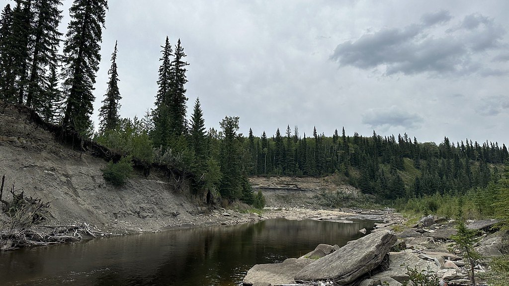
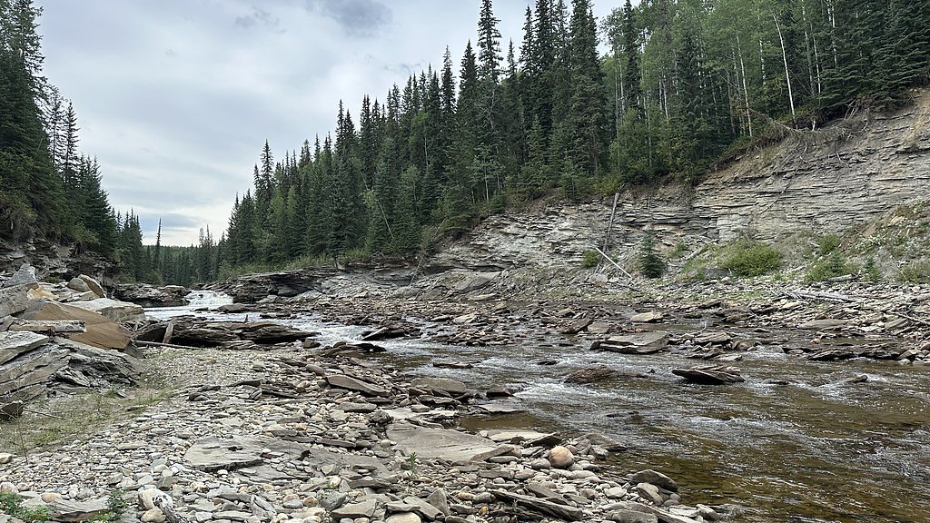
Red Willow Falls is a small, relatively remote waterfall in the boreal/foothills region west of Grande Prairie, Alberta (coordinates provided). It appears to be reached by a mix of secondary/forest/resource roads and an unmaintained or lightly maintained footpath. Visitor reports suggest the falls are most impressive during spring snowmelt and after heavy rain; summer and fall visits are common but flow can be lower. Detailed, official visitor infrastructure (boardwalks, signage, formal viewpoints) may be limited or absent, and approach can involve uneven terrain and vegetation.
Why This Waterfall Exists
Red Willow Falls flows over Wapiti Formation, a layered sedimentary rock layer deposited about 66-101 million years ago. These soft rocks erode readily, allowing the stream to carve a vertical drop into the landscape.
Trail & Hike Details
The Approach
The moderate 3.7-km out-and-back trail gains 132 metres of elevation on the way to the falls.
Trail Description
Approach routes reported by visitors are often short but unmaintained: expect uneven footing, brush, and possibly boggy sections typical of boreal foothills. There may be sections that require scrambling down a bank to reach the falls or stream edge. Trail signage and clear tread may be absent, and conditions vary by season and recent logging/industrial activity.
What to Expect
A natural, relatively small waterfall in a forested setting. Flow is seasonal, highest in spring and after heavy rains, lower in late summer/fall. No formal viewing platforms, railings, or restrooms. Ground can be muddy, slippery, and covered in leaf litter or snow depending on season. Limited cell coverage is possible. Wildlife in the area may include moose, deer, black bears, and smaller mammals and birds. Insect activity (mosquitoes, blackflies) can be high in summer.
Accessibility
The trail is not wheelchair accessible. Uneven terrain and elevation changes require steady footing.
Frequently Asked Questions
🐶 Are Dogs Allowed at Red Willow Falls?
❌ Dogs are not allowed
Are There Any Fees or Permits Required?
🆖 No fees required
🏊 Is There Swimming at Red Willow Falls?
❌ Swimming is not allowed
When to Visit
Late spring to early summer for highest flow (snowmelt and runoff). Early fall can offer quieter visits and autumn colors but flows are often lower. Winter visits may be possible if conditions and access roads allow, but expect ice, deep snow, and limited access.
Seasonal Access
The best time to visit is Spring, Summer, and Fall. Winter access may be limited. Check with the managing park or local authority for current conditions.
Safety Information
The site is remote and conditions can change quickly. Hazards include slippery rocks and banks, fast or cold water, unstable edges, limited cell coverage, seasonal road closures or poor road surfaces, and potential industrial traffic on resource roads. Check weather and local travel advisories, bring appropriate gear, and do not approach the edge of the falls. If unfamiliar with backcountry travel, consider going with an experienced companion or guide.
7-Day Flow Outlook
Based on the WSC gauge REDWILLOW RIVER NEAR RIO GRANDE (18 km away).
Today
Moderate
1.4 m³/s
4/10Tomorrow
Moderate
1.2 m³/s
5/10Tue
Moderate
1.2 m³/s
6/10Wed
Moderate
1.0 m³/s
6/10Thu
Moderate
1.0 m³/s
8/10Fri
Moderate
1.1 m³/s
6/10Sat
Moderate
1.2 m³/s
5/10Best window: Thu — moderate flow, sunny (trip score 8/10).
Best time of year: this gauge typically runs highest from mid April to mid July, peaking in May.
How we calculate this
This is a transparent outlook, not a precise forecast. We take the waterfall's current flow strength (how it ranks against its historical normal for today, from the nearest WSC stream gauge), carry that ranking forward along the gauge's seasonal curve, and nudge it for forecast rain. Confidence is highest for the next day or two and falls further out. Always check official conditions and your own judgment before visiting — high flows can be dangerous.
Know when to go.
Get a free email alert when waterfalls near Grande Prairie hit peak flow. We only send when conditions are worth the trip — no weekly newsletters, no spam.
Weather Forecast
Location & Access
Getting There
The falls lie roughly 55–90 miles (road distance may vary) west of Grande Prairie. Access typically requires driving on paved highways followed by secondary or unpaved resource/forest roads. The final approach may be along an unofficial or lightly maintained trail; a high-clearance vehicle may be helpful. Use the provided GPS coordinates (55.0542, -119.9865) and local maps. Expect limited or no signage.
Get Directions on Google MapsParking
Parking is likely informal, a roadside pullout or small gravel clearing on a forest road. Do not block active logging roads. There may be very limited space; park off the road where safe and legal. No dedicated parking lot or facilities are expected.
Elevation
857 metres above sea level
Coordinates
55.054193° N, -119.986533° W
Visitor Tips & Gear
1) Use the exact GPS coordinates; do not rely solely on unnamed forest roads. 2) Bring a map, compass or GPS and download offline maps, cell service may be unreliable. 3) Wear waterproof boots with good traction; expect wet/steep banks. 4) If you park on a resource road, be mindful of industrial traffic and do not block gates or active roads. 5) Practice Leave No Trace; there are likely no garbage services. 6) Check local land management (municipal, provincial, or private landowner) for access rules and seasonal restrictions before visiting. 7) Consider travelling with another person and tell someone your route and expected return time.
As an Amazon Associate, we earn from qualifying purchases.
With 3.7 km and 132 m of elevation gain, sturdy boots and trekking poles will help on this moderate trail. Sun exposure on the trail makes good sun protection a must in summer.

Polarized Sunglasses (Knockaround)
Cuts glare off the water so you actually see the falls — and your photos turn out better too.

Columbia Watertight II Rain Jacket
Packs into its own pocket, seam-sealed, and keeps you dry from spray and surprise rain.

Earth Pak Waterproof Dry Bag
Keeps your phone and gear dry when waterfall mist soaks everything else.

Waterproof Phone Pouch (AiRunTech)
Cheap insurance — take photos right next to the falls without killing your phone.

Timberland Euro Sprint Mid Waterproof
Trusted waterproof boot with premium leather and grippy rubber sole — reliable on rocky, wet trails.

TrailBuddy Trekking Poles
Lightweight aluminum, cork grips, and flip-locks that actually hold — a best-seller for good reason.
Where to Stay
Browse vacation cabins and private rentals nearby
Unique outdoor stays — tents, yurts, and treehouses
Rent a campervan or RV for your waterfall road trip
Some links are affiliate links. We may earn a commission at no extra cost to you.
Additional Information
Nearby Attractions
The nearest significant service center is Grande Prairie. The surrounding region offers boreal forest scenery, other small streams and natural areas, and typical northern Alberta outdoor recreation opportunities. Specific named attractions near the falls are not well documented; check local tourism resources for up-to-date suggestions.
Wildlife
Typical boreal/foothills species: moose, white-tailed deer, elk (in some areas), black bears, wolves, foxes, beavers, migratory and resident birds, and abundant insect life in warm months. Take standard wildlife safety precautions.
Cities near Red Willow Falls
Writing about Red Willow Falls? Embed this waterfall on your site for free.