Red Squirrel Falls
By Armen Suny · Last verified Jun 2026
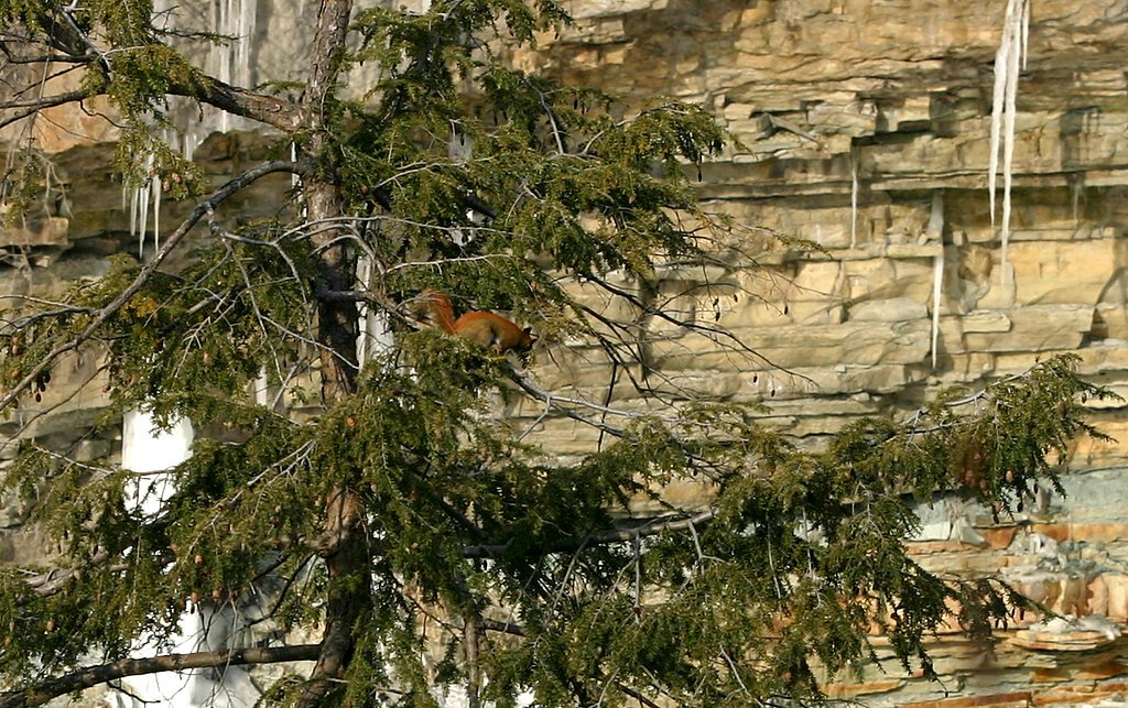
Photo Credits (3)
About Red Squirrel Falls
Red Squirrel Falls is a remote river waterfall in northeastern Ontario (coordinates 47.1715, -80.0534). The falls sit in a rugged, forested landscape typical of the Temagami/Cobalt region and are most often visited by people willing to travel gravel or logging roads and do a short walk or bushwhack to a riverside viewpoint. Flow and appearance vary seasonally (spring melt produces the highest flows). Specific published measurements for the drop are not confidently documented here.
Why This Waterfall Exists
Red Squirrel Falls flows over Cobalt Group, a soft fine-grained rock layer deposited over 2.3-2.5 billion years ago. These soft rocks erode readily, allowing the stream to carve a vertical drop into the landscape.
Trail & Hike Details
Trail Description
Trail access to Red Squirrel Falls may be primitive or unmarked. Visitors should anticipate a short walk from a roadside pullout, possibly including uneven, rocky, or muddy ground and some bushwhacking through forest understory. There may be no maintained trail, steps, or viewing platform. Expect tree roots, wet areas, and steep or slippery approaches near the riverbank. Exact route and distance vary depending on the road you approach from; use the coordinates to plan your approach and consider consulting local trail reports or recent visitor notes if available.
What to Expect
A natural, largely undeveloped waterfall setting in boreal forest. Seasonal variations in flow (highest in spring). Few or no amenities: no staffed facilities, no restrooms, and limited signage. Wildlife is common. Rocks near the falls are slippery and currents can be deceptively strong. Access roads may be rough and sometimes gated or seasonally impassable.
Accessibility
Access appears primitive and is likely unsuitable for wheelchairs or visitors with limited mobility. Expect uneven, rocky, and potentially steep approaches with no constructed viewing platform.
Frequently Asked Questions
🐶 Are Dogs Allowed at Red Squirrel Falls?
❌ Dogs are not allowed
Are There Any Fees or Permits Required?
🆖 No fees required
🏊 Is There Swimming at Red Squirrel Falls?
❌ Swimming is not allowed
When to Visit
Late spring for highest flows and dramatic water; summer and early fall for easier road conditions and more stable weather. Winter can produce impressive ice and frozen falls but access and footing are hazardous, only attempt in winter with appropriate experience and equipment.
Seasonal Access
The best time to visit is Spring, Summer, Fall, and Winter. Check with the managing park or local authority for current conditions.
Safety Information
Exercise caution: slippery rocks, steep or unstable riverbanks, and strong currents near the falls can be hazardous. Roads to the area may be rough, gated, or seasonally impassable; check conditions before traveling. Cell service may be limited, carry navigation aids and inform someone of your itinerary. Watch for wildlife, carry bear deterrents if appropriate, and be aware of ticks in warm months. Winter ice near falls can be thin and unstable; do not assume frozen water is safe.
Current Water Conditions
Based on a Water Survey of Canada gauge 38 km away
5.8 m³/s
Current discharge — how much water is flowing
About average for this time of year
Based on 39 years of record
4.57 m
Water depth at gauge
7-Day Discharge Trend
What does this mean for your visit?
Flow is about average for this time of year.
About This Gauge
This gauge is on a regional waterway. Conditions at the falls may differ, especially after local rain.
7-Day Flow Outlook
Based on the WSC gauge STURGEON RIVER AT UPPER GOOSE FALLS (38 km away).
Today
Moderate
5.7 m³/s
6/10Tomorrow
Moderate
5.6 m³/s
6/10Tue
Moderate
6.0 m³/s
5/10Wed
Moderate
5.5 m³/s
6/10Thu
Moderate
5.5 m³/s
5/10Fri
Moderate
5.0 m³/s
6/10Sat
Moderate
4.9 m³/s
6/10Best window: Today — moderate flow, cloudy (trip score 6/10).
Best time of year: this gauge typically runs highest from early April to mid June, peaking in May.
How we calculate this
This is a transparent outlook, not a precise forecast. We take the waterfall's current flow strength (how it ranks against its historical normal for today, from the nearest WSC stream gauge), carry that ranking forward along the gauge's seasonal curve, and nudge it for forecast rain. Confidence is highest for the next day or two and falls further out. Always check official conditions and your own judgment before visiting — high flows can be dangerous.
Know when to go.
Get a free email alert when waterfalls near Cobalt hit peak flow. We only send when conditions are worth the trip — no weekly newsletters, no spam.
Weather Forecast
Location & Access
Getting There
The falls are reached by driving on secondary and likely unpaved/logging roads from nearby towns (Cobalt ~26 miles, New Liskeard ~32 miles, Sudbury ~71 miles). Expect long stretches with limited services and possibly rough road conditions; a high-clearance or 4x4 vehicle may be advisable in wet seasons. Cell service may be unreliable, carry an offline map or GPS with the provided coordinates.
Get Directions on Google MapsParking
There is likely an informal pullout or small parking area off a logging/gravel road rather than an established lot. Parking may be primitive; do not block gates or access roads.
Elevation
317 metres above sea level
Coordinates
47.171535° N, -80.053409° W
Visitor Tips & Gear
• Check recent local reports or with local land/park authorities for road and access conditions before you go. • Use a high-clearance vehicle if possible; avoid low-clearance cars on wet/soft gravel roads. • Wear sturdy, waterproof footwear with good traction; approach the riverbank carefully. • Expect little to no cell service, bring GPS and an offline map. • Tell someone your plans and expected return time. • Pack out all trash and respect private property and any posted signs or gates. • Avoid swimming near the falls (strong currents, submerged hazards); see safety info below.
Where to Stay
Browse vacation cabins and private rentals nearby
Unique outdoor stays — tents, yurts, and treehouses
Rent a campervan or RV for your waterfall road trip
Some links are affiliate links. We may earn a commission at no extra cost to you.
Nearby Campground
Ranger Point
18.6 km away
Additional Information
Nearby Attractions
Historic mining sites and museums around Cobalt, numerous lakes and canoeing opportunities in the Temagami and northeastern Ontario lake country, and other rivers and waterfalls in the region. Check local tourism resources for up-to-date recommendations.
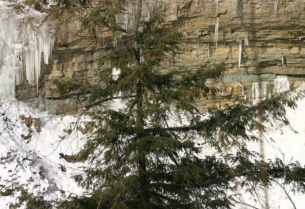
Wildlife
Typical boreal wildlife, black bears, moose, white-tailed deer, beavers, and a variety of birds (including raptors). Ticks are present in warmer months. Practice wildlife safety and secure food appropriately.
Cities near Red Squirrel Falls
Writing about Red Squirrel Falls? Embed this waterfall on your site for free.