Photo Credits (1)
About Raven Falls
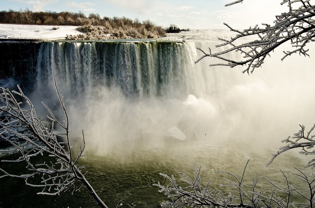
Raven Falls is a remote waterfall site in the Temiskaming / Timiskaming region of northeastern Ontario (coordinates 48.0299, -79.5797). It is set in a rugged Canadian Shield landscape of mixed forest, exposed bedrock and typical northern Ontario waterways. Visitor reports for similarly remote falls in this region indicate a narrow stream or river channel with cascades or a single drop depending on seasonal flow; water volume is typically highest in spring runoff and after heavy rains. Specific published information about formal viewpoints, infrastructure, or exact vertical measurement for this named feature is limited, so details below are conservative and use cautious language where not confirmed.
Why This Waterfall Exists
Raven Falls flows over Cobalt Group, a layered sedimentary rock layer deposited over 1.6-2.5 billion years ago. These soft rocks erode readily, allowing the stream to carve a vertical drop into the landscape.
Trail & Hike Details
Trail Description
There is limited formal trail information available for Raven Falls. Expect an unmaintained or minimally maintained route from a roadside pullout or informal trail. Terrain in this region commonly includes exposed bedrock, rooty/rocky singletrack, wet/muddy sections, and short steep pitches near creek banks. Trails to falls in remote Ontario often require route-finding; you may encounter fallen trees, eroded sections, and seasonal blowdown. If a short spur exists from a logging road, it may be under 2 miles round trip, but that is not confirmed for this site.
What to Expect
A remote, wooded setting on the Canadian Shield with rocky shorelines and mixed forest. Seasonal variation: highest flows in spring snowmelt and after heavy rains; lower flows in late summer and during dry periods. No guaranteed amenities (restrooms, signage, guardrails, lifeguards). Limited or no cell service. Wildlife typical of northern Ontario (moose, deer, black bear, beaver) and insects (black flies, mosquitoes, ticks). Trail may be slippery and uneven near the falls; river currents and submerged hazards are possible.
Accessibility
Access is likely not wheelchair accessible. Trails (if present) are likely unmaintained, rocky, and potentially steep near water; not suitable for strollers or standard wheelchairs. Expect limited signage and infrastructure.
Frequently Asked Questions
🐶 Are Dogs Allowed at Raven Falls?
❌ Dogs are not allowed
Are There Any Fees or Permits Required?
🆖 No fees required
🏊 Is There Swimming at Raven Falls?
❌ Swimming is not allowed
When to Visit
Late spring (snowmelt/peak runoff) through early summer for highest flows and scenic water volume. Fall offers good color but lower water volumes. Winter may offer frozen/ice-formed falls for experienced winter hikers/ice observers, but access and hazard risks increase (ice stability, cold, short daylight).
Seasonal Access
The best time to visit is Spring, Summer, Fall, and Winter. Check with the managing park or local authority for current conditions.
Safety Information
Remote location with limited or no cell service, plan accordingly. Trail and shoreline hazards include slippery and unstable bedrock, steep or undercut banks, fast currents, and submerged rocks. Seasonal hazards: high spring flows, ice in shoulder seasons, and winter ice conditions that can be treacherous. Wildlife encounters are possible, store food securely and be bear-aware. If using logging or forest roads, watch for active operations and obey signage. Bring navigation tools and sufficient supplies; do not attempt in poor weather or low visibility.
7-Day Flow Outlook
Based on the WSC gauge BLANCHE RIVER ABOVE ENGLEHART (27 km away).
Best time of year: this gauge typically runs highest from early April to mid June, peaking in May.
How we calculate this
This is a transparent outlook, not a precise forecast. We take the waterfall's current flow strength (how it ranks against its historical normal for today, from the nearest WSC stream gauge), carry that ranking forward along the gauge's seasonal curve, and nudge it for forecast rain. Confidence is highest for the next day or two and falls further out. Always check official conditions and your own judgment before visiting — high flows can be dangerous.
Know when to go.
Get a free email alert when waterfalls near New Liskeard hit peak flow. We only send when conditions are worth the trip — no weekly newsletters, no spam.
Weather Forecast
Location & Access
Getting There
Raven Falls is located at approximately 48.0299, -79.5797 in the Timiskaming District of northeastern Ontario. The falls lie in a remote, forested area of the Canadian Shield. Nearest population centers are New Liskeard (~29.6 miles / ~47.6 km), Rouyn-Noranda (~34.6 miles / ~55.7 km), and Cobalt (~36.0 miles / ~57.9 km). Access likely requires travel on secondary or unpaved forest/logging roads off the main highways; consult current maps, local land-use offices (e.g., MNRF/Forest Service) and recent trip reports before attempting access. Expect limited signage and little to no cell service.
Get Directions on Google MapsParking
Likely limited or informal roadside parking on secondary/unpaved roads or at a small pullout. There does not appear to be an official paved parking lot or developed trailhead; use caution when parking on shoulders and avoid blocking gates or access roads. If using logging roads, check for active operations and signage.
Elevation
278 metres above sea level
Coordinates
48.029879° N, -79.579741° W
Visitor Tips & Gear
1) Check local maps and recent trip reports before traveling; confirm road status and any active logging operations. 2) Tell someone your route and expected return time; remote area with limited cell service. 3) Wear sturdy waterproof footwear and traction for wet bedrock. 4) Bring insect repellent and tick checks after your hike. 5) Avoid getting too close to the waterfall edge, wet rock is slippery and undercut banks may be unstable. 6) Leave no trace: pack out what you pack in. 7) If using unpaved roads, consider a high-clearance vehicle; conditions can change rapidly.
Where to Stay
Browse vacation cabins and private rentals nearby
Unique outdoor stays — tents, yurts, and treehouses
Rent a campervan or RV for your waterfall road trip
Some links are affiliate links. We may earn a commission at no extra cost to you.
Additional Information
Nearby Attractions
Nearby towns include New Liskeard, Cobalt and Rouyn-Noranda. Regional attractions typically include Lake Temiskaming, local hiking and canoe routes, and historic mining sites in Cobalt. Confirm local offerings with visitor information centers in the nearest towns.
Wildlife
Regionally common species: moose, white-tailed deer, black bear, beaver, otter, fox, various waterfowl and songbirds. Ticks and biting insects (black flies, mosquitoes) are common in spring and summer.
Cities near Raven Falls
Writing about Raven Falls? Embed this waterfall on your site for free.