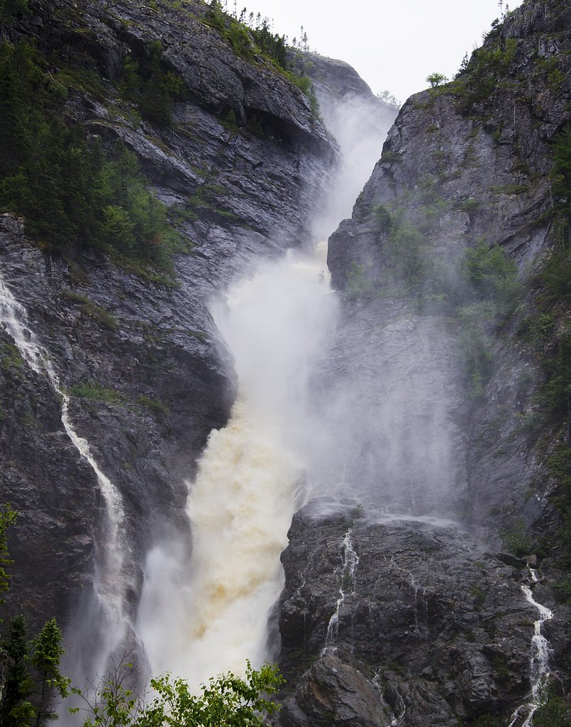
Rattling Brook Falls
By Armen Suny · Last verified Jun 2026
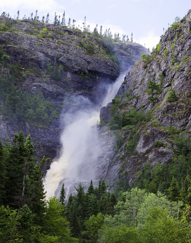
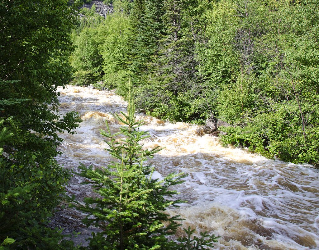
Photo Credits (3)
Difficulty
Easy
Trail Length
0.8 km
About Rattling Brook Falls
Rattling Brook Falls is a small coastal/boreal waterfall located on the Great Northern Peninsula of Newfoundland and Labrador near the town of La Scie (coordinates: 49.6238, -56.18). The falls cascade through mixed spruce and balsam fir forest down toward lower ground; seasonal flow can vary widely (higher in spring melt and after heavy rain). Details such as exact vertical drop and formal developed facilities at the site are not well documented and may be limited. Visitors should expect a relatively natural, possibly informal access point rather than a developed park with infrastructure.
Why This Waterfall Exists
Rattling Brook Falls flows over hard volcanic rock laid down about 444-539 million years ago. These resistant rocks form a durable ledge that water cannot easily wear away, creating the falls where softer material downstream has already eroded.
Trail & Hike Details
Trail Description
Expect a short, informal path from the parking/pullout to a viewing spot. The route may be rocky, uneven, and include tree roots or wet sections. There may not be constructed steps, railings, or designated viewpoints. Trails around small coastal waterfalls in this region often require basic route-finding and caution near slick surfaces.
What to Expect
A natural, rugged setting with spruce/balsam fir forest, moss-covered rocks, and exposed bedrock. Flow is usually strongest in spring and after heavy rain. Views may be limited to a single vantage point above or below the falls depending on access. In summer expect biting insects (blackflies/mosquitoes) at certain times; in winter the falls may form ice features but approach can be hazardous due to ice and snow.
Accessibility
The trail is short and relatively flat, but the surface may be uneven. Contact the managing agency for accessibility details.
Frequently Asked Questions
🐶 Are Dogs Allowed at Rattling Brook Falls?
❌ Dogs are not allowed
Are There Any Fees or Permits Required?
🆖 No fees required
🏊 Is There Swimming at Rattling Brook Falls?
❌ Swimming is not allowed
When to Visit
Late spring to early summer for highest flows and easiest access. Summer and early fall offer best overall hiking/weather conditions. Winter visits can show impressive ice formations but are more hazardous and require winter gear and experience.
Seasonal Access
The best time to visit is Spring, Summer, Fall, and Winter. Check with the managing park or local authority for current conditions.
Safety Information
Hazards include slippery wet rock, steep or unstable edges, cold water, and rapidly changing weather. In winter, ice can be unstable and conceal hazards. Always stay on durable surfaces where present, keep a safe distance from the water and edges, supervise children closely, and avoid risky approaches for photos. Tell someone your plans and expected return time if traveling to remote areas.
Current Water Conditions
Based on a Water Survey of Canada gauge 30.2 km away
0.3 m³/s
Current discharge — how much water is flowing
About average for this time of year
Based on 45 years of record
1.05 m
Water depth at gauge
7-Day Discharge Trend
What does this mean for your visit?
Flow is about average for this time of year.
About This Gauge
This gauge is on a regional waterway. Conditions at the falls may differ, especially after local rain.
7-Day Flow Outlook
Based on the WSC gauge SOUTH WEST BROOK NEAR BAIE VERTE (30 km away).
Today
Moderate
0.3 m³/s
6/10Tomorrow
Moderate
0.3 m³/s
6/10Tue
Moderate
0.3 m³/s
6/10Wed
Moderate
0.3 m³/s
6/10Thu
Moderate
0.3 m³/s
6/10Fri
Moderate
0.3 m³/s
6/10Sat
Moderate
0.3 m³/s
6/10Best window: Today — moderate flow, rain showers (trip score 6/10).
Best time of year: this gauge typically runs highest from early April to early June, peaking in May.
How we calculate this
This is a transparent outlook, not a precise forecast. We take the waterfall's current flow strength (how it ranks against its historical normal for today, from the nearest WSC stream gauge), carry that ranking forward along the gauge's seasonal curve, and nudge it for forecast rain. Confidence is highest for the next day or two and falls further out. Always check official conditions and your own judgment before visiting — high flows can be dangerous.
Know when to go.
Get a free email alert when waterfalls near La Scie hit peak flow. We only send when conditions are worth the trip — no weekly newsletters, no spam.
Weather Forecast
Location & Access
Getting There
General access is from local roads off the main coastal highways serving La Scie and surrounding communities. Use coordinates 49.6238, -56.18 for navigation. Roadside pullouts or small informal parking areas may be used, expect local, possibly unpaved roads near the site. Check weather and local conditions before travel; some approach roads may be rough or seasonally impassable.
Get Directions on Google MapsParking
Parking is likely informal roadside or a small pullout rather than a formal lot. Park well off the roadway, be courteous to local residents, and avoid blocking driveways or narrow roads. During freeze/thaw or heavy rain, surfaces may be soft or muddy.
Elevation
203 metres above sea level
Coordinates
49.623798° N, -56.180037° W
Visitor Tips & Gear
• Wear sturdy, waterproof footwear with good traction. • Use insect repellent in warmer months. • Stay back from the water's edge and avoid climbing on wet rocks. • Park well off the roadway and follow local signage or property boundaries. • There may be no cell service in some areas; bring a map or download offline directions. • Check local weather and road reports before traveling; conditions can change quickly.
Where to Stay
Browse vacation cabins and private rentals nearby
Unique outdoor stays — tents, yurts, and treehouses
Rent a campervan or RV for your waterfall road trip
Some links are affiliate links. We may earn a commission at no extra cost to you.
Nearby Campground
Kona Beach
25.5 km away
Additional Information
Nearby Attractions
Coastal scenery and small fishing communities around La Scie; additional walks and viewpoints along the Great Northern Peninsula. Local towns may offer cultural and historical sites related to Newfoundland fishing communities.
Wildlife
Typical Newfoundland wildlife may be present: seabirds, small mammals, and occasionally moose in coastal forested areas. Expect insects such as blackflies and mosquitoes in warmer months.
Cities near Rattling Brook Falls
Writing about Rattling Brook Falls? Embed this waterfall on your site for free.