Quarry Lake Fall
Nova Scotia • Terence Bay Wilderness Area • 8 m
By Armen Suny · Last verified Oct 2026
About Quarry Lake Fall
Quarry Lake Fall is a small waterfall at Quarry Lake in the Terence Bay Wilderness Area, a 4,551-hectare provincial protected area southwest of Halifax. The province says the wilderness area has no managed trails; it is used for hiking, canoeing, angling and hunting, and portages link Quarry Lake to the coast. Expect to find your own way over rough, wet ground.
The Setting
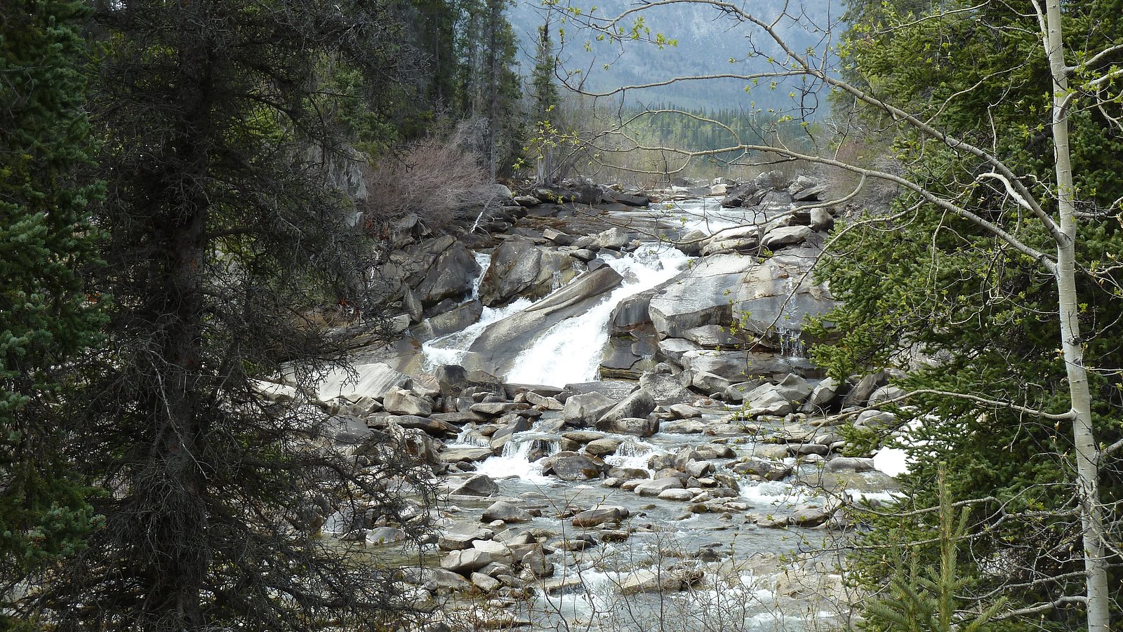
Quarry Lake Fall sits at 20 metres within Terence Bay Wilderness Area, in the coastal lowlands of Nova Scotia. The falls drop 8 metres.
Height: 25 feet
Trail & Hike Details
Trail Description
There is no managed trail to the falls. The province says parts of the Terence Bay Wilderness Area can be hiked but managed trails do not exist, so reaching the falls means following informal paths or travelling off-trail over wet, rocky, uneven ground.
What to Expect
The falls drop a gentle 8 metres.
Accessibility
Site is likely not wheelchair accessible. Terrain includes uneven, rocky, and potentially steep surfaces with no formalized accessible infrastructure.
Frequently Asked Questions
🐶 Are Dogs Allowed at Quarry Lake Fall?
❌ Dogs are not allowed
Are There Any Fees or Permits Required?
🆖 No fees required
🏊 Is There Swimming at Quarry Lake Fall?
❌ Swimming is not allowed
When to Visit
Spring for usually stronger flows and greener surroundings; early fall for foliage. Summer provides warmer weather but flow may be reduced. Winter can offer dramatic frozen scenery but brings icy, hazardous conditions, only for well-prepared visitors.
Seasonal Access
The best time to visit is Spring, Summer, Fall, and Winter. Check with Terence Bay Wilderness Area for current conditions.
Safety Information
Primary hazards: slippery rock, unstable edges and loose rock, seasonal high flows, sudden drop-offs into deep or cold water, and potential lack of cell coverage. There may be no lifeguards or emergency infrastructure. Do not attempt cliff jumping. Check weather and water conditions before visiting and tell someone your plans. If visiting in winter, expect ice and bring traction aids.
Current Water Conditions
These readings come from the Water Survey of Canada gauge on Sackville River, 27.7 km away, not on Quarry Lake Fall's own stream. Use them as a sign of whether the area is running wet or dry.
3.7 m³/s
Current discharge — how much water is flowing
About average for this time of year
Based on 57 years of record
0.88 m
Water depth at gauge
7-Day Discharge Trend
What does this mean for your visit?
Flow is about average for this time of year.
About This Gauge
This gauge is on a regional waterway. Conditions at the falls may differ, especially after local rain.
7-Day Flow Outlook
Based on the WSC gauge SACKVILLE RIVER AT BEDFORD (28 km away).
Today
Moderate
3.9 m³/s
6/10Tomorrow
Moderate
3.9 m³/s
6/10Sat
Moderate
3.6 m³/s
8/10Sun
Moderate
3.1 m³/s
8/10Mon
Moderate
3.1 m³/s
6/10Tue
Moderate
3.3 m³/s
6/10Wed
Moderate
2.9 m³/s
8/10Best window: Sat — moderate flow, cloudy (trip score 8/10).
Best time of year: this gauge typically runs highest from mid March to early May, peaking in April.
How we calculate this
This is a transparent outlook, not a precise forecast. We take the waterfall's current flow strength (how it ranks against its historical normal for today, from the nearest WSC stream gauge), carry that ranking forward along the gauge's seasonal curve, and nudge it for forecast rain. Confidence is highest for the next day or two and falls further out. Always check official conditions and your own judgment before visiting — high flows can be dangerous.
Know when to go.
Get a free email alert when waterfalls near Halifax hit peak flow. We only send when conditions are worth the trip — no weekly newsletters, no spam.
Weather Forecast
Location & Access
Getting There
The falls are at Quarry Lake in the Terence Bay Wilderness Area, about 13 miles southwest of downtown Halifax (coordinates 44.4861, -63.7181). No official trailhead or route is published, so plan your approach with a topographic map and GPS.
Get Directions on Google MapsParking
No official parking area or trailhead for the falls is published. Do not block roads or driveways at the edge of the wilderness area.
Elevation
20 metres above sea level
Coordinates
44.486069° N, -63.718143° W
Land Management
Managed by Nova Scotia Environment and Climate Change
Visitor Tips & Gear
Carry a map and GPS, since there are no managed or signed trails. Wear waterproof footwear with good traction, stay back from slippery rock at the falls, and pack out all trash.
Where to Stay
Browse vacation cabins and private rentals nearby
Unique outdoor stays — tents, yurts, and treehouses
Rent a campervan or RV for your waterfall road trip
Some links are affiliate links. We may earn a commission at no extra cost to you.
Nearby Campground
Bayside Camp and Retreat Centre
10.8 km away
Additional Information
Nearby Attractions
The Terence Bay Wilderness Area lies in the natural corridor between Spryfield and the Atlantic coast, alongside Long Lake Provincial Park. Downtown Halifax is about 13 miles to the northeast.
Wildlife
Expect typical Nova Scotia wildlife near freshwater and forest edges: songbirds, waterfowl, small mammals (squirrels, rabbits), deer, and possibly fox or beaver. Take care with food and garbage to avoid attracting wildlife.
Cities near Quarry Lake Fall
Nearby Waterfalls

Writing about Quarry Lake Fall? Embed this waterfall on your site for free.