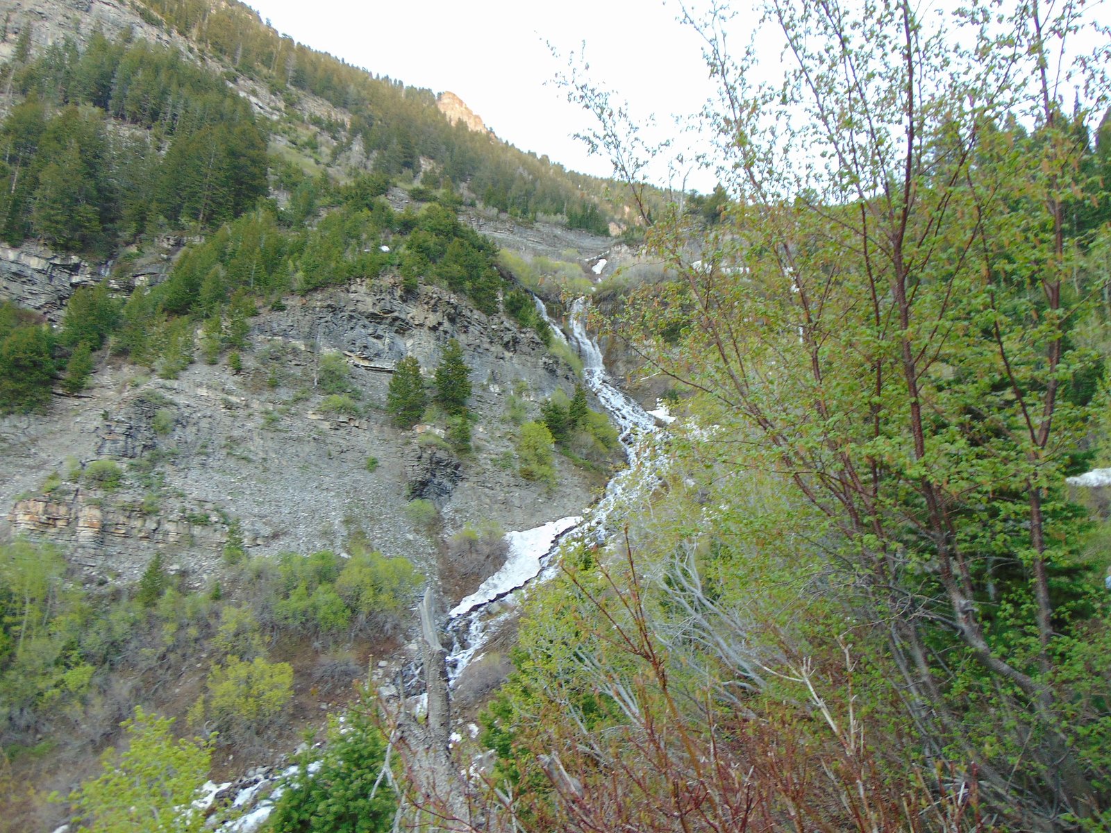
North Eller Falls
Ontario • Short Hills Provincial Park
By Armen Suny · Last verified Jun 2026
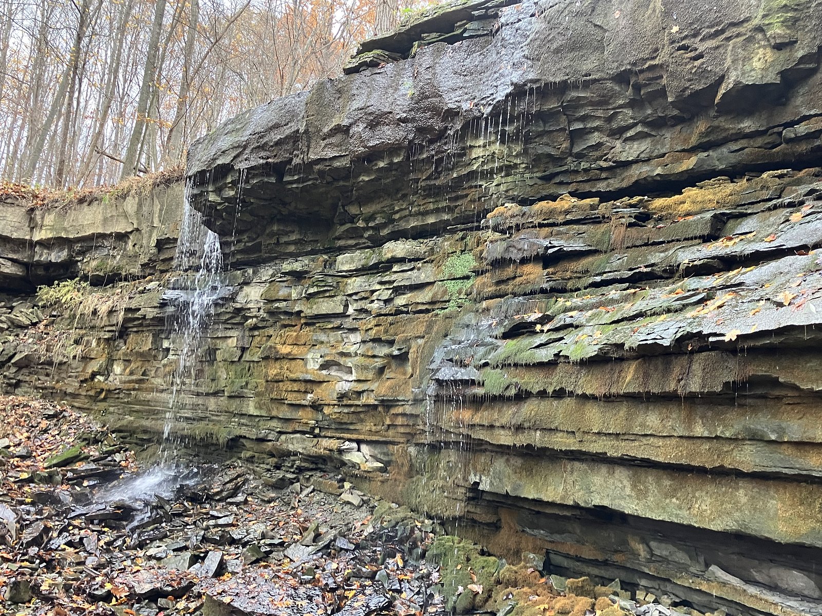
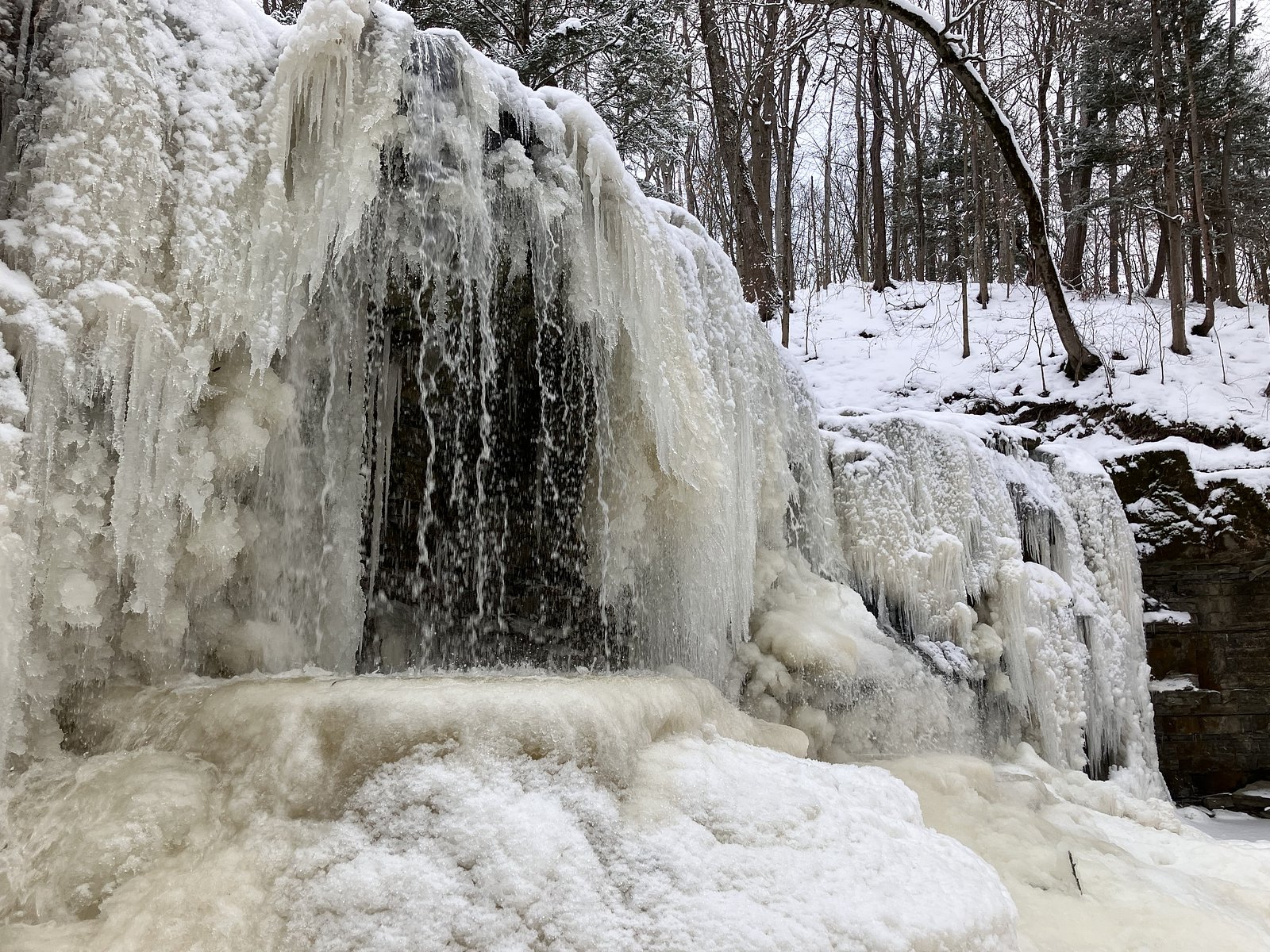
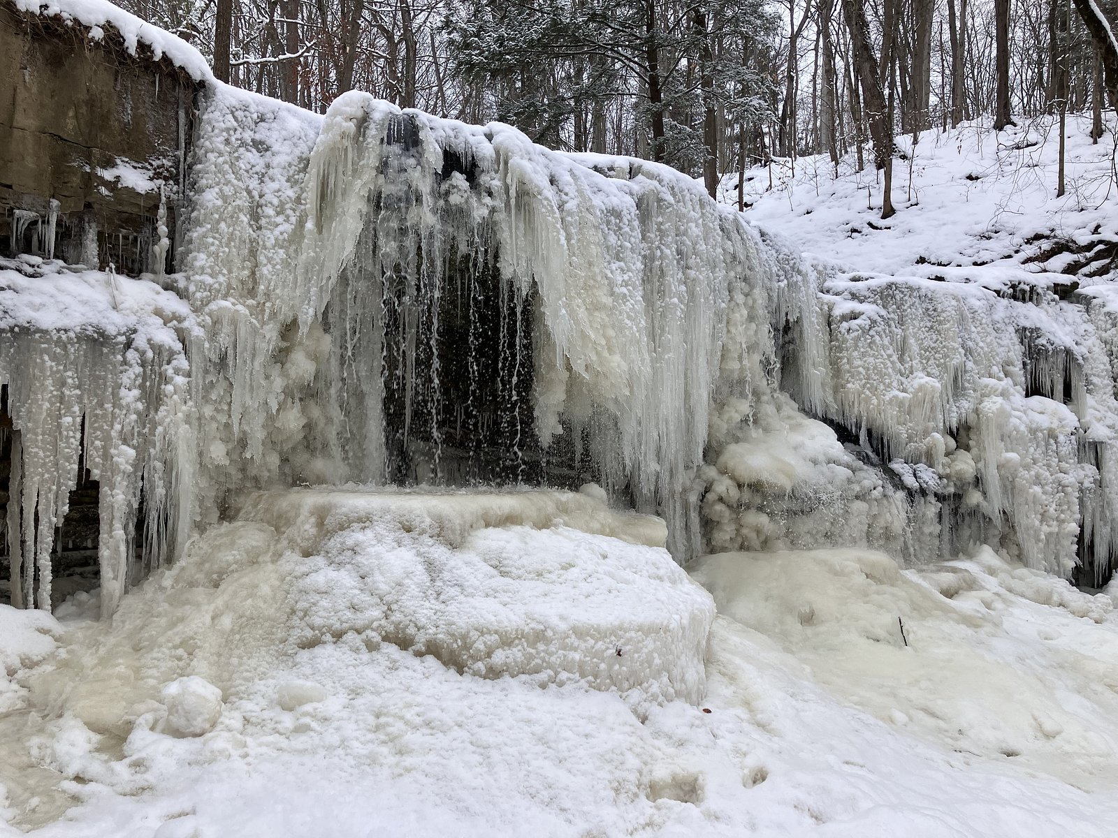
Photo Credits (4)
Difficulty
Moderate
Trail Length
4.0 km
Trail Type
Out And Back
Elevation Gain
61 m
About North Eller Falls
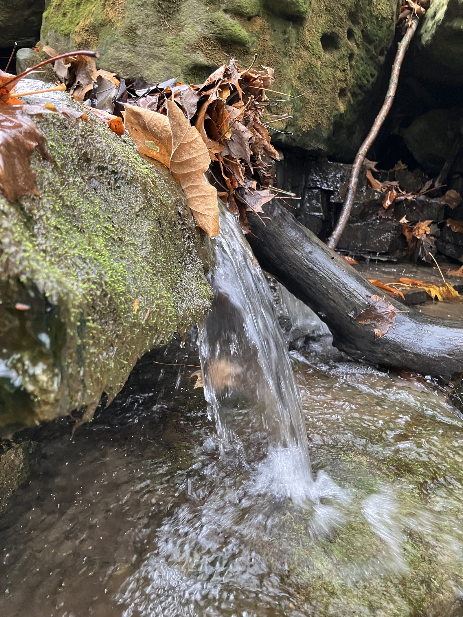
North Eller Falls is a smaller, lesser-known cascade in the Niagara region (coordinates 43.093, -79.282). It appears to be a woodland stream waterfall rather than a large vertical drop like nearby Niagara Falls. Flow is likely seasonal and highest in spring or after heavy rain. Public information about this specific feature is limited; visitors should treat descriptions as approximate and verify local access rules before visiting.
The Setting
North Eller Falls sits at 140 metres within Short Hills Provincial Park, in the coastal lowlands of Ontario.
Nearby Falls Worth Visiting
Swayze Falls (14 m) lies 1.6 kilometres to the west. Also nearby: Terrace Falls (6 m, 0.3 km) and Scout Falls (6 m, 1.1 km).
Trail & Hike Details
The Approach
The moderate 4.0-km out-and-back trail gains 61 metres of elevation on the way to the falls.
Trail Description
There is no widely-available, reliable trail description for North Eller Falls. Reports for similar small regional waterfalls indicate access is often via short, possibly unmarked footpaths through mixed forest, with uneven or slippery terrain near the stream. Expect a potentially short approach but with unmaintained or informal walking routes and possible short scrambles to water level.
What to Expect
A modest stream cascade in a wooded setting rather than a large tourist waterfall. Flow may vary seasonally (higher in spring, lower in late summer/drought). Terrain near the falls may include rocky streambanks, leaf litter, roots, and steep banks. Limited or no facilities (no restrooms, benches, or official viewpoints) are expected.
Accessibility
The trail is not wheelchair accessible. Uneven terrain and elevation changes require steady footing.
Frequently Asked Questions
🐶 Are Dogs Allowed at North Eller Falls?
❌ Dogs are not allowed
Are There Any Fees or Permits Required?
🆖 No fees required
🏊 Is There Swimming at North Eller Falls?
❌ Swimming is not allowed
When to Visit
Spring is typically best for higher flow and fuller cascades. Early summer can be pleasant for warmer weather, and fall offers foliage colors. Winter may produce ice formations but can be hazardous due to ice, hidden thin crusts, and extremely slippery conditions, only visit in winter if experienced and properly equipped.
Seasonal Access
The best time to visit is Spring, Summer, Fall, and Winter. Check with Short Hills Provincial Park for current conditions.
Safety Information
Hazards may include: slippery rocks and banks, steep or unstable edges, fast or cold water after rain, hidden drop-offs, poison ivy, ticks, and limited or no cell reception. Do not attempt to climb wet or icy rock faces; stay a safe distance from the lip and never underestimate water current. If access is across private land, respect property boundaries and posted signage to avoid confrontations or hazards. Always tell someone your plans and expected return time.
Current Water Conditions
0.3 m³/s
Current discharge — how much water is flowing
About average for this time of year
Based on 20 years of record
5.06 m
Water depth at gauge
7-Day Discharge Trend
What does this mean for your visit?
Flow is about average for this time of year.
About This Gauge
7-Day Flow Outlook
Based on the WSC gauge TWELVE MILE CREEK NEAR POWER GLEN (3 km away).
Today
Moderate
0.2 m³/s
8/10Tomorrow
Moderate
0.2 m³/s
8/10Tue
Moderate
0.3 m³/s
6/10Wed
Strong
0.3 m³/s
8/10Thu
Moderate
0.2 m³/s
8/10Fri
Moderate
0.2 m³/s
8/10Sat
Moderate
0.3 m³/s
6/10Best window: Today — moderate flow, cloudy (trip score 8/10).
Best time of year: this gauge typically runs highest from late February to mid April, peaking in April.
How we calculate this
This is a transparent outlook, not a precise forecast. We take the waterfall's current flow strength (how it ranks against its historical normal for today, from the nearest WSC stream gauge), carry that ranking forward along the gauge's seasonal curve, and nudge it for forecast rain. Confidence is highest for the next day or two and falls further out. Always check official conditions and your own judgment before visiting — high flows can be dangerous.
Know when to go.
Get a free email alert when waterfalls near Hamilton hit peak flow. We only send when conditions are worth the trip — no weekly newsletters, no spam.
Weather Forecast
Location & Access
Getting There
General location: 43.093, -79.282 in the Niagara Region of Ontario, roughly 11–18 miles from notable landmarks such as Niagara Falls (11.4 mi) and Youngstown (17.7 mi). Access typically requires driving on local roads off the QEW or regional routes; exact trailhead or signed access points are not well documented. Confirm parking and access with local municipality or landowner if possible.
Get Directions on Google MapsParking
No confirmed formal parking lot is documented for this site. Parking may be roadside and informal; expect limited space. Do not block driveways or impede traffic. If you cannot confirm public parking, consider parking in a legal, designated area and walking in or canceling the visit.
Elevation
140 metres above sea level
Coordinates
43.092957° N, -79.282016° W
Land Management
Managed by Ontario Parks
Visitor Tips & Gear
1) Confirm land ownership and access before visiting; some smaller falls in the region are on private property or have restricted access. 2) Wear sturdy, slip-resistant footwear; rocks and banks are often wet and slippery. 3) Bring a map or offline GPS and note the coordinates (43.093, -79.282). 4) Avoid getting too close to edges and unstable banks; rope or barriers are unlikely. 5) Respect posted signs and local rules; pack out all trash. 6) Cellular reception may be limited in wooded or ravine areas.
As an Amazon Associate, we earn from qualifying purchases.
With 4.0 km and 61 m of elevation gain, sturdy boots and trekking poles will help on this moderate trail. Icy conditions are common in winter — traction cleats are a smart addition.

Columbia Watertight II Rain Jacket
Packs into its own pocket, seam-sealed, and keeps you dry from spray and surprise rain.

Polarized Sunglasses (Knockaround)
Cuts glare off the water so you actually see the falls — and your photos turn out better too.

Earth Pak Waterproof Dry Bag
Keeps your phone and gear dry when waterfall mist soaks everything else.

Waterproof Phone Pouch (AiRunTech)
Cheap insurance — take photos right next to the falls without killing your phone.

Timberland Euro Sprint Mid Waterproof
Trusted waterproof boot with premium leather and grippy rubber sole — reliable on rocky, wet trails.

TrailBuddy Trekking Poles
Lightweight aluminum, cork grips, and flip-locks that actually hold — a best-seller for good reason.
Where to Stay
Browse vacation cabins and private rentals nearby
Unique outdoor stays — tents, yurts, and treehouses
Rent a campervan or RV for your waterfall road trip
Some links are affiliate links. We may earn a commission at no extra cost to you.
Nearby Campground
Shangri-La Family Campground
7.2 km away
Additional Information
Nearby Attractions
Niagara Falls (~11.4 miles), Niagara University (~12.6 miles), Youngstown / Old Fort Niagara area (~17–18 miles), Niagara-on-the-Lake and Niagara Parkway attractions are within driving range. Exact distances are approximate based on the provided coordinates.
Wildlife
Typical Niagara-region wildlife may be present: white-tailed deer, raccoons, squirrels, various songbirds, waterfowl near larger water bodies, and ticks. Be aware of ticks in warm months and take precautions.
Cities near North Eller Falls
Nearby Waterfalls

Writing about North Eller Falls? Embed this waterfall on your site for free.