Nicoamen Falls
By Armen Suny · Last verified Jun 2026
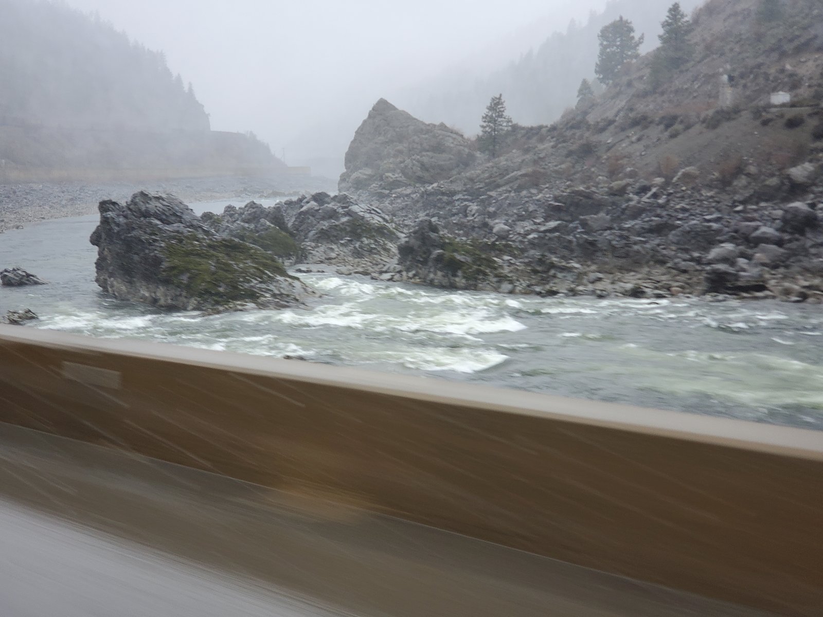
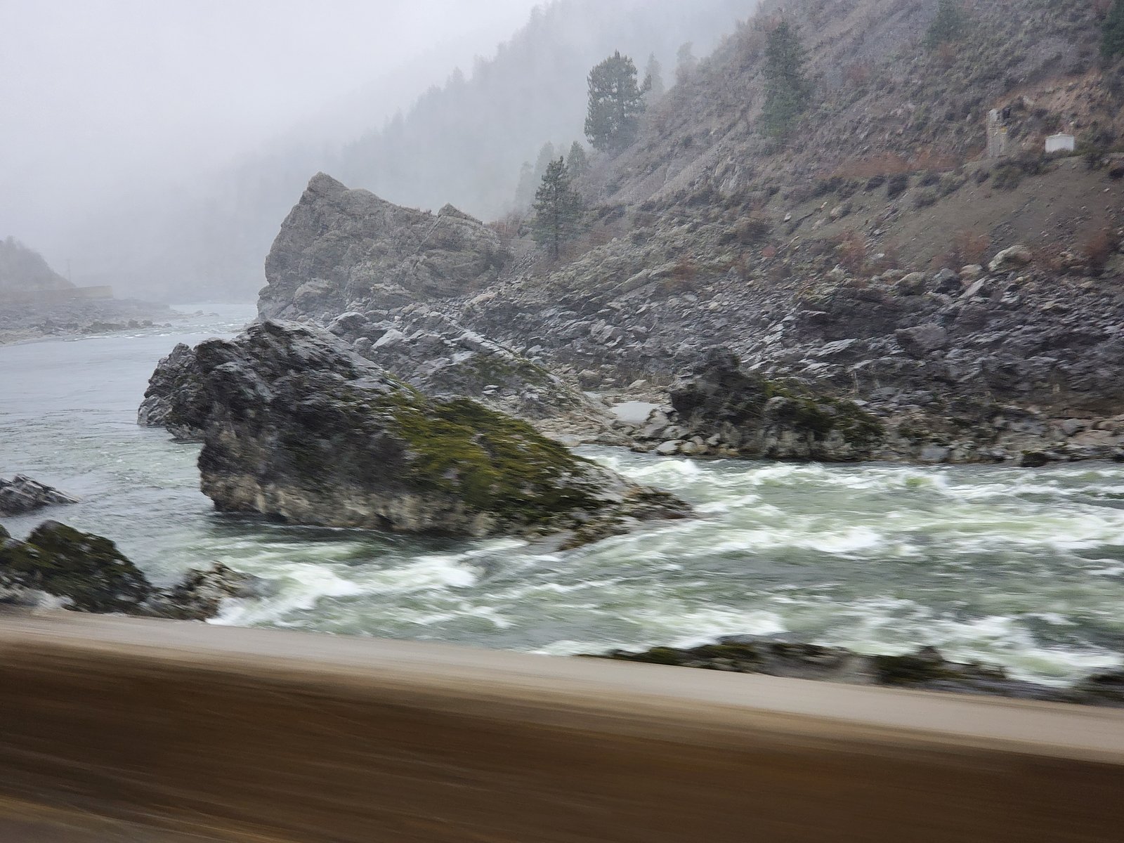
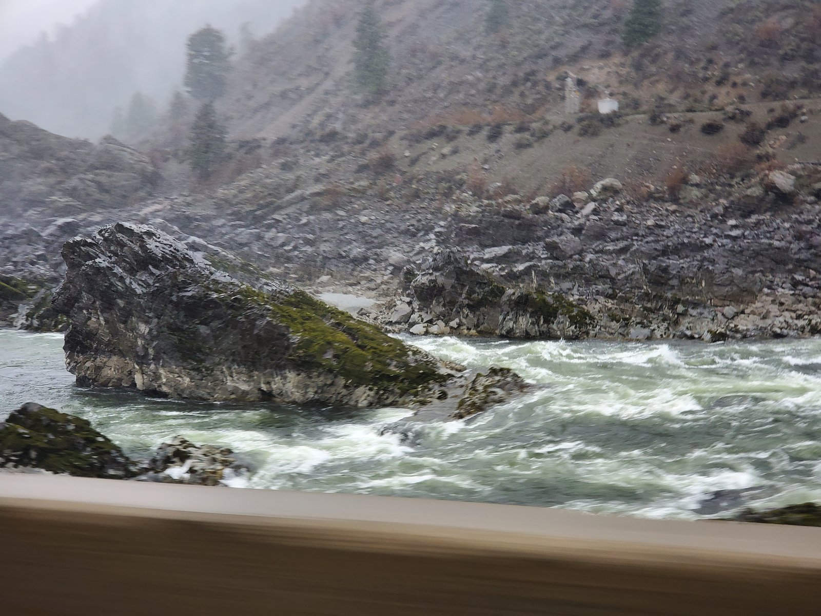
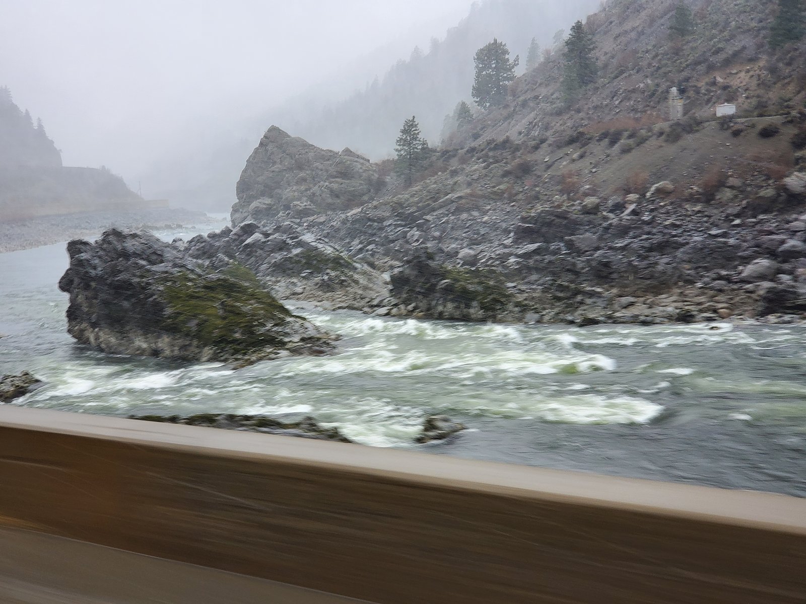
Photo Credits (5)
Difficulty
Drive Up
Trail Length
0.2 km
Trail Type
Out And Back
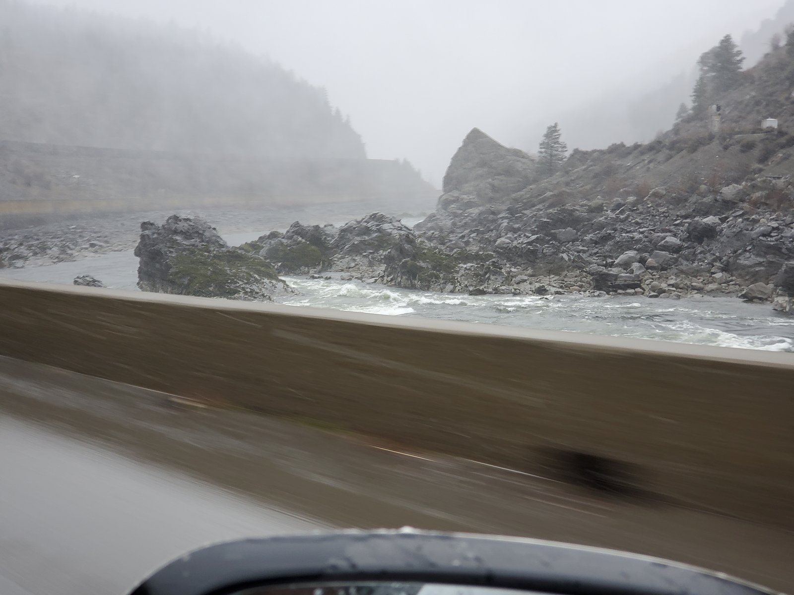
About Nicoamen Falls
Nicoamen Falls is a remote waterfall on the Nicoamen River in south-central British Columbia, located in a steep, narrow canyon south of Lillooet. The falls are best known for a scenic, rugged setting with variable flow (high in spring from snowmelt and lower by late summer). Access is informal and typically involves driving on unpaved forest or logging roads followed by a short hike and potentially a steep scramble to a viewpoint. Exact onsite facilities are minimal or non-existent.
Why This Waterfall Exists
Nicoamen Falls flows over loose river sediment, primarily alluvium, laid down about 3 million years ago. These soft rocks erode readily, allowing the stream to carve a vertical drop into the landscape.
Trail & Hike Details
The Approach
No hiking required. Nicoamen Falls is accessible by vehicle with a roadside viewing area.
Trail Description
There is no widely documented maintained trail to Nicoamen Falls. Visitors report approaches via rough forest-service roads followed by an unmaintained footpath or short cross-country scramble to viewpoint areas. Trails, where present, may be steep and exposed near the canyon rim. Route-finding skills are often required. Because of the variable and informal access, exact trail distance and elevation gain are not well documented.
What to Expect
Expect a remote, rugged canyon setting with limited or no infrastructure (no restrooms, signage, or barriers). Spring snowmelt produces the most impressive flows; by late summer the stream may be significantly lower. Views are often from the canyon rim or from an uneven, rocky approach; getting to the base of the falls may be difficult or unsafe due to steep cliffs and unstable talus. Wildlife typical of interior BC (bears, cougars, ungulates, and birds of prey) may be present. Limited or no cell service in the area.
Accessibility
This waterfall is viewable from a vehicle-accessible area. No hiking is required.
Frequently Asked Questions
🐶 Are Dogs Allowed at Nicoamen Falls?
❌ Dogs are not allowed
Are There Any Fees or Permits Required?
🆖 No fees required
🏊 Is There Swimming at Nicoamen Falls?
❌ Swimming is not allowed
When to Visit
Late spring to early summer (snowmelt) for the most impressive flow and full waterfalls. Mid-to-late summer can offer easier road access but lower flows. Fall can provide quieter visits and scenic color but expect lower water levels and potentially wet or muddy roads. Winter visits are generally not recommended unless experienced with winter backcountry travel, roads may be impassable and conditions hazardous.
Seasonal Access
The best time to visit is Spring, Summer, and Fall. Winter access may be limited. Check with the managing park or local authority for current conditions.
Safety Information
Hazards include steep cliffs, loose rock, slippery surfaces (especially when wet), cold swift water, limited or no cell coverage, and difficult road conditions. Flashy stream flow during spring snowmelt can create strong currents and undercut banks. Travel with a companion when possible, inform someone of your route and return time, carry a map/compass or GPS, and be prepared for rapid weather changes. If you encounter wildlife, follow provincial guidance for safe wildlife interaction.
Current Water Conditions
1,070.0 m³/s
Current discharge — how much water is flowing
Much lower than usual for this time of year
Based on 73 years of record
3.62 m
Water depth at gauge
7-Day Discharge Trend
What does this mean for your visit?
Flow is well below normal for this time of year, so the waterfall may be a trickle.
About This Gauge
This gauge is on a nearby waterway and may not reflect exact conditions at the falls.
7-Day Flow Outlook
Based on the WSC gauge THOMPSON RIVER NEAR SPENCES BRIDGE (10 km away).
Today
Barely Flowing
1070 m³/s
4/10Tomorrow
Barely Flowing
1042 m³/s
4/10Tue
Barely Flowing
1035 m³/s
4/10Wed
Barely Flowing
1013 m³/s
4/10Thu
Barely Flowing
999 m³/s
4/10Fri
Barely Flowing
971 m³/s
4/10Sat
Barely Flowing
964 m³/s
4/10Best window: Today — barely flowing flow, partly cloudy (trip score 4/10).
Best time of year: this gauge typically runs highest from early May to early August, peaking in June.
How we calculate this
This is a transparent outlook, not a precise forecast. We take the waterfall's current flow strength (how it ranks against its historical normal for today, from the nearest WSC stream gauge), carry that ranking forward along the gauge's seasonal curve, and nudge it for forecast rain. Confidence is highest for the next day or two and falls further out. Always check official conditions and your own judgment before visiting — high flows can be dangerous.
Know when to go.
Get a free email alert when waterfalls near Lillooet hit peak flow. We only send when conditions are worth the trip — no weekly newsletters, no spam.
Weather Forecast
Location & Access
Getting There
Coordinates: 50.268, -121.3926. The falls lie in a remote area south of Lillooet (approx. 43.2 miles by road) and west/northwest of Kamloops (approx. 64.3 miles). Approaches usually start from the Lillooet region via regional or forestry roads; these roads can be rough and may require a high-clearance or 4x4 vehicle. From the nearest paved highway, expect unmarked spur roads and limited signage. A GPS with the coordinates or a detailed regional map is strongly recommended. Cell coverage may be limited.
Get Directions on Google MapsParking
No formal parking lot or facilities. Parking is typically informal at a pullout on a forestry or logging road near the trailhead; vehicles should be parked clear of the road. Overnight parking or camping at the immediate site is unlikely to be permitted or safe, use established campgrounds in the region instead.
Elevation
384 metres above sea level
Coordinates
50.267966° N, -121.392563° W
Visitor Tips & Gear
• Use a reliable map or GPS and download offline maps; coordinates are 50.268, -121.3926. • Travel on forestry roads with a high-clearance vehicle; some roads may be seasonally closed or in poor condition. • Wear sturdy footwear and be prepared for steep, loose terrain if approaching the canyon rim. • Check local park/forest service notices and recent trip reports for road conditions. • Tell someone your plan and expected return time; cell coverage may be unreliable. • Do not approach cliff edges; rocks can be slippery and unstable. • Pack out all trash and follow Leave No Trace principles.
Where to Stay
Browse vacation cabins and private rentals nearby
Unique outdoor stays — tents, yurts, and treehouses
Rent a campervan or RV for your waterfall road trip
Some links are affiliate links. We may earn a commission at no extra cost to you.
Nearby Campground
Skihist Campground
8.6 km away
Additional Information
Nearby Attractions
Nearest service towns: Lillooet (closest) and Kamloops (regional hub). The broader region offers lakes, hiking, and scenic drives typical of interior British Columbia. Check local visitor information in Lillooet for recommended trails, campgrounds, and road conditions.
Wildlife
Interior BC wildlife may include black bears, cougars, deer, elk, small mammals, and raptors. Be bear-aware and store food properly. Mountain goats or bighorn sheep may occur in rocky areas.
Cities near Nicoamen Falls
Writing about Nicoamen Falls? Embed this waterfall on your site for free.