Myles Doyle Falls
By Armen Suny · Last verified Jun 2026
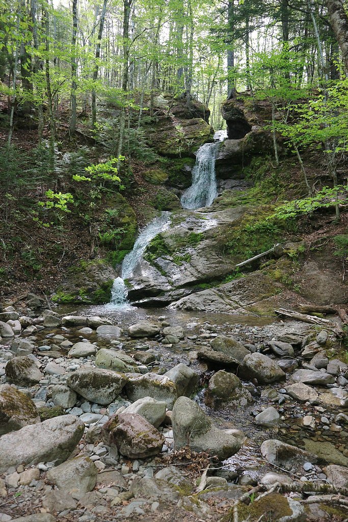
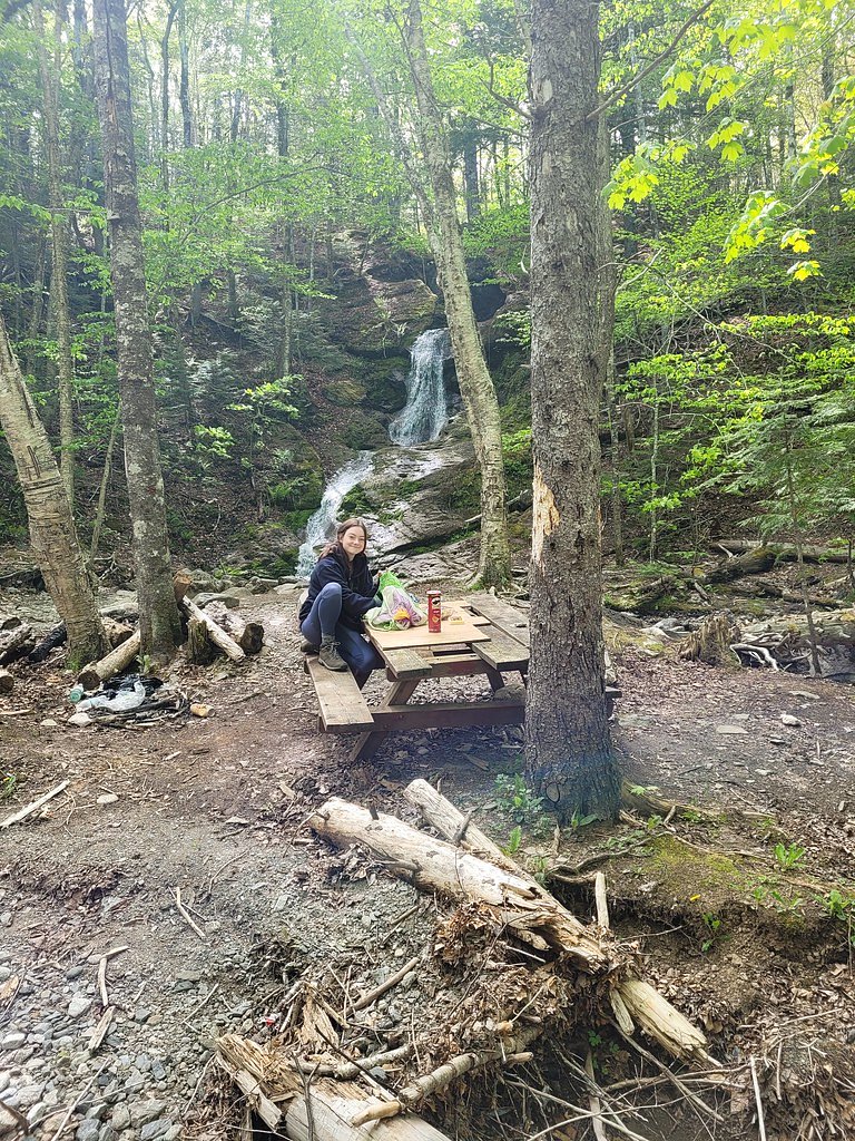
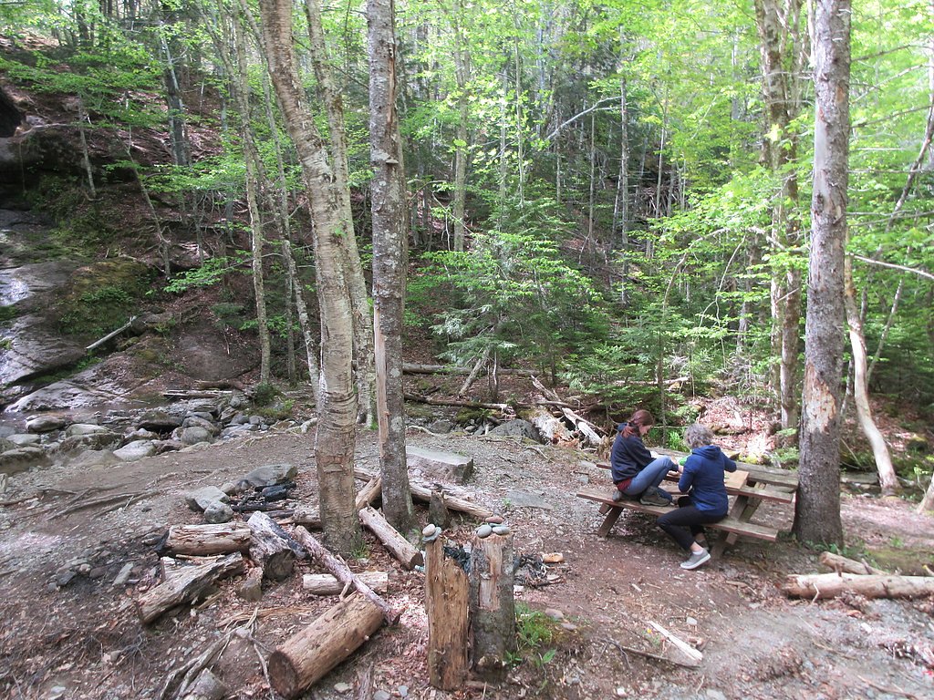
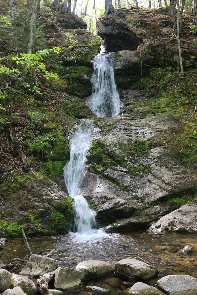
Photo Credits (5)
Difficulty
Drive Up
Trail Length
0.2 km
Trail Type
Out And Back
About Myles Doyle Falls
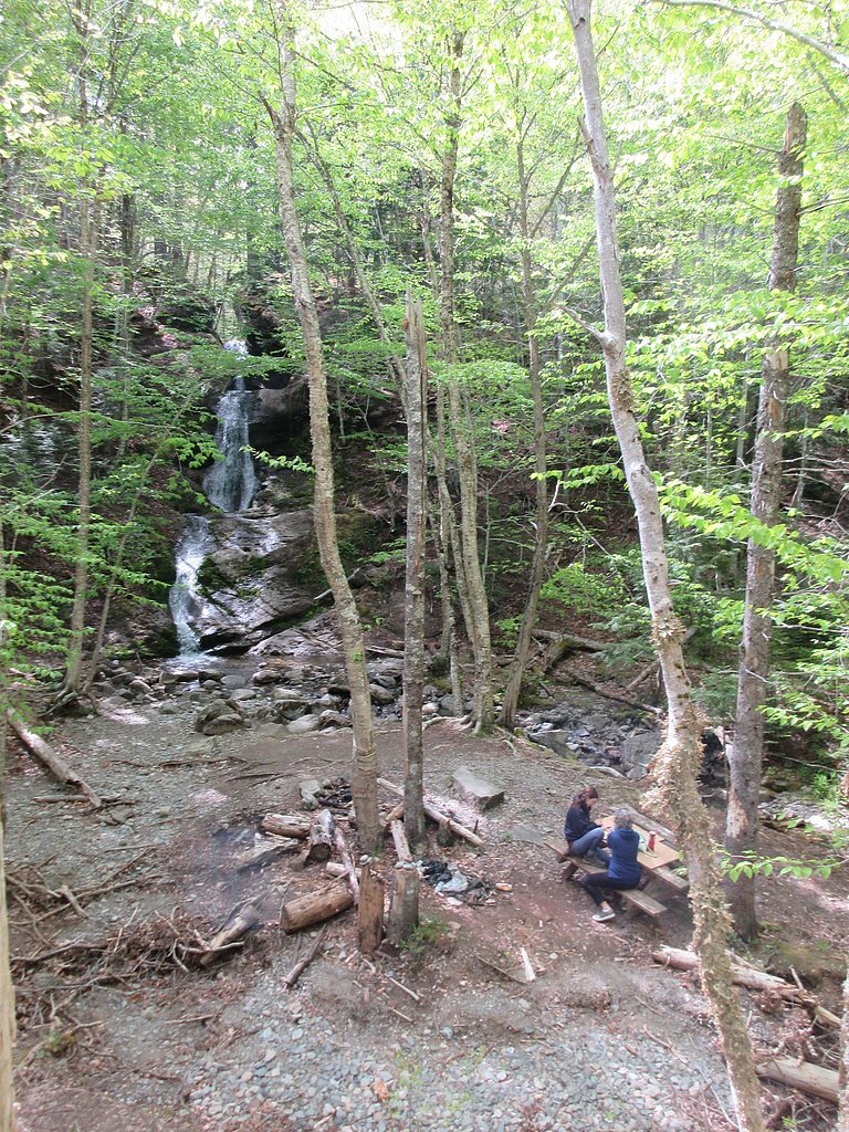
Myles Doyle Falls is a small, rural waterfall in northeastern Nova Scotia (coordinates 45.8652, -61.2726). It sits on a forested stream and is reachable from local secondary roads; the falls are primarily of interest to local hikers and waterfall enthusiasts rather than large numbers of tourists. Specific published details (official trail length, exact vertical drop, and formal facilities) are limited in publicly available sources, so some information below is conservative and may vary with water flow and seasonal conditions.
Nearby Falls Worth Visiting
Kewstoke Brook Falls (20 m) lies 12.1 kilometres to the north.
Trail & Hike Details
The Approach
No hiking required. Myles Doyle Falls is accessible by vehicle with a roadside viewing area.
Trail Description
There is limited official trail documentation for Myles Doyle Falls. The approach is likely a short walk from a roadside pullout through mixed forest and uneven terrain with roots, rocks and wet ground near the stream. Trails (if present) may be narrow and unimproved. Expect slippery surfaces close to the water and potentially steep banks at the falls. There may be little to no signage or built infrastructure (steps, handrails).
What to Expect
Rural forest setting, a modest waterfall on a small stream, seasonal variation in flow (higher in spring and after heavy rain, lower in late summer/drought). No guaranteed visitor facilities (toilets, trash cans, picnic tables). Terrain near the falls can be wet and slippery; cell coverage may be spotty. Insects (black flies, mosquitoes) can be abundant in spring and early summer. Wildlife such as deer and a variety of birds are likely present; black bears are possible in Nova Scotia, exercise usual wildlife precautions.
Accessibility
This waterfall is viewable from a vehicle-accessible area. No hiking is required.
Frequently Asked Questions
🐶 Are Dogs Allowed at Myles Doyle Falls?
❌ Dogs are not allowed
Are There Any Fees or Permits Required?
🆖 No fees required
🏊 Is There Swimming at Myles Doyle Falls?
❌ Swimming is not allowed
When to Visit
Spring (snowmelt and spring rains) typically yields the highest flows and best waterfall photos. Late spring through early fall offers milder weather for hiking; early fall can provide good foliage. Winter can produce ice formations but access and safety may be poor, only attempt with winter skills/equipment.
Seasonal Access
The best time to visit is Spring, Summer, Fall, and Winter. Check with the managing park or local authority for current conditions.
Safety Information
Primary hazards: slippery and unstable rocks near the water, steep or eroded banks, variable water flow after rain, limited or no safety infrastructure (rails/signage), spotty cell coverage, ticks and biting insects in warmer months, and potential wildlife encounters. Do not approach cliff edges or stand directly under overhangs. If visiting in winter, watch for ice and hypothermia risk. Always tell someone your plans and expected return time.
Current Water Conditions
0.0 m³/s
Current discharge — how much water is flowing
Much lower than usual for this time of year
Based on 19 years of record
1.69 m
Water depth at gauge
7-Day Discharge Trend
What does this mean for your visit?
Flow is well below normal for this time of year, so the waterfall may be a trickle.
About This Gauge
7-Day Flow Outlook
Based on the WSC gauge RIVER DENYS AT BIG MARSH (6 km away).
Today
Low
0.0 m³/s
3/10Tomorrow
Barely Flowing
0.0 m³/s
5/10Tue
Barely Flowing
0.0 m³/s
4/10Wed
Low
0.1 m³/s
3/10Thu
Low
0.0 m³/s
3/10Fri
Low
0.1 m³/s
4/10Sat
Low
0.0 m³/s
4/10Best window: Tomorrow — barely flowing flow, sunny (trip score 5/10).
Best time of year: this gauge typically runs highest from mid November to mid December, peaking in April.
How we calculate this
This is a transparent outlook, not a precise forecast. We take the waterfall's current flow strength (how it ranks against its historical normal for today, from the nearest WSC stream gauge), carry that ranking forward along the gauge's seasonal curve, and nudge it for forecast rain. Confidence is highest for the next day or two and falls further out. Always check official conditions and your own judgment before visiting — high flows can be dangerous.
Know when to go.
Get a free email alert when waterfalls near Baddeck hit peak flow. We only send when conditions are worth the trip — no weekly newsletters, no spam.
Weather Forecast
Location & Access
Getting There
The falls are located at 45.8652, -61.2726 in a rural area of Nova Scotia. They are approximately 33.6 miles from Baddeck and 41.5 miles from Antigonish by road. Expect to travel on secondary and local gravel or paved roads; final approach is likely on a minor road or forest access road. There may be limited signage. Use the provided coordinates and a reliable GPS or mapping app. Check for private property boundaries before parking or walking onto undeveloped land.
Get Directions on Google MapsParking
Parking is likely informal, a small pullout or roadside shoulder. There are probably no formal parking lots, nor toilet facilities. Space may be limited; park fully off the travel lane and avoid blocking driveways or gates.
Elevation
105 metres above sea level
Coordinates
45.865157° N, -61.272607° W
Visitor Tips & Gear
• Use the provided coordinates and a reliable map app; approach via well-maintained roads where possible. • Wear sturdy, waterproof footwear with good traction; expect muddy, rocky and uneven ground. • Watch for slippery rocks and avoid getting too close to edges or under unstable overhangs. • Bring insect repellent in spring and summer; dress in layers and have a wind/rain jacket. • Park fully off the roadway and respect private property, obtain permission if crossing private land. • Leave no trace: pack out all trash and avoid disturbing vegetation or stream banks. • If visiting in winter, be prepared for icy conditions and limited access; use caution around frozen falls which can be hazardous.
Where to Stay
Browse vacation cabins and private rentals nearby
Unique outdoor stays — tents, yurts, and treehouses
Rent a campervan or RV for your waterfall road trip
Some links are affiliate links. We may earn a commission at no extra cost to you.
Nearby Campground
Whycocomagh Campground
17.4 km away
Additional Information
Nearby Attractions
Nearest service towns are Baddeck (approx. 33.6 miles) and Antigonish (approx. 41.5 miles). The broader region includes Bras d'Or Lake and other coastal and inland scenic areas. For established visitor services, accommodations and attractions, use Baddeck or Antigonish as bases.
Wildlife
Typical Nova Scotia wildlife: deer, small mammals, a variety of songbirds and waterfowl. Black bears are present in parts of Nova Scotia, be bear-aware. Insects (black flies, mosquitoes) can be numerous in spring/early summer.
Cities near Myles Doyle Falls
Nearby Waterfalls
Writing about Myles Doyle Falls? Embed this waterfall on your site for free.