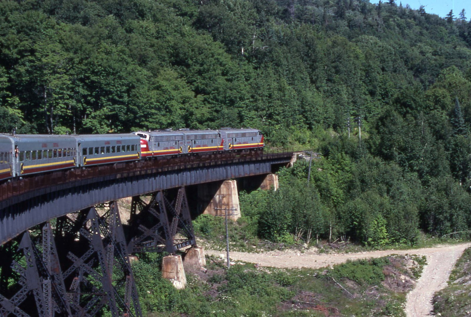
Montreal Falls
By Armen Suny · Last verified Jun 2026
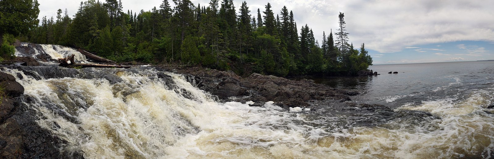
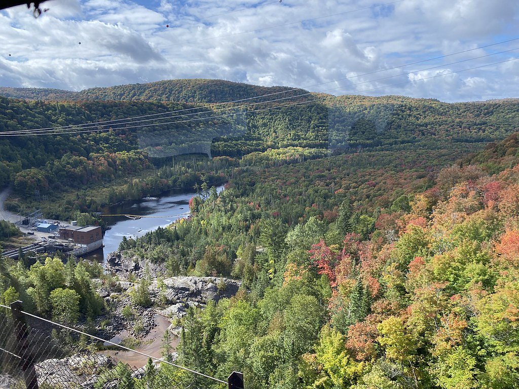
Photo Credits (5)
Difficulty
Easy
Trail Length
1.9 km
Trail Type
Out And Back
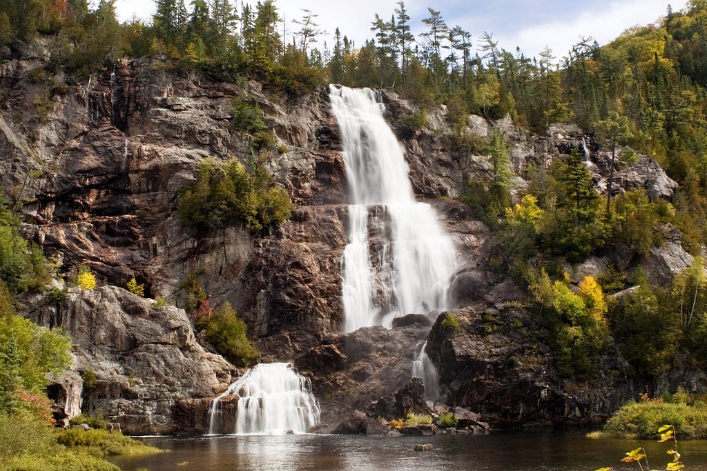
About Montreal Falls
Montreal Falls is a remote waterfall on the Montreal River in northeastern Ontario, located near the coordinates 47.2703, -84.4357 (roughly 71 miles from Chapleau). The site appears to be a natural cascade or small plunge in a boreal forest setting; there are limited official facilities and access is likely along forest or logging roads followed by a short unmaintained approach. Specific published details (official height, managed trail infrastructure) are not widely documented, so descriptions here are conservative and may vary by season and river flow.
Why This Waterfall Exists
Montreal Falls flows over hard intrusive rock laid down over 2.5-2.8 billion years ago. These resistant rocks form a durable ledge that water cannot easily wear away, creating the falls where softer material downstream has already eroded.
Trail & Hike Details
Trail Description
There is no widely published maintained trail description for Montreal Falls. Most visitor approaches to remote Ontario waterfalls in this region involve driving on secondary logging/forestry roads then following an unmarked footpath or riverbank to the falls. Expect uneven, potentially wet or muddy terrain, tree roots, and rocky shoreline. Navigation aids (GPS with coordinates, compass, or detailed topo maps) are recommended. Trails may be short bushwhacks from the road or longer approaches depending on the chosen access point.
What to Expect
A natural, undeveloped waterfall setting within boreal forest. No restrooms, signage, or trash services are expected. Water flow will vary seasonally, typically higher in spring and after heavy rains, lower in late summer or drought. Expect insects (blackflies, mosquitoes) in warmer months and possible ice and slippery conditions in colder months. Wildlife such as moose, black bears, and wolves inhabit the region; sightings are possible. Cell coverage may be unreliable or absent.
Accessibility
The trail is not wheelchair accessible. Uneven terrain and elevation changes require steady footing.
Frequently Asked Questions
🐶 Are Dogs Allowed at Montreal Falls?
❌ Dogs are not allowed
Are There Any Fees or Permits Required?
🆖 No fees required
🏊 Is There Swimming at Montreal Falls?
❌ Swimming is not allowed
When to Visit
Late spring (snowmelt) for highest flows and dramatic falls; early summer for more reliable road access and warmer temperatures; early fall for lower flows combined with fall colors. Winter can offer scenic ice formations but access may require snowmobile/long snowshoe and conditions are icy and cold.
Seasonal Access
The best time to visit is Spring, Summer, Fall, and Winter. Check with the managing park or local authority for current conditions.
Safety Information
This is a backcountry, undeveloped site. Hazards include: remote location with limited or no cell coverage; unstable or slippery rock near the falls; strong currents and cold water, do not underestimate river hazards; seasonal road closures or impassable forest roads (spring thaw and after heavy rain); insects (blackflies, mosquitoes) and ticks; wildlife including bears and moose. Always tell someone your plans, carry appropriate safety gear, and consider a satellite emergency device if venturing far from services.
Current Water Conditions
Based on a Water Survey of Canada gauge 30.3 km away
3.1 m³/s
Current discharge — how much water is flowing
Much lower than usual for this time of year
Based on 57 years of record
2.12 m
Water depth at gauge
7-Day Discharge Trend
What does this mean for your visit?
Flow is well below normal for this time of year, so the waterfall may be a trickle.
About This Gauge
This gauge is on a regional waterway. Conditions at the falls may differ, especially after local rain.
7-Day Flow Outlook
Based on the WSC gauge BATCHAWANA RIVER NEAR BATCHAWANA (30 km away).
Today
Barely Flowing
3.1 m³/s
4/10Tomorrow
Barely Flowing
3.4 m³/s
3/10Tue
Low
3.8 m³/s
4/10Wed
Barely Flowing
3.4 m³/s
4/10Thu
Barely Flowing
3.3 m³/s
3/10Fri
Barely Flowing
3.1 m³/s
4/10Sat
Barely Flowing
2.9 m³/s
4/10Best window: Today — barely flowing flow, partly cloudy (trip score 4/10).
Best time of year: this gauge typically runs highest from early April to late May, peaking in April.
How we calculate this
This is a transparent outlook, not a precise forecast. We take the waterfall's current flow strength (how it ranks against its historical normal for today, from the nearest WSC stream gauge), carry that ranking forward along the gauge's seasonal curve, and nudge it for forecast rain. Confidence is highest for the next day or two and falls further out. Always check official conditions and your own judgment before visiting — high flows can be dangerous.
Know when to go.
Get a free email alert when waterfalls near Chapleau hit peak flow. We only send when conditions are worth the trip — no weekly newsletters, no spam.
Weather Forecast
Location & Access
Getting There
The waterfall is in a remote area of northeastern Ontario. Access likely involves driving on provincial highways to the Chapleau region, then on secondary/forest/logging roads. High-clearance vehicles are commonly recommended for remote forest roads; some sections may be seasonally gated or impassable during spring thaw. Expect limited or no signage. Use the provided coordinates (47.2703, -84.4357) and an up-to-date topographic map or GPS.
Get Directions on Google MapsParking
No formal parking lot is known to be maintained at this location. Visitors should expect a primitive pullout or roadside stopping area on a forest road. Park clear of the travel lane and follow local regulations; do not block gates or private access. If uncertain, treat parking as minimal/backcountry.
Elevation
359 metres above sea level
Coordinates
47.270296° N, -84.435712° W
Visitor Tips & Gear
1) Use the exact coordinates and a reliable map/GPS; roads may be unmarked. 2) Travel with a capable vehicle (high clearance) and check road conditions; many forest roads are seasonal. 3) Tell someone your route and expected return; remote area with limited or no cell service. 4) Wear sturdy, waterproof footwear and watch for slippery rock near the water. 5) Carry insect repellent in spring/summer and layers for rapidly changing weather. 6) Pack out all trash and respect private land/forest operations (do not block gates). 7) Carry bear spray and know how to use it if visiting in bear country.
Where to Stay
Browse vacation cabins and private rentals nearby
Unique outdoor stays — tents, yurts, and treehouses
Rent a campervan or RV for your waterfall road trip
Some links are affiliate links. We may earn a commission at no extra cost to you.
Nearby Campground
Agawa Falls
14 km away
Additional Information
Nearby Attractions
Nearest service town: Chapleau (approximately 71 miles by road, depending on route). The broader area includes boreal forest, lakes and rivers, and the Chapleau Crown Game Preserve (regional wildlife viewing). Other local outdoor opportunities include fishing, canoeing, hiking, and seasonal wildlife viewing.
Wildlife
Region supports moose, black bear, wolves, foxes, beaver, beaver activity, and a wide variety of boreal birds. Exercise standard wildlife safety precautions (store food securely, maintain distance, do not feed wildlife).
Cities near Montreal Falls
Nearby Waterfalls
Writing about Montreal Falls? Embed this waterfall on your site for free.