
Mill falls
Nova Scotia • 8 m
By Armen Suny · Last verified Jun 2026
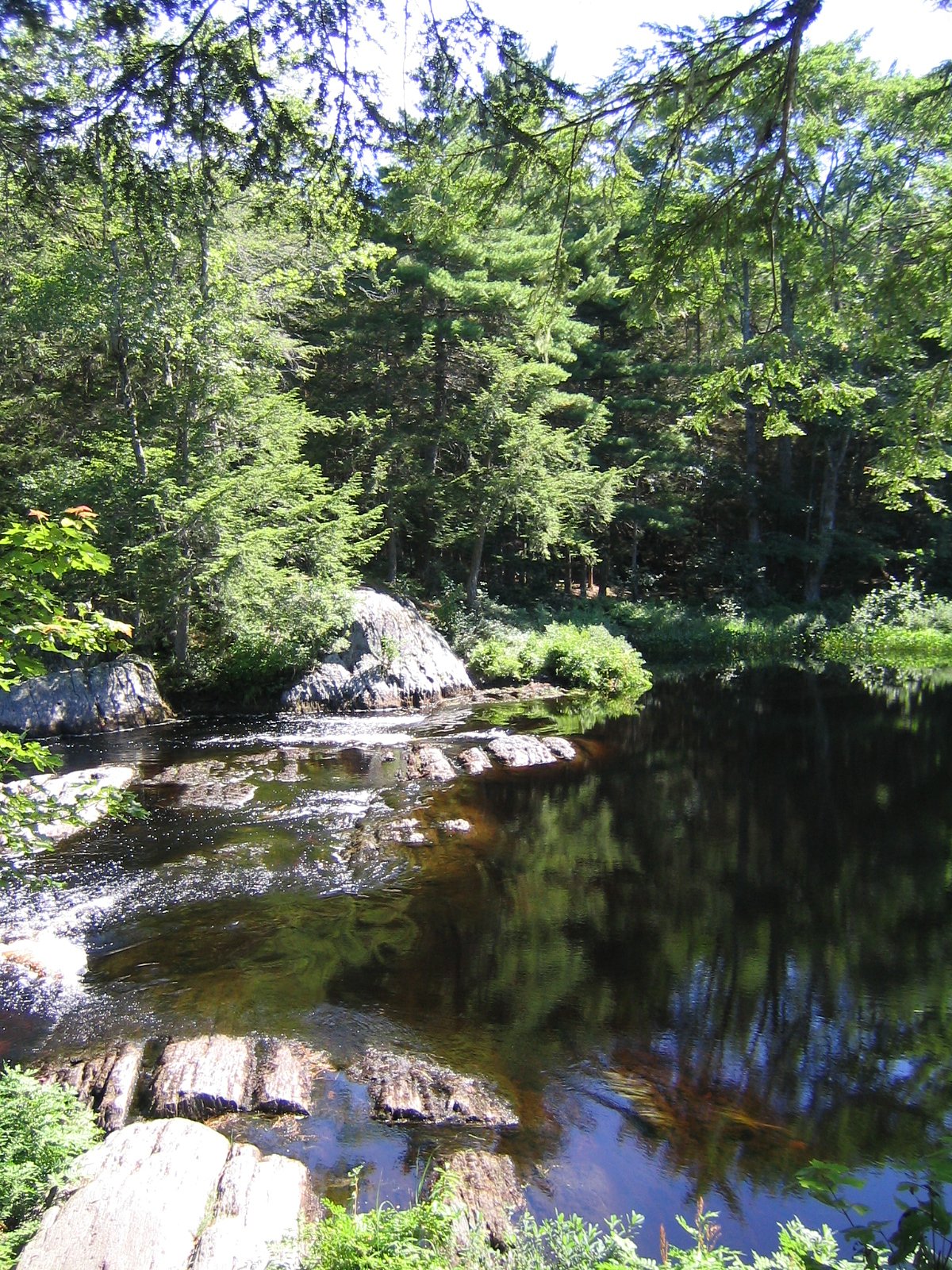
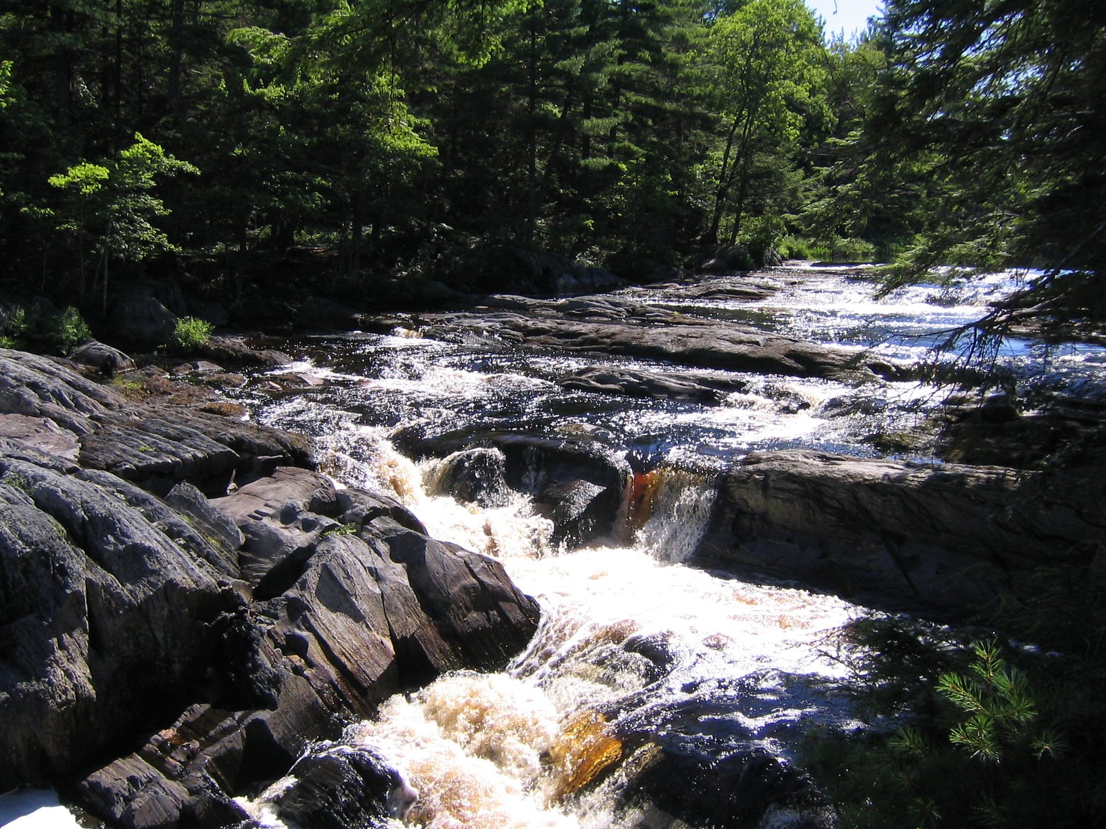
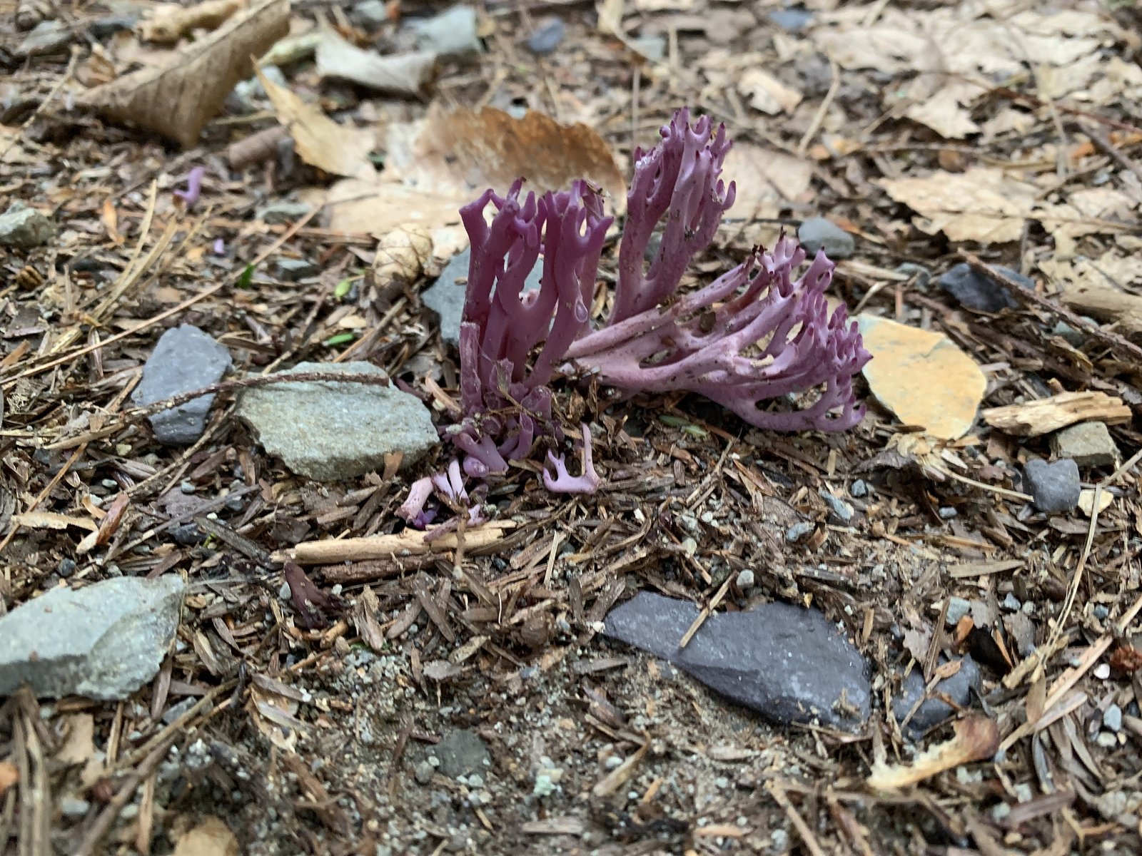

Photo Credits (5)
Difficulty
Easy
Trail Length
2.7 km
Trail Type
Out And Back
Elevation Gain
57 m
About Mill falls
Mill Falls (Nova Scotia) appears to be a small woodland/river cascade in southwestern Nova Scotia near the towns of Digby, Shelburne and Liverpool. The feature is located at the supplied coordinates (44.4395, -65.216). It is likely a modest-sized waterfall associated with a local stream or former mill site and may be reached via local forest/pastoral roads and short informal walking routes. Specific published descriptions and official trail information are limited; details below are cautious and conservatively stated where certainty is low.
The Setting
Mill falls sits at 124 metres within Kejimkujik National Park And National Historic Site Of Canada, in the coastal lowlands of Nova Scotia. The falls drop 8 metres.
Height: 25 feet
Trail & Hike Details
The Approach
The easy 2.7-km out-and-back trail gains 57 metres of elevation on the way to the falls.
Trail Description
There does not appear to be an established, maintained trail with published length or elevation data for this waterfall. Expect an informal path or bushwhack from a roadside pullout: short distance but possibly uneven, with roots, rocks and wet ground. Approaches may be unmarked and cross private property in places. Because detailed trail maps and guidebook descriptions for this specific site are limited, plan for simple off-trail navigation and use caution.
What to Expect
The falls drop a gentle 8 metres.
Accessibility
The trail is not wheelchair accessible. Uneven terrain and elevation changes require steady footing.
Frequently Asked Questions
🐶 Are Dogs Allowed at Mill falls?
❌ Dogs are not allowed
Are There Any Fees or Permits Required?
🆖 No fees required
🏊 Is There Swimming at Mill falls?
❌ Swimming is not allowed
When to Visit
Late spring (snowmelt and seasonal rains) typically yields the strongest flows. Early summer offers comfortable temperatures and green forest. Fall provides good foliage color. Avoid visiting alone in winter unless you are prepared for icy, cold conditions and limited access; ice can make banks and trails hazardous.
Seasonal Access
The best time to visit is Spring, Summer, and Fall. Winter access may be limited. Check with the managing park or local authority for current conditions.
Safety Information
• Rocks and riverbanks are often slippery, stay a safe distance from the edge and do not climb on wet rocks. • Stream currents can be stronger than they appear, especially after rain, swimming or wading can be hazardous. • No lifeguards or emergency services on site; cell reception may be unreliable, let someone know your plans and expected return time. • Watch for ticks, and take precautions against black flies and mosquitoes. • Respect private property, trespassing can be dangerous and illegal. If access requires crossing posted land, seek permission.
Current Water Conditions
0.8 m³/s
Current discharge — how much water is flowing
Lower than usual for this time of year
Based on 57 years of record
0.60 m
Water depth at gauge
7-Day Discharge Trend
What does this mean for your visit?
Flow is lower than usual for this time of year.
About This Gauge
7-Day Flow Outlook
Based on the WSC gauge MERSEY RIVER BELOW MILL FALLS (1 km away).
Today
Barely Flowing
0.9 m³/s
3/10Tomorrow
Barely Flowing
0.8 m³/s
4/10Tue
Barely Flowing
0.7 m³/s
4/10Wed
Barely Flowing
0.7 m³/s
3/10Thu
Low
0.8 m³/s
4/10Fri
Barely Flowing
0.7 m³/s
4/10Sat
Barely Flowing
0.7 m³/s
3/10Best window: Tomorrow — barely flowing flow, cloudy (trip score 4/10).
Best time of year: this gauge typically runs highest from mid March to early May, peaking in April.
How we calculate this
This is a transparent outlook, not a precise forecast. We take the waterfall's current flow strength (how it ranks against its historical normal for today, from the nearest WSC stream gauge), carry that ranking forward along the gauge's seasonal curve, and nudge it for forecast rain. Confidence is highest for the next day or two and falls further out. Always check official conditions and your own judgment before visiting — high flows can be dangerous.
Know when to go.
Get a free email alert when waterfalls near Digby hit peak flow. We only send when conditions are worth the trip — no weekly newsletters, no spam.
Weather Forecast
Location & Access
Getting There
Location: 44.4395, -65.216 (southwestern Nova Scotia). The falls are reached from local secondary roads off the main coastal routes in the Digby/Shelburne/Liverpool region. There is no well-documented municipal or provincial day-use site name widely published for this exact point; expect to use local maps, a GPS device, or contact local tourism offices for the final access road. Access may involve driving on narrow rural/forestry roads and a short walk; some approaches may cross private land.
Get Directions on Google MapsParking
Parking is likely limited and informal (roadside pullout or small cleared area). There may not be a marked or maintained parking lot, park well off the travelled lane, legally and safely. Confirm parking permissions if the nearest approach crosses private property.
Elevation
124 metres above sea level
Coordinates
44.439472° N, -65.216040° W
Land Management
Managed by Parks Canada Agency
Visitor Tips & Gear
• Confirm access ahead of time with local tourism offices or municipal offices if possible. • Park legally and off the road; do not block driveways or gates. • If the approach crosses private land, seek permission from the landowner. • Wear sturdy footwear; expect slippery, uneven ground near the falls. • Watch for black flies, mosquitoes and ticks in warmer months; bring insect repellent. • Leave no trace: pack out all trash and avoid disturbing vegetation or historic structures.
As an Amazon Associate, we earn from qualifying purchases.
This easy 2.7 km hike is straightforward — comfortable trail shoes and plenty of water should do. Sun exposure on the trail makes good sun protection a must in summer.

Polarized Sunglasses (Knockaround)
Cuts glare off the water so you actually see the falls — and your photos turn out better too.

Columbia Watertight II Rain Jacket
Packs into its own pocket, seam-sealed, and keeps you dry from spray and surprise rain.

Earth Pak Waterproof Dry Bag
Keeps your phone and gear dry when waterfall mist soaks everything else.

Waterproof Phone Pouch (AiRunTech)
Cheap insurance — take photos right next to the falls without killing your phone.

JOBY GorillaPod Starter Kit
Wraps around railings and rocks for long-exposure waterfall shots — no flat surface needed.

Osprey Daylite Daypack
Light, organized, and just the right size for a day hike — fits water, snacks, and layers.
Where to Stay
Browse vacation cabins and private rentals nearby
Unique outdoor stays — tents, yurts, and treehouses
Rent a campervan or RV for your waterfall road trip
Some links are affiliate links. We may earn a commission at no extra cost to you.
Nearby Campground
Backcountry Place D
3.4 km away
Additional Information
Nearby Attractions
Nearby towns include Digby (~31 miles), Shelburne (~35 miles) and Liverpool (~41 miles) which offer coastal viewpoints, historic downtowns, and access to the Bay of Fundy and Atlantic shoreline. Local rivers and small parks in the region may offer additional fishing, kayaking or short hikes.
Wildlife
Typical regional species may include white-tailed deer, various songbirds and shorebirds, waterfowl, and small mammals. Black bears may occur in parts of Nova Scotia, be aware of proper food storage and wildlife safety practices. Expect insects such as black flies and mosquitoes in spring and summer.
Cities near Mill falls
Writing about Mill falls? Embed this waterfall on your site for free.