Mary Ann Falls
Nova Scotia • Cape Breton Highlands National Park • 6 m
By Armen Suny · Last verified Jun 2026
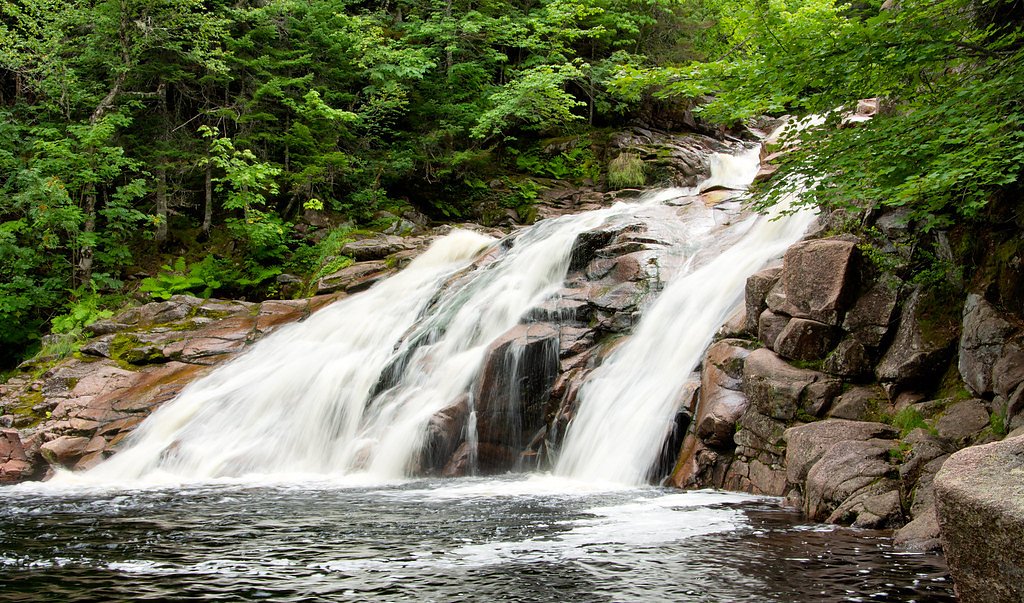
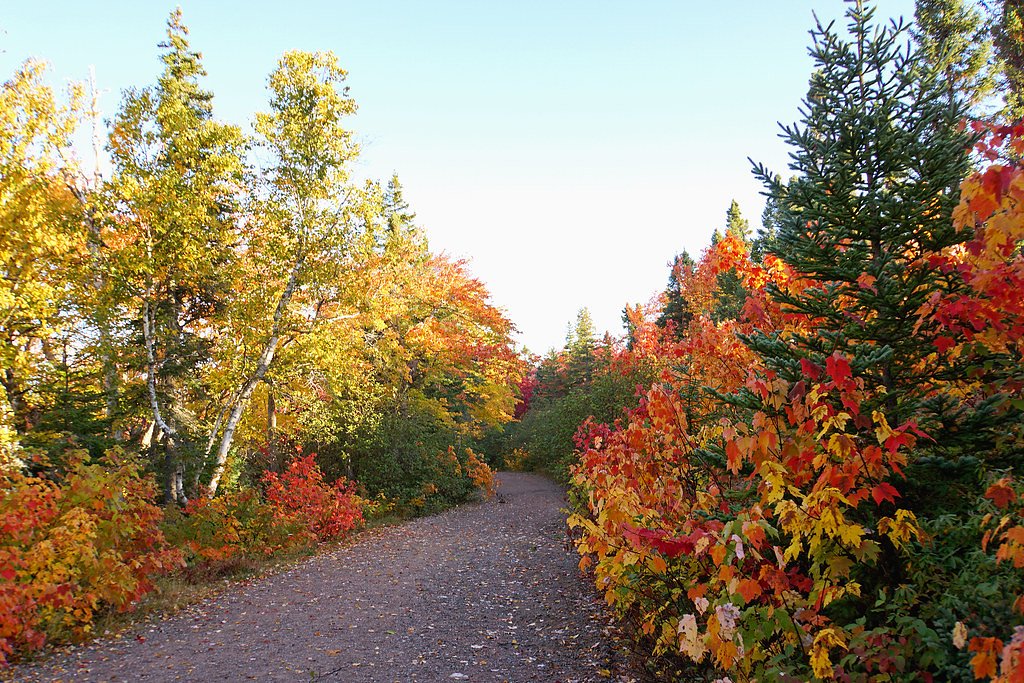
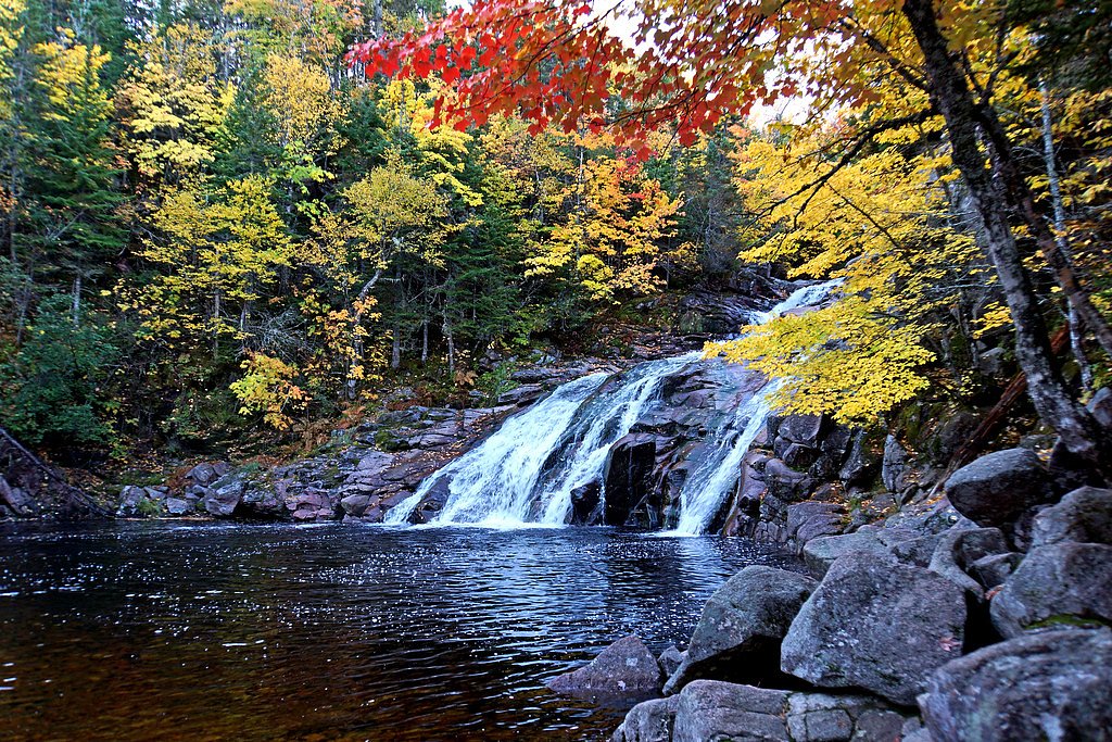
Photo Credits (4)
Difficulty
Easy
Trail Length
1.6 km
About Mary Ann Falls
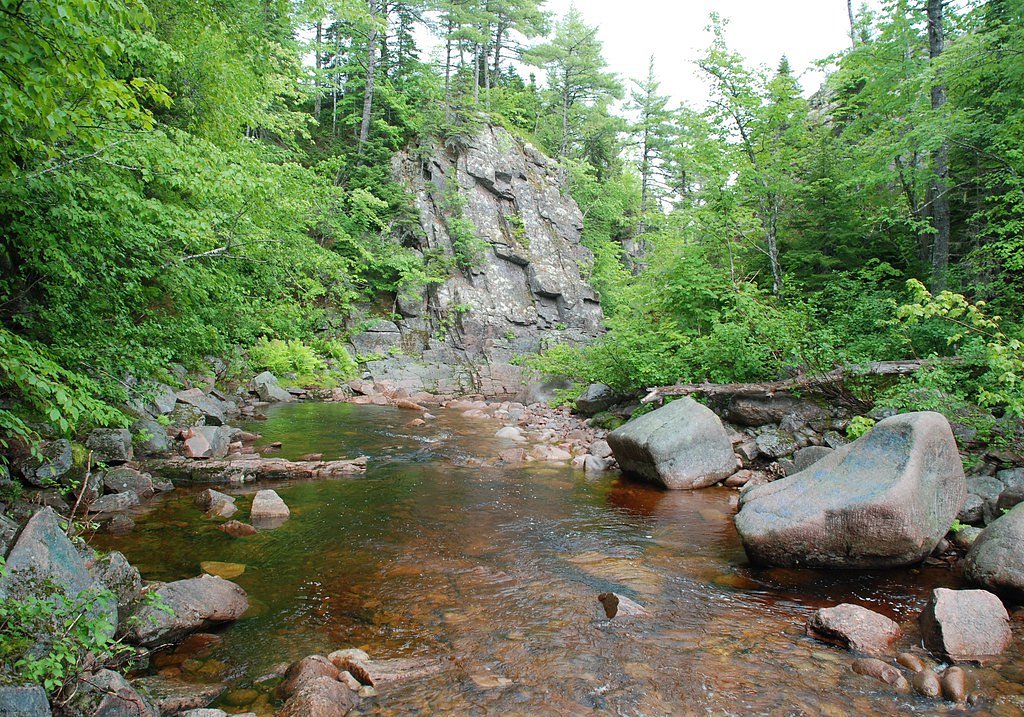
Mary Ann Falls is a small, scenic waterfall on Cape Breton Island in Nova Scotia (coordinates: 46.7615, -60.3636). It is commonly visited for a short nature stop and photo opportunities. Flow and appearance may vary seasonally (typically higher in spring and after heavy rain). Published, consistent measurements (height and exact official description) are limited; some local reports describe a modest cascade rather than a large drop.
The Setting
Mary Ann Falls sits at 57 metres within Cape Breton Highlands National Park, in the coastal lowlands of Nova Scotia. The falls drop 6 metres.
Height: 20 feet
Trail & Hike Details
Trail Description
Visitors typically reach a short forested path or informal trail from a roadside parking or pullout. The route may include uneven roots and rocks and a brief descent to a viewing area. There are likely no maintained boardwalks, railings, or facilities; approach to the waterline may be on wet, slippery rocks.
What to Expect
The falls drop a gentle 6 metres.
Accessibility
The trail is not wheelchair accessible. Uneven terrain and elevation changes require steady footing.
Frequently Asked Questions
🐶 Are Dogs Allowed at Mary Ann Falls?
❌ Dogs are not allowed
Are There Any Fees or Permits Required?
🆖 No fees required
🏊 Is There Swimming at Mary Ann Falls?
❌ Swimming is not allowed
When to Visit
Late spring (snowmelt and higher flows) usually yields the most impressive water volume. Early summer and fall offer comfortable weather and good visibility; winter can create ice features but access may be hazardous or restricted.
Seasonal Access
The best time to visit is Spring, Summer, Fall, and Winter. Check with Cape Breton Highlands National Park for current conditions.
Safety Information
• Slippery wet rocks and moss can cause falls, stay on stable ground and keep away from cliff edges. • Fast currents or deep plunge pools can be hazardous; do not underestimate water. • Limited or no facilities, bring water and a first-aid kit. • Cell service may be spotty; tell someone your plans if traveling alone. • Winter conditions create ice and unstable footing; many falls are hazardous or inaccessible in winter. • Watch for ticks in warmer months and take appropriate precautions.
Current Water Conditions
Based on a Water Survey of Canada gauge 45.3 km away
1.9 m³/s
Current discharge — how much water is flowing
About average for this time of year
Based on 59 years of record
0.56 m
Water depth at gauge
7-Day Discharge Trend
What does this mean for your visit?
Flow is about average for this time of year.
About This Gauge
This gauge is on a regional waterway. Conditions at the falls may differ, especially after local rain.
7-Day Flow Outlook
Based on the WSC gauge INDIAN BROOK AT INDIAN BROOK (45 km away).
Today
Moderate
2.0 m³/s
6/10Tomorrow
Moderate
2.0 m³/s
8/10Tue
Moderate
2.0 m³/s
8/10Wed
Moderate
2.3 m³/s
6/10Thu
Moderate
2.2 m³/s
6/10Fri
Moderate
2.0 m³/s
6/10Sat
Moderate
1.9 m³/s
6/10Best window: Tomorrow — moderate flow, partly cloudy (trip score 8/10).
Best time of year: this gauge typically runs highest from early April to late May, peaking in May.
How we calculate this
This is a transparent outlook, not a precise forecast. We take the waterfall's current flow strength (how it ranks against its historical normal for today, from the nearest WSC stream gauge), carry that ranking forward along the gauge's seasonal curve, and nudge it for forecast rain. Confidence is highest for the next day or two and falls further out. Always check official conditions and your own judgment before visiting — high flows can be dangerous.
Know when to go.
Get a free email alert when waterfalls near Sydney hit peak flow. We only send when conditions are worth the trip — no weekly newsletters, no spam.
Weather Forecast
Location & Access
Getting There
The falls sit on Cape Breton Island, roughly 38.2 miles from Sydney and about 48.7 miles from Baddeck (driving distances as provided). Use the provided coordinates (46.7615, -60.3636) for direct navigation. Expect rural roads; the final approach is likely on a minor paved or gravel road with limited signage.
Get Directions on Google MapsParking
Parking is likely limited to a small roadside pullout or informal gravel area near the trailhead. There may be no formal paved lot, signage, or facilities. Park off the road where safe and legal; spaces may be few.
Elevation
57 metres above sea level
Coordinates
46.761481° N, -60.363580° W
Land Management
Managed by Parks Canada Agency
Visitor Tips & Gear
• Use the coordinates to navigate, signage may be minimal. • Wear sturdy, grippy footwear; rocks near the water are slippery. • Expect no formal facilities, bring water and pack out trash. • Check recent trip reports or local sources for access updates (seasonal road conditions, washouts). • Respect private property: if a trail crosses private land, follow posted rules and leave no trace. • Be cautious with children near edges and fast water. • In spring and after heavy rain, currents and flows can be stronger than they look.
Where to Stay
Browse vacation cabins and private rentals nearby
Unique outdoor stays — tents, yurts, and treehouses
Rent a campervan or RV for your waterfall road trip
Some links are affiliate links. We may earn a commission at no extra cost to you.
Nearby Campground
Broad Cove Campground
5.6 km away
Additional Information
Nearby Attractions
Cape Breton Highlands National Park (sections of the Cabot Trail), Ingonish area beaches, Baddeck and the Bras d'Or Lake region. Use local maps to plan combined visits.
Wildlife
Typical Cape Breton wildlife may include black bear (occasional), moose, white-tailed deer, various shore and forest birds (including bald eagles and seabirds), and small mammals. Be bear-aware and store food appropriately.
Cities near Mary Ann Falls
Writing about Mary Ann Falls? Embed this waterfall on your site for free.