Photo Credits (2)
Difficulty
Easy
Trail Length
0.4 km
Trail Type
Out And Back
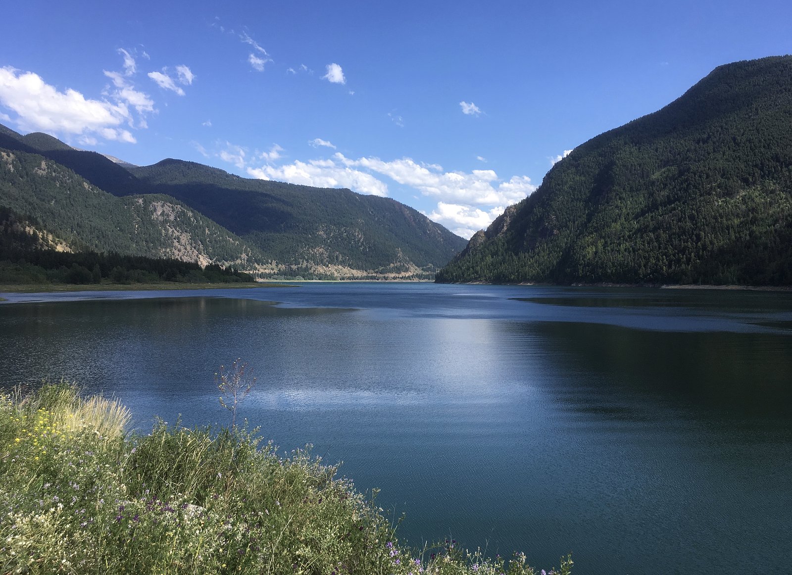
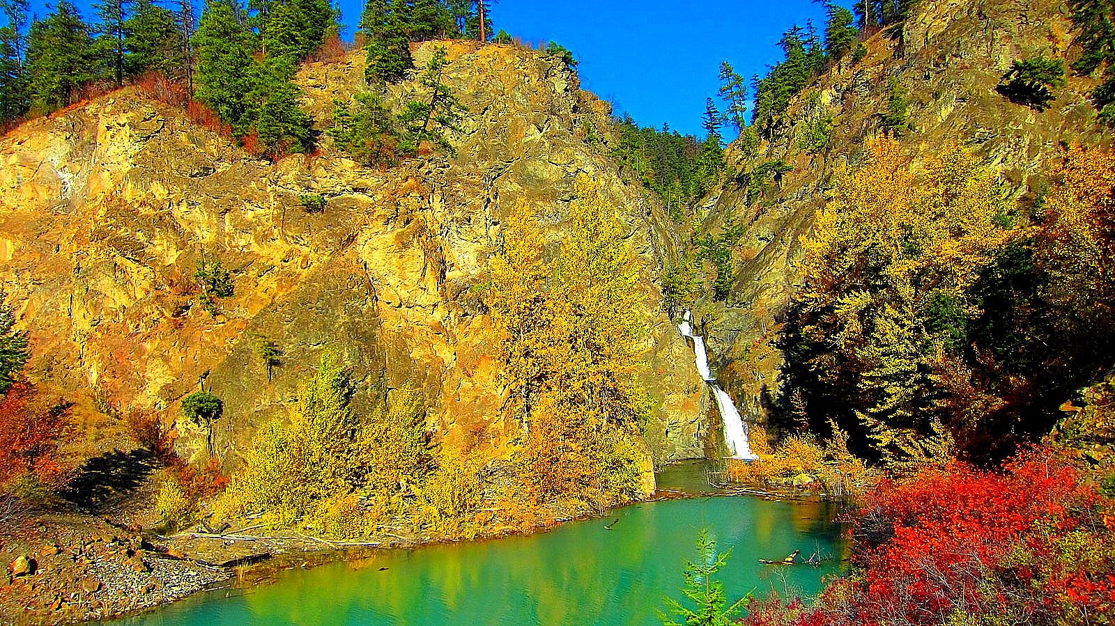
About Marshall Creek
Marshall Creek is a small, creek-fed waterfall located in the interior of British Columbia near the Lillooet area (approximate coordinates 50.8422, -122.4606). It appears to be a lesser-known, relatively remote cascade that may be most impressive during spring snowmelt and after heavy rains. Specific published information about the waterfall is limited; the description above may be approximate and visitors should confirm local conditions before travel.
Why This Waterfall Exists
Marshall Creek flows over layered sedimentary rock laid down about 145-359 million years ago. Over time, the stream has worn through these layers at different rates, creating the step that forms the waterfall.
Trail & Hike Details
Trail Description
Trail and approach information for Marshall Creek are not well-documented in major trail databases. Visitors should expect a rough, possibly unmarked route from roadside or a short bushwhack to the creek. Trails in this type of location may cross uneven ground, talus, and brush. Because official trail data is not available here, consider this an exploratory visit and plan accordingly.
What to Expect
A small, natural cascade with limited infrastructure. Flow may vary seasonally, peak flows typically in spring during snowmelt and after heavy rain; flows may be reduced in late summer and autumn. No formal viewpoints, railings, restrooms, or maintained paths are confirmed. Surrounding terrain may include mixed forest, steep banks, and rocky streambed.
Accessibility
The trail is short and relatively flat, but the surface may be uneven. Contact the managing agency for accessibility details.
Frequently Asked Questions
🐶 Are Dogs Allowed at Marshall Creek?
❌ Dogs are not allowed
Are There Any Fees or Permits Required?
🆖 No fees required
🏊 Is There Swimming at Marshall Creek?
❌ Swimming is not allowed
When to Visit
Late spring to early summer is typically best for higher flows (snowmelt). Summer may offer easier road access but lower water levels. Fall can be scenic but may have lower flow; winter access may be restricted or hazardous due to snow/ice and seasonal road closures.
Seasonal Access
The best time to visit is Spring, Summer, Fall, and Winter. Check with the managing park or local authority for current conditions.
Safety Information
Hazards may include slippery rocks and banks, fast or cold water during high flows, unstable ground near the creek, falling rock in steep sections, poor or no cell coverage, and seasonal road or trail closures. Weather can change rapidly, carry appropriate gear. If accessing by logging/forestry roads, be aware of active industrial traffic and closed gates. When in doubt, choose the safer option and avoid risky cliff or waterside approaches.
Current Water Conditions
Based on a Water Survey of Canada gauge 27.3 km away
71.6 m³/s
Current discharge — how much water is flowing
2.56 m
Water depth at gauge
7-Day Discharge Trend
About This Gauge
This gauge is on a regional waterway. Conditions at the falls may differ, especially after local rain.
7-Day Flow Outlook
Based on the WSC gauge BRIDGE RIVER BELOW LAJOIE DAM (27 km away).
Today
Moderate
77 m³/s
6/10Tomorrow
Moderate
74 m³/s
9/10Tue
Moderate
72 m³/s
9/10Wed
Moderate
72 m³/s
8/10Thu
Moderate
72 m³/s
8/10Fri
Moderate
77 m³/s
6/10Sat
Moderate
80 m³/s
6/10Best window: Tomorrow — moderate flow, mainly sunny (trip score 9/10).
How we calculate this
This is a transparent outlook, not a precise forecast. We take the waterfall's current flow strength (how it ranks against its historical normal for today, from the nearest WSC stream gauge), carry that ranking forward along the gauge's seasonal curve, and nudge it for forecast rain. Confidence is highest for the next day or two and falls further out. Always check official conditions and your own judgment before visiting — high flows can be dangerous.
Know when to go.
Get a free email alert when waterfalls near Lillooet hit peak flow. We only send when conditions are worth the trip — no weekly newsletters, no spam.
Weather Forecast
Location & Access
Getting There
Marshall Creek is in a remote/rural part of British Columbia near Lillooet (roughly 30 miles from Lillooet by general straight-line distance). Access may require travel on paved highways followed by secondary or forestry/logging roads. Exact turnoffs and route conditions are not well-documented here; verify with local maps, BC Forest Service/municipal sources, or recent trip reports before heading out.
Get Directions on Google MapsParking
Parking is likely to be informal (roadside pullouts or small unimproved clearings). There may be no official parking lot, signage, or facilities. Park safely off the road and avoid blocking gates or private driveways.
Elevation
707 metres above sea level
Coordinates
50.842208° N, -122.460561° W
Visitor Tips & Gear
1) Confirm current access and road conditions with local authorities or recent visitor reports before traveling. 2) Expect limited or no signage and bring a detailed map/GPS with the provided coordinates. 3) Wear sturdy shoes, banks and rocks can be slippery. 4) Respect private property and posted closures. 5) Pack out all trash and avoid altering the site. 6) Cell service may be limited, tell someone your route and expected return time.
Where to Stay
Browse vacation cabins and private rentals nearby
Unique outdoor stays — tents, yurts, and treehouses
Rent a campervan or RV for your waterfall road trip
Some links are affiliate links. We may earn a commission at no extra cost to you.
Nearby Campground
Marshall Creek Recreation Site
11.2 km away
Additional Information
Nearby Attractions
General attractions in the broader Lillooet region include scenic river valleys, other waterfalls and creeks, hiking routes, and cultural/historical sites around Lillooet town. Specific nearby named attractions to Marshall Creek are not confirmed here, check local maps and visitor resources for options.
Wildlife
Typical interior BC wildlife may be present: black bears (and possibly grizzly in some areas), cougars, deer, small mammals, and a variety of birds. Insects such as mosquitoes and ticks may be seasonally abundant. Take standard wildlife precautions (store food properly, be alert, make noise on trails, carry bear spray where recommended).
Cities near Marshall Creek
Writing about Marshall Creek? Embed this waterfall on your site for free.