Lyall Creek Falls
By Armen Suny · Last verified Jun 2026
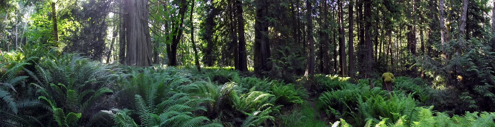
Photo Credits (2)
Difficulty
Easy
Trail Length
2.7 km
Trail Type
Out And Back
Elevation Gain
68 m
About Lyall Creek Falls
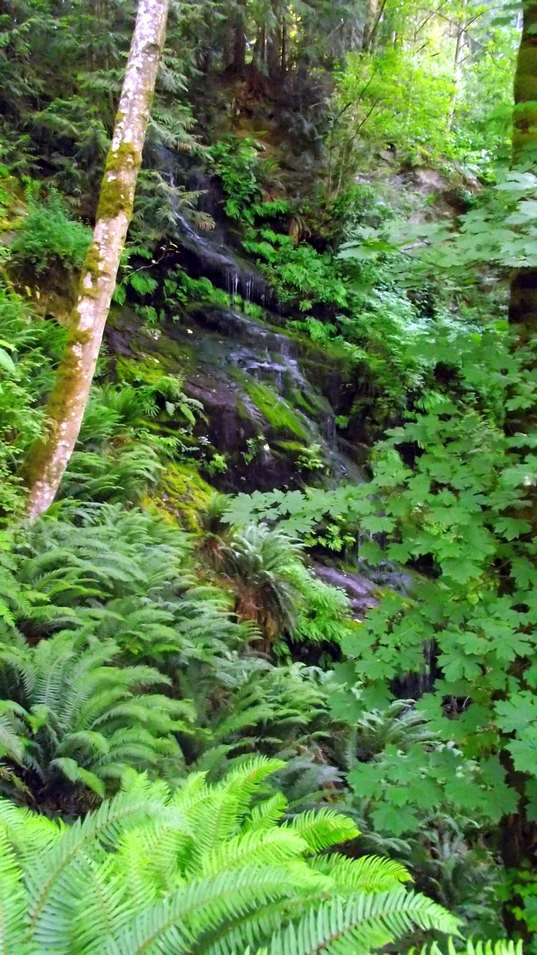
Lyall Creek Falls is a small, forested cascade located in the southern Gulf Islands / San Juan regional area near the Canada–U.S. border at approximately 48.7907, -123.1622. The falls appear as a woodland stream drop and may be most impressive during spring runoff or after periods of heavy rain. Detailed, official descriptions and measured height are not readily available; the fall is likely modest in height and set in a forested creek corridor.
The Setting
Lyall Creek Falls sits at 75 metres within Gulf Islands National Park Reserve Of Canada, in the coastal lowlands of British Columbia.
Why This Waterfall Exists
Lyall Creek Falls flows over Nanaimo Group, a layered sedimentary rock layer deposited about 66-101 million years ago. Over time, the stream has worn through these layers at different rates, creating the step that forms the waterfall.
Trail & Hike Details
The Approach
The easy 2.7-km out-and-back trail gains 68 metres of elevation on the way to the falls.
Trail Description
Specific, mapped trail descriptions for Lyall Creek Falls are not readily available in major trail databases. Approaches (if present) are likely short forest walks or rough access from a nearby road, possibly involving uneven footing, roots, and low vegetation. Trails may be unmarked and not maintained to formal park standards; expect informal footpaths and potential scrambling to viewpoints.
What to Expect
Expect a small, wooded creek cascade rather than a large, multi-hundred-foot waterfall. Spring and early summer typically produce the highest flows. The site is likely forested with moss, ferns, and typical coastal Pacific Northwest / southern Vancouver Island vegetation. Facilities (toilets, viewing platforms, railings) are likely absent. Cell coverage may be intermittent.
Accessibility
The trail is not wheelchair accessible. Uneven terrain and elevation changes require steady footing.
Frequently Asked Questions
🐶 Are Dogs Allowed at Lyall Creek Falls?
❌ Dogs are not allowed
Are There Any Fees or Permits Required?
🆖 No fees required
🏊 Is There Swimming at Lyall Creek Falls?
❌ Swimming is not allowed
When to Visit
Late spring (snowmelt and seasonal rains) and early fall (after rain events) are typically the best times for higher flows. Weekdays or early mornings will often be quieter.
Seasonal Access
The best time to visit is Spring, Summer, and Fall. Winter access may be limited. Check with the managing park or local authority for current conditions.
Safety Information
Exercise caution around the creek and waterfall: slippery and unstable banks, moss-covered rocks, sudden increases in flow after rain, and steep drop-offs are possible. There are likely no guardrails, signage, or lifeguards. Cell service may be limited, tell someone your plan and expected return time. Check tide and weather forecasts if your approach involves shoreline travel. If uncertain about route or land access, consult local authorities or experienced local hikers.
Current Water Conditions
Based on a Water Survey of Canada gauge 37.9 km away
0.3 m³/s
Current discharge — how much water is flowing
Much lower than usual for this time of year
Based on 73 years of record
0.41 m
Water depth at gauge
7-Day Discharge Trend
What does this mean for your visit?
Flow is well below normal for this time of year, so the waterfall may be a trickle.
About This Gauge
This gauge is on a regional waterway. Conditions at the falls may differ, especially after local rain.
7-Day Flow Outlook
Based on the WSC gauge KOKSILAH RIVER AT COWICHAN STATION (38 km away).
Today
Barely Flowing
0.3 m³/s
5/10Tomorrow
Barely Flowing
0.2 m³/s
4/10Tue
Barely Flowing
0.2 m³/s
4/10Wed
Barely Flowing
0.2 m³/s
4/10Thu
Barely Flowing
0.2 m³/s
4/10Fri
Barely Flowing
0.2 m³/s
5/10Sat
Barely Flowing
0.2 m³/s
4/10Best window: Today — barely flowing flow, sunny (trip score 5/10).
Best time of year: this gauge typically runs highest from late November to late December, peaking in December.
How we calculate this
This is a transparent outlook, not a precise forecast. We take the waterfall's current flow strength (how it ranks against its historical normal for today, from the nearest WSC stream gauge), carry that ranking forward along the gauge's seasonal curve, and nudge it for forecast rain. Confidence is highest for the next day or two and falls further out. Always check official conditions and your own judgment before visiting — high flows can be dangerous.
Know when to go.
Get a free email alert when waterfalls near Vancouver hit peak flow. We only send when conditions are worth the trip — no weekly newsletters, no spam.
Weather Forecast
Location & Access
Getting There
Coordinates: 48.7907, -123.1622. The falls are in the southern Gulf Islands / northern San Juan region (user-reported distances: Roche Harbor ~10.1 miles, Point Roberts ~14.1 miles, Friday Harbor ~16.7 miles). Actual access may require travel by ferry or private boat to one of the nearby islands, followed by a short drive and a forested trail or roadside approach. Exact public access points are not definitively documented here; visitors should consult local maps, island ferry schedules, and land manager (provincial/local) resources prior to travel.
Get Directions on Google MapsParking
Parking availability is uncertain and may be limited to roadside pullouts or small informal lots near trailheads. Visitors should expect minimal facilities and check local signage; do not block private driveways or gated forestry access.
Elevation
75 metres above sea level
Coordinates
48.790749° N, -123.162191° W
Land Management
Managed by Parks Canada Agency
Visitor Tips & Gear
• Check recent trip reports or local land manager sites before visiting, as access and trail conditions may change. • Wear sturdy, waterproof footwear; trails and creek banks can be slippery. • Bring insect repellent in warmer months. • Pack out all trash; there are likely no facilities. • Verify private property boundaries and respect signage, some access in the Gulf Islands region crosses private land. • If travelling from the U.S. side (Roche Harbor / Friday Harbor), plan ferry or boat transport and allow time for customs if crossing the border.
As an Amazon Associate, we earn from qualifying purchases.
This easy 2.7 km hike is straightforward — comfortable trail shoes and plenty of water should do. Sun exposure on the trail makes good sun protection a must in summer.

Polarized Sunglasses (Knockaround)
Cuts glare off the water so you actually see the falls — and your photos turn out better too.

Columbia Watertight II Rain Jacket
Packs into its own pocket, seam-sealed, and keeps you dry from spray and surprise rain.

Earth Pak Waterproof Dry Bag
Keeps your phone and gear dry when waterfall mist soaks everything else.

Waterproof Phone Pouch (AiRunTech)
Cheap insurance — take photos right next to the falls without killing your phone.

JOBY GorillaPod Starter Kit
Wraps around railings and rocks for long-exposure waterfall shots — no flat surface needed.

Osprey Daylite Daypack
Light, organized, and just the right size for a day hike — fits water, snacks, and layers.
Where to Stay
Browse vacation cabins and private rentals nearby
Unique outdoor stays — tents, yurts, and treehouses
Rent a campervan or RV for your waterfall road trip
Some links are affiliate links. We may earn a commission at no extra cost to you.
Nearby Campground
Breezy Bay Clifftop Camping
2.9 km away
Additional Information
Nearby Attractions
Nearby island communities and attractions in the region include Roche Harbor and other San Juan Islands destinations, marine recreation (boating/kayaking), and coastal hiking opportunities on nearby islands. Exact nearby parks or official attractions depend on the specific island and landing point.
Wildlife
Expect coastal island wildlife such as black-tailed deer, numerous shore and forest birds (e.g., eagles, herons), small mammals, and intertidal marine life if visiting shorelines. Be aware of ticks in some seasons and secure food from wildlife.
Cities near Lyall Creek Falls
Writing about Lyall Creek Falls? Embed this waterfall on your site for free.