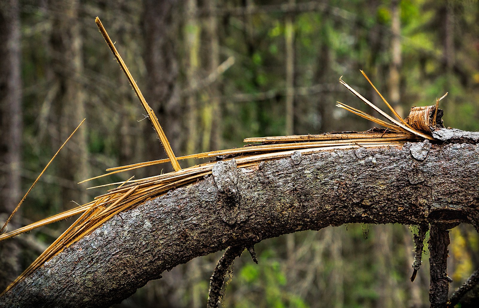
Lower Bugaboo Falls
By Armen Suny · Last verified Jun 2026
Photo Credits (1)
Difficulty
Moderate
Trail Length
2.9 km
Trail Type
Out And Back
Elevation Gain
136 m
About Lower Bugaboo Falls
Lower Bugaboo Falls is a remote, forested cascade located in southeastern British Columbia (coordinates: 50.8723, -116.3989). It sits in a mountainous, backcountry setting roughly 36.5 miles from Lake Louise and about 49.6 miles from Banff (both in Alberta). Visitor accounts describe a natural, undeveloped waterfall with forested approaches and rocky banks. Specifics such as exact height and formal park designation appear to be limited or inconsistently documented; the falls are best approached with caution and preparedness for primitive trail conditions.
Why This Waterfall Exists
Lower Bugaboo Falls flows over loose river sediment, primarily alluvium, laid down about 3 million years ago. These soft rocks erode readily, allowing the stream to carve a vertical drop into the landscape.
Trail & Hike Details
The Approach
The moderate 2.9-km out-and-back trail gains 136 metres of elevation on the way to the falls.
Trail Description
Trail and approach information is sparse and may be a mix of short footpaths, informal game trails, or minimally maintained hiking routes. Expect uneven, rocky terrain and potential stream crossings. The final approach to the falls may require some scrambling on wet rock or loose talus. Because official descriptions are limited, treat the route as unmarked in places and carry navigation tools (map, compass, GPS).
What to Expect
You should expect a natural, undeveloped waterfall setting with forested surroundings, rocky creek banks, and potentially wet/slippery surfaces. Flow rates will be highest in spring melt and after heavy rains, and lower in late summer or drought conditions. There are likely no formal viewing platforms, fences, or maintained trail infrastructure. Cell service is likely limited in places; weather can change rapidly in mountain areas.
Accessibility
The trail is not wheelchair accessible. Uneven terrain and elevation changes require steady footing.
Frequently Asked Questions
🐶 Are Dogs Allowed at Lower Bugaboo Falls?
❌ Dogs are not allowed
Are There Any Fees or Permits Required?
🆖 No fees required
🏊 Is There Swimming at Lower Bugaboo Falls?
❌ Swimming is not allowed
When to Visit
Late spring (high flows) through early fall for best access and safety. Spring offers higher flow and dramatic ice-off; summer provides easier access and drier trails. Winter access may be hazardous or impassible due to snow and ice.
Seasonal Access
The best time to visit is Spring, Summer, and Fall. Winter access may be limited. Check with the managing park or local authority for current conditions.
Safety Information
Hazards include slippery rocks, fast cold water, steep drop-offs near the falls, unstable talus, limited or no cell service, and wildlife encounters. Seasonal hazards include high spring flows, rapidly changing weather, and avalanche risk in winter/early spring. Bring navigation tools, tell someone your plans, and err on the side of caution, use more conservative ratings/plans if uncertain about your route or fitness.
Current Water Conditions
110.0 m³/s
Current discharge — how much water is flowing
About average for this time of year
Based on 77 years of record
1.44 m
Water depth at gauge
7-Day Discharge Trend
What does this mean for your visit?
Flow is about average for this time of year.
About This Gauge
7-Day Flow Outlook
Based on the WSC gauge SPILLIMACHEEN RIVER NEAR SPILLIMACHEEN (4 km away).
Today
Moderate
113 m³/s
8/10Tomorrow
Moderate
115 m³/s
9/10Tue
Moderate
110 m³/s
8/10Wed
Moderate
107 m³/s
8/10Thu
Moderate
109 m³/s
8/10Fri
Strong
109 m³/s
8/10Sat
Strong
113 m³/s
8/10Best window: Tomorrow — moderate flow, mainly sunny (trip score 9/10).
Best time of year: this gauge typically runs highest from mid May to mid August, peaking in June.
How we calculate this
This is a transparent outlook, not a precise forecast. We take the waterfall's current flow strength (how it ranks against its historical normal for today, from the nearest WSC stream gauge), carry that ranking forward along the gauge's seasonal curve, and nudge it for forecast rain. Confidence is highest for the next day or two and falls further out. Always check official conditions and your own judgment before visiting — high flows can be dangerous.
Know when to go.
Get a free email alert when waterfalls near Lake Louise hit peak flow. We only send when conditions are worth the trip — no weekly newsletters, no spam.
Weather Forecast
Location & Access
Getting There
Approach is typically by local access roads and trails from nearby provincial highways. Exact trailhead signage and formal access points are not well documented online; many visitor reports indicate the route involves unpaved or forest-service roads and a short off-trail or minimally maintained walk to the creek. Use a detailed topo map/GPS and plan for limited signage. Nearest well-known hubs are Lake Louise (≈36.5 miles) and Banff (≈49.6 miles), but local driving distances and road conditions vary seasonally.
Get Directions on Google MapsParking
Parking is likely limited to roadside pullouts or informal parking at a nearby trailhead/forest road. There does not appear to be an established paved parking lot or visitor facilities; high-clearance vehicles may be helpful. Expect no toilets or services.
Elevation
906 metres above sea level
Coordinates
50.872322° N, -116.398921° W
Visitor Tips & Gear
• Use up-to-date maps or GPS and verify road conditions before driving. • Wear sturdy, waterproof hiking boots and bring trekking poles for stream crossings and unstable ground. • Expect no facilities, pack out all trash and follow Leave No Trace principles. • Check recent trip reports or local ranger/park service for access notes. • In winter, the approach may be icy, avalanche-prone, and not recommended without proper experience and gear. • Carry bear spray and know how to use it; make noise to avoid surprising wildlife.
As an Amazon Associate, we earn from qualifying purchases.
With 2.9 km and 136 m of elevation gain, sturdy boots and trekking poles will help on this moderate trail. Sun exposure on the trail makes good sun protection a must in summer.

Polarized Sunglasses (Knockaround)
Cuts glare off the water so you actually see the falls — and your photos turn out better too.

Columbia Watertight II Rain Jacket
Packs into its own pocket, seam-sealed, and keeps you dry from spray and surprise rain.

Earth Pak Waterproof Dry Bag
Keeps your phone and gear dry when waterfall mist soaks everything else.

Waterproof Phone Pouch (AiRunTech)
Cheap insurance — take photos right next to the falls without killing your phone.

Timberland Euro Sprint Mid Waterproof
Trusted waterproof boot with premium leather and grippy rubber sole — reliable on rocky, wet trails.

TrailBuddy Trekking Poles
Lightweight aluminum, cork grips, and flip-locks that actually hold — a best-seller for good reason.
Where to Stay
Browse vacation cabins and private rentals nearby
Unique outdoor stays — tents, yurts, and treehouses
Rent a campervan or RV for your waterfall road trip
Some links are affiliate links. We may earn a commission at no extra cost to you.
Nearby Campground
Jubilee Mountain Campground
5.3 km away
Additional Information
Nearby Attractions
Nearby regional attractions include Lake Louise and Banff (both in Alberta), alpine lakes, mountain scenery, and other backcountry hiking and climbing areas. Exact nearby points of interest depend on the local road network used to approach the falls.
Wildlife
Typical mountain and forest wildlife may be present: black bear, possibly grizzly in some zones, deer, moose, small mammals, and birds. Use standard wildlife safety practices.
Cities near Lower Bugaboo Falls
Nearby Waterfalls
Writing about Lower Bugaboo Falls? Embed this waterfall on your site for free.