Louise Falls
Northwest Territories • 15 m
By Armen Suny · Last verified Jun 2026
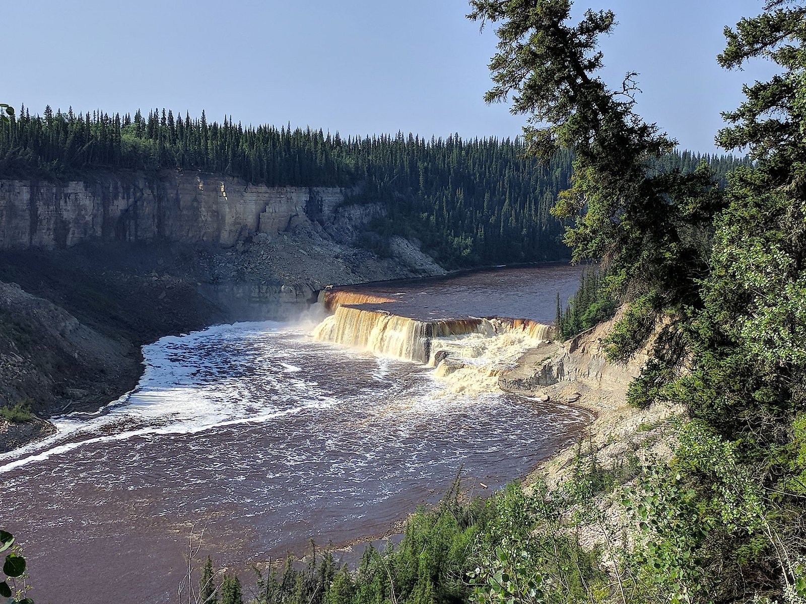
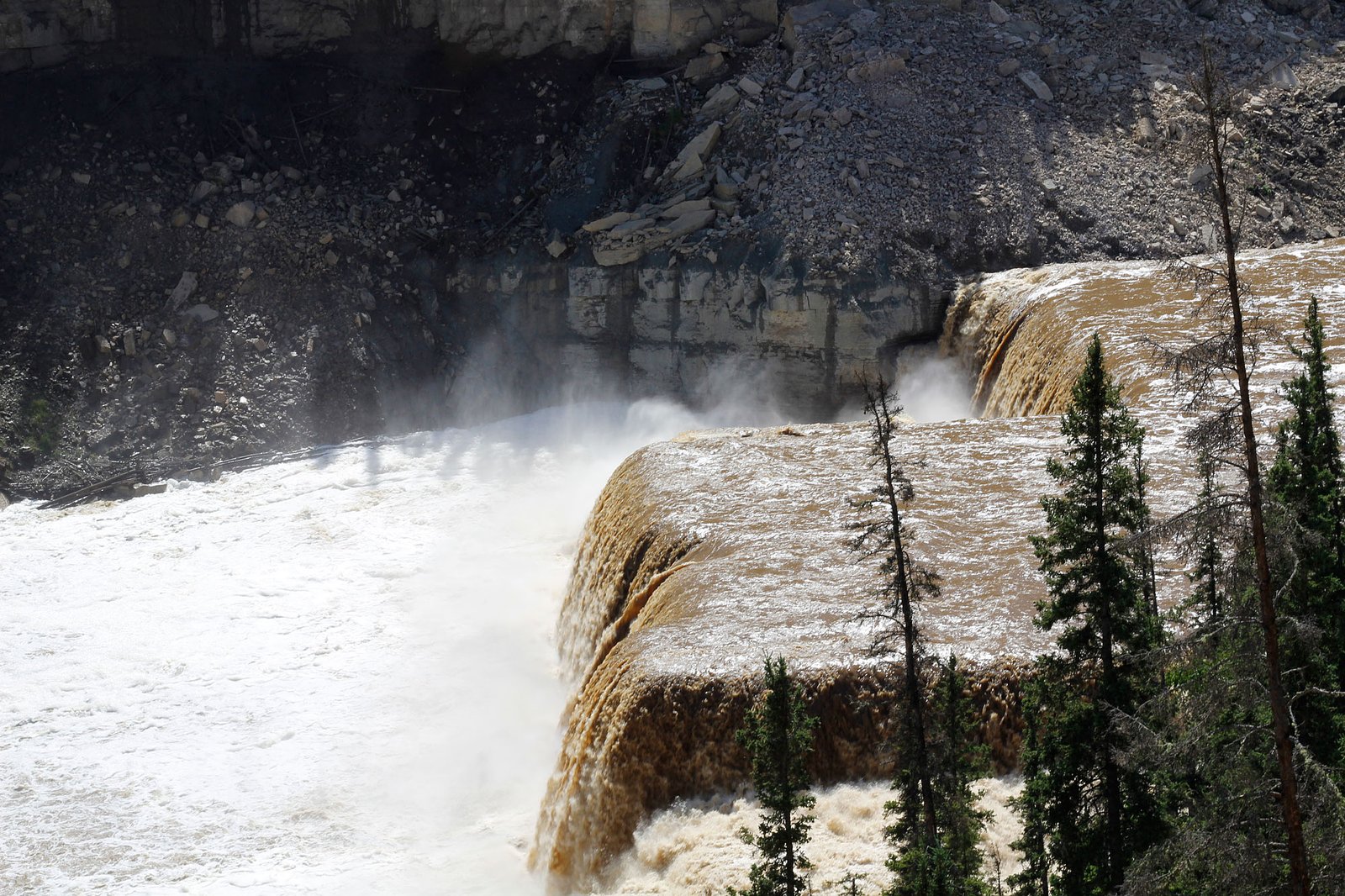
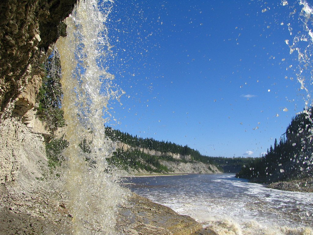
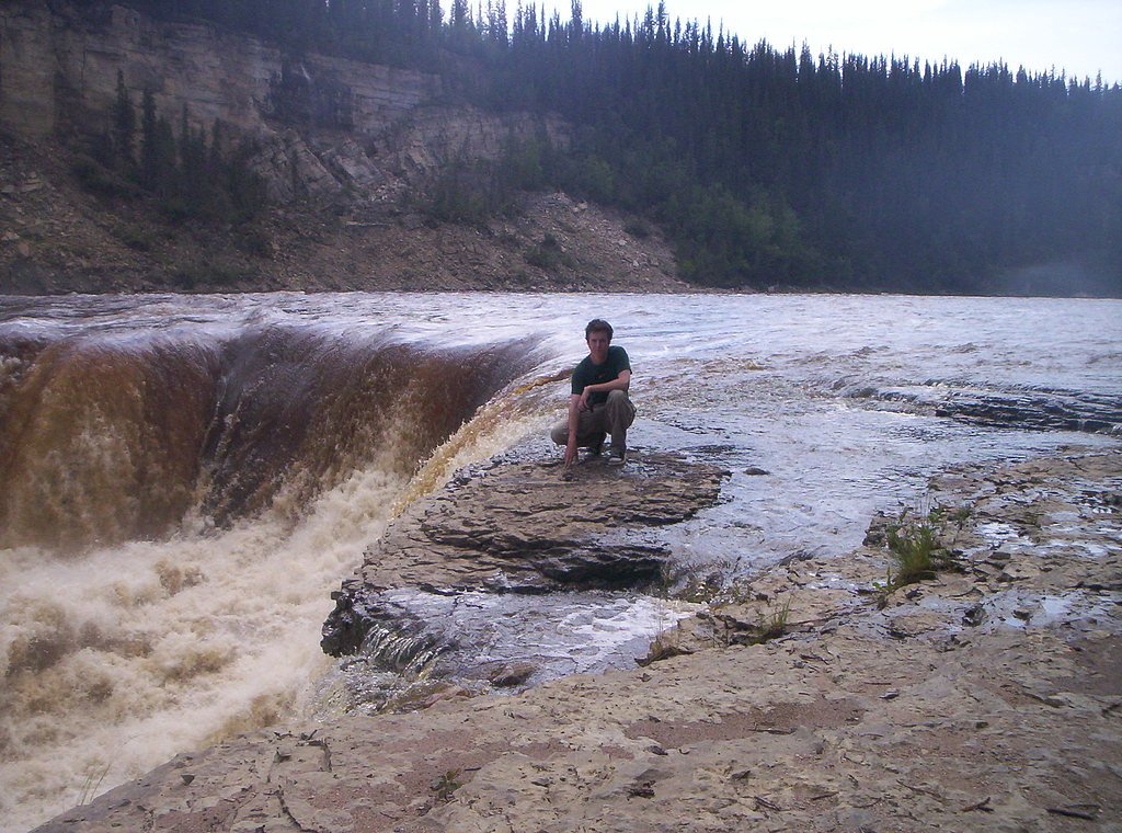
Photo Credits (5)
Difficulty
Moderate
Trail Length
12.7 km
Trail Type
Out And Back
Elevation Gain
237 m
About Louise Falls
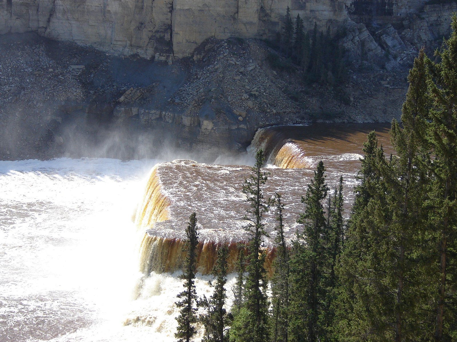
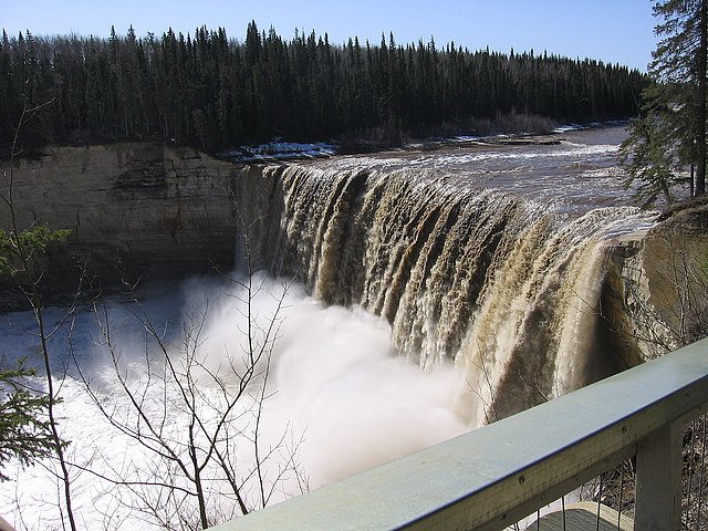
Louise Falls is a waterfall on the Hay River in the Northwest Territories, Canada, located just downstream of higher Alexandra Falls. Both waterfalls are part of Twin Falls Gorge Territorial Park.
The Setting
Louise Falls sits at 228 metres in the foothills of Northwest Territories. The falls drop 15 metres.
Why This Waterfall Exists
Louise Falls flows over Alexandra Member, a layered carbonate rock layer deposited about 372-383 million years ago. These soft rocks erode readily, allowing the stream to carve a 49-foot drop into the landscape.
Trail & Hike Details
The Approach
The moderate 12.7-km out-and-back trail gains 237 metres of elevation on the way to the falls.
Trail Description
A short, well-defined trail from the parking area leads to one or more developed viewpoints and platforms overlooking Louise Falls and the Hay River gorge. The walking surface is typically a packed/gravel path with some stairs and short sections of uneven rock near viewpoints. The entire visit to the Louise Falls viewpoints is short (minutes to under an hour), and many visitors combine it with the nearby Alexandra Falls loop.
What to Expect
The falls drop 15 metres over layered carbonate rock.
Accessibility
The trail is not wheelchair accessible. Uneven terrain and elevation changes require steady footing.
Frequently Asked Questions
🐶 Are Dogs Allowed at Louise Falls?
❌ Dogs are not allowed
Are There Any Fees or Permits Required?
🆖 No fees required
🏊 Is There Swimming at Louise Falls?
❌ Swimming is not allowed
When to Visit
Late spring and early summer for peak water flow; early fall for color and generally stable weather. Winter offers ice and snow scenery but can bring difficult access and icy conditions, only attempt with appropriate equipment and experience.
Seasonal Access
The best time to visit is Spring, Summer, Fall, and Winter. Check with the managing park or local authority for current conditions.
Safety Information
Hazards include steep cliffs, slippery and uneven rock near viewpoints, strong river currents, and rapidly changing weather. Stay behind railings and marked barriers, supervise children closely, wear appropriate footwear, and avoid getting close to the water's edge. In winter expect ice and snow; hypothermia risk exists year-round if immersed. Emergency services can be remote; carry a means to communicate and tell someone your plans.
Current Water Conditions
Based on a Water Survey of Canada gauge 33.9 km away
46.9 m³/s
Current discharge — how much water is flowing
Lower than usual for this time of year
Based on 62 years of record
2.10 m
Water depth at gauge
7-Day Discharge Trend
What does this mean for your visit?
Flow is lower than usual for this time of year.
About This Gauge
This gauge is on a regional waterway. Conditions at the falls may differ, especially after local rain.
7-Day Flow Outlook
Based on the WSC gauge HAY RIVER NEAR HAY RIVER (34 km away).
Today
Low
51 m³/s
4/10Tomorrow
Moderate
54 m³/s
5/10Tue
Moderate
53 m³/s
5/10Wed
Moderate
50 m³/s
5/10Thu
Low
45 m³/s
5/10Fri
Low
41 m³/s
5/10Sat
Low
40 m³/s
5/10Best window: Tomorrow — moderate flow, heavy drizzle (trip score 5/10).
Best time of year: this gauge typically runs highest from late April to late July, peaking in May.
How we calculate this
This is a transparent outlook, not a precise forecast. We take the waterfall's current flow strength (how it ranks against its historical normal for today, from the nearest WSC stream gauge), carry that ranking forward along the gauge's seasonal curve, and nudge it for forecast rain. Confidence is highest for the next day or two and falls further out. Always check official conditions and your own judgment before visiting — high flows can be dangerous.
Know when to go.
Get a free email alert when waterfalls near Hay River hit peak flow. We only send when conditions are worth the trip — no weekly newsletters, no spam.
Weather Forecast
Location & Access
Getting There
Louise Falls is located near Hay River (roughly 40 miles / ~64 km by road from Hay River town centre by the access road toward Twin Falls Gorge Territorial Park). Use the park access road and follow signs to the Louise/Alexandra Falls parking area. Coordinates provided: 60.5027, -116.2428.
Get Directions on Google MapsParking
There is a small park parking area near the trailhead/viewpoints. Parking is typically informal and may be limited during peak season. Vehicles should park in designated spaces and not block gates or pullouts.
Elevation
228 metres above sea level
Coordinates
60.502711° N, -116.242847° W
Visitor Tips & Gear
• Stay on designated trails and behind guardrails; cliff edges can be unstable. • Cell service may be limited, download maps or directions ahead of time. • In spring and early summer flows are strongest and most dramatic. • Wear sturdy footwear; surfaces near the viewpoints can be wet and slippery. • If visiting in winter, bring traction devices and warm clothing; some access routes may be closed or difficult. • Respect wildlife and keep distance; secure food and trash.
As an Amazon Associate, we earn from qualifying purchases.
With 12.7 km and 237 m of elevation gain, sturdy boots and trekking poles will help on this moderate trail. Icy conditions are common in winter — traction cleats are a smart addition.

Columbia Watertight II Rain Jacket
Packs into its own pocket, seam-sealed, and keeps you dry from spray and surprise rain.

Polarized Sunglasses (Knockaround)
Cuts glare off the water so you actually see the falls — and your photos turn out better too.

Earth Pak Waterproof Dry Bag
Keeps your phone and gear dry when waterfall mist soaks everything else.

Waterproof Phone Pouch (AiRunTech)
Cheap insurance — take photos right next to the falls without killing your phone.

Timberland Euro Sprint Mid Waterproof
Trusted waterproof boot with premium leather and grippy rubber sole — reliable on rocky, wet trails.

TrailBuddy Trekking Poles
Lightweight aluminum, cork grips, and flip-locks that actually hold — a best-seller for good reason.
Where to Stay
Browse vacation cabins and private rentals nearby
Unique outdoor stays — tents, yurts, and treehouses
Rent a campervan or RV for your waterfall road trip
Some links are affiliate links. We may earn a commission at no extra cost to you.
Nearby Campground
Louise Falls
0.4 km away
Additional Information
Nearby Attractions
Alexandra Falls (nearby twin waterfall and commonly visited with Louise Falls), Twin Falls Gorge Territorial Park, Hay River town and waterfront.
Wildlife
Northern boreal species may be present, moose, black bears, wolves, foxes, and various bird species. Maintain distance and follow wildlife safety guidelines. Insects (mosquitoes/blackflies) can be abundant in summer.
Cities near Louise Falls
Nearby Waterfalls
Writing about Louise Falls? Embed this waterfall on your site for free.