

Photo Credits (4)
Difficulty
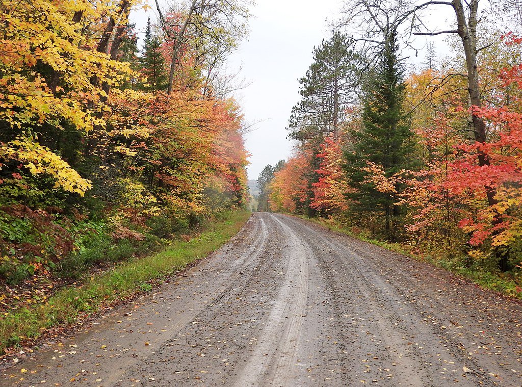
Drive Up
Trail Length
0.2 km
About Lorne Falls
Lorne Falls is a small waterfall feature located in northeastern Ontario near the coordinates 46.3152, -81.5209, roughly 32.5 miles from Sudbury and 34.5 miles from Little Current. The falls appear on local topographic and recreational maps as a cascade on a small stream or river and are set in typical mixed boreal/Great Lakes–St. Lawrence forest. Specifics such as official park status, exact vertical drop, and developed infrastructure are not well-documented in widely available sources; visitors should expect a natural, potentially undeveloped site and plan accordingly.
The Setting
Lorne Falls sits at 211 metres in the foothills of Ontario. The falls drop 20 metres.
Why This Waterfall Exists
Lorne Falls flows over Mississagi Formation, a cemented gravel rock layer deposited over 1.6-2.5 billion years ago. Over time, the stream has worn through these layers at different rates, creating a 65-foot drop that forms the waterfall.
Trail & Hike Details
The Approach
No hiking required. Lorne Falls is accessible by vehicle with a roadside viewing area.
Trail Description
Available information does not document a developed trail with measured distance or elevation gain. Approaches to similar small waterfalls in this region commonly involve a short walk over uneven forest floor, roots and rocks, and possibly a short scramble to reach good viewpoints. Trails may be muddy in spring and after rains and icy in winter. Expect an informal path rather than a maintained boardwalk or stairway.
What to Expect
The falls drop 20 metres over cemented gravel rock.
Accessibility
This waterfall is viewable from a vehicle-accessible area. No hiking is required.
Frequently Asked Questions
🐶 Are Dogs Allowed at Lorne Falls?
❌ Dogs are not allowed
Are There Any Fees or Permits Required?
🆖 No fees required
🏊 Is There Swimming at Lorne Falls?
❌ Swimming is not allowed
When to Visit
Spring (late March–May) for highest flows; late summer for warm weather visiting; fall for foliage colors. Winter offers frozen-waterfall scenery but requires winter travel skills and caution due to ice.
Seasonal Access
The best time to visit is Spring, Summer, Fall, and Winter. Check with the managing park or local authority for current conditions.
Safety Information
Potential hazards include slippery and unstable rocks near the waterfall, fast or cold water, unstable banks, and sudden changes in water flow. Ticks and biting insects are common in warmer months. Wildlife encounters (including black bears and moose) are possible, store food securely and maintain distance. Roads and trails may be muddy or impassable during spring thaw or after heavy rains. In winter, ice near the falls can be unstable; do not assume frozen water is safe to walk on. Always tell someone your plans and expected return time.
7-Day Flow Outlook
Based on the WSC gauge MINISTIC CREEK ABOVE AGNEW LAKE (14 km away).
Best time of year: this gauge typically runs highest from late March to late May, peaking in April.
How we calculate this
This is a transparent outlook, not a precise forecast. We take the waterfall's current flow strength (how it ranks against its historical normal for today, from the nearest WSC stream gauge), carry that ranking forward along the gauge's seasonal curve, and nudge it for forecast rain. Confidence is highest for the next day or two and falls further out. Always check official conditions and your own judgment before visiting — high flows can be dangerous.
Know when to go.
Get a free email alert when waterfalls near Sudbury hit peak flow. We only send when conditions are worth the trip — no weekly newsletters, no spam.
Weather Forecast
Location & Access
Getting There
The falls are reached by driving to the vicinity of the provided coordinates (46.3152, -81.5209). Expect to use local paved or gravel roads and possibly short unmaintained access roads or trails from the nearest parking area. Phone signal may be patchy; download maps or save the coordinates for offline use.
Get Directions on Google MapsParking
Parking is likely limited and informal (pullout or small gravel lot). There may be no designated parking lot, signage, or facilities. Park well off the roadway and avoid blocking gates or driveways.
Elevation
211 metres above sea level
Coordinates
46.315196° N, -81.520857° W
Visitor Tips & Gear
• Wear sturdy, waterproof footwear with good traction, rocks and trails will be slippery. • Bring insect repellent and check for ticks after your visit. • Treat the site as remote: carry water, a basic first aid kit, and a charged phone (signal may be intermittent). • Do not rely on finding garbage facilities or signage. Pack out what you bring in. • Stay back from the edge of ledges and fast water; wet rocks are hazardous. • If visiting in winter, be prepared for deep snow, icy conditions, and limited daylight. • Confirm access with local land managers or municipal offices if you are uncertain whether the land is private or subject to forestry activity.
Where to Stay
Browse vacation cabins and private rentals nearby
Unique outdoor stays — tents, yurts, and treehouses
Rent a campervan or RV for your waterfall road trip
Some links are affiliate links. We may earn a commission at no extra cost to you.
Nearby Campground
Fairbank Provincial Park Campground
18.6 km away
Additional Information
Nearby Attractions
Nearest population centers noted are Sudbury (~32.5 miles) and Little Current (~34.5 miles). The broader region includes lakes, provincial parks, and outdoor recreation opportunities typical of northeastern Ontario (canoeing, fishing, hiking). Check local visitor information for specific nearby parks and attractions.
Wildlife
Typical regional wildlife may include white-tailed deer, moose (seasonal), black bear, beavers, otters, small mammals, and numerous bird species. Also be aware of ticks and biting insects in spring and summer.
Cities near Lorne Falls
Writing about Lorne Falls? Embed this waterfall on your site for free.